8 Great Road Trips to Take in Southern California
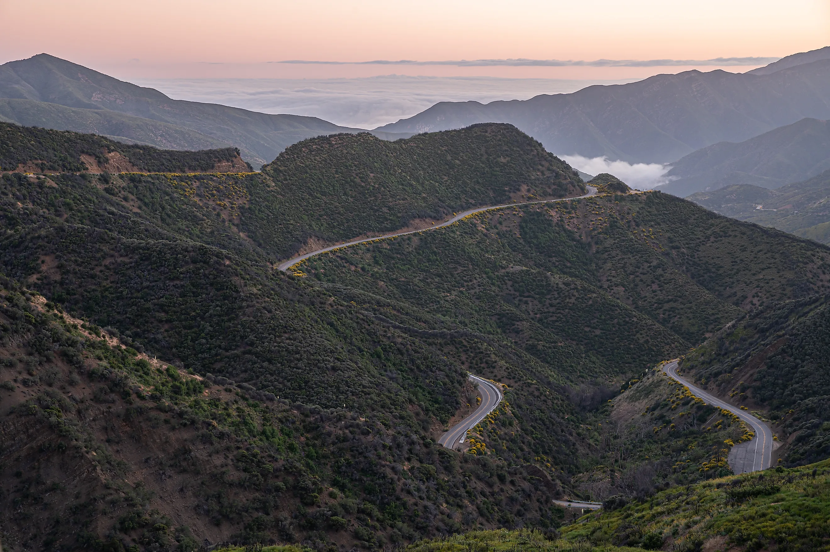
Between Southern California's Pacific coastline and the desert lies a long stretch of high country, and every road heading east or west has to find a way through it. On SR 154 above Santa Barbara, the Cold Spring Canyon Bridge carries you more than 400 feet above a gorge the old road dropped into, with Cold Spring Tavern still serving thirsty travelers and local regulars. Kelbaker Road leads through lava fields and volcanic cones in the Mojave National Preserve, with the Kelso Dunes a short detour south, where the sand is known to sing. The Montezuma Grade falls 13.5 miles from Ranchita into Borrego Springs and Anza-Borrego Desert State Park, the largest in California. These eight great road trips show how Southern California gets to and from the coast and the desert, one crossing at a time.
SR 33 Over Pine Mountain

Fifty-one miles separate Ojai from Ventucopa, a little over an hour of driving. The westernmost crossing comes with a caveat. State Route 33 closes eight-tenths of a mile at Wheeler Gorge for tunnel work. The suggested detour loops out by SR 126, Interstate 5, and SR 166. Three tunnels carry the road at post miles 18.33, 18.81, and 18.85 above Ojai. Rehabilitation on them comes in 55-hour weekend closures, and the work is due to finish in the winter of 2026 to 2027.
Past Ojai, the highway becomes the Jacinto Reyes National Scenic Byway, which lies wholly within Ventura County. The designated stretch spans 37 miles of SR 33, from the edge of Ojai at milepost 12 to the Lockwood Valley Road junction at the Ozena Fire Station. The Reyes family was largely responsible for mapping the line. They wanted to reach the sea from their ranch on the Cuyama side of the mountains. Four congressionally designated wilderness areas fall within reach of the corridor. Sespe Creek flows 31.5 Wild and Scenic miles through that country, undammed, and no other river in Southern California can make the claim. Past Ozena, the pavement descends into the Cuyama Valley, and Ventucopa closes the drive.
SR 154 Across San Marcos Pass

The next pass east chose to span its canyon rather than drop into it. The Cold Spring Canyon Bridge erased a four-mile detour in Santa Barbara County, and the pass crossing stretches 34 miles between Los Olivos and Santa Barbara, about 45 minutes. Until 1964, the road into the Santa Ynez Valley dropped into the canyon on what is now Stagecoach Road, then climbed back out the far side. The deck-style steel arch measures 1,218 feet long across nine spans. A single 700-foot arch spans the gap, and the deck rides more than 400 feet above the canyon floor on column bents and two 134-foot towers. Stagecoach Road survives below, and the old alignment is where the bridge is best seen.
Cold Spring Tavern stands about a mile off the highway on that same old road and has been in operation since 1868. It serves from 11:30 am, closing at 3 pm Monday and Thursday and 4 pm Friday through Sunday, and shuts Tuesday and Wednesday. Beyond the summit, Lake Cachuma fills the valley behind Bradbury Dam, built on the Santa Ynez River in 1953. Water does not flow over the mountains but through them, in the Tecolote Tunnel, bored roughly 6.4 miles to the South Coast. South of the pass, Chumash Painted Cave State Historic Park lies two miles up a road too steep and narrow for trailers or RVs, but worth the trip for those who can make it.
Kelbaker Road Through the Mojave Preserve

Past the coastal passes, the grade stops being the problem, and the emptiness starts. Kelbaker Road enters a lava field about 16 miles southeast of Baker, in eastern San Bernardino County. The drive to the preserve's southern entrance on Interstate 40 measures 56 miles, close to an hour. The Cinder Cones National Natural Landmark spans 25,600 acres of flows and volcanic cones and was designated in 1973. Their ages are thought to range from 10,000 to 7.6 million years. Yellow flowers come up along the shoulder here in April and May. Aiken Mine Road heads toward the lava tube 19.5 miles from Baker, and it requires high clearance or four-wheel drive.
Further south, Kelso Depot marks the junction with Kelso Cima Road. From 1924, it worked as a station, restaurant, and housing for railroad employees on the Los Angeles and Salt Lake route of the Union Pacific. The depot serves as the information center for this corner of the Mojave Desert. Heating and cooling rehabilitation has shut the visitor center, and only the restrooms beside it stay open. On a road with no services, the closure matters more than it would elsewhere. Kelso Dunes lie seven miles south, then three miles west on graded dirt. Wind carried the sand there from dried Soda Lake and the Mojave River Sink over 25,000 years. A walker may hear them sing.
SR 62 From Morongo Valley to Twentynine Palms

This crossing climbs from the Coachella floor onto the high desert bench, and water marks both ends of it. Highway 62 leaves the Coachella Valley, climbs, and, at the east edge of Morongo Valley, passes standing water. Big Morongo Canyon Preserve occupies a canyon on the San Bernardino County line where perennial water reaches the surface. Cottonwood and willow grow there in the middle of desert scrub. Federal records count more than 247 bird species on the preserve, at least 72 of them resident breeders. Thirty-two miles divide Morongo Valley from Twentynine Palms, about 40 minutes.
Above the grade, the highway tracks the high desert bench through Yucca Valley and Joshua Tree, where the Joshua Tree Visitor Center on Park Boulevard opens at 7:30 am. Twentynine Palms finishes the drive at the Oasis of Mara, where fan palms grow over another fault. A 1902 census counted 37 Serrano and Chemehuevi living at the oasis. The Twentynine Palms Corporation handed the site over in 1950 for the headquarters of today's Joshua Tree National Park. Water reaches the surface at both ends of the climb, at a marsh below and a palm oasis above.
Box Canyon Road Through the Mecca Hills

Further east, the fault that shapes this country surfaces as the scenery itself. Box Canyon Road cuts through the Mecca Hills of Riverside County. The restless San Andreas Fault has left the formations in the Mecca Hills Wilderness among the most unusual sites of their kind in the world. The wilderness covers 26,242 acres and was entered into the national system in 1994. The county maintains the road, and storms have taken it out before. The road travels 25 miles from Mecca to Chiriaco Summit, roughly 35 minutes.
Inside that corridor, Painted Canyon Road meets Box Canyon Road at the Coachella Canal and needs four-wheel drive. The non-wilderness corridor contains Sheep Hole Oasis and Hidden Springs Canyon, both with reliable water, as well as caves locals call grottoes. Where the road meets Interstate 10, the General Patton Memorial Museum sits at Chiriaco Summit, open daily 9:30 am to 4:30 pm and closed Thanksgiving and Christmas. Walkers here carry a liter of water per person and set out early, since cell service is spotty to nonexistent and there are no designated trails.
The Montezuma Grade to Borrego Springs

The Peninsular Ranges stand as the last high ground before the desert, and getting a road down them took a decade. Montezuma Valley Road drops off that front, though until 1964, the pavement did not. It simply stopped at Verruga in San Diego County, later renamed Ranchita, and anyone bound for Borrego Valley went around by Yaqui Pass. Construction ran from 1954 and took nearly 10 years. Two county foremen were often the only county employees on site, supervising prisoners from the Montezuma Honor Camp. The honorary mayor of Borrego Springs declared June 24, 1964, a holiday to mark the opening. Only 13.5 miles lie between Ranchita and Borrego Springs, about 20 minutes of driving.
The descent breaks out of the high-country vegetation into the great bowl of the desert. To the north, the Santa Rosa Mountains stand as wilderness that no paved road enters or crosses. At the bottom of the grade, Anza-Borrego Desert State Park is the largest state park in California, with 500 miles of dirt roads and 12 wilderness areas. Search for its information building by name rather than by the park, because some map apps route the park name onto a dirt four-wheel-drive road. The building sits at the west end of Palm Canyon Drive, roughly 200 yards past the flagpole, and is mostly underground.
The Overland Stage Route South

South of Anza-Borrego, the crossings get older, and the record of them gets stranger. County Highway S-2 follows a line older than its own name, and the county admits the name is wrong. Property owners petitioned to change it from Imperial Highway to the Great Overland Stage Route of 1849. The Supervisors agreed, despite the mail route never being called "Great," the route not being "Southern," and its not existing in 1849. Imperial County paved the first stretch inland from Ocotillo. Engineers cut the line down Sweeney Pass in 1951, and improvements ran from 1959 to 1961. Scissors Crossing to Ocotillo totals 48 miles, just under an hour.
Partway along, a state plaque at post mile 25.7, 8.6 miles south of SR 78, marks Box Canyon in Anza-Borrego. Its text records that on January 19, 1847 the Mormon Battalion hewed a passage through the gorge walls with hand tools. The work opened the first road into Southern California. Further south, Vallecito County Park occupies 71 acres around a reconstruction of the Butterfield stage station, and Agua Caliente County Park maintains three geothermally heated pools. Both open Labor Day weekend and close at the end of May, so the two stops on this road shut for the summer.
Old Highway 80 to the In-Ko-Pah Rim

Old Highway 80 ends where it used to drop. The road heads east from Descanso, then south past Live Oak Springs and Boulevard to Jacumba Hot Springs. It finishes at the Desert View Tower above the In-Ko-Pah Gorge. Below that point, Interstate 8 descends to the Imperial Valley. The drive from Descanso to the tower is 40 miles and takes about 40 minutes, with the final stretch on the interstate.
The tower is older than the highway that bypasses it. Bert Vaughn raised it in the 1920s and dedicated it to the pioneers and the highway and railroad builders who opened the area. Stone from the surrounding hills went into it. The tower rises 70 feet at about 3,000 feet of elevation. A second state plaque sits roughly 100 yards off in Imperial County, marking the Mountain Springs Station site. From 1862 to 1870, two men ran a store there, and ox teams pulled wagons up a 30% grade. A turnpike company worked the site as a toll station until 1876. The ruins of the stone house are no longer accessible.
What It Took To Get Through
Near Mountain Springs, ox teams once hauled wagons over a 30% grade. A century later, the same problem gets solved with tunnels, an arch thrown across a canyon, and a decade of construction on the Montezuma Grade. The roads changed, but the wall did not, and every one of these eight is worth a trip from coast to desert, and vice versa.