The Most Densely Packed County In America
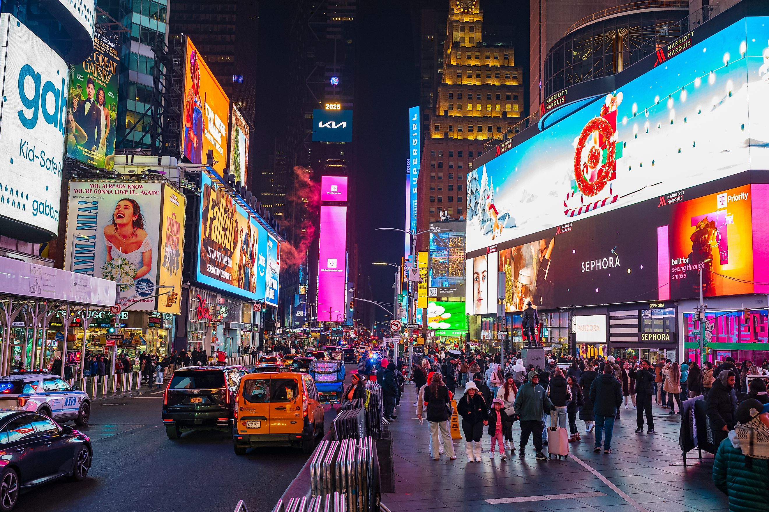
According to the U.S. Census Bureau, New York County, New York is the most densely packed county in the United States. With a population of 1,664,862 (as of 2025), New York County's population per square mile of 73,478 gives it the highest population density of any county in the U.S. The second-most densely packed county, Kings County, is also in New York. In fact, of the top five counties with the highest population density, four of them are in New York City. Read on to learn more about the most densely packed county in America, plus a few of the runners-up.
1. New York County, New York - 73,478 people/sq. mi.

New York County is coextensive with the borough of Manhattan in New York City. Considering that this county/borough is the economic heart of the U.S., it makes sense that it is the most densely populated county in the country. New York County occupies the island of Manhattan, several small adjacent islands (including Roosevelt Island, Belmont Island, Wards Island, Randall's Island, Liberty Island, and Governors Island), and a small sliver of the mainland known as Marble Hill. The island of Manhattan is divided from the mainland by the Harlem River to the north, and is bordered by the East River to the east and the Hudson River to the west. Although the official population of New York County is 1.6 million, its daily commuters and visitors may push that number to over 3.9 million on any given day.
The sections of Manhattan/New York County include:
- Downtown - Lower Manhattan, including everything south of 14th Street. Neighborhoods within the downtown area include the Financial District, Battery Park City, Tribeca, SoHo, Greenwich Village, the Lower East Side, Governors Island, Liberty Island, and Ellis Island. Downtown is known for its narrow, historic streets, its financial center at Wall Street, and as a busy residential and commercial sector.
- Midtown- Midtown Manhattan occupies the middle part of the island, between 14th Street and 59th Street, or the southern edge of Central Park. Key neighborhoods within Midtown Manhattan include Times Square, Midtown East, Midtown West, Chelsea, Hell's Kitchen, the Flatiron District, Roosevelt Island, Belmont Island. This section of New York County is a huge commercial center with iconic skyscrapers, tourist attractions, and major transit centers such as Grand Central Terminal and Penn Station.
- Uptown - Upper Manhattan is the district north of 59th Street. Neighborhoods in this area include Upper East Side, Upper West Side, Harlem, Washington Heights, Inwood, Randalls Island, and Wards Island. The character of Uptown includes cultural and residential areas surrounding Central Park and more residential, hilly areas towards the northern tip of the island of Manhattan.
Some of the most valuable real estate in the country is found in New York County. Manhattan/New York County is known as the headquarters of the financial industry in the U.S., as the home to Wall Street, the New York Stock Exchange, and NASDAQ. New York County holds the most corporate headquarters of any city in the country, containing about 520 million square feet of office space. It is also the site of the United Nations Headquarters, a prime center of international diplomacy.
2. Kings County, New York - 38,254.5 people/sq. mi.

The second most densely populated county in America is Kings County, New York. It is coextensive with Brooklyn in New York City, and is the most populated borough in the city. Kings County is a globally recognized economic and cultural center. More people live in Kings County (2.6 million) than New York County (1.6 million), but because Kings County is larger, at 69.32 square miles of land area (compared with New York County's land area of 22.66 square miles), its population density is second to that of New York County. Kings County/Brooklyn is known for its cultural diversity, with communities from Latin America, the Caribbean, Asia, and Europe all residing within its borders.
Kings County/Brooklyn is on the southwestern tip of Long Island, directly across the East River from New York County/Manhattan. Its neighborhoods include:
- North Brooklyn - The communities of Williamsburg and Greenpoint are found in North Brooklyn, an area known for its arts, culture, boutiques, nightlife, and waterfront views.
- Brownstone Brooklyn - Brooklyn Heights, Cobble Hill, and Park Slope are in this neighborhood. It is characterized by historic, tree-lined streets, 19th-century architecture, and its proximity to Prospect Park.
- Downtown Brooklyn - This includes the DUMBO neighborhood (which stands for Down Under the Manhattan Bridge Overpass). Downtown Brooklyn is the commercial and tech center of Kings County, with industrial warehouses and views of the Manhattan skyline.
- South Brooklyn - Coney Island, Brighton Beach, and Bay Ridge are all within South Brooklyn. This area is known for its boardwalks, beaches, and residential communities.
Brooklyn/Kings County is also known for the Brooklyn Bridge, an architectural and engineering wonder that has connected Kings and New York Counties since 1883. This county is also home to venues like the Brooklyn Academy of Music, Brooklyn Botanic Garden, and Brooklyn Museum.
3. Bronx County, New York - 33,324.3 people/sq. mi.

Bronx County, New York, better known as and coextensive with the Bronx borough in New York City, is the third most densely populated county in the U.S. It is the city's northernmost borough and the only borough in the city located on the mainland, rather than on an island. Home to 1.47 million people, the Bronx was named after Jonas Bronck, an early European settler from 1639 for whom the Bronck's River (now Bronx River) was named. Although the Bronx is densely populated, about 25% of its area is open space, including the Bronx Zoo and the New York Botanical Garden. The Bronx is bordered by Westchester County to the north, the Hudson River to the west, the Harlem River to the south (separating it from Manhattan), the East River to the southeast, and the Long Island Sound to the east. Its area also includes islands in the East River and Long Island Sound, such as City Island and Hart Island, and Rikers Island. Marble Hill, which is politically part of Manhattan/New York County, is actually geographically attached to Bronx County.
The Bronx River separates Bronx County into eastern and western halves. The official dividing line is Jerome Avenue, a continuation of Manhattan's Fifth Avenue. Dozens of small neighborhoods are contained within Bronx County, found within these regions:
- West and Northwest Bronx-Many green spaces, Art Deco buildings, and home to neighborhoods such as:
- Riverdale- Houses large mansions in Tudor and Georgian style, College of Mount Saint Vincent
- Spuyten Duyvil - At the southwestern tip of the Bronx, with historic estates and the Henry Hudson House
- Kingsbridge - Contains Kingsbridge Armory, Van Cortlandt Park, elevated train lines
- Bedford Park - Includes the tree-lined Mosholu Parkway, small businesses, Dominican cafes
- Concourse - Surrounds Grand Concourse Blvd., home to Yankee Stadium
- South Bronx - Industrialized, dense area along the waterfront, with neighborhoods including:
- Mott Haven - At the southernmost tip of the borough, historic row houses, restaurants, art lofts
- Port Morris - Galleries, distilleries, auto shops, freight depots
- The Hub - 148th Street & Third Avenue, known for shopping
- Melrose -Brownstones, apartment houses, community gardens, housing developments
- Hunts Point - Peninsula extending into East River, famous for Hunts Point Cooperative Market
- East and Northeast Bronx - Flatter, more residential, maritime/suburban atmosphere, with neighborhoods like:
- Pelham Parkway- In central/northeastern Bronx, with apartment houses, co-ops, detached homes, and green space
- Morris Park - Filled with bakeries, barbershops, family-owned businesses, homes, apartment buildings, and Albert Einstein College of Medicine
- Co-op City- In the northeast, largest cooperative housing development in the world
- Throggs Neck - At the intersection of the East River and Long Island Sound, under Throggs Neck Bridge, features detached homes, Ferry Point Park, and Trump Links Golf Course
- City Island - Historic fishing village with many seafood restaurants
- Belmont - Home of Little Italy and the Bronx Zoo
4. Queens County, New York - 21,689.6 people/sq. mi.

Queens County, New York is coextensive with the New York City borough of Queens, the largest borough of the city by area (108.72 square miles of land) and second-most populous, with 2.3 million residents. It is on Western Long Island, bordered by Brooklyn, Nassau County, and waterways that meet Manhattan and the Bronx. Queens County is the fourth most densely populated county in the U.S. It is known for its ethnic and linguistic diversity, JFK International Airport, La Guardia Airport, and over 90 distinct neighborhoods. Some of the most popular neighborhoods in Queens are:
- Long Island City - This neighborhood is known for luxury high-rises, waterfront parks, contemporary art, and views of the Manhattan skyline
- Astoria - Astoria is a traditionally Greek neighborhood with Mediterranean restaurants, young professionals, and Astoria Park
- Flushing - One of the largest districts in Queens, Flushing is Queen County's Chinatown and filled with Asian eateries
- East Elmhurst- Home to LaGuardia airport, borders Flushing Bay and the East River
- Jackson Heights - Often called the melting pot of Queens, you can find South Asian, Himalayan, Colombian, and Mexican businesses here
- Forest Hills - Resembles a traditional English village, with Tudor-style homes, private parks, and cobblestone streets
- Jamaica - The economic and transit center of Queens County, Jamaica is where the NYC Subway, Long Island Rail Road, and AirTrain to JFK Airport are found. JFK Airport is on the edge of Jamaica Bay
5. San Francisco County, California - 17,694.7 people/sq. mi.

The city and county of San Francisco takes the fifth spot on our list of the most densely populated counties in the U.S. Sitting on the northern tip of California's San Francisco Peninsula, San Francisco County borders San Mateo County to the south, and borders water with Marin, Contra Costa, and Alameda counties. With 826,000 people living in its 46.91 square miles, its population density is 17,694.7 people per square mile. Roughly 36 neighborhoods are packed into this area, each with its own architecture, culture, and weather pattern. Some of the most popular include:
- Marina District: Along San Francisco County's northern edge, this neighborhood features flat, walkable streets, nightlife, and views of the Golden Gate Bridge
- Pacific Heights: Sits high on a ridge and is one of the most affluent neighborhoods in San Francisco County. It contains multi-million-dollar Victorian mansions and offers panoramic views of San Francisco Bay
- Chinatown: This neighborhood is the oldest Chinatown in North America and largest Chinese neighborhood outside of Asia
- Mission District: A historic Latino neighborhood filled with murals, street art, and Mexican food, includes Mission Dolores Park
- Haight-Ashbury: Famous as the 1960s counterculture birthplace, today this neighborhood is still bohemian with vintage clothing boutiques, smoke shops, record stores, and Victorian architecture
- Noe Valley: Near the center of the city of San Francisco, Noe Valley is favored by families and has been nicknamed "Stroller Valley"
Crowded, Congested Counties
These five U.S. counties are the most crowded, populated counties in America. They are intensely packed with people for many reasons. These include historical settlement, geographic limitations, being centers for the economy and job markets, and housing mass transit networks. Within each of these counties, you will find distinct neighborhoods that hold their own characteristics and identities. These neighborhoods are so unique that people living within these neighborhoods often identify themselves by neighborhood rather than by area or by county.