Least Densely Populated US States
The United States has an overall population density of approximately 97 people per square mile, calculated by dividing the country's 2025 population of about 341.8 million by its land area of roughly 3.5 million square miles. That national average masks an extraordinary range: at one end, the District of Columbia exceeds 11,000 people per square mile; at the other, Alaska has fewer than two. The ten states profiled below all have population densities below the national average by a wide margin, and most have densities below 30 people per square mile. Their thin populations reflect some combination of difficult terrain, extensive federal land ownership, agricultural land use, and historical settlement patterns, and recent data show that population trends across these states have diverged sharply since 2020.
How Population Density Is Measured
Population density is the resident population of a place divided by its land area, expressed as people per square mile (or, in metric, people per square kilometer). The U.S. Census Bureau calculates state densities using its annual population estimates and the official land area figures published in its 2020 gazetteer. Water area is excluded from the calculation, which matters most for states with extensive coastlines or large lakes. The data below use the Census Bureau's 2025 population estimates (July 1, 2025; released January 27, 2026, after a federal funding lapse delayed the originally scheduled December 2025 release) and the corresponding land areas in square miles.
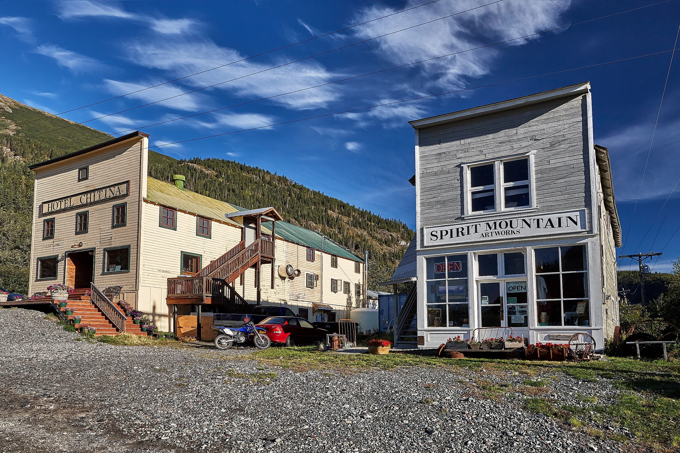
1. Alaska
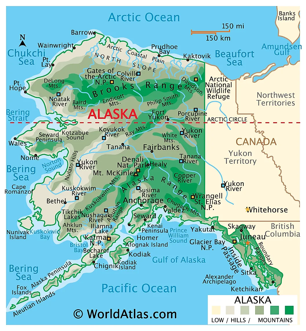
Alaska is by a substantial margin the least densely populated state in the United States, with about 1.29 people per square mile based on a 2025 population estimate of 737,270 residents spread across 570,641 square miles of land. The state covers more area than the next three largest states combined (Texas, California, and Montana) and is roughly five times the size of Germany. About 290,000 residents, or close to 40 percent of the state, live in the city of Anchorage alone; another 32,000 live in Fairbanks. Outside these two centers and the capital, Juneau, the population thins out rapidly into small Indigenous villages and isolated communities accessible mainly by air or boat.
The reasons for Alaska's extremely low density are mostly geographic. Much of the state lies above the Arctic Circle or in the Brooks Range, where winter temperatures regularly fall below minus 40 degrees Fahrenheit and the growing season is too short for most agriculture. Roads connect only a small portion of the populated areas, and large parts of the state are accessible only by aircraft. The economy is concentrated in oil and gas (centered on Prudhoe Bay on the North Slope), commercial fishing, federal government employment, and tourism. Population growth has been roughly flat since 2015, with deaths and out-migration approximately balancing births and in-migration.
2. Wyoming
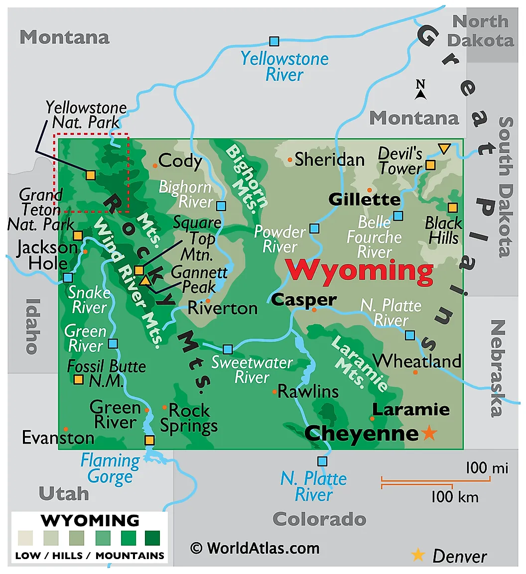
Wyoming has the smallest total population of any U.S. state at 588,753 residents in the 2025 population estimate, giving it a population density of about 6.06 people per square mile across 97,093 square miles of land. The capital and largest city, Cheyenne, has only about 65,000 residents. The next largest cities (Casper, Laramie, and Gillette) each have fewer than 60,000 residents, making Wyoming one of the most rural states in the country.
Roughly 48 percent of Wyoming's land is owned by the federal government, including parts of Yellowstone and Grand Teton National Parks, Bridger-Teton and Shoshone National Forests, and large tracts managed by the Bureau of Land Management. The state's traditional economic base in coal, oil, and natural gas has contracted significantly over the past decade as utilities have shifted away from coal-fired electricity. Wyoming's population growth has been close to zero since 2015, though the 2025 Census release showed a small uptick of about 2,000 residents between July 2024 and July 2025. The largest growth sectors are tourism centered on Jackson Hole and Yellowstone, and a small but expanding renewable energy industry on the eastern plains.
3. Montana
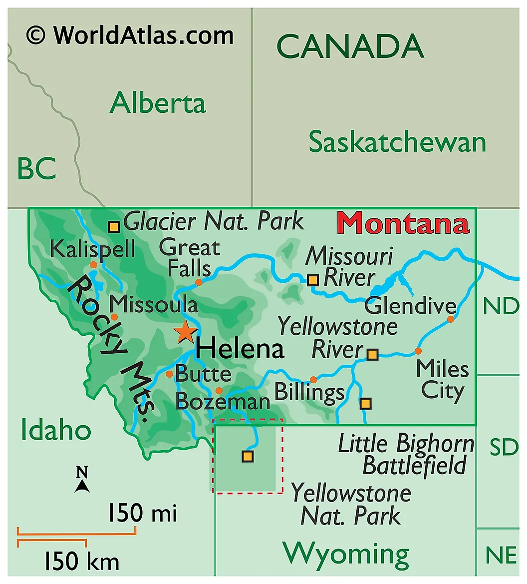
Montana had a 2025 population of 1,144,694 and a land area of 145,546 square miles, producing a density of 7.86 people per square mile. The state is split between two distinct physiographic regions: the Rocky Mountains in the western third, which are forested and mountainous and contain Glacier National Park and most of the state's tourism economy; and the eastern two-thirds, which are part of the Great Plains and are dominated by cattle ranching, wheat farming, and oil and gas extraction in the Bakken Formation along the North Dakota border. Helena is the capital; Billings is the largest city at about 121,000 residents.
Montana grew faster than the national average during the COVID-19 pandemic, with annual increases of around 1.5 percent in 2021 and 2022 driven by remote workers relocating from coastal states. The 2025 Census release identified Montana as one of only two states (with West Virginia) where the rate of population growth accelerated between 2024 and 2025, against the national trend of slowing growth. Most of the gain has been concentrated in Bozeman, Missoula, and the Flathead Valley. Property prices in those areas roughly doubled between 2019 and 2023, and the resulting affordability pressure has slowed in-migration somewhat. Montana also has one of the older median ages of any state at about 40.6 years.
4. North Dakota
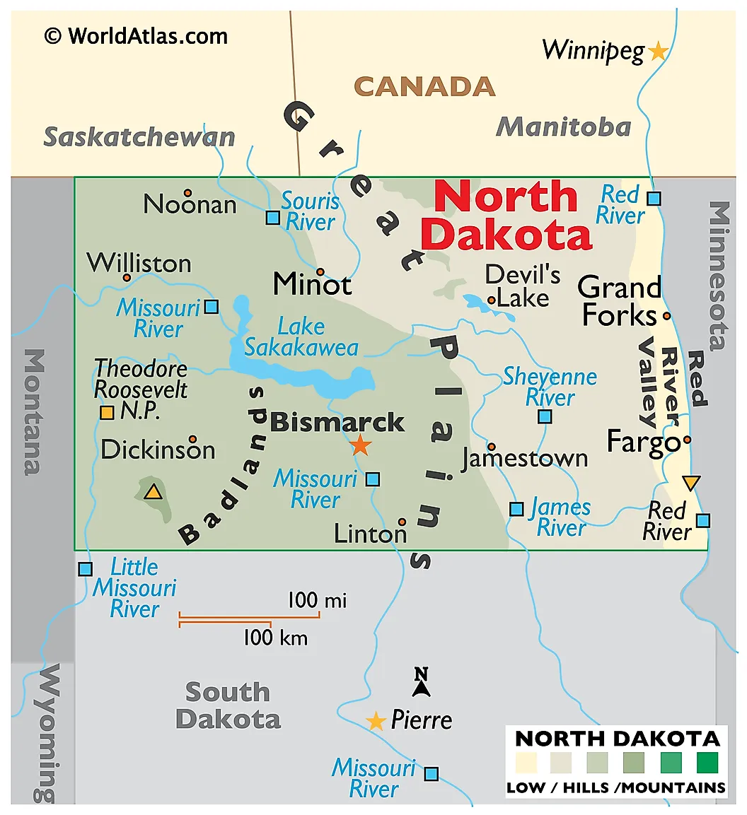
North Dakota had a 2025 population of 799,358 across 69,001 square miles of land, producing a density of 11.58 people per square mile. The state's economy is dominated by agriculture (especially wheat, soybeans, and sugar beets in the eastern Red River Valley) and by oil production from the Bakken and Three Forks Formations in the western part of the state. Bismarck is the capital; Fargo is the largest city at about 134,000 residents.
North Dakota experienced rapid population growth from approximately 2008 through 2014 during the Bakken oil boom, when hydraulic fracturing made the formation's deep oil reserves commercially viable and the state's population grew by more than 12 percent over the decade. Growth has since slowed as oil prices have stabilized at lower levels, but the state's unemployment rate remains among the lowest in the country (typically below 3 percent) and the population continues to grow slowly. The state retains a unique anti-corporate farming law dating to 1932 that restricts corporate ownership of farmland, which has helped maintain the dispersed family-farm structure across the eastern plains.
5. South Dakota
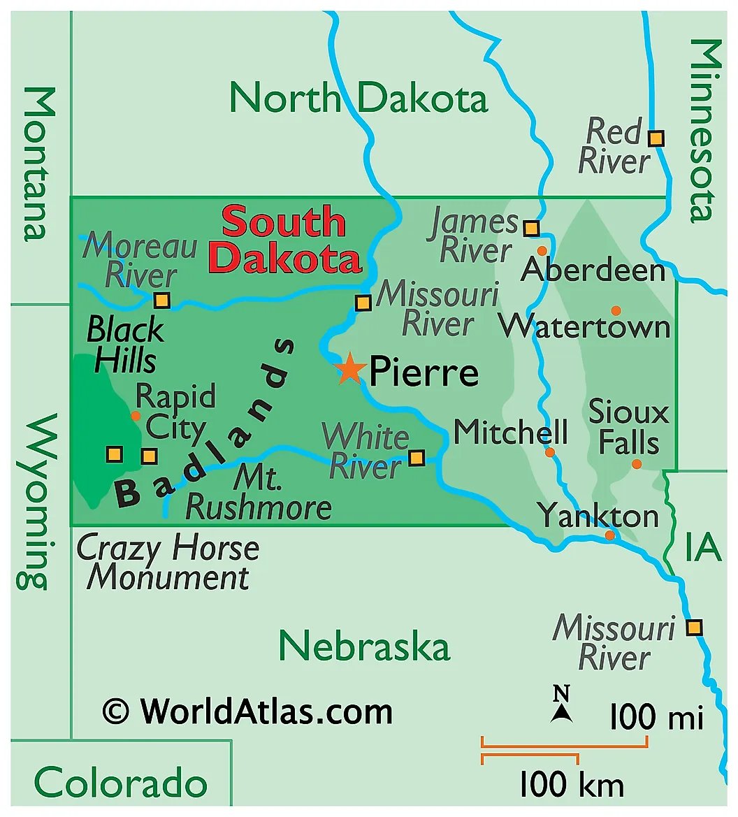
South Dakota had a 2025 population of 935,094 across 75,811 square miles of land, producing a density of about 12.33 people per square mile. The Missouri River runs north to south through the middle of the state and serves as a rough dividing line between two distinct economic zones. East of the river, the land is fertile prairie used for row-crop agriculture (corn, soybeans, wheat) and supports the state's largest cities, including Sioux Falls (the largest city, with about 213,000 residents) and Brookings. West of the river, the land becomes drier and is dominated by cattle ranching, the Black Hills and Mount Rushmore, the Badlands, and the Pine Ridge and Rosebud Indian Reservations.
South Dakota's population has grown steadily but slowly over the past decade, with much of the growth concentrated in Sioux Falls and its surrounding metro area. The state has no personal income tax and a relatively light regulatory regime, which has attracted credit-card processing and financial services firms (most notably Citibank's relocation of its credit-card operations to Sioux Falls in 1981) and small manufacturers. Native Americans make up approximately 9 percent of the state's population, the third-highest share of any state after Alaska and New Mexico, and most live on or near one of the state's nine federally recognized reservations.
6. New Mexico
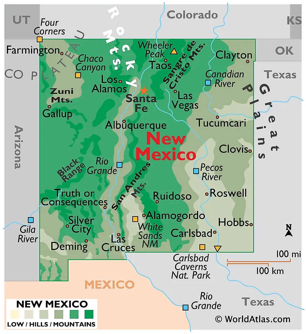
New Mexico had a 2025 population of 2,125,498 across 121,298 square miles of land, producing a density of 17.52 people per square mile. The state is one of the few in the country to have lost population between 2024 and 2025, with the 2025 Census release showing a decline of about 1,300 residents. It is the fifth-largest state in the United States by area and the only state where Hispanic or Latino residents make up a majority of the population (about 50 percent at the 2020 Census). Albuquerque, the largest city, has about 562,000 residents; Santa Fe, the capital, has approximately 89,000. About 35 percent of New Mexico's land is federally owned, including White Sands National Park, Carlsbad Caverns, Gila National Forest, and several large military installations.
The federal presence is a major economic factor: Los Alamos National Laboratory (which originated the Manhattan Project and remains a major nuclear weapons design center), Sandia National Laboratories outside Albuquerque, Kirtland Air Force Base, Holloman Air Force Base, White Sands Missile Range, and Cannon Air Force Base together employ tens of thousands of residents directly and indirectly. The state's other major economic sectors are oil and natural gas extraction in the Permian Basin in the southeast, tourism, and agriculture (chiefly cattle, dairy, and chile peppers). Population growth has been below the national average since 2010, with significant out-migration to Texas and Arizona offsetting natural increase.
7. Idaho
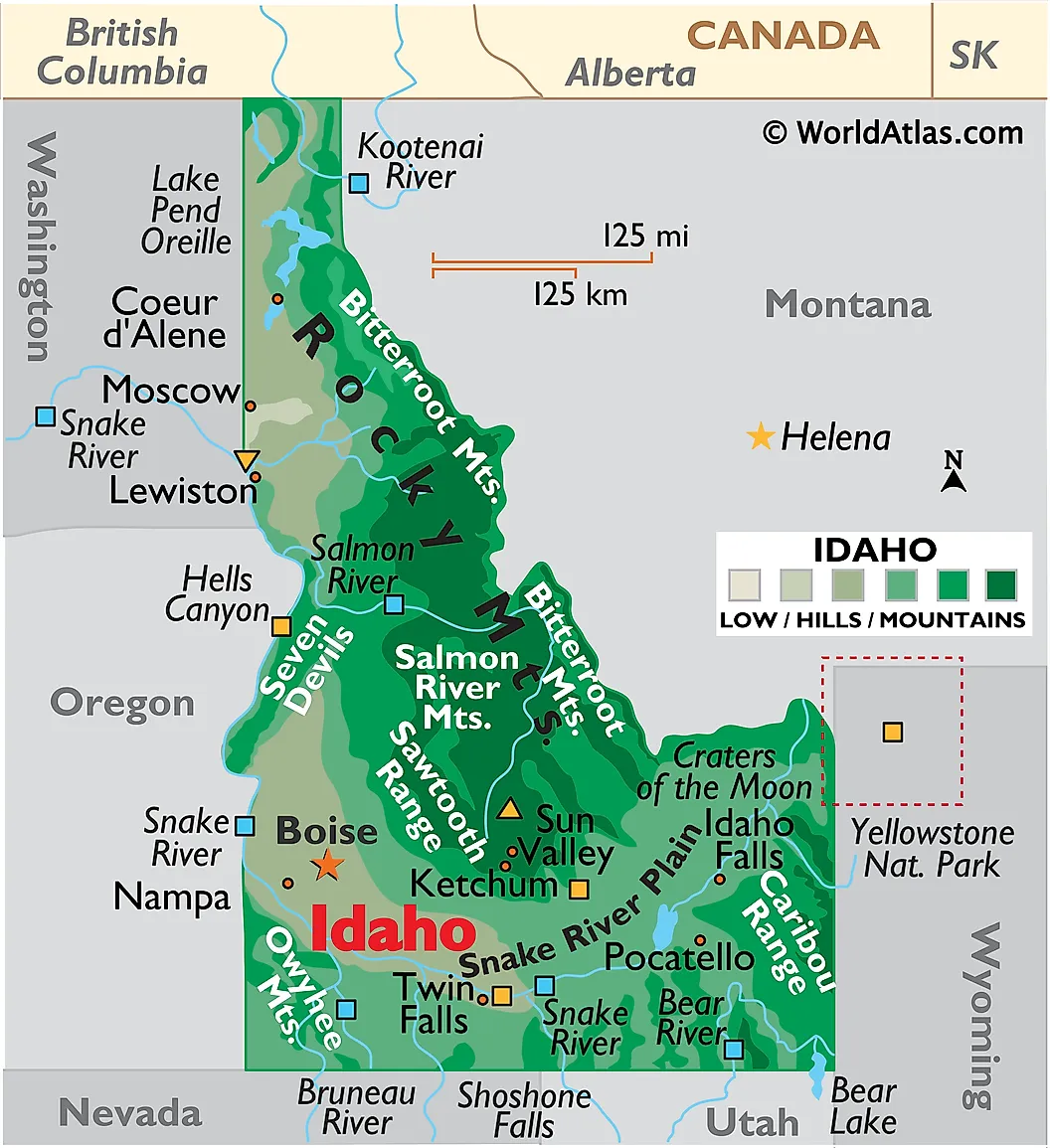
Idaho had a 2025 population of 2,029,733 across 82,643 square miles of land, producing a density of 24.56 people per square mile. The state crossed the two-million population threshold during 2024 and continued growing through 2025, ranking among the fastest-growing states even as the national growth rate slowed. Boise, the capital, has about 240,000 residents in the city proper and roughly 800,000 in its metropolitan area, making it by far the largest population center in the state. Idaho Falls and Coeur d'Alene are the other significant urban areas. Approximately 62 percent of Idaho's land is federally owned, the third-highest share of any state, including most of the Sawtooth and Bitterroot ranges, the Frank Church-River of No Return Wilderness (the largest contiguous wilderness area in the lower 48 states), and Craters of the Moon National Monument.
Idaho was the fastest-growing state in the United States in 2021, with a 3 percent annual population increase driven by pandemic-era migration from California, Washington, Oregon, and Utah. That growth has moderated but remains strong: Idaho added about 29,000 residents between July 2024 and July 2025 (a growth rate of roughly 1.4 percent, nearly triple the national rate of 0.5 percent). Boise, the capital, has about 240,000 residents in the city proper and roughly 800,000 in its metropolitan area, making it by far the largest population center in the state. Agriculture (particularly potato farming, dairy, and wheat) and lumber remain important to the state's economy, but the largest growth sectors have been technology, with the Boise headquarters of Micron Technology being a major employer.
8. Nebraska
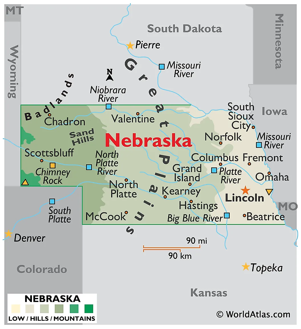
Nebraska had a 2025 population of 2,018,006 across 76,824 square miles of land, producing a density of 26.27 people per square mile. The state is dominated by agriculture: it ranks among the top three U.S. states in beef production, corn production, and ethanol production. The Sandhills region in the northwest is the largest area of sand dunes in the Western Hemisphere, covering about a quarter of the state, and supports a sparse population of cattle ranches on grass-stabilized dunes. Lincoln is the state capital, and Omaha is the largest city with about 487,000 residents in the city itself and roughly 980,000 in the wider metropolitan area.
Population growth has been slow but positive, averaging about 0.4 percent annually over the past decade. Most of the growth has been concentrated in the Omaha and Lincoln metropolitan areas, while many rural Nebraska counties have lost population continuously since the 1930s. The state's economy includes a strong financial services sector centered in Omaha (Berkshire Hathaway is headquartered there, along with Mutual of Omaha and First National of Omaha), the headquarters of Union Pacific Railroad, and Offutt Air Force Base, the headquarters of U.S. Strategic Command.
9. Nevada
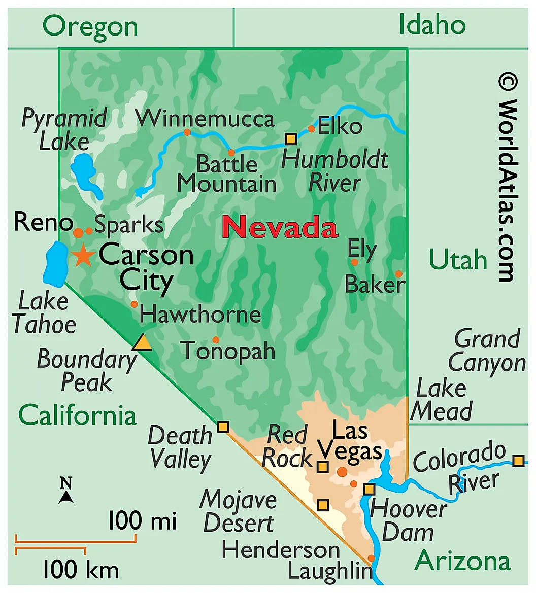
Nevada had a 2025 population of 3,282,188 across 109,781 square miles of land, producing a density of 29.90 people per square mile. The state ranks ninth on this list despite being the most urbanized in the group: approximately 73 percent of Nevada residents live in the Las Vegas metropolitan area in Clark County, and another 15 percent in the Reno metropolitan area in Washoe County. The rest of the state is among the most sparsely populated land in the country, with several counties in the central and northern desert having fewer than one person per square mile.
About 80 percent of Nevada's land is federally owned, the highest share of any state in the country (Alaska is higher in absolute terms but slightly lower as a percentage). The Department of Defense controls the Nevada National Security Site (the former Nevada Test Site, about 1,360 square miles), Nellis Air Force Base, and the Naval Air Station Fallon. Most of the rest is managed by the Bureau of Land Management. The state's economy is dominated by tourism, gaming, and hospitality (centered on the Las Vegas Strip), with growing sectors in logistics, data centers, and mining (Nevada produces approximately 70 percent of U.S. gold output, mostly from the Carlin Trend in the north). Nevada has grown faster than the national average for most of the past forty years, but growth has slowed since 2022 as Las Vegas housing prices have risen and Western water constraints have become more acute.
10. Kansas
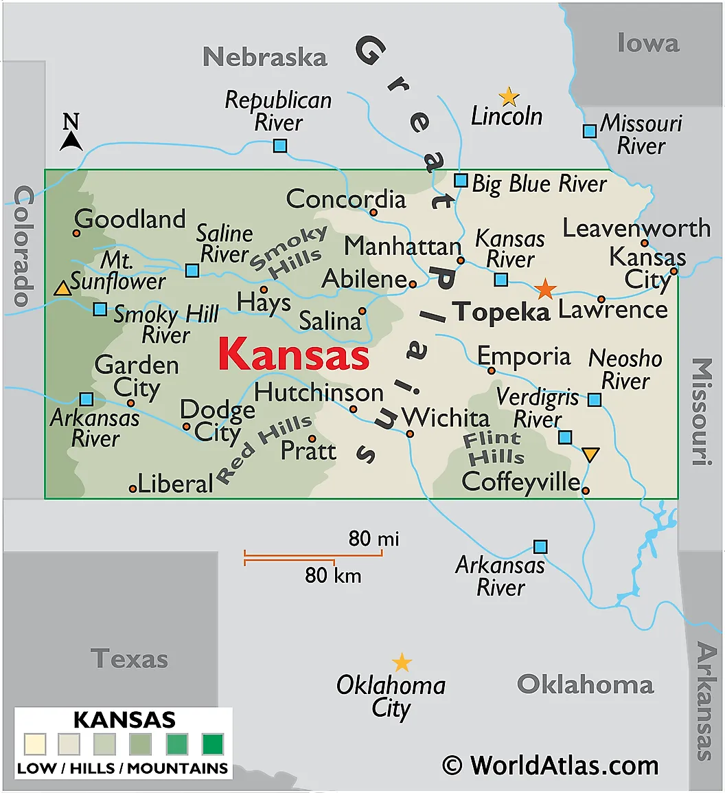
Kansas had a 2025 population of 2,977,220 across 81,759 square miles of land, producing a density of 36.42 people per square mile. The state is one of the largest U.S. producers of wheat, sorghum, and beef cattle, and most of its area is given over to row-crop agriculture (in the wetter eastern third) or to wheat farming and cattle ranching (in the drier western two-thirds). The Flint Hills region in the east-central part of the state contains one of the last large remnants of the tallgrass prairie that once covered the central United States. Topeka is the capital; Wichita is the largest city with about 397,000 residents.
Kansas has grown slowly but steadily over the past decade, with most of the growth concentrated in the Kansas City suburbs in Johnson County and the Wichita metropolitan area. The state's economy includes significant aviation manufacturing centered on Wichita (Spirit AeroSystems, Textron Aviation, and Bombardier Learjet all operate major facilities there), as well as the headquarters of Sprint (now T-Mobile US) and the Garmin GPS company in Olathe. Rural western Kansas continues a long-term population decline that began in the 1930s, with most counties west of Salina having lost population every decade since.
Population Trends Across the Low-Density States
The ten least densely populated states have followed sharply divergent trajectories over the past fifteen years. The pandemic period from 2020 through 2022 produced unusual growth in several Mountain West states (Idaho, Montana, Nevada) as remote-capable workers relocated from coastal metropolitan areas in search of cheaper housing and outdoor recreation. Idaho was the fastest-growing state in the country in 2021 and has added roughly 230,000 residents since the 2020 Census. Montana and Nevada both grew faster than the national average over the same period, and Montana was one of only two states (with West Virginia) whose growth rate accelerated between 2024 and 2025 according to the 2025 Census release.
The Plains states have moved in more mixed directions. North Dakota's 2008-2014 oil boom produced rapid growth and the state has continued to add residents in each of the last four years, reaching a record 799,358 residents in 2025. South Dakota, Nebraska, and Kansas have all grown slowly, with population gains concentrated in a few metropolitan areas (Sioux Falls, Omaha-Lincoln, Wichita, and Kansas City) and continued declines in rural counties. New Mexico was one of the few states in the country to lose population between 2024 and 2025. Wyoming's growth has been close to zero for the past decade, reflecting the contraction of its coal industry, though the 2025 Census release showed a small uptick. The national population growth rate slowed sharply from 1.0 percent in 2024 to 0.5 percent in 2025, driven mainly by a drop in net international migration from 2.7 million to 1.3 million.
Federal land ownership is a structural factor that limits population growth across most of these states. Nevada (80 percent federal), Idaho (62 percent), Wyoming (48 percent), New Mexico (35 percent), and Montana (29 percent) all have populations geographically constrained by the boundaries of national parks, national forests, Bureau of Land Management holdings, Indian reservations, and military installations. Even where federal land permits some development (grazing leases, mining claims, recreation), it cannot support dense residential settlement. These structural constraints suggest that the rank order of the least densely populated states is unlikely to change substantially in the coming decades, even as absolute numbers continue to drift upward in the faster-growing members of the group.
The Updated Rankings
| Rank | State | 2025 Population | Land Area (sq mi) | Density (people/sq mi) |
|---|---|---|---|---|
| 1 | Alaska | 737,270 | 570,641 | 1.29 |
| 2 | Wyoming | 588,753 | 97,093 | 6.06 |
| 3 | Montana | 1,144,694 | 145,546 | 7.86 |
| 4 | North Dakota | 799,358 | 69,001 | 11.58 |
| 5 | South Dakota | 935,094 | 75,811 | 12.33 |
| 6 | New Mexico | 2,125,498 | 121,298 | 17.52 |
| 7 | Idaho | 2,029,733 | 82,643 | 24.56 |
| 8 | Nebraska | 2,018,006 | 76,824 | 26.27 |
| 9 | Nevada | 3,282,188 | 109,781 | 29.90 |
| 10 | Kansas | 2,977,220 | 81,759 | 36.42 |
Source: U.S. Census Bureau's 2025 population estimates (July 1, 2025; released January 27, 2026); state land areas from the 2020 Census Bureau gazetteer.


