The Microclimates of San Francisco
"If You Don't Like The Weather, Walk A Few Blocks" is a meteorological refrain often used to describe the weather in San Francisco, California. This is a statement that is not far from the truth. San Francisco is a city with a variety of micro-climates. The city's varied topographic, oceanic influences, and geographic location influences the micro-climates of San Francisco.
Geography Of San Francisco
San Francisco is a hilly city. There are at least 50 hills located with the city's boundaries. The highest hill within the city of San Francisco is Mount Davidson. Its elevation is 283 m (928 ft) above sea level. This city is a maritime city. In terms of land forms, San Francisco is a peninsula. The Pacific Ocean forms the city's western boundary. The Golden Gate strait and San Francisco Bay form the northern and eastern boundaries of San Francisco respectively. Only the southern border is a land boundary.
Oceanic Influences
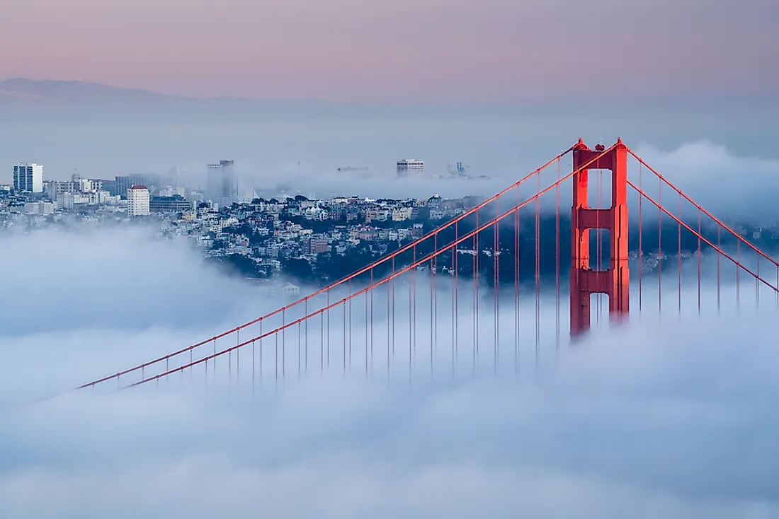
Being in the direct path of cool ocean currents, the climate of San Francisco is moderated. Temperatures in San Francisco are often cooler than locations further inland within the Bay Area region. The oceanic influences produce dense fog in San Francisco. Cool ocean currents combining with a marine layer help to produce dense fog. The Golden Gate is another factor influencing San Francisco's climate. Winds will blow through the Golden Gate, bringing fog with it. This directly impacts San Francisco. This is further influences by warmer inland weather. A low pressure system is created by warmer temperatures further inland, which contrast with high pressure on California's Pacific coast. This draws in winds from the Pacific Ocean.
San Francisco's Terrain
In addition to the oceanic influences, the terrain influences the micro-climates of San Francisco. The city of has a land area of 121.46 sq km (46.89 sq mi). The terrain in this small land area varies greatly from one neighborhood to another. This is due to the hills in the center of the city. Mount Sutro and Mount Davidson, known as the Twin Peaks, are the highest hills in the city. The hills are part of the coastal mountain ranges in California. Neighborhoods bordering the Pacific Ocean tend to have cool, foggy weather, especially the western portion of the Sunset District. In contrast, the micro-climate in the Noe Valley neighborhood located east of the Twin Peaks is warmer than other parts of the city due to the hills blocking fog and cold winds. The same is so for the Mission District, which is at a lower elevation than the Noe Valley. Other hills within the city have the similar effect of creating micro-climates. Many hills create valleys that are somewhat sheltered from the fog and chilly ocean winds.
The topography can also steer cold winds and fog to certain areas. Candlestick Point is located in the far southeast area of San Francisco. It is located the furthest from the Pacific Ocean. However, Candlestick Point can be just as foggy and chilly as areas bordering the Pacific Ocean. The Alemany Gap plays a large role in this. The Alemany Gap is a mountain pass in between San Bruno Mountain and the Twin Peaks area. Wind and fog from the Pacific Ocean will flow through this pass towards Candlestick Point. There are two branches of the Alemany Gap. This is influenced by the nearby McLaren Ridge. Wind and fog flow through this pass and around McLaren Ridge. This creates two wind tunnels, steering winds that converge at Candlestick Point. This makes Candlestick Point one of the windiest, foggiest, and coldest neighborhoods in San Francisco, rivaling areas on the Pacific coast of the city.
Multiple Micro-Climates
Terrain and oceanic influences play a major role in creating San Francisco's micro-climates. These factors also play a role in where these micro-climates exist within the city.