The Counties With The Most Coastline
Dorchester County, Maryland, has about 593 square miles of land and an estimated 1,539 miles of shoreline. At first, those numbers seem difficult to reconcile. A map provides the answer. Chesapeake Bay, rivers, and tidal creeks divide the county's western half. Marshes, coves, and islands break it into narrow fingers of land.
The National Oceanic and Atmospheric Administration, or NOAA, faces the same measurement problem on a national scale. Its traditional figure gives the US 95,471 miles of shoreline, but NOAA notes that no single legally designated shoreline exists for calculating the country's total. The agency's method includes the outer coast, offshore islands, sounds, bays, rivers, and creeks to the head of tidewater or to where tidal waters narrow to 100 feet.
The counties below have some of the largest documented shoreline totals connected to one ocean system. The figures come from federal, state, county, and regional government sources, but agencies do not measure every shoreline in exactly the same way. The numbers should not form a strict national ranking. Alaska is also absent for a specific reason. The state has boroughs and census areas, which the US Census Bureau classifies as county equivalents rather than counties.
Dorchester County, Maryland

Reported shoreline of 1,539 miles.
The Chesapeake Bay side of Dorchester County hardly contains a straight edge. The Choptank River forms much of the northern boundary, while the Little Choptank, Honga, Nanticoke, and Transquaking river systems break up the land farther south.
The Maryland Geological Survey calculated approximately 1,539 miles of shoreline in Dorchester, the highest figure in its county dataset. The agency used digitized shorelines mapped primarily during the late 1980s and early 1990s and cautions that its figures are approximate. It applied the same method throughout Maryland, however, making comparisons within the state particularly useful.
Blackwater National Wildlife Refuge protects more than 30,000 acres near Cambridge, much of it composed of tidal marsh, forests, and shallow water. West of the refuge, Hoopers Island follows a narrow line of land through the Chesapeake. Some stretches are barely wide enough to put much distance between one shore and the other.
Dorchester has about 593 square miles of land. Its measured shoreline is more than two and a half times that number, a consequence of the waterways that repeatedly cut into its western half.
Somerset County, Maryland

Reported shoreline of 1,106 miles.
Smith Island is a good place to understand Somerset County's 1,106-mile shoreline figure. The inhabited Chesapeake Bay island group sits about 12 miles west of Crisfield and consists of low-lying islands divided by marshes and waterways.
Back on the mainland, the shore does not become much simpler.
The Big Annemessex and Manokin rivers reach inland from Tangier Sound, while creeks branch away from them. The Pocomoke River forms much of Somerset's eastern boundary. Marshes dominate substantial portions of the county's western side.
The Maryland Geological Survey calculates about 338 square miles of land in Somerset County. It ranks only eighteenth among Maryland counties by total area in the agency's table, yet its 1,106 miles of shoreline are second only to Dorchester in the same dataset.
The difference becomes clear around places such as Deal Island and Fairmount, where roads repeatedly approach tidal creeks, marshes, and Tangier Sound. Somerset's outer dimensions reveal little about the amount of water woven through its western half.
Suffolk County, New York

Reported coastline of 980 miles.
Long Island extends roughly 118 miles between New York Harbor and Montauk Point, but Suffolk County's eastern end refuses to follow a single line toward the Atlantic.
Suffolk County government reports 980 miles of coastline. Long Island Sound borders the county to the north, and the Atlantic Ocean runs along its southern side. Great South Bay, Moriches Bay, Shinnecock Bay, Gardiners Bay, and the Peconic Bays occupy much of the space between those larger bodies of water.
Then Long Island splits.
The North Fork reaches toward Orient, while the South Fork continues to Montauk Point. Peconic Bay lies between them. Shelter Island sits between the forks, adding another island perimeter to the county.
Along the South Shore, barrier islands create a separate set of edges. Fire Island stretches between the Atlantic and Great South Bay, with several inlets interrupting the barrier island system.
The drive between the Nassau County line and Montauk covers only a fraction of the distance required to trace Suffolk's bays, harbors, forks, and islands.
Hancock County, Maine

Reported coastline of 952.7 miles.
Hancock County's coastline changes direction constantly. County hazard mitigation documents put its total at 952.7 miles, the longest county coastline in Maine.
Mount Desert Island accounts for a substantial piece of the puzzle. Bar Harbor faces Frenchman Bay on its eastern side, while Somes Sound reaches deep into the island from the south. Much of Acadia National Park lies here, including the granite headlands along the Park Loop Road.
The mainland is equally irregular. Frenchman Bay separates Mount Desert Island from the Schoodic Peninsula, while Union River Bay reaches north toward Ellsworth. Blue Hill Bay cuts into the county farther west.
Smaller islands add more shoreline offshore.
Maine's statewide numbers show the effect of all those indentations. NOAA's traditional measurement gives Maine approximately 3,478 miles of shoreline, slightly more than California's 3,427 miles. California has a much longer general oceanfront span, but Maine's islands, bays, tidal rivers, and peninsulas force a shoreline measurement to take countless detours.
Hancock County contains nearly 1,000 miles of those detours.
Worcester County, Maryland

Reported shoreline of 774 miles.
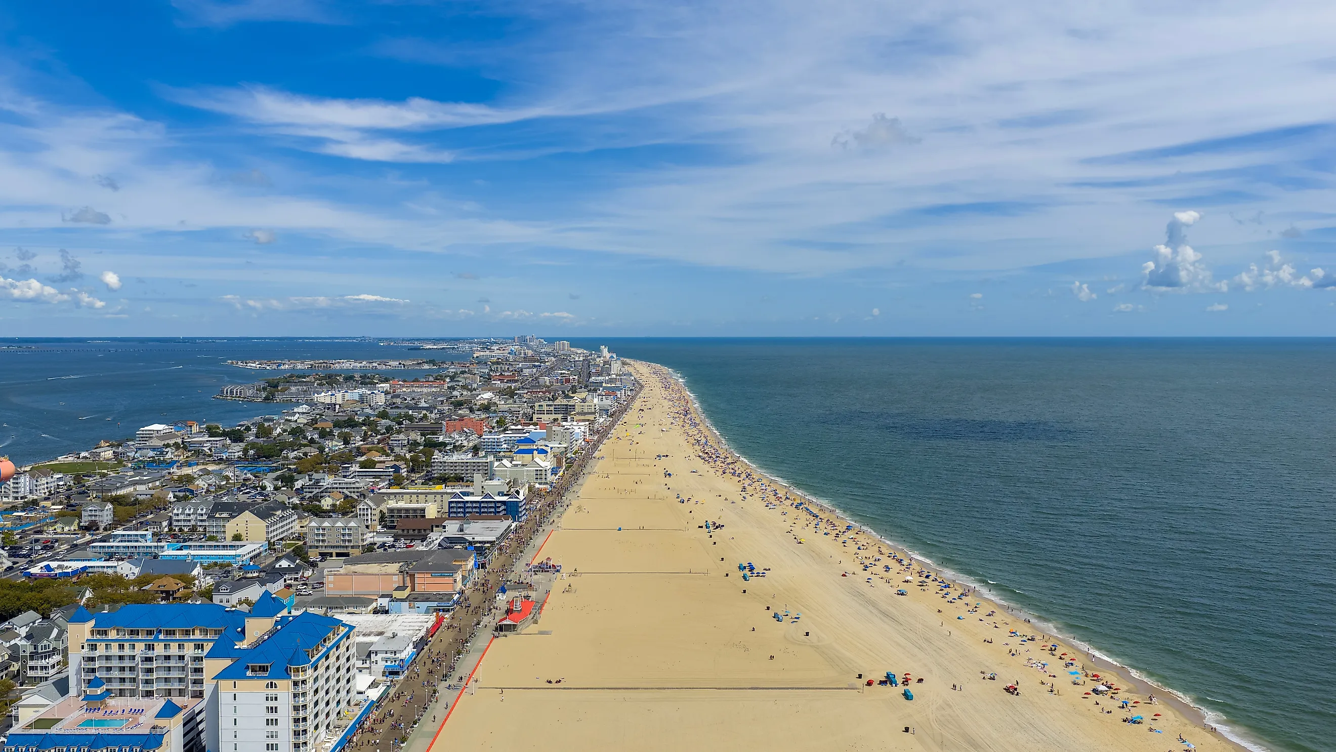
Visitors standing on the beach in Ocean City see only one side of Worcester County's coastal geography.
The Atlantic forms the county's eastern edge, with Ocean City in the north and Assateague Island continuing south toward Virginia. Behind that narrow barrier coast lies a separate network of shallow bays.
Assawoman Bay sits west of northern Ocean City. Isle of Wight Bay follows farther south before the system continues through Sinepuxent Bay and Chincoteague Bay. Creeks and tidal channels extend from those bays toward the mainland.
Add those edges together, and the Maryland Geological Survey records approximately 774 miles of shoreline in Worcester County. The county has about 475 square miles of land.
Assateague makes the contrast particularly easy to see. On parts of the barrier island, the Atlantic lies to the east while Sinepuxent Bay lies only a short distance to the west. Worcester's ocean beach might receive most of the attention, but its protected bay shore contributes heavily to the county's much larger shoreline total.
Talbot County, Maryland

Reported shoreline of 605 miles.
Talbot County has no Atlantic beach, yet the Maryland Geological Survey measures 605 miles of shoreline within its roughly 259 square miles of land.
The county occupies a section of Maryland's Eastern Shore between Chesapeake Bay and the Choptank River. The Miles River enters from the west and separates several long peninsulas around St. Michaels. The Tred Avon River reaches toward Easton, passing Oxford near its mouth.
Tilghman Island extends along the county's western side between Chesapeake Bay and the Choptank River. Knapps Narrows, a narrow channel crossed by a drawbridge, separates the island from the mainland.
Smaller creeks keep adding bends between these larger waterways. Broad Creek branches off the Choptank, while Harris Creek reaches north between peninsulas near Tilghman and Bozman.
On a road map, Easton and St. Michaels are only about 10 miles apart as the crow flies. Along the surrounding tidal shore, the route becomes far longer.
Barnstable County, Massachusetts

Reported coastline of 586 miles.
Cape Cod's familiar hook accounts for nearly all of Barnstable County. A Massachusetts watershed assessment gives the peninsula about 440 square miles of land and 586 miles of coastline. All 15 Cape Cod towns are within Barnstable County.
Three major marine boundaries surround it.
The Atlantic faces the Outer Cape from Chatham through Orleans, Eastham, Wellfleet, Truro, and Provincetown. Cape Cod Bay fills the inside of the peninsula's curve. Nantucket Sound lies south of towns such as Barnstable, Yarmouth, Dennis, and Harwich.
Provincetown adds one of the strangest turns. The northern end of Cape Cod curls back toward the southeast, forming Provincetown Harbor inside the hook.
The coast around Chatham is even less stable. Barrier beaches, shoals, and inlets have shifted repeatedly as currents and storms move sand along the shoreline. Massachusetts tracks these changes through historical shoreline mapping.
Cape Cod might have one of the most recognizable outlines in America, but its 586-mile measurement requires following far more than the broad hook visible on a national map.
St. Mary's County, Maryland

Reported shoreline of 536 miles.
Point Lookout marks the southern tip of St. Mary's County, where the Potomac River reaches Chesapeake Bay. From there, the county extends north as a peninsula with tidal water along most of its outer boundary.
The Maryland Geological Survey records 536 miles of shoreline around approximately 373 square miles of land.
The Potomac forms the southwestern side. The Patuxent River follows the northeastern edge, and Chesapeake Bay meets the county to the southeast. Smaller waterways cut into the peninsula from all three.
Breton Bay reaches toward Leonardtown from the Potomac. St. Clement's Bay creates another deep indentation farther north. The St. Mary's River enters near the county's southern end before passing St. Mary's City.
The county's shape is easier to understand from Point Lookout State Park. The narrow peninsula there has the Potomac on one side and Chesapeake Bay on the other, with the two bodies of water meeting immediately offshore.
Anne Arundel County, Maryland

Reported shoreline of 508 miles.
Annapolis faces Chesapeake Bay, but most of Anne Arundel County's 508 miles of shoreline follow rivers and creeks rather than the bay itself.
The Severn River runs past Annapolis before reaching the Chesapeake. The South River enters the bay several miles farther south. North of Annapolis, the Magothy River creates another broad tidal corridor. Each river branches into creeks and coves before reaching the main bay.
The Maryland Geological Survey calculates about 418 square miles of land in Anne Arundel County and approximately 508 miles of shoreline.
The geography becomes especially clear around Annapolis. Downtown sits beside Spa Creek and the Severn River, while the Chesapeake lies just beyond the river's mouth. Across the Severn, the Broadneck Peninsula separates the Severn from the Magothy.
Farther south, another series of peninsulas divides the South, Rhode, and West rivers.
Anne Arundel's coastline is therefore less about one continuous Chesapeake Bay edge than a collection of tidal rivers extending inland from it.
San Juan County, Washington

Reported marine shoreline of 414 miles.
San Juan County reaches more than 400 miles of shoreline without a single long mainland coast.
The county consists of San Juan, Orcas, Lopez, and Shaw islands, along with scores of smaller islands and rocks. Washington's Puget Sound Partnership reports approximately 414 miles of marine shoreline within the county.
The islands occupy the Salish Sea between mainland Washington and Vancouver Island. The Strait of Juan de Fuca connects those waters to the Pacific Ocean.
Orcas, the largest of the San Juan Islands by area, has an especially irregular outline. East Sound cuts deeply into its southern half, almost dividing the island. San Juan Island has its own long bays, including San Juan Channel-facing Friday Harbor and the more protected waters around Roche Harbor.
Ferries serve San Juan, Orcas, Lopez, and Shaw because no bridge connects the islands to mainland Washington.
Every additional island also adds another complete perimeter. Washington counts more than 170 named islands and rocks in the San Juan archipelago, helping a geographically small county accumulate hundreds of miles of Pacific-connected shore.
Why Coastline Numbers Are So Difficult To Rank
Putting Dorchester's 1,539 miles beside San Juan's 414 miles makes the comparison look straightforward. The underlying measurements are not.
The Maryland Geological Survey states that its county shoreline figures are approximate. The agency digitized shorelines from aerial imagery, primarily from the late 1980s and early 1990s, and applied the same measurement method across Maryland. Suffolk County, Hancock County, Massachusetts, and Washington rely on their own datasets and methods.
NOAA encounters the same issue nationally. Its traditional measurement places the US shoreline at 95,471 miles. A later high resolution geospatial calculation produced 221,923 statute miles for the United States and its territories. NOAA does not consider the newer number an official replacement for the traditional figure.
Map detail accounts for much of the difference. A broad measurement can skip tiny coves and irregularities. Increase the resolution, and the line follows more creek mouths, islands, headlands, marshes, and inlets.
The counties above make that problem visible on a manageable scale. Dorchester's shore disappears into marshes and tidal creeks. Suffolk divides around two forks and several large bays. Hancock breaks apart around islands and peninsulas. San Juan County consists almost entirely of islands.
A ruler measures the distance across these counties easily. Following the water's edge is another matter.