5 Best Lakeside Towns in New South Wales
The New South Wales towns of Jindabyne, Forster, Toronto, The Entrance, and Menindee have all been shaped by the lakes they overlook. One sits on a reservoir that swallowed a township in the sixties. Another stands on the shores of Australia's largest coastal saltwater lake. A third looks out on the state's biggest producer of Sydney rock oysters. Each of these waterside towns makes for a superb getaway.
Jindabyne, Snowy Mountains

The town of Jindabyne originally stood in a grassy valley on the Snowy River until Jindabyne Dam, a rockfill wall 236 feet high and 1,099 feet long, was completed in 1967. Part of the Snowy Mountains Scheme, a massive hydroelectric and irrigation project that reshaped the region, residents were moved uphill between 1962 and 1964.
Most buildings were demolished, and whatever remained of the old town was then covered by water. When Lake Jindabyne levels fall in dry years, you can spot foundation stones from several old buildings, as well as the steps of the old Roman Catholic church, along the shoreline. The Snowy Region Visitor Centre does a good job of explaining the whole sequence of events.
Fishing is another reason to come to Jindabyne. The Gaden Trout Hatchery, six miles northwest of town on the Thredbo River, breeds rainbow trout, brown trout, brook trout, and even Atlantic salmon to stock lakes and rivers across New South Wales, with guided tours available from its visitor center. You can get out onto the lake itself for some fishing, with boat ramps allowing access to much of the lake's roughly 11 square miles of water.
At an altitude of 3,002 feet in the Snowy Mountains, Jindabyne is one of the highest towns of its size in the country, with snowfall not uncommon. In warmer months, the Thredbo Valley Track takes mountain bikers down through snow gum forest to the Thredbo River. Nearby Kosciuszko National Park contains Mount Kosciuszko, the highest mountain in Australia at 7,310 feet, along with the ski fields of Thredbo, Perisher, and Charlotte Pass.
Forster, Mid North Coast

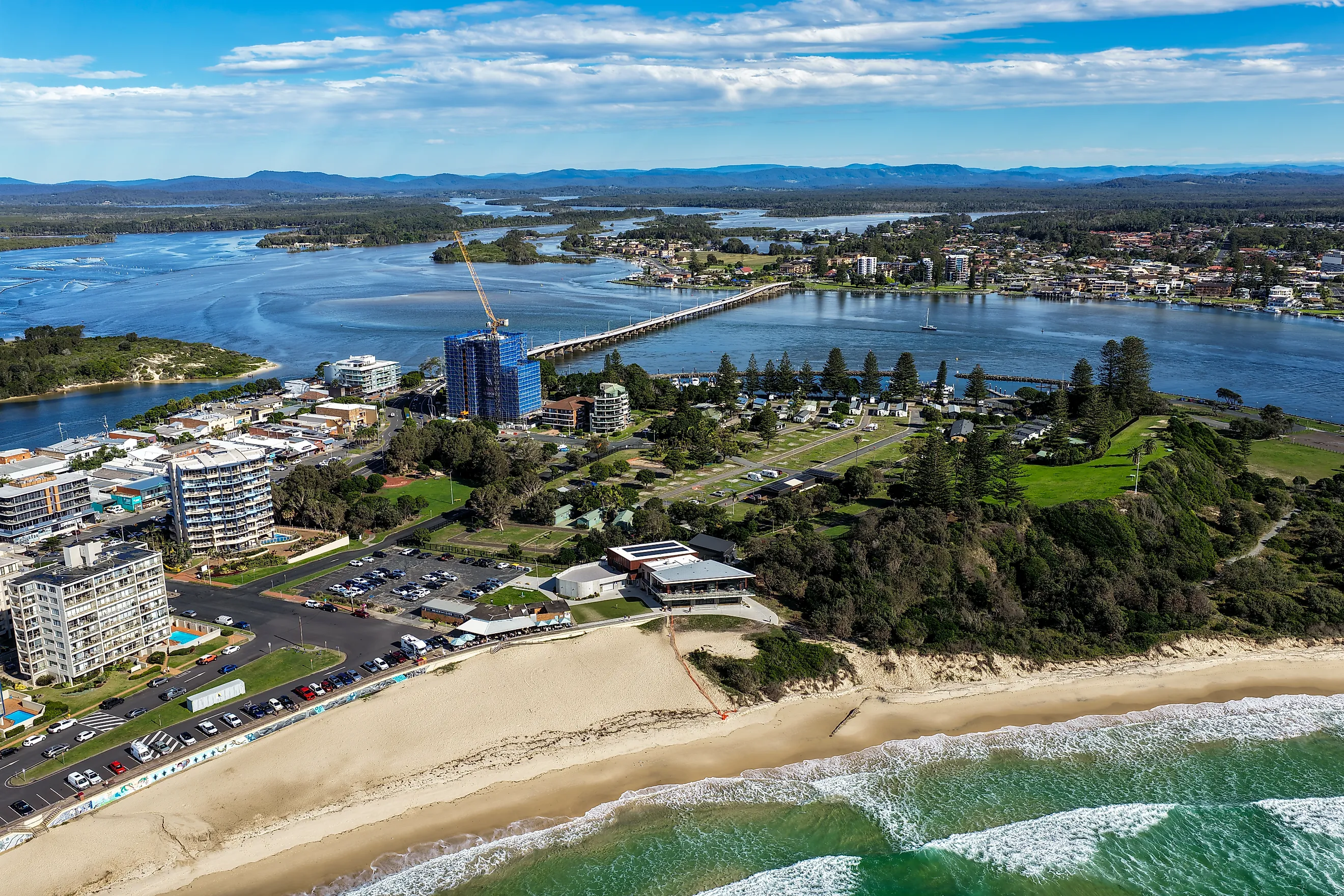
Wallis Lake covers 38 square miles on a stretch of shoreline marketed as the Barrington Coast, and Forster occupies the eastern side of its mouth. For 35 years, the only way to cross the narrow channel here was aboard a punt roped to a motorboat that had to feel its way between shifting sandbanks.
That low-tech method ended in July 1959, when the Forster-Tuncurry Bridge opened. Built with 47 spans over a length of 2,070 feet, it was the longest pre-stressed concrete bridge in the Southern Hemisphere at the time. A shared path with a viewing bay partway across was added in 2005. The lake is best known for its Sydney rock oysters and produces more of these delicacies than any other body of water in the state.
On the ocean side of town, the Bicentennial Walk starts at Forster Main Beach and runs along the headlands past Bennetts Head toward One Mile Beach, passing the Forster Ocean Baths on the way. South of town, Booti Booti National Park occupies the strip between lake and sea.
Climb through the rainforest here to Cape Hawke Lookout and its tower for spectacular views inland to Barrington Tops plateau, Wallingat National Park, and out over the Pacific. If you're lucky and are here between May and November, you may catch sight of humpback whales passing by.
Toronto, Lake Macquarie

Named after the city in Canada, Toronto, NSW, was founded in 1887 on the shores of Lake Macquarie. At 42 square miles, it's Australia's largest coastal saltwater lake. Joined to the Tasman Sea by the narrow Swansea Channel, Toronto is the biggest town on the western side. Its waterfront can best be enjoyed with a stroll along Victory Parade, which follows the shoreline past the Toronto Hotel, built in 1887, to the Royal Motor Yacht Club.
A shared cycling and walking path links the town to Fassifern railway station, passing a 250-million-year-old petrified forest en route. Also visit the Toronto Foreshore, keeping an eye out for the plaque commemorating the Reverend Lancelot Threlkeld. A missionary here in 1830, Threlkeld compiled one of the earliest written records of the Aboriginal Awabakal language.
Across Catalina Bay, Rathmines is where the Royal Australian Air Force ran its main flying boat base from 1939 to 1961. At its wartime peak, the station housed 3,000 personnel, 1,000 of them members of the Women's Auxiliary Australian Air Force, and its Catalina aircraft flew anti-submarine patrols along the east coast. The Rathmines Catalina Association runs tours of the site and is restoring an old Catalina at nearby Kilaben Bay. A memorial topped with a Catalina propeller was dedicated in Catalina Park in 1972.
The Entrance, Central Coast

At half past three in The Entrance, a quaint town on the Central Coast, a large group of Australian pelicans gathers for a feed. This captivating event takes place frequently at the aptly named Pelican Plaza in Memorial Park and is led by volunteers from Marine Wildlife Rescue Central Coast who hand out fish and talk about the birds, including the injured ones they treat.
The town's unusual name comes from the channel where Tuggerah Lake, the largest of three connected lagoons known as the Tuggerah Lakes, meets the Tasman Sea. On the ocean side, the Grant McBride Baths were built in stages between 1938 and 1965, with free entry to the pools, which stay open year-round. The nearby Entrance Historic Carousel has been a fixture on the waterfront since the 1930s and was made in Germany in the 1800s.
Beside the carousel, Vera's Water Garden is a free splash park that's fun for the kids, while a shared 7.5-mile path follows Tuggerah Lake south through Long Jetty, a strip of lakefront jetties, cafes, and secondhand shops. Picnic Point Reserve at the northwestern corner has a boat ramp, playground, and skate park.
Pelican Island, just offshore in Tuggerah Lake, is a breeding site for migratory shorebirds and part of Wyrrabalong National Park. On the coastal section of that same park, Crackneck Lookout is a good place to watch for humpback whales between May and August.
Menindee, Far West

The Darling River winds its way to this corner of New South Wales after crossing hundreds of miles of dry country, and Menindee was the first town founded on it. Established in the 1850s, it's the oldest European settlement in the western half of the state. The first business to open was the Menindee Hotel (now Maidens Hotel), the second oldest hotel in the state in continuous operation. Robert O'Hara Burke and William John Wills stopped here in October 1860 on their expedition meant to cross the continent to the Gulf of Carpentaria. Neither man came back.
The sheer amount of water stored here surprises most first-time visitors. The Menindee Lakes are a shallow chain filled from the Darling River, and the basins have their own names, among them Lake Wetherell, Lake Pamamaroo, Copi Hollow, Lake Menindee, and Lake Cawndilla. Dead river red gums stand in the shallows where floodwater reached them and are the image most people think of when remembering the place.
Kinchega National Park begins at the edge of town and runs 39 miles south along the river across an impressive 109,175 acres. The Kinchega Woolshed, built in 1875 from corrugated iron and river red gum, stayed in use for 97 years and saw some six million sheep shorn inside it. The steam engine that drove the hand shears is still in the machinery room, and the ruins of the Old Kinchega Homestead stand nearby.
Five Lakefront Towns Worth Seeing
These five towns in New South Wales are among the most interesting lakeside towns in Australia. Of the lakes they sit on, two were made or reshaped by engineers, and three are coastal lagoons held back from the sea by sand, each with a channel keeping the water salty. Between them, they cover alpine snow, oyster leases, a wartime flying boat base, and red gums standing in outback floodwater. Pick a lake, and the town next to it will serve as a superb base from which to explore New South Wales.