The US Waters Where Forever Chemicals Have Been Found
Odds are, PFAS are in your blood right now. The Centers for Disease Control and Prevention found the chemicals in the blood of about 97% of the Americans it tested, which is close to everyone. Short for per- and polyfluoroalkyl substances, PFAS barely break down, which is how they earned the name forever chemicals. Once they reach a river or a bay, they tend to stay. They have been traced from the Cape Fear River in North Carolina, now a national symbol of the problem, to the remote canyons of the Colorado out West. Here are nine U.S. waters where they have shown up.
Cape Fear River, North Carolina

The Cape Fear River begins where the Haw and Deep river systems meet in Chatham County and runs roughly 200 miles toward the Atlantic Ocean. Its river basin spans more than 9,000 square miles, making it the largest river basin within North Carolina. The river has long been used for transportation, recreation, industry, and etc.
In June 2017, the North Carolina Department of Environmental Quality began investigating GenX in the Cape Fear River. Investigators identified the Chemours Fayetteville Works facility as a source, and state sampling subsequently documented GenX and other PFAS in surface waters downstream. North Carolina continues to collect samples for GenX, PFOA, PFOS, and other compounds at locations along the river.
There is a historical battleship from WW2 on the waters of Cape Fear. The ship is called "NORTH CAROLINA" and as the website says it participated in every major naval offensive in the Pacific theater earning 15 battle stars. This is a walk-in history museum and is considered a National Historic Landmark. Anyone can visit, and tickets for General Admission around $6 for Adults and children go free.
Ohio River
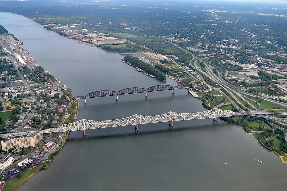
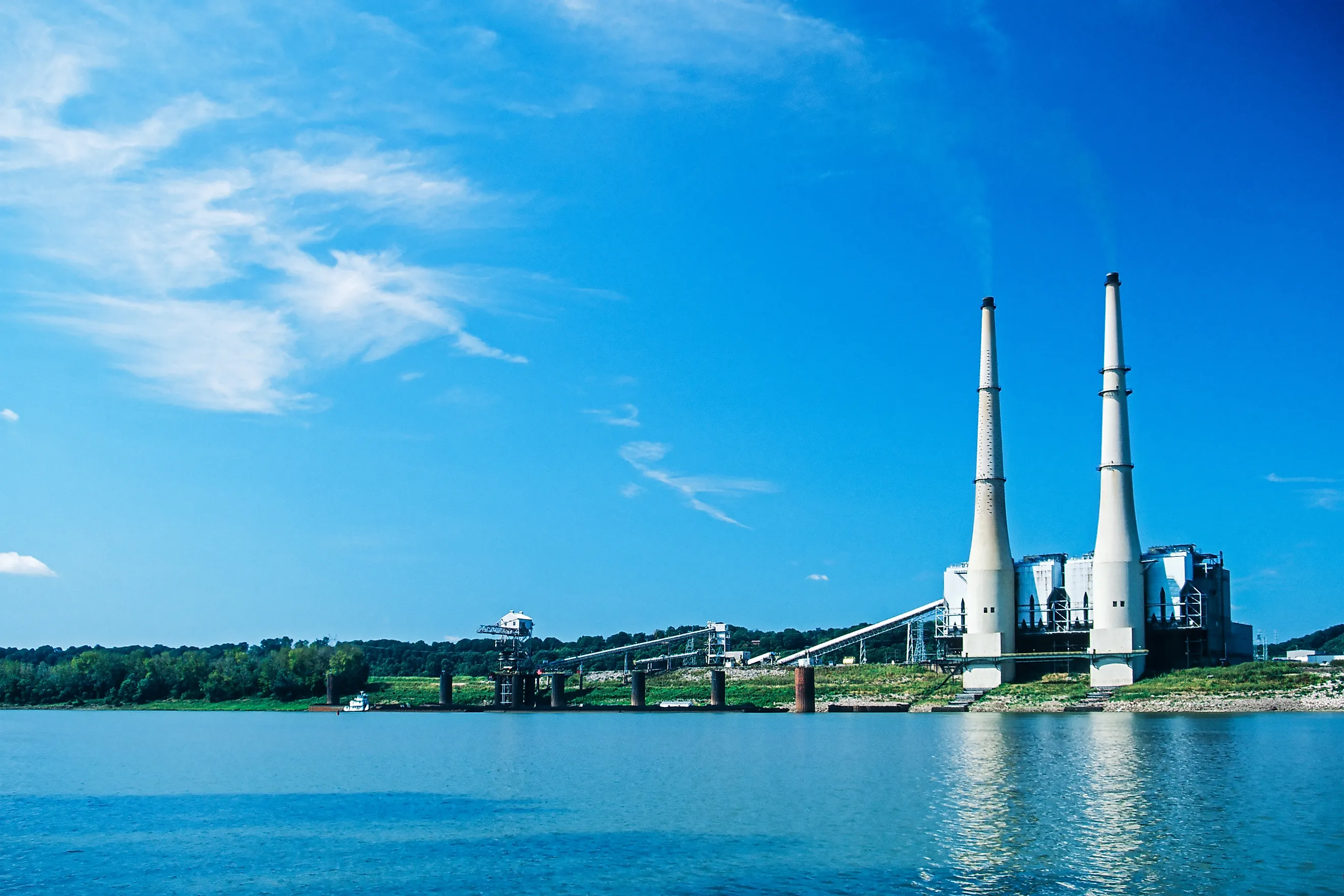
The Ohio River stretches 981 miles from where the Allegheny and Monongahela rivers meet in Pittsburgh to where it meets the Mississippi River at Cairo, Illinois. The river supplies drinking water to more than five million people and supports navigation, recreation, wildlife, and industry.
In 2021 the Ohio River Valley Water Sanitation Commission, which is called ORSANCO, looked for PFAS in 20 spots along the river under different flow conditions. Researchers tested for 28 PFAS and detected 12 of them, with six appearing at quantifiable concentrations at one or more sites. PFOA, PFOS, GenX and PFBA were some of the things they found in the study. ORSANCO followed that work in 2023 with another survey at sites near Parkersburg, Louisville, and Paducah that expanded testing to 40 PFAS.
One of the river's more unusual places to visit is Falls of the Ohio State Park in Clarksville, Indiana. When the water level is right, people can walk along the Ohio River and see fossil beds that are about 390-million-years-old. The Indiana Department of Natural Resources says they are among the largest Devonian fossil beds in the world and more than 600 types of fossils have been found there.
Tennessee River, Alabama

The Tennessee River is the largest tributary of the Ohio River. It forms where the Holston and French Broad rivers meet near Knoxville and runs about 652 miles through Tennessee, Alabama, Mississippi, and Kentucky before joining the Ohio at Paducah. Its drainage basin covers roughly 40,900 square miles. The city of Decatur sits on the northern Alabama stretch, where the river widens into Wheeler Lake behind Wheeler Dam.
Decatur has been a 3M production site since 1961, and the plant made PFOA and PFOS there until the company phased both out around 2002. As early as 1979, 3M's own testing found one of its PFAS compounds in fish in the Tennessee River about 26 miles downstream of the plant. State and federal agencies have since documented PFAS in the river, in Wheeler Reservoir, and in nearby drinking water systems, and in 2020 the Alabama Department of Environmental Management entered a consent order requiring 3M to remediate contaminated sites around Decatur.
Just east of Decatur lies Wheeler National Wildlife Refuge, the largest refuge in Alabama at about 35,000 acres. President Franklin Roosevelt established it along the river and Wheeler Lake in 1938. Tens of thousands of migratory birds winter there, and it is one of the more dependable places in the Southeast to see sandhill cranes and, in some years, the far rarer whooping crane.
Mississippi River

The Mississippi River begins at Lake Itasca in northern Minnesota and flows about 2,340 miles to the Gulf of Mexico, which makes it the second longest river in North America. Its watershed drains all or part of 32 states. 3M produced PFAS at its Chemolite plant in Cottage Grove, on the river southeast of St. Paul, and disposed of PFAS waste at several east-metro sites from the 1950s into the 1970s.
Minnesota's PFAS problem is one of the oldest in the country. In 2002, 3M told state regulators that PFAS had turned up in a production well at the Cottage Grove plant, and by 2004 the chemicals had been found in east-metro drinking water. The state sued 3M and reached an $850 million settlement in 2018 to fund clean drinking water. In May 2026, Minnesota sued the company again, alleging that discharges from dozens of outfalls at the Cottage Grove facility continue to reach the Mississippi. Fish consumption advisories cover stretches of the river, tied in part to PFAS.
Through the Twin Cities, about 72 miles of the river form the Mississippi National River and Recreation Area, a National Park Service corridor created in 1988. It links river bluffs, trails, locks, and historic mill sites, among them St. Anthony Falls in Minneapolis, the only major waterfall on the whole river.
Delaware River

This river has one of the longest ongoing regional programs for tracking PFAS. The Delaware River Basin Commission started checking for PFAS in fish back in 2004 and in the river's surface water in 2007. They recently finished a study that lasted several years. In 2026 the commission published the latest phase of the study, during this time, they gathered samples of surface water, mud, fish, and blue crabs from the Delaware River and some of its smaller branches. PFAS were detected at nearly every surface-water sampling site. They also noticed that the amount of PFAS in the surface water tended to be higher the farther downstream they went, especially in the parts of the river affected by tides.
Off the Delaware River there is a beautiful national recreation area on the New Jersey and Pennsylvania border. Here there are stunning mountain views, great hiking trails, and peaceful river activities.
Huron River, Michigan

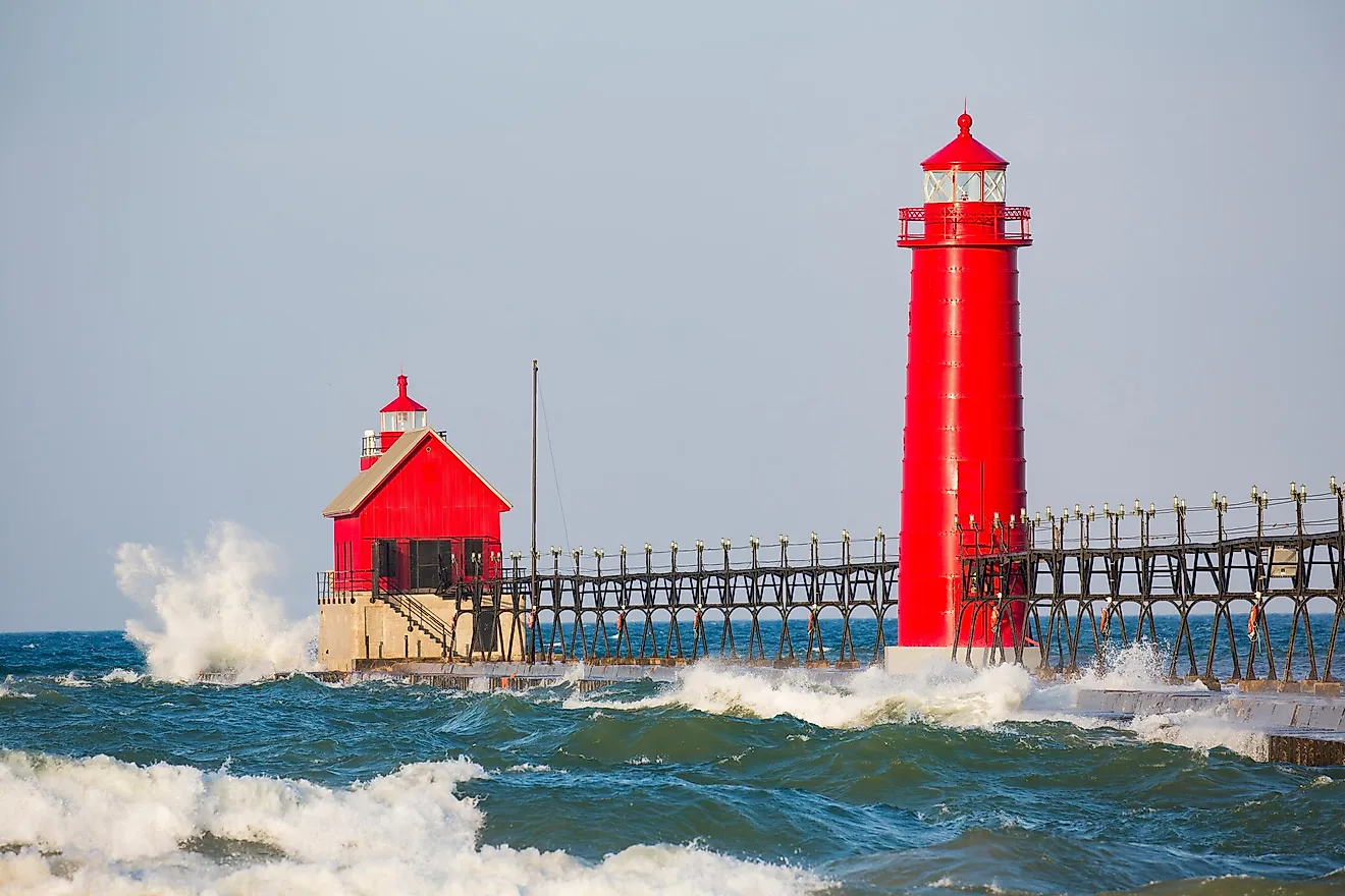
The Huron River winds through southeastern Michigan, running past Brighton, Ann Arbor, and Ypsilanti before it empties into Lake Erie. It is a popular recreational river for the Detroit region, with a chain of dams, impoundments, and parks along its length.
In August 2018, the Michigan Department of Health and Human Services issued a Do Not Eat advisory for all fish in the Huron River after high levels of PFOS turned up in fish and surface water. Within weeks the state extended it to cover the river from North Wixom Road in Oakland County downstream to where it reaches Lake Erie, across five counties. Investigators traced the contamination to a chrome plating company, Tribar Technologies in Wixom, that had sent PFAS into the local wastewater plant. Regulatory action against Tribar has lowered PFAS levels since 2018, though the advisory remains in place along most of the river.
Despite the advisory, the river stays open for paddling and other recreation, since the state notes that PFAS do not pass easily through skin. Much of its main branch makes up the Huron River Water Trail, a designated national water trail of about 104 miles. Signs at access points ask anglers to release what they catch, and officials advise rinsing off any foam on the water, which can hold higher concentrations of PFAS.
Lake Washington, Washington

Lake Washington is a large lake situated near the city of Seattle. It has a maximum depth of 214 feet and a surface area of approximately 21,500 acres. Being the second largest natural lake in Washington, it serves as an excellent example of how high water quality can be reached by treating a lake. In the 1960s, the sewage diversion made the water condition better, and even nowadays King County monitors the water quality.
Moreover, recently, scientists checked whether there are any traces of PFAS in the water of the Lake Washington. Indeed, this is not the first scientific investigation in this lake. Previously, in 2008 and 2016, the Washington Department of Ecology discovered PFAS in surface water and fish in the entire state of Washington. The highest concentration of PFAS was registered in the lakes of the urban western Washington. Therefore, Lake Washington became the key object for further research. Samples were collected from the Lake Washington area between 2020 and 2023 from various sites such as surface water, groundwater, storm runoff, and sediment. PFAS were found in 467 out of 479 samples collected from those sites.
If one wants to visit Lake Washington, then Seward Park is a good spot. This 300-acre park is on Bailey Peninsula and has a 2.4-mile path for walking and biking, a shoreline, places to launch boats, and areas with old trees. You can also see a bit of local history in the park's land itself. When the Lake Washington Ship Canal was built in 1917, the lake level dropped, which uncovered land that later became part of Seward Park's waterfront.
San Francisco Bay, California

San Francisco Bay is the largest estuary in the United States on the West Coast. It is an area where fresh water from Central Valley and salt water from the Pacific Ocean meet. San Francisco Bay is a complex ecosystem consisting of deep channels, shallow bays, tidal marshes, rivers, and wetlands.
According to the San Francisco Estuary Institute, there was research conducted in 2022 where water samples from 22 locations within the Bay were tested in 2021. There were 40 kinds of PFAS chemicals analyzed, of which only 11 were found. Seven out of these chemicals were present in more than 50 percent of the samples. Also, the amount of PFAS detected was variable depending on location. As a result, one cannot say that PFAS were "found in San Francisco Bay," as in the entire bay, the concentration is not equal throughout the estuary.
Moreover, the Bay is a huge recreational site for the people living in San Francisco Bay Area. Walking and biking paths offer a wide range of trails for recreation where people can enjoy watching the waters of the Bay from shorelines. From the East Bay side, you get a clear view of the San Francisco-Oakland Bay Bridge and the city skyline. But the Bay is more than just a pretty view. California's Regional Water Quality Control Board says its channels, tidal flats, marshes, and other habitats are home to fish, crabs, clams, waterfowl, and other wildlife.
Colorado River
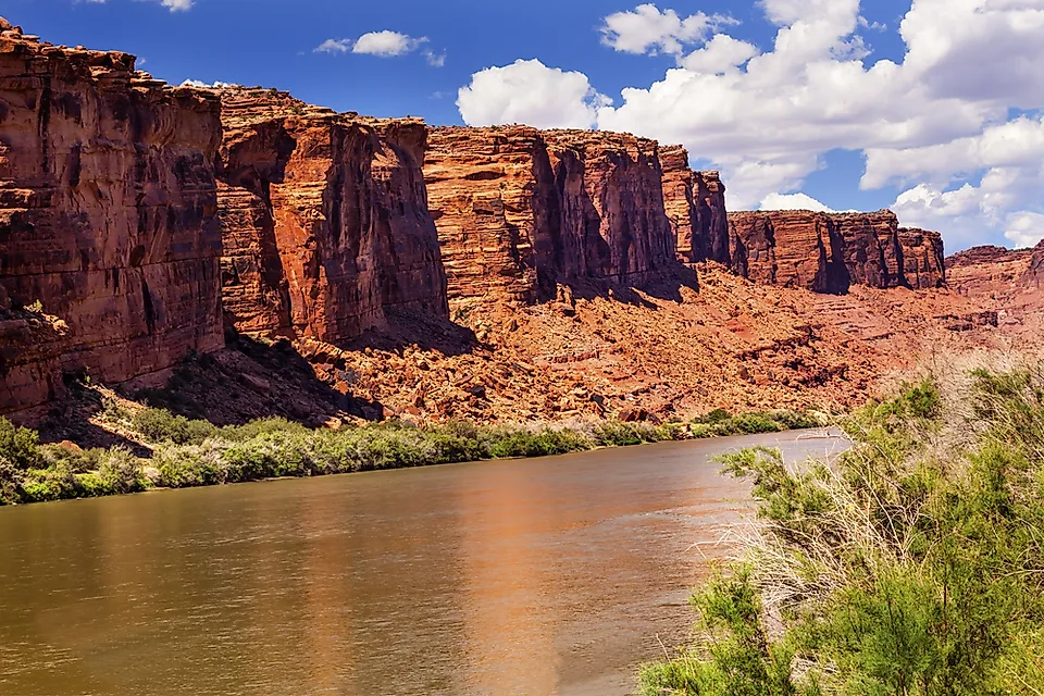
Black Rocks on the Colorado River feature rocks approximately 1.7 billion years old. The Black Rocks rock formation is located in the Ruby-Horsethief section of the river, which is a 25 mile stretch of the river between Loma, Colorado, and Westwater, Utah. This section of the river features calm waters that run through red-rock cliffs. It is one of the best locations for rafting and kayaking, although any expedition lasting more than a day requires a permit.
In recent times, however, this river became one of the subjects of an important research project dedicated to the presence of PFAS compounds. As a part of the study, the U.S. Geological Survey sampled surface water in the Upper Colorado River Basin from May 2022 to June 2024. Samples were taken from the Colorado River near Cameo, near the Colorado-Utah border, and from expeditions conducted on the river below Kremmling, Colorado, and up to Potash, Utah. The samples were tested for presence of PFAS, pharmaceuticals, major and trace elements, and other water quality factors. The results of the collected data were published by the USGS in July 2026.
When people visit the Ruby-Horsethief Canyon, they might notice another geological link without realizing it. The old Vishnu schist found at Black Rocks is part of the same type of rock formation seen hundreds of miles downstream in areas of the Grand Canyon. While this river is mostly known for its huge canyons and its importance for water supply, the PFAS monitoring shows that even seemingly remote areas are now part of the national effort to understand these long-lasting synthetic chemicals.
What PFAS Detections In US Waters Really Mean
Just because PFAS chemicals show up in a river, lake, or bay does not mean people should stay out of the water. Also, a single sample does not tell you what the conditions are like everywhere in that water body. It depends on the specific chemical, the concentration, how people might be exposed to it, where it is, and for how long. This is why different agencies monitor drinking water, surface water, and fish separately. These nine locations show just how widespread these chemicals have become, as they have been used for decades in things like firefighting foam and materials that repel stains and water.