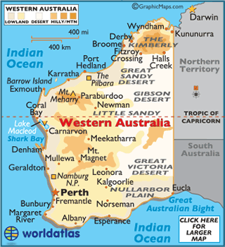
- Coastline: 12,913 mi (20,781 km)
- Land Area:
(land) 976,790 sq miles (2,529,875 sq km)
(water) 44,687 sq miles (115,740 sq km)
(TOTAL) 1,021,478 sq miles (2,645,615 sq km) - To convert sq km (kilometers) to sq mi (miles)
use our converter - Land Area: (all countries)
- Counties: There are 26 counties in Western Australia. They are Beaufort, Carnarvon, Durham, Glenelg, Goderich, Grantham, Grey, Hay, Howick, Kent, Lanark, Lansdowne, Melbourne, Minto, Murray, Nelson, Peel, Plantagenet, Perth, Stirling, Sussex, Twiss, Victoria, Wellington, Wicklow, York
- Horizontal Width: 771.36 miles (1241.39 km) from Perth east to Eucla
- Vertical Length: 1,105.53 miles (1,779.18 km) from Kununurra south to Eucla
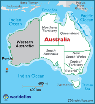
Note: Lengths and widths are point-to-point, straight-line measurements from a Mercator map projection, and will vary some using other map projections - Bordering States/Territories: (2) Northern Territory, South Australia
- Geographic Center: About 278.63 miles (448.41 km) east of Meekatharra
- Highest Point: Mount Meharry 4,098 ft (1,249 m)
- Lowest Point: Lake Macleod −13 ft (-4 m)
- Latitude and Longitude
- Relative Location