- Coastline:
8,293 miles (13,347
km)
- Land Area:
(land) 668,207 sq miles (1,730,648 sq km)
(water) 47,102 sq miles (121,994 sq km)
(TOTAL) 715,309 sq miles (1,852,642 sq km)
To convert sq km (kilometers) to sq mi (miles)
use our converter - Land Area: (all countries)
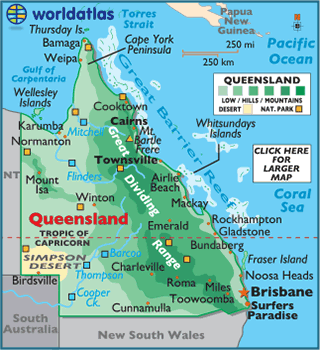
- Land Divisions: There are 322 counties in Queensland.
- Horizontal Width: 598.79 miles (963.66 km) from Mount Isa east to Airlie Beach
- Vertical Length: 1,261.97 miles (2,030.94 km) from Bamaga south to Cunnamulla
Note: Lengths and widths are point-to-point,
straight-line measurements from a Mercator map projection, and will vary
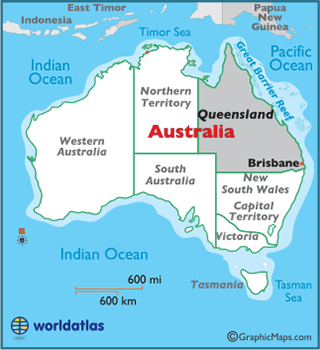
some using other map projections - Bordering States/Territories: (3) Northern Territory, South Australia, New South Wales
- Geographic Center: About 117.44 miles (189 km) southeast of Winton
- Highest Point: Mt. Bartle Frere 5,321 ft (1,622 m)
- Lowest Point: Pacific Ocean 0 m
- Latitude and Longitude
- Relative Location