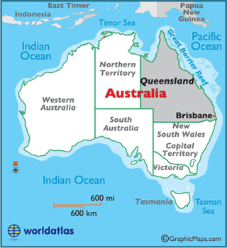
Queensland
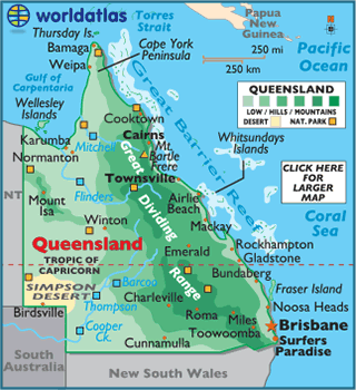
The landscape of Queensland varies, and includes tropical islands, sandy beaches, flat river plains, elevated plateaus, dry deserts, and agricultural belts.
Perhaps the most notable geographical feature of Queensland is the Great Barrier Reef, the largest coral reef system in the world. The Great Barrier Reef is located in the Coral Sea, and stretches over 1,250 miles (2,000 km), with an area of 133,000 sq. miles (344,400 km). Over 2,800 individual reefs make up the Great Barrier Reef, and it is the biggest single structure made by living organisms in the world
The largest sand island in the world, Fraser Island, lies just off the coast of Queensland, and contains half of the world's dune lakes. These rare lakes have no natural inflow or outflow, and are formed in depressions between sand dunes. There are a total of 80 worldwide.
On the mainland, there are no large, natural lakes within the state, but there are hundreds of rivers. The major coastal rivers include the Flinders, Mitchell, Fitzroy, Mary, and Brisbane Rivers. At 520 miles (840 km), the Flinders River is the longest of these rivers.
In the eastern part of Queensland, the Great Dividing Range dominates the land. The highest point of the state is Mount Bartle Frere at 5,321 ft 1,622 m (1,622 m).
The lowest point of Queensland is the Pacific Ocean (0m).