The State Parks Built Around A Single Lake
Lakes have shaped some of the country's most popular outdoor recreation for generations, but at certain state parks, the lake is more than a place to swim or fish. These parks turn their lakes into more than a backdrop. They shape the trails, beaches, wildlife, and geology that define the park itself. From the quartzite cliffs of Wisconsin to the mountain reservoir of Arkansas, each offers a different version of lakeside recreation. Together, these parks show how a single lake can give a state park its character and draw visitors in year-round.
Devil's Lake State Park, Wisconsin

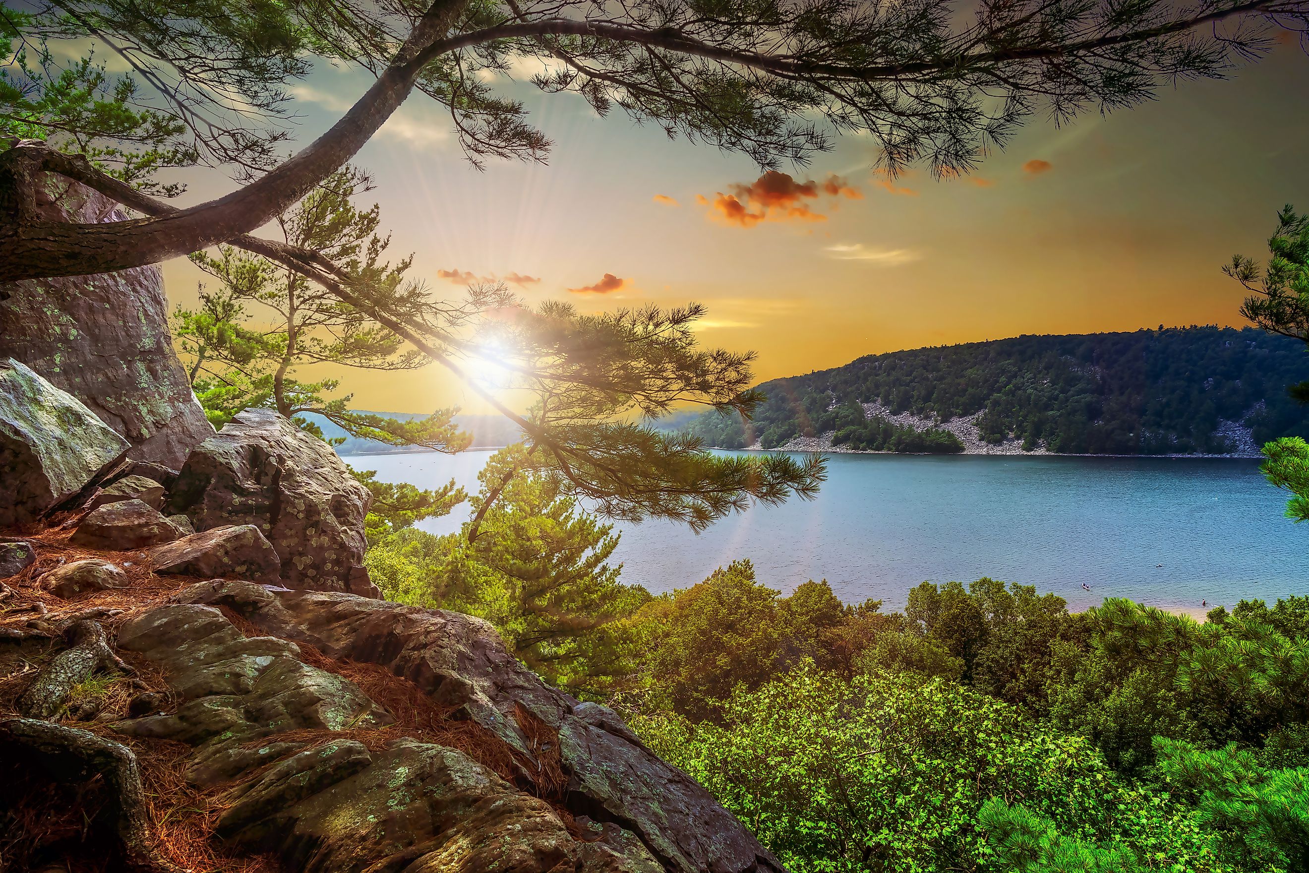
A roughly 360-acre lake sits between quartzite bluffs that rise 500 feet above the water at Wisconsin's Devil's Lake State Park. The bluffs are part of the Baraboo Range, whose quartzite formed from sand deposited around 1.6 billion years ago. Glacial activity later altered the valley, leaving the lake basin and steep rock formations that surround it.
This geology gives the park its defining feature, a lake enclosed by rock rather than simply bordered by forest. Nearly 30 miles of trails cross the park, including routes up the East and West Bluffs and sections of the Ice Age National Scenic Trail. At water level, the park has two beaches totaling 3,300 feet, along with boat launches, swimming holes, and camping spots.
Devil's Lake State Park is open from 6:00 am to 11:00 pm year-round, but a Wisconsin vehicle admission pass is required for all motor vehicles. These can be purchased online or from the Natural Resources Center at the park itself. Park services do vary by season during the year, however, with some buildings being closed during the colder months. Devil's Lake is also Wisconsin's busiest state park, seeing more than 2.5 million visitors annually.
Lake Ouachita State Park, Arkansas

Lake Ouachita is Arkansas' largest lake and covers about 40,000 acres and stretches roughly 30 miles through the Ouachita Mountains. The lake has about 975 miles of shoreline, much of it surrounded by forested hills and small coves. Lake Ouachita State Park sits on 360 acres on the lake's eastern end, making the park compact compared to its namesake. The lake was created by Blakely Mountain Dam in the 1950s, while the Ouachita Mountains were formed from sediment deposited in an ancient inland sea.
The park's Caddo Bend Trail follows a peninsula extending into the lake for four miles and features an overlook at Point 50 and exposed layers of sandstone and shale along the shoreline. The park also offers swimming, fishing, boating, and canoeing, while summer programs include guided lake cruises and kayaking tours. Eight cabins, four camper cabins, and 93 campsites provide overnight accommodations within the park, with some being located right on the water.
Lake Ouachita State Park and its trails are open year-round, although individual activities and programs operate on seasonal schedules. Arkansas State does not charge a day-use admission fee at the park, but some services such as camping, cabins, or tours carry their own charges and reservations.
Inks Lake State Park, Texas

Inks Lake State Park sits along the eastern edge of the Llano Uplift, where some of the oldest exposed rocks in Texas shape the shoreline. The Valley Springs Gneiss, formed through intense heat and pressure over millions of years, appears throughout the park as pink-hued rocky outcrops and islands rising from the lake. This formation is especially visible around Devil's Waterhole, where Valley Spring Creek meets Inks Lake and has carved a small canyon through the rock.
The park has more than 12 miles of trails, including routes along the lake and through the surrounding rocky hills. Devil's Waterhole is also used for swimming and paddling, while Inks Lake supports fishing, boating, and water sports. Nearly 200 campsites and 22 cabins provide overnight lodging right along the waterline.
Inks State Park is open daily from 6:00 am to 10:00 pm year-round. Daily use admission is $7 for adults, while children 12 and younger enter for free. Texas State Parks recommends reservations for camping, lodging, and activities due to crowding during the summer months.
Moraine State Park, Pennsylvania

Lake Arthur is the central feature of Pennsylvania's 16,725-acre Moraine State Park. The 3,225-acre lake has 42 miles of shoreline, with forest, wetlands, and rolling terrain extending around it. Much of the landscape was shaped by continental glaciers, while earlier coal mining and oil and gas drilling left disturbed land that was later reclaimed as part of the park's development. Today, Lake Arthur occupies the basin left by those glacial processes and remains the focus of the park.
The lake supports motorboating, sailing, paddleboarding, and fishing, with nine public boat launches around its shoreline. Lakeview Beach and Pleasant Valley Beach provide swimming access between Memorial Day and Labor Day, while the park has 29.2 miles of hiking trails available year-round. The 14.8-mile Glacier Ridge Trail also forms part of the North Country National Scenic Trail and provides lookout views of the lake.
Moraine State Park is open year-round between sunrise and sunset, and Pennsylvania does not charge an entrance or day-use fee at its parks. This park does not have a traditional campground, but 11 modern cabins are available for rent throughout the year, and the Link Road overnight shelter aids those who are backpacking through the park. Unlike some parks, Moraine State Park has fully functional activities during the winter months, including ice fishing, iceboating, and sledding.
Lake Bemidji State Park, Minnesota

Lake Bemidji State Park covers 1,654 acres along the north shore of Lake Bemidji, a glacial lake connected to the Mississippi River system. The park's landscape includes northern hardwoods, pine forests, wetlands, and a conifer bog, giving the shoreline a unique character. A boardwalk crosses the bog, where pitcher plants, sundews, orchids, and sphagnum moss grow in the wet ground.
Lake Bemidji provides the park's main water-based recreation, including swimming, fishing, canoeing, kayaking, and boating. The surrounding trails extend through forest and wetland habitat, while the park also serves as the northern trailhead of the 115-mile Paul Bunyan State Trail. In winter, the area remains in use for cross-country skiing, snowshoeing, ice fishing, and snowmobiling.
The park operates year-round, with daily hours usually running from 6:00 am to 10:00 pm. Minnesota requires vehicle permits for state park entry, which are offered as $7 daily passes or as tiered seasonal passes. Campsites and camper cabins can be reserved through the Minnesota Department of Natural Resources, although some options may only be available during the spring, summer, or fall.
Deep Creek State Park, Maryland

Maryland's largest inland lake stretches across 3,900 acres in Garrett County, with about 65 miles of shoreline and depths reaching roughly 75 feet. Deep Creek Lake State Park sits on more than 1,800 acres on the lake's western side, where the water meets the forested plateau of the Allegany Highlands. The lake is man-made, created in 1925 as part of a hydroelectric project, and it remains the central feature of the park today.
The park provides about a mile of public lakefront, including two sandy beaches, a swimming area, fishing access, and a canoe and kayak launch. A public boat ramp also provides the primary state-managed access point for boaters on Deep Creek Lake. On land, trails pass through the surrounding woods, while the Discovery Center offers exhibits and nature programs. Camping is available at more than 100 sites, with additional accommodation including yurts and mini cabins.
Deep Creek Lake State Park is open year-round from 8:00 am to sunset, and trails are open between sunrise and sunset. Deep Creek does charge a day-use fee of $3 for Maryland residents and $5 for nonresidents. The main gate to the park closes during snowmobile season from December 15 through March 15, although programs remain available at the Discovery Center.
White Lake State Park, New Hampshire
White Lake State Park covers 902 acres along the shore of White Lake, a 125-acre glacial lake in New Hampshire's Lakes Region. The lake formed when glacial ice became buried beneath sediment and melted, leaving a depression that filled with water. Today, the park's sandy beach and wooded shoreline occupy much of the lake's western edge, while the surrounding White Mountains provide the backdrop.
Most of the park's recreation takes place directly on the lake itself. Swimming areas are along the beach, while canoe, kayak, and paddleboard rentals are available during the operating season. A walking path follows the shoreline, and the park features small hiking loops around its campsites.
White Lake's beaches are open full-time from May 9th through October 12th, while the campground operates from May 15th through October 24th. The park remains open for recreation outside those dates unless conditions prevent it. Day-use admission is $5 for adults and $2 for children ages 6 to 11. Children 5 and younger and New Hampshire residents aged 65 and older enter free.
When One Lake Defines The Whole Park
A lake can determine the character of an entire state park, even when the water occupies only a part of its total area. In these seven parks, the surrounding terrain, trails, recreation, and plant life are all closely connected to the lake. The settings range from glacial lakes in the Northeast to Midwest reservoirs surrounded by rocky hills, but the lakes remain the defining feature of each entry. There are numerous state parks where a single lake can create a legacy, and these seven are just a few that gain their identity from their water.