What Happens If The Ohio River Floods Louisville Again
In January 1937, weeks of relentless rain pushed the Ohio River higher until roughly 70 percent of Louisville, Kentucky lay under water. The Great Flood of 1937 is still the worst disaster in the city's history. It drove about 175,000 residents from their homes and killed 190 people across Kentucky. Its crest reached some 40 feet above the river's normal level, a mark no Louisville flood has matched in the decades since. For a city built on river commerce, the Ohio has always been both an economic engine and a standing threat.
That disaster set off decades of construction. Working through the U.S. Army Corps of Engineers, the federal government built a flood-protection system that Louisville's Metropolitan Sewer District now runs. About 29 miles of concrete floodwalls and earthen levees, backed by 16 pumping stations, shield roughly 110 square miles of the metro area and more than 200,000 people. That barrier has held the Ohio out of the protected city for more than half a century, most recently in April 2025, when the river climbed to its eighth-highest level on record and the pumps kept the core dry. Most of the system dates to the 1940s and 1950s, though, and its aging pumps and gates are the reason a flood today would play out very differently than the one in 1937.
The floodwall would keep the Ohio out of the city core

The first thing that would happen in a major Ohio River flood is the thing that did not happen in 1937: the river itself would stay out of downtown. The protection system the Army Corps of Engineers began building after 1937 was designed to stop a flood even larger than that one, with the walls set a full three feet above the record 1937 crest. Construction started in the late 1940s, much of it going up as veterans returned home from World War II, and the full system took close to 40 years to finish.
Today that network runs about 29 miles along the Louisville riverfront. It combines roughly 24 miles of earthen levees with 4.5 miles of concrete floodwall, and around 45 removable closures can seal the gaps where roads and rail pass through. In a repeat of 1937, those defenses would keep the main channel of the Ohio from spilling into the roughly 110 square miles they enclose.
The greater threat is the rain trapped behind the wall

The wall that blocks the Ohio also traps the water behind it. When the river runs high, rain that falls inside the protected area cannot drain out the usual way, and the creeks and storm drains that normally empty into the Ohio are sealed off from it. That interior water has nowhere to go on its own. It has to be lifted over the wall and released into the swollen river on the other side.
This is the job of the 16 pumping stations. During heavy flooding, gates along the creeks and drains close to keep the Ohio from backing up into the city, and the pumps move the trapped water out. The scale is large. Over five days in April 2025, after more than seven inches of rain, the stations moved more than 12.1 billion gallons of stormwater out of Louisville and into the river.
A pump failure could flood the neighborhoods behind the wall

Because so much depends on the pumps, their condition is the real question in any future flood. Most of the stations were built in the 1950s and still run on original equipment. Paddy's Run, in western Louisville, dates to 1953 and stays in service only through constant maintenance, because many of its parts have not been manufactured for decades. As storms grow more frequent and more intense, the load on that 1950s machinery keeps rising.
If a station failed at the peak of a flood, the consequence would be direct. With the pumps down, water would collect behind the floodwall with no way over it, and the creeks and drains would back up into the streets the wall was built to keep dry. The greatest exposure is in the west and southwest, the low-lying, historically Black neighborhoods in the area Paddy's Run drains, the same part of the city the 1937 flood hit hardest.
Thousands of residents could be forced from their homes

Displacement is the human cost that shows up in every serious Louisville flood, protected or not. In 1937, about 175,000 people left their homes. Even the smaller flood of March 1945, the second-highest on record, drove roughly 50,000 from theirs. A modern flood would threaten far fewer, because the wall now shields the core, but the areas at the edge of the system and the neighborhoods prone to flash flooding would still empty out.
One image from 1937 fixed the moment in the national memory. The photographer Margaret Bourke-White shot a line of Black flood refugees waiting for food and relief beneath a billboard that read "World's Highest Standard of Living," part of a national advertising campaign that had nothing to do with the water rising around them. The gap between the slogan and the scene became one of the defining photographs of the Depression.
River Road and waterfront events would shut down first

The waterfront feels a flood first, long before the wall is tested. The lowest ground sits outside the floodwall, right along the water, and it floods in any high-water event. River Road runs beside the Ohio east of downtown and floods when the river climbs. The removable gates then go up across low streets to keep the river out of the rest of the city.
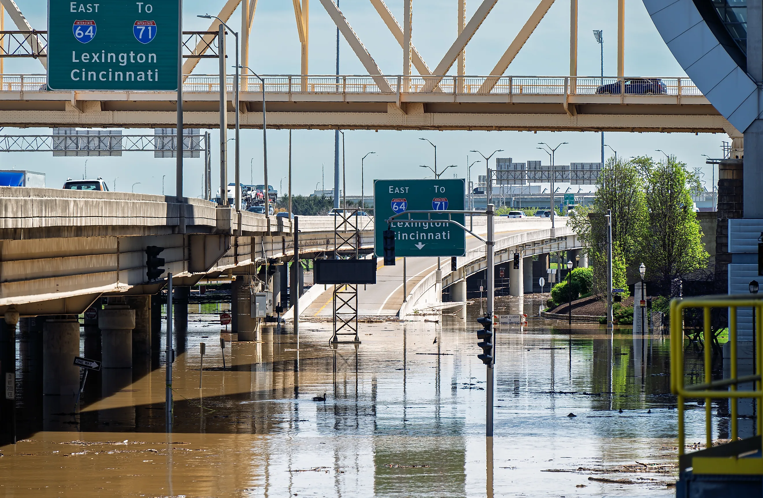
April 2025 showed the pattern. More than seven inches of rain produced the eighth-highest flood level in Louisville's recorded history. The system prevented widespread flooding, but homes and businesses along River Road were hit hardest. The city also canceled Thunder Over Louisville, the fireworks show that opens the Kentucky Derby Festival, because the riverfront it uses was under threat. Even when the walls hold, life along the water still stops for days.
Southern Indiana would take the harder hit

The Ohio does not flood both banks equally. Directly across from Louisville, the Southern Indiana communities sit lower and have historically taken the worse damage. In 1937, water covered about 90 percent of Jeffersonville, a share well beyond what Louisville's own inundation reached in percentage terms.
The flood wrecked a landmark on the Indiana side as well. Rose Island was a popular amusement park on a peninsula near Charlestown, reached by ferry across the river through the 1920s and early 1930s. Ten feet of water ruined it in 1937, and it never reopened. Its ruins now sit inside Charlestown State Park, where marked trails pass the old swimming pool and the stone footings of rides that the river left behind.
The damage would run into the billions of dollars

The financial toll of a major flood would be severe even with the system working. The 1937 flood caused about $250 million in damage across Kentucky in that era's dollars, a figure that would top $3 billion today. The 1997 flood, which crested well below 1937, still ran past $1 billion in damage across the wider Ohio River valley.
The stakes have only grown. The flood-protection system now stands between the river and more than $30 billion in property across the metro area, along with tens of thousands of homes and businesses. If a flood overwhelmed any part of that defense, recovery would cost billions, beyond the damage the water itself caused.
The next flood will test decades-old defenses
Louisville stands far better prepared than it did in 1937, when no wall stood between the city and the river. The difference now is condition rather than design. Bringing the floodwalls, gates, and 1950s pumping stations back to the standard the system was built to meet would cost an estimated $683 million.
That work has already begun. A $230 million replacement of the Paddy's Run station passed 75 percent completion in mid-2026 and, once finished, will more than double its capacity to 1.9 billion gallons a day. The Army Corps began design work in 2023 on a broader overhaul covering 14 pump stations, two road-closure structures, and repairs to the walls and gates. The wall will very likely hold the next time the Ohio rises. How much of the city stays dry behind it depends on how much of that machinery is rebuilt before the water arrives.