What Happens If The Columbia’s Dams Come Down All At Once
Fourteen dams stand on the main stem of the Columbia River, and above Bonneville the American stretch is almost all reservoir, slackwater backed up nearly to the Canadian border with one short wild reach left in central Washington. The wild river salmon once ran by the millions is mostly gone, replaced by that chain of flatwater. People already argue hard over pulling four dams off one tributary. Pulling all fourteen at once, in the same few years, would be a far stranger thing to watch unfold.
Draining The Reservoirs Would Uncover Decades Of Trapped Sediment

The Elwha River on Washington's Olympic Peninsula is the clearest preview. Its two dams came out between September 2011 and October 2014, and about 30 million metric tons of sediment were exposed to erosion as the reservoirs drained. Roughly 90% of what washed out traveled to the coast, adding about 150 acres to the river's delta. On the Klamath, where four dams near the Oregon-California line were taken down between October 2023 and October 2024, more than 2,200 acres of former lakebed came out of the water.
Lake Roosevelt, the 151-mile reservoir behind Grand Coulee, sits 10 miles below a smelter at Trail, British Columbia, that discharged wastewater and a glassy slag into the Columbia for nearly a century, until slag dumping stopped in 1995. The U.S. Geological Survey has found arsenic, cadmium, copper, lead, mercury, and zinc throughout the lake's sediment, and most of the young white sturgeon examined in one study had eaten slag. USGS scientists also suggested that airborne metal levels around the lake stayed low in the mid-2000s partly because drawdowns left little of that sediment exposed. Draining the lake completely would uncover its entire bed and leave much of that metal-laden sediment free to wash downstream.
The Mainstem Dams Hold About 21,000 Megawatts Of U.S. Capacity

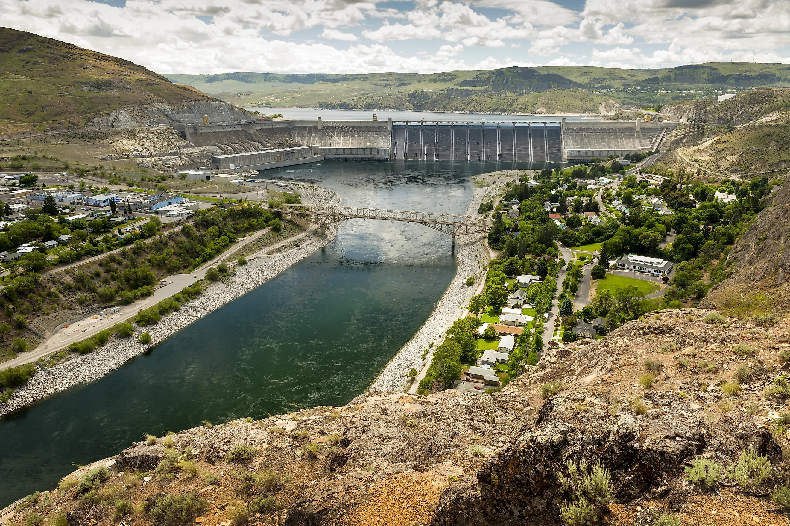
Grand Coulee has 6,809 megawatts of capacity, the most of any power station in the country, and produces about 21 billion kilowatt-hours a year. The ten other U.S. mainstem dams bring the nameplate total to roughly 21,000 megawatts, and the three Canadian mainstem dams add about 5,500 more. Those plants produce most of the Columbia Basin hydropower that, according to the Bonneville Power Administration, supplies about 55% of the Northwest's electricity. Four dams on the lower Snake River, a Columbia tributary, have a combined capacity of a little over 3,000 megawatts, and estimates of the cost to replace their benefits, mostly electricity and grid services, have run between $10 billion and $31 billion. The U.S. mainstem dams have about seven times that capacity.
Grand Coulee's Pumps Lift Water To 671,000 Acres Of Farmland

Water for the Columbia Basin Project starts at Lake Roosevelt. Pumps at Grand Coulee lift it 280 feet to a feeder canal that fills Banks Lake, a reservoir in the northern 27 miles of the Grand Coulee itself, and Banks Lake water is then carried through more than 300 miles of main canals and about 2,000 miles of smaller laterals to roughly 671,000 acres. The pumps draw from a reservoir held up by a 550-foot dam, so without it the river would sit more than 200 feet below the lake's lowest operating level. Farmers there use about 2.5 million acre-feet of Columbia water a year. Wheat covers more acres in the Columbia Basin region than any other crop, and the region grows nearly two-thirds of Washington's potatoes and about a fifth of the national crop. Its farms produce more than $3 billion worth of crops.
Spring Floods Would Reach Portland With Less Storage Upstream

The Columbia runs highest in late spring, when mountain snow melts across the basin, and the second-largest flood on record arrived at that time of year. On May 30, 1948, an embankment failed at Vanport, Oregon, a wartime housing city of about 18,500 people on the edge of Portland, and the town was under 10 to 20 feet of water within an hour. In all, the flood killed at least 50 people and left more than 46,000 homeless. The river peaked at about 1.01 million cubic feet per second on May 31 and stayed near 900,000 for almost three weeks.
After Vanport, interest grew in building flood-control dams on the Columbia, and the 1964 Columbia River Treaty led to Mica, Keenleyside, and Duncan dams in British Columbia and Libby Dam in Montana. The three Canadian dams can hold 15.5 million acre-feet, with 7 million at Mica and 7.1 million at Keenleyside, both on the Columbia's main stem. Lake Roosevelt holds about 9.5 million acre-feet in total behind Grand Coulee. Duncan, on a tributary of Kootenay Lake, and Libby, on the Kootenai River, would remain, but the spring runoff now held in Kinbasket Lake, the Arrow Lakes, and Lake Roosevelt would pass downstream toward Portland and Vancouver.
Wheat Barges Would Lose Their Route To Portland

Above Bonneville Dam, the 14-foot barge channel to Lewiston exists because a slack-water pool sits behind each dam, and boats pass each one through a navigation lock, eight locks in all between Bonneville and Lower Granite on the Snake. Below Bonneville, ocean-going ships use a 43-foot channel that runs 105 miles between Astoria and Portland, and that stretch does not depend on the dams. Ports on the lower Columbia handle more than half of U.S. wheat exports, much of it delivered by rail, and about 10% of the nation's wheat exports start their trip on Snake River barges.
The four lower Snake dams sit on a tributary, so they would still stand. Their barges would be stranded anyway, because the route to the export terminals passes through the locks at McNary, John Day, The Dalles, and Bonneville. That grain would move by rail and truck instead, at a higher fuel cost per ton, since a barge carries a ton of cargo about 675 miles on a gallon of fuel and rail is about 30% less efficient, trucks about 78% less.
Celilo Falls Is Still Intact Beneath Celilo Lake

On March 10, 1957, the reservoir behind The Dalles Dam flooded Celilo Falls, about a dozen miles east of the town of The Dalles. People had lived at village sites along the falls for at least 11,000 years, fishing for four species of salmon, along with sturgeon and lamprey, where the river passed through gaps as narrow as 40 feet. The federal government compensated the Warm Springs, Yakama, Umatilla, and Nez Perce tribes for the lost fishing sites, and the tribes kept their fishing rights.
In 2008, the Army Corps of Engineers released sonar maps showing the main cataract intact beneath the water, after years of rumors that the Corps had blasted it. Lowering the reservoir would bring that rock back into open air. Louie Pitt Jr., a Warm Springs tribal member who was 6 when the dam was built and whose family once made a living selling salmon caught at the falls, told the Associated Press, "Someday those dams will be gone. When that day comes, the falls will return."
Salmon Would Regain A Path To The Upper Columbia

Before the big dams, the Columbia's salmon runs numbered an estimated 10 million to 16 million fish a year, against an average of about 2.3 million over 2014 through 2023. Grand Coulee and Chief Joseph, 55 miles downriver, were both built without fish passage, and no salmon have swum past them since. The fish above them today were trucked around the dams in tribal releases that began in 2019. Researchers with the Upper Columbia United Tribes report hundreds of miles of streams in the upper basin with habitat that could support tens of thousands of adult salmon.
Adult salmon reached newly opened water quickly after the Elwha and Klamath removals. On the Elwha, snorkel surveyors spotted three adult Chinook above the old Glines Canyon Dam site in September 2014, the first in that part of the river in over a century, while demolition was still wrapping up. On the Klamath, Oregon biologists identified the first fall-run Chinook in the state's stretch of the river in October 2024, the same month the last obstacles were cleared and the first since 1912.
Rebuilding a population takes longer than reopening a river. On the Elwha, salmon abundance climbed about three years after fish passage was restored, which researchers took as a sign that the sediment's downstream effects had eased. California biologists say it will take 12 to 15 years, long enough for several generations to return, to judge the result on the Klamath.
The real dam debate in the Northwest covers four Snake River dams with about a seventh of the U.S. mainstem's generating capacity and barges carrying roughly a tenth of U.S. wheat exports, and those dams are still standing. In June 2025, the federal government withdrew from a 2023 agreement that had committed more than $1 billion to salmon and clean energy in the basin, and in September 2025 a federal court allowed the long-running lawsuit over the dams to resume. A mainstem removal would take out roughly seven times that generating capacity and cut off the water supply for 671,000 acres of farmland. The roughly 50-mile Hanford Reach, the one U.S. stretch of the Columbia that is neither reservoir nor tidal, is the closest thing left to the river as it ran before the dams.