Northern Dvina River
Also called Severnaya Dvina in Russian, Northern Dvina is a 462-mile-long river that flows in the northern European portion of Russia. As per the noted Russian-German linguist Max Vasmer’s Etymological Dictionary, the Northern Dvina River has been named after the 630-mile-long Western Dvina River. In the native Komi language, the Northern Dvina River has been referred to as “Výnva,” or “powerful river,” where the terms výn means ‘power’ and va means ‘water’ or ‘river.’ Flowing through Russia’s Vologda and Arkhangelsk Oblasts, the Northern Dvina River finally empties into the White Sea via the large Dvina Bay.
Course Of Northern Dvina River

The Sukhona River, which originates in the southeastern part of Lake Kubenskoye, flows out in the southeast direction, where the Vologda and Lezha Rivers join it and then turn in the northeastern direction. Close to the town of Veliky Ustyug in Russia’s Vologda Oblast, the Sukhona River meets the north-flowing Yug River, forming the Northern Dvina, which is one of European Russia’s biggest and most important rivers. The Northern Dvina River then flows for about 37 miles in the northern direction crossing the Vologda Oblast into the Arkhangelsk Oblast. Here, in the Russian city of Kotlas, the Northern Dvina River meets the west-flowing Vychegda River, which originates from the Ural Mountains. As the length of the Vychegda River is more than that of the Northern Dvina River at their confluence, therefore the length of the Northern Dvina River from its source to its meeting point with the Vychegda River is often referred to as the Lesser Northern Dvina. After it is joined by the Vychegda River, the amount of water in the Northern Dvina increases, and it is then referred to as the Greater Northern Dvina.

The Northern Dvina River then turns northwest, receiving inflows from rivers like Uftyuga, Nizhnyaya Toyma, Vaga, Yemtsa, Pinega, etc. Close to the mouth of Pinega, the Northern Dvina River splits into many channels. The branches then rejoin, and the river flows past the present-day logging town of Novodvinsk. Downstream from Novodvinsk, the 350 sq. mi river delta begins. The Northern Dvina River delta ends in the White Sea’s large Dvina Bay.
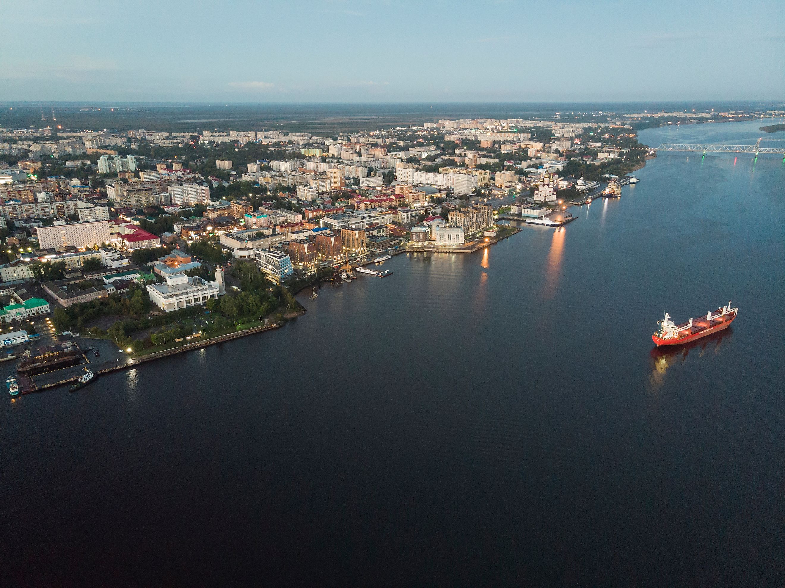
Geography Of Northern Dvina River

The Northern Dvina River, together with Sukhona, its major tributary, has a total length of about 809 miles, making it as long as the Rhine River – one of the principal European rivers that flow in Central and Western Europe. The upper Sukhona River is linked to the Volga-Baltic Waterway by the 39.76-mile-long Northern Dvina Canal.
The River Basin of Northern Dvina covers an area of 137,859 sq. mi and includes significant portions of the Vologda and Arkhangelsk Oblasts, areas in the western part of the Komi Republic, the northern portion of Kirov Oblast, and smaller portions to the north of Kostroma and Yaroslavl Oblasts. The Northern Dvina River flows through the Vologda Oblast’s Velikoustyugsky District and through the Kotlassky, Verkhnetoyemsky, Kholmogorsky, Krasnsoborky, Vinogradovsky, and Primorsky districts of Arkhangelsk Oblast. Some notable settlements in the roughly T-shaped Northern Dvina River Basin include Arkhangelsk, Veliky Ustyug, Vologda, Solvychegodsk, Kholmogory, and Totma.

The Northern Dvina River flows almost uninterruptedly through low, undulating plains of glacial origin, which gradually slopes down to the White Sea. On the east, the Northern Dvina River Basin is bounded by the Timansky Ridge and the Northern Uvaly Hills. Thick coniferous forests dominate the river basin’s northern and middle parts, while the southern parts feature mixed forests. Many low-lying bogs and lakes are found past the left banks of the river, whereas open meadows are found along the floodplain of the Northern Dvina River.
Primarily fed by the melting snow, the Northern Dvina River has a maximum discharge of 700,000 cubic feet per second during spring. As a result, ice jams and floods are often experienced along the entire stretch during the spring months. In November, the upper course of the river starts to freeze and becomes ice-free again by April-end, while the river’s lower course remains frozen for a few more months.
History Of Northern Dvina River

The area through which the Northern Dvina River flows was initially inhabited by Finnic people and then further colonized by the Novgorod Republic. However, an exception to this was the town of Veliky Ustyug which formed a part of the Vladimir-Suzdal Principality. The Novgorod merchants first reached the White Sea during the 13th century. The principal transportation route from Novgorod to the Northern Dvina includes the Volga and its tributary Sheksna, and from there into the Slavyanka River, Lake Nikolskoye, Lake Blagoveshchenskoye, Porozovitsa River, Lake Kubenskoye, Sukhona River and finally the Northern Dvina River. In addition, there are several ways that one can use to enter the Mezen River Basin from the Northern Dvina.
From the 14th century onwards, Kholmogory served as the major trading harbor on the Northern Dvina River, but it lost its position of eminence to Arkhangelsk during the 17th century. Arkhangelsk was the principal trading harbor linking Russia with Western Europe, and the Northern Dvina was the major trading route between Central Russia and Arkhangelsk. In 1703, the establishment of Saint Petersburg by the Russian Monarch Peter the Great led to the opening of a way for the Baltic Sea trade via a highway between Arkhangelsk and Saint Petersburg. Moreover, the construction of a railway line between Arkhangelsk and Vologda accelerated the decline of the Northern Dvina River as the primary trading route.

Extensively used by the settlers and fur hunters as the main waterborne transportation route in early times, the complete length of the Northern Dvina River is navigable only during the summer months. The river’s principal cargo is timber, which is cut on a mass scale throughout the river basin and is then rafted to many sawmilling centers located along the river banks. At the delta’s upstream portion is Russia’s biggest sawmilling center, Arkhangelsk, which also serves as a significant timber-exporting port and one of the western terminal ports on the North Sea transportation route. The naval base of Severodvinsk is placed on the delta’s southwestern side.
However, in recent times, the waters of the Northern Dvina River have become severely polluted as it receives untreated wastewater from various industries. It has been estimated that the Northern Dvina River dumps approximately 23 billion cubic feet of polluted industrial wastewater into the Dvina Bay and the White Sea. Therefore, the concerned authorities must take necessary measures to prevent pollution of the Northern Dvina River.