7 Most Scenic Drives in South Australia
In South Australia, a single drive can pass 800 million-year-old mountain ranges, volcanic crater lakes, and long coastal lagoons within the same state. For example, the Flinders Ranges Way climbs through ancient formations to reach Wilpena Pound, a natural amphitheater. Along the Fleurieu Peninsula, Route 31 traces 31 kilometers of coastline past ochre cliffs and white-sand beaches south of Adelaide. These routes range from short coastal stretches near the city to multi-day journeys that cross remote regions and varied terrain. For road trippers, these seven options are the most scenic drives in South Australia.
Flinders Ranges Way — Adelaide to Wilpena Pound

The drive from Adelaide to Wilpena Pound follows Highway 1 north to Port Augusta before joining the Flinders Ranges Way. It covers approximately 460 kilometers and takes roughly five to six hours without stops, but the landscape transformation along the way rewards a much slower pace. Highway 1 carries drivers north through the market gardens of the Adelaide Plains and the broadacre farmland around Port Wakefield before the terrain begins to shift. At Port Augusta, plenty of spots like Gill’s Seafood & Chicken are ideal for a rest stop. Past Port Augusta, the Flinders Ranges Way branches northeast toward Quorn and Hawker, and the flat pastoral country gives way to the sawtooth ridgelines and red-rock gorges of the Flinders Ranges.
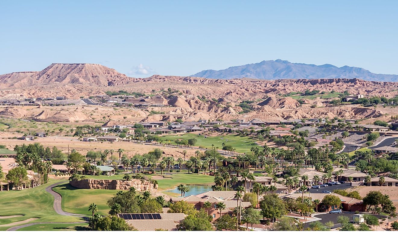
The small town of Hawker is one of the last major fuel stops before Wilpena Pound and sits at the base of scenery that grows increasingly dramatic with every kilometer. North of Hawker, the road threads between the ancient walls of Wilpena Pound, an enormous natural amphitheater formed roughly 800 million years ago, its jagged rim rising up hundreds of meters above the surrounding plains. The Cazneaux Tree, one of the most photographed landmarks in the Flinders, stands along the roadside north of the Wilpena turnoff. Side roads lead to Bunyeroo Gorge and the Brachina Gorge Geological Trail, where hundreds of millions of years of earth history are exposed in layered rock formations along a 21-kilometer self-guided drive. Most of the main route from Adelaide remains sealed, but gorge roads are unsealed and can close after rain.
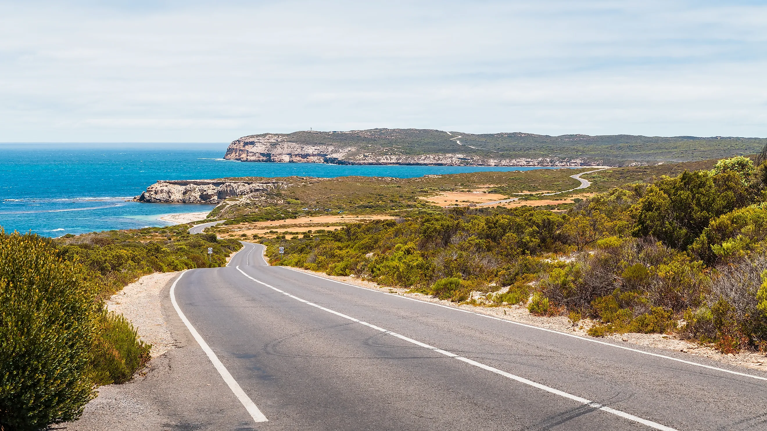
Route 31 Coastal Drive — Fleurieu Peninsula

The drive along Route 31 follows 31 kilometers of coastline. From O'Sullivan Beach to Sellicks Beach, just south of Adelaide, it passes through a string of seaside villages that each offer a different character. The drive can be completed in under an hour, but the beaches, lookouts, and cliffside pull-offs along the way encourage a half-day pace.
The route begins at O'Sullivan Beach and moves south through Christies Beach and Port Noarlunga, where the Onkaparinga River meets the sea beneath sandstone cliffs. At Maslin Beach, ochre-colored cliffs contrast sharply against white sand and turquoise water, creating one of the most photographed stretches of coast in the state. Port Willunga follows, where the remains of the Star of Greece shipwreck emerge from the sand at low tide beneath golden cliff faces. There is also a restaurant by the same name for a quick food stop. The road continues through Aldinga, where a freshwater wetland of cultural significance to the Kaurna people borders the beachfront, before ending at Sellicks Beach, where vehicles with a beach pass can drive directly onto the sand.
The route sits within the broader McLaren Vale wine region, so detours into the surrounding vineyards pair naturally with the coastal drive. Road quality throughout is sealed and suitable for all vehicles. The drive rewards a visit in any season, though autumn and spring deliver the most comfortable temperatures and the clearest coastal light.
Onkaparinga Valley Scenic Drive (B34) — Adelaide Hills

The B34 winds 34 kilometers between the German-settled village of Hahndorf and the historic township of Birdwood through the heart of the Adelaide Hills. The road follows the broader Onkaparinga Valley, passing through a rolling landscape of vineyards, orchards, and eucalyptus-lined ridgelines that feels remarkably different from the city just 20 minutes to the west.
Hahndorf, settled by Lutheran immigrants from Prussia in 1839, provides the starting point with its tree-lined main street of sandstone and timber buildings. Heading north, the road passes through Verdun, Balhannah, and Oakbank, each a small township with cellar doors and roadside stalls selling seasonal produce. Woodside, roughly midway along the route, offers a cluster of artisan food producers. The road continues through Charleston and historic Mount Torrens, then arrives in Birdwood. Here, tourists can take in some history at the National Motor Museum, which houses a collection of over 300 vintage vehicles spanning more than a century.
The drive climbs and descends through a series of gentle ridges, and the canopy of overhanging gum trees creates a dappled light effect that shifts with the season. Autumn turns the deciduous plantings along the route into corridors of gold and rust. The road remains sealed throughout and is suitable for all vehicles, though the winding curves require attention. Weekend traffic can build around Hahndorf, so an early departure or midweek visit ensures a more relaxed pace.
Barossa Valley — Tanunda, Angaston, and Eden Valley

The Barossa Valley sits about an hour's drive northeast of Adelaide and contains some of Australia's oldest vineyards, many dating to the 1840s. A scenic loop between Tanunda, Angaston, and Eden Valley covers roughly 30 kilometers and passes through a landscape defined by rows of old-vine shiraz, dry-stone walls, and heritage Lutheran churches.
Leaving Tanunda, the road rolls through open vineyard country with views toward the low ridgeline of the Barossa Ranges to the east. Mengler Hill Lookout, a short detour off the main road, provides a panoramic vantage point over the valley floor. Angaston, at the eastern edge of the valley, sits at a slightly higher elevation among heritage stone buildings and cellar doors like Yalumba, which has operated continuously since 1849. From Angaston, the road south to Eden Valley climbs into cooler country where Riesling replaces Shiraz as the dominant grape. The Heysen Trail, a long-distance walking track that traverses the state, crosses the road near here. The return to Tanunda completes a loop that captures the visual range of the Barossa, from broad valley floor to forested ridge.
All roads on this route are sealed, and the gentle terrain suits any vehicle. Weekend traffic builds around Tanunda during vintage season in autumn, but the roads remain uncrowded midweek. Spring wildflower season and the golden light of autumn make the strongest visual impression.
Eyre Peninsula Coastal Drive — Port Lincoln Circuit

This coastal drive around the Eyre Peninsula follows the Lincoln Highway (B100) and connecting coastal roads west and south of Port Lincoln along a stretch of coast where limestone cliffs drop into some of the clearest water in Australia. The full circuit covers roughly 700 to 750 kilometers around the peninsula, depending on the route, but the most scenic stretch lies within the shorter loop south and west of Port Lincoln, toward Coffin Bay and beyond.
From Port Lincoln, the road heads south past Boston Bay and along a series of elevated coastal sections with views across Spencer Gulf. Coffin Bay National Park, about 50 kilometers west of Port Lincoln, marks a highlight with its pristine white-sand beaches and sheltered oyster-growing waters. Further west along the coast, the road passes increasingly remote stretches of beach and scrubland before reaching the dramatic cliffs of the western shore. At Elliston, the Great Ocean Tourist Drive traces the clifftops past sea caves, blowholes, and the natural rock arch at Lock's Well.
Traffic outside of holiday periods remains light across the entire peninsula. The road quality varies between sealed highways and unsealed coastal tracks, so checking conditions before departing is advisable. A high-clearance vehicle opens access to additional coastal detours, particularly within national parks. Spring and autumn provide comfortable driving temperatures and good visibility, while winter brings migrating southern right whales close to shore along the western coast. Summer heat on the peninsula can be intense.
Southern Ocean Drive — Mount Gambier to Victor Harbor

This coastal route, often referred to as the "Southern Ocean Drive," follows the Princes Highway (B1) and Riddoch Highway (A66) along approximately 800 to 900 kilometers. The section covered here stretches from Mount Gambier near the Victorian border to Victor Harbor on the Fleurieu Peninsula, tracing the southern coastline through a succession of geological landmarks, wetland systems, and wine regions. This multi-day drive ranks among the most visually diverse routes in the state.
Mount Gambier provides a dramatic starting point with its Blue Lake, a volcanic crater visible from a roadside lookout that shifts from grey to a vivid cobalt blue each November. Heading northwest, the drive passes through the Coonawarra wine region, known for its terra rossa soil and cabernet sauvignon, before reaching the coastal town of Robe, where historic stone buildings line a waterfront backed by long, empty beaches. The route then follows the edge of Coorong National Park, a 130-kilometer-long coastal lagoon system separated from the Southern Ocean by the sand dunes of the Younghusband Peninsula. Birdlife along this section is extraordinary, with pelicans, terns, and migratory waders gathering in large numbers. Beyond the Coorong, the drive reaches the Murray River mouth at Goolwa before continuing to Victor Harbor at the western end of Encounter Bay.
The entire route follows sealed roads suitable for all vehicles, and traffic remains manageable outside school holiday periods. Autumn and spring offer the most comfortable driving conditions, though the Blue Lake's color change peaks between November and February. Fuel stops in Robe, Kingston SE, Meningie, and Goolwa keep the drive manageable across multiple days.
Yorke Peninsula — Adelaide to Innes National Park

Stretching south from Adelaide for roughly 300 kilometers, the Yorke Peninsula narrows to a dramatic coastal tip that takes about three and a half to four hours to reach, delivering drivers from the suburbs into a landscape of open farmland, coastal cliffs, and remote beaches. Highway 1 carries traffic north to Port Wakefield before the Copper Coast Highway (B85) turns south through the Copper Triangle towns of Kadina, Wallaroo, and Moonta, where Cornish mining heritage from the 1860s survives in stone cottages and old engine houses.
South of the Copper Triangle, the road narrows and the peninsula thins, with views of Gulf St Vincent on the east and Spencer Gulf on the west visible from elevated stretches. The small town of Minlaton provides a fuel and supply stop roughly two-thirds of the way down. At the peninsula's tip, Innes National Park occupies a rugged stretch of coast where sandstone cliffs meet powerful Southern Ocean swells. Pondalowie Bay, accessible via an unsealed road within the park, sits in a sheltered cove backed by scrubland and offers a sense of remoteness unusual for a drive that begins so close to a capital city. Stenhouse Bay boasts sheer cliff faces and turquoise waters, with a jetty for visitors to explore. The best time to drive is spring or autumn, when wildflowers bloom along the roadsides and temperatures remain mild.
South Australia's Open Road
These seven drives demonstrate how quickly the South Australian landscape shifts, from vineyard-draped hills 20 minutes outside Adelaide to 800 million-year-old Outback gorges five hours to the north, from the turquoise shallows of Coffin Bay to the volcanic crater lakes of Mount Gambier. The state's relatively low population density means that many of these routes carry light traffic outside holiday weekends, leaving the scenery largely uninterrupted by congestion. Carrying extra water, checking fuel availability in remote areas, and monitoring road conditions through the South Australian Department for Infrastructure and Transport keep the driving experience safe and enjoyable across all seasons.