7 Cute Small Town Drives In New Hampshire
New Hampshire packs White Mountain notches, a long reach of the Connecticut River, and Lake Winnipesaukee into a small footprint, and the towns worth seeing sit on the two-lane roads that wind between them. The Kancamagus Highway climbs to a 2,855-foot pass on its way from Conway to Lincoln. Route 12A threads the Connecticut River valley through Cornish, where three nineteenth-century covered bridges survive inside one town line. Along the coast, an 18.5-mile byway ties Portsmouth to Hampton Beach past colonial forts, salt marsh, and state beaches. These seven routes each link small New Hampshire towns where traffic stays light, and the drive is the destination.
The Kancamagus Highway

The Kancamagus Highway, known locally as "the Kanc," runs east-west through the heart of the White Mountains along Route 112, linking Conway and North Conway in the east with Lincoln in the west. This 34.5-mile route takes just over an hour to drive, but most travelers spend an entire afternoon or a full day exploring its length. The drive climbs to Kancamagus Pass at 2,855 feet, the divide between the Saco and Merrimack watersheds, then follows the Swift River for roughly 21 miles down the eastern side.
Hundreds of thousands of drivers travel it each year, most of them concentrated in fall foliage season when the mountainsides turn fire-colored. Conway, population 9,822, sits at the eastern gateway with outlet shops and adventure outfitters. Lincoln, at the western end with about 1,600 residents, holds Loon Mountain ski area and river access. Between them, the White Mountain National Forest operates six campgrounds along the road, which opened to through traffic in 1959 and became the first route in the Northeast designated a National Scenic Byway.
Covered Bridge Country

Route 12A follows the eastern bank of the Connecticut River north out of Charlestown, covering about 27 miles through Cornish and Plainfield before it reaches West Lebanon. Driven straight, the route takes under an hour. Stopping at the bridges and river viewpoints turns it into a half day. The Cornish-Windsor Bridge carries traffic 460 feet across the water into Windsor, Vermont. Built in 1866, it remains the longest wooden covered bridge in the United States. Its red timber frame creates a striking silhouette against the river and the Vermont hills beyond.
Cornish holds two more nineteenth-century spans inside its own town line. The Blow-Me-Down Bridge of 1877 crosses Blow-me-down Brook on an 85-foot kingpost truss, and the Dingleton Hill Bridge of 1882 spans Mill Brook a few miles south. James Tasker, a local builder, framed both and worked on the Cornish-Windsor span as well. Saint-Gaudens National Historical Park sits along the same stretch of 12A, on grounds the sculptor Augustus Saint-Gaudens used as a summer studio. Fall turns this route into a riot of color, and spring brings wildflowers to the roadsides.
Lake Winnipesaukee Loop

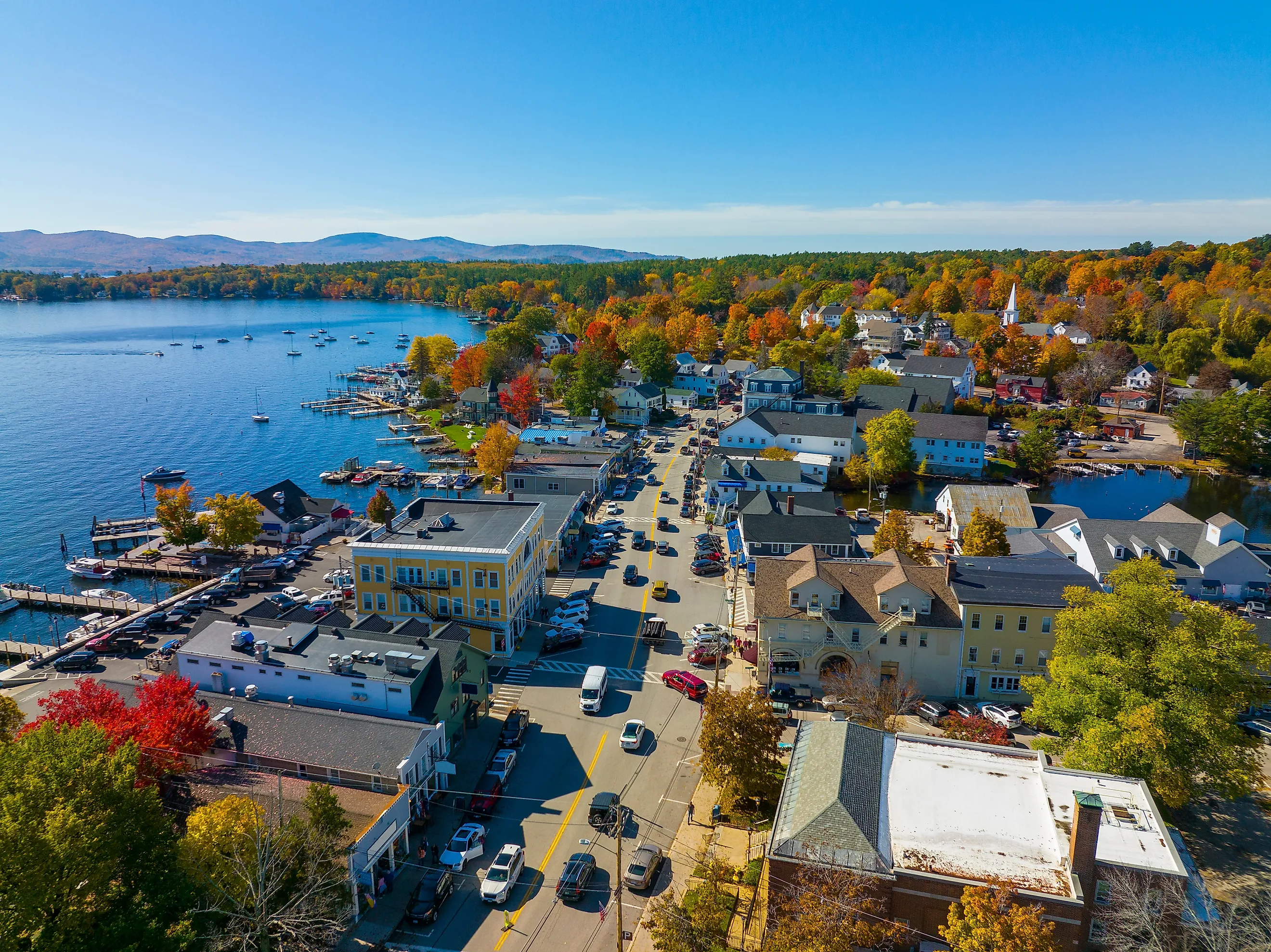
The Lake Winnipesaukee loop connects several small towns built around the largest lake in New Hampshire, 71 square miles of water with 288 miles of shoreline and more than 250 islands. Meredith sits on the western shore and serves as the natural starting point. Route 25 heads east to Center Harbor and Moultonborough, small villages perched on the lake's northern edge. The route then winds south through forested hills on Route 109, offering frequent glimpses of water between the trees.
Wolfeboro carries the official town motto "The Oldest Summer Resort in America" and maintains that character with its waterfront shops, galleries, and restaurants. The full loop stretches 63 miles and takes roughly two hours of driving without stops. Most travelers push well past that, adding beaches and trails along the way. A detour up Route 171 in Moultonborough reaches Castle in the Clouds, a mountain estate completed in 1914 with formal gardens and walking paths some 700 feet above the water. Route 25B offers a hillier, quieter alternative heading east out of Meredith toward Center Harbor.
Connecticut River Byway

The Connecticut River Byway follows New Hampshire's western border, where the river forms the boundary with Vermont, and its northern leg carries the least traffic. Route 135 covers roughly 47 miles between Woodsville and Lancaster, tracing the river nearly the whole way. Haverhill sits at the southern end with a village green and working farms scattered through the surrounding landscape. A short detour east on Route 302 reaches Bath and its two historic spans. The village covered bridge of 1832 crosses the Ammonoosuc River and ranks among the oldest in the state.
Nearby, the Haverhill-Bath Bridge of 1829 is generally reckoned the oldest surviving covered bridge in New Hampshire, and it has been open to foot traffic only since 1999. Farther north the road passes countryside where white church steeples puncture forested hillsides before reaching Lancaster, where a stone tower built in 1912 at Weeks State Park looks out over the valley from Mount Prospect. The river runs alongside or within sight of the road throughout, with pull-offs for watching the water or climbing down to rocky beaches.
White Mountain Gateway

Littleton sits at the northern gateway to the White Mountains along the Ammonoosuc River, and Route 18 heads south from there through Bethlehem and Franconia, covering about 20 miles before it ends at the notch. Littleton's downtown lines the river with galleries, antique shops, and local restaurants. Just west of Franconia, Route 117 climbs over Sugar Hill, a village of a few hundred residents with long views toward the Presidential and Franconia ranges.
Continuing south, the Franconia Notch Parkway takes Interstate 93 through Franconia Notch State Park between Cannon Mountain and the Franconia Range, narrowing to a single lane in each direction. It is the only stretch of interstate in the state that does, and Congress had to pass a special act to permit it. Beyond the notch, the road reaches Lincoln, roughly 25 miles in total. The corridor holds a working landscape of small farms and forest, with little development and light traffic. Spring brings wildflowers and summer opens the high trails, while fall draws leaf-peepers and winter turns the region over to skiers.
Lakes Region Scenic Drive

This lesser-known loop explores the hills south of Lake Winnipesaukee, where the Belknap Range rises behind the shoreline. Starting in Gilford and looping through Belmont and back toward Meredith, the route covers roughly 20 miles and takes about an hour without stops. It offers fewer lake views than the main Winnipesaukee loop but considerably more rural character. Small farms, working forests, and quiet village centers characterize the drive, and produce stands and farm stores replace tourist-oriented businesses.
Gilford itself sits on the lake's southern shore below Gunstock Mountain, so the circuit can be joined from the water side or the hill side. Spring mud season turns these roads into muddy ribbons through farmland, and summer brings agricultural festivals. Fall lines the trees with color, and winter closes the higher elevations while leaving the lower roads passable.
Seacoast Route

The shortest of these seven drives is the Coastal Byway, 18.5 miles of Routes 1A and 1B covering nearly all of New Hampshire's ocean frontage in about an hour. Starting in historic Portsmouth, Route 1B crosses the causeway to New Castle past Fort Constitution and Fort Stark before rejoining Route 1A. The road then heads south through Rye and North Hampton toward Hampton Beach.
Odiorne Point State Park in Rye holds the Seacoast Science Center and the remains of Fort Dearborn, a World War II coastal battery, while the state beaches at Jenness and Wallis Sands look out toward the Isles of Shoals. Hampton Beach at the southern end has a boardwalk and summer crowds. The northern section through New Castle and Rye maintains a more intimate scale, and Portsmouth preserves colonial architecture and a working waterfront. Salt marsh, rocky coastline, and ocean air characterize the rest.
Small-Town New Hampshire Between the Notches
Distances in New Hampshire stay short enough that the roads matter as much as the destinations, and the two-lane routes carry most of what the interstates skip. Route 135 traces the Connecticut River for 47 miles between Woodsville and Lancaster without passing anything that could be called a resort, while the Winnipesaukee loop covers 63 miles and touches half a dozen shoreline villages. South of that lake a 20-mile circuit through Gilford and Belmont trades water views for farmland, and north of Littleton the Franconia Notch Parkway narrows to a single lane each way because the mountains left no room for more. Between the notches and the river valleys, these are the small New Hampshire towns the through-traffic misses.