Connecticut River
The Connecticut River is the New England region's longest river. The Algonquian people of southern New England named it the "long tidal river" because it stretches over 410 miles and passes through four states, beginning at the northern tip of New Hampshire along the Quebec border and continuing through Vermont, Massachusetts, and Connecticut on its way to Long Island Sound. For several millenniums, the plentiful resources of the Connecticut River drew humans who transformed and remade the surrounding landscape in profound, though not necessarily beneficial ways.
Course Of The River
The Connecticut River runs from its headwaters near the Canadian border all the way to Long Island Sound. The watershed's land use is around 77 percent wooded. The rest are distributed among agricultural, wetlands/water, and developed uses. The Connecticut River is the only significant river in the northeastern United States that does not have a major port at its mouth.
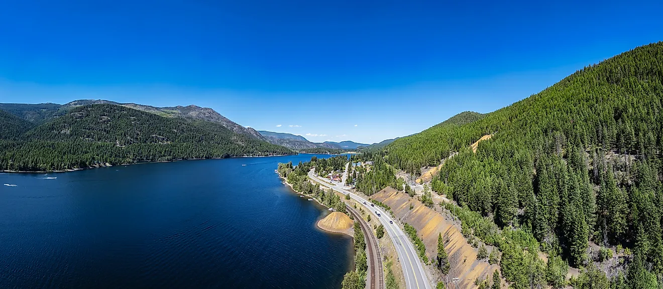
Upper Connecticut River

The Connecticut River rises near Pittsburg, New Hampshire, from Fourth Connecticut Lake, a tiny pond 300 yards south of the United States' national boundary with Chartierville, Quebec, Canada. Beginning at the height of 2,670 feet above sea level, the Connecticut River travels for 14 miles past the remaining Connecticut Lakes and Lake Francis, all within the town of Pittsburg, before widening to form a 255-mile boundary between New Hampshire and Vermont. The Connecticut River descends more than 2,480 feet in elevation as it travels south to the Massachusetts border, where it rests at 190 feet above sea level. The "Upper Valley" refers to the region above and downstream of the river that separates Lebanon, New Hampshire, and White River Junction, Vermont.
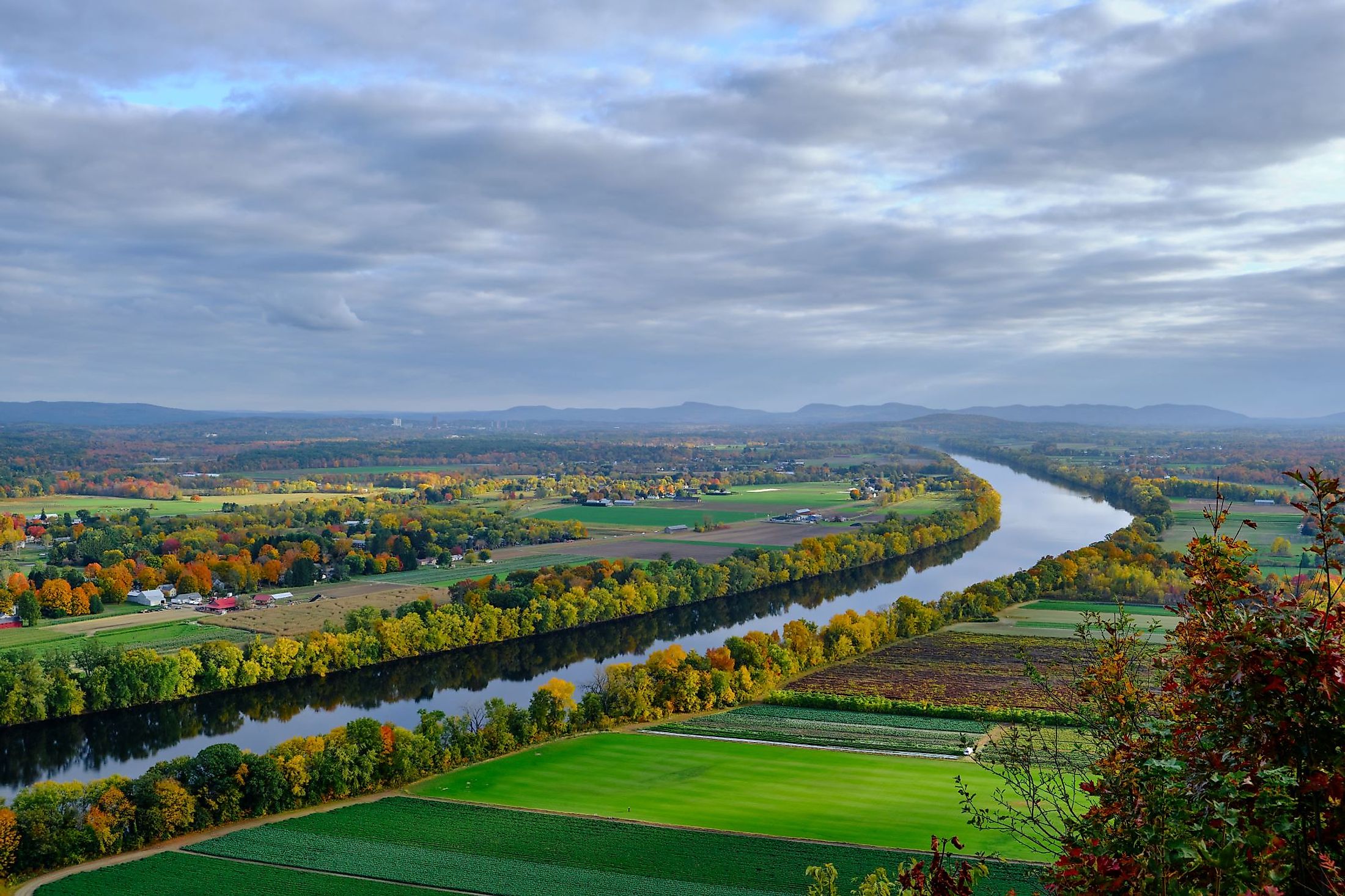
Middle Connecticut River

The river reaches its greatest depth – 130 feet – in Gill, Massachusetts, at the French King Bridge, and its greatest width – 2,100 feet – in Longmeadow, right across from the Six Flags New England amusement park. This middle section of the Connecticut River is dotted with lush green forests and agricultural hamlets. Nevertheless, the region is most known for its multiple college towns, including Northampton, South Hadley, and Amherst, as well as the river's most populated city, Springfield. The community is built on cliffs next to the Connecticut River, where it meets two main tributaries, the Chicopee River to the east and the Westfield River to the west.
Lower Connecticut River

The Lower Connecticut River segment begins 15 miles south of Hartford, near Middletown, with a narrowing of the river and then a sudden bend southeast. The Connecticut River flows through a sparsely populated, mountainous, forested region in southern Connecticut before broadening and emptying into Long Island Sound between Old Saybrook and Old Lyme.
History Of The Connecticut River
The Connecticut River's development began more than 10,000 years ago, at the end of the last ice age. The early people of the Connecticut River Valley exploited the river not only for transportation and trading route extension but also for the lush hunting and farming areas it supplied. These forefathers of modern tribes left artifacts that experts are still discovering today, some of which are over 5,000 years old. The Dutch were the first Europeans to arrive in Connecticut in 1614. With the foundation of English colonies in Massachusetts, developing economic interactions between indigenous people and newcomers grew increasingly challenging. Native populations living along the river moved up to the Massachusetts Bay and Plymouth colonies as early as 1631, hoping to fortify their position against the expanding economic and political might of the Pequot-Dutch trade alliance. Despite being provided incentives, the English initially showed little interest in establishing a presence in the river valley until September 26, 1633, when a party of Plymouth immigrants led by William Holmes sailed up the Connecticut River. The company passed the Dutch fort at modern-day Hartford and built their own trading post just south of the confluence of the Farmington and Connecticut Rivers. Over the next two years, another group of immigrants from Massachusetts, as well as one from England, arrived in the area and established what became the colony of Connecticut. With English immigrants going up into New Hampshire and Vermont in pursuit of pelts and other marketable items, the Connecticut River's value as a trading route grew. By the late 18th and early 19th centuries, the river had a thriving shipbuilding sector and became an important lumber transport route.
Plant And Animal Life In Connecticut River

Several wild faunal species are found in the Connecticut River Valley, whether it be lynx or pine marten in the boreal white spruce-balsam fir woods or migrating Canada geese, songbirds, and waterfowl congregating along the river and its agricultural regions. The river and its corridor support almost 300 native animal species, including numerous state and nationally endangered and vulnerable species, such as the state-endangered cobblestone tiger beetle. The dwarf wedge mussel is a species found in the river that is both state and nationally endangered. The Connecticut River has the world's greatest population of this species. The Connecticut River Valley is also home to various plant communities. The silver maple - wood nettle - ostrich fern floodplain woodland thrives on the river's regular spring floods. Among the ostrich ferns in several of these floodplain habitats grows the state-listed endangered green dragon. Calcareous riverbank seeps are found exclusively in the Connecticut River valley in New Hampshire, at river narrows, on outcrops, and on rocky or sandy substrates where groundwater emerges, and yearly ice destroys woody vegetation and creates fen-like conditions. Circum-neutral riverbank outcrop communities are found solely in New Hampshire along the Connecticut River and feature flood-tolerant plant species, including Jesup's milk-vetch, a federally listed endangered species with only known occurrences along the Connecticut River.
Significant Developments

After centuries of development, Connecticut's shoreline represents a unique and delicate mix of economic and natural values. The Connecticut River Gateway Commission, which oversees waterfront development requirements, was established in 1973 due to public demand. Additional laws aimed at cleaning up the Connecticut River helped improve the surrounding ecosystem, gradually reintroducing schools of shad and herring to the river and, in 1989, allowing bald eagles to nest for the first time in over a century. The whole Connecticut River watershed became the Silvio O. Conte National Fish and Wildlife Refuge in 1995 due to new legislation. Three years later, the Connecticut River was designated as an American Heritage River, and it is still protected as one of just 14 rivers in the Nation. The Connecticut River has come a long way, but there are still many chances to improve river access for leisure, connectivity, habitat restoration, and flows at the huge hydro plants located along the corridor. If computer modeling work by experts at the University of Massachusetts to synchronize water releases amongst the river's 54 significant dams pay off, the river might soon flow at a more natural pace. Access to traditional breeding habitat for anadromous fish is restored by building fish ladders at numerous dams on the river.
Threats To Connecticut River
During less-than-severe droughts, some significant streams go dry because too much water is drawn from subterranean aquifers that would normally sustain the rivers during the dry season. New commercial wells require a permit to extract water; wells that existed before the 1982 state water diversion statute require only registration with the state. These older wells in their watersheds have a significant impact on many streams. At the same time, Connecticut is increasingly vulnerable to heavy rains, which produce floods and pollution. Bacteria levels in most of Connecticut's streams are greater than what is deemed safe for recreational activities. A different statistical analysis conducted by DEEP in 2010 showed that 47 percent of wadeable streams (streams shallow enough to be examined) are appropriate for water-based recreation. Sanitary sewers were developed alongside storm sewers in 15 Connecticut cities and municipalities. When it rains, these combined sewer systems transport more water than their treatment centers can manage, and a mix of rainfall and untreated sewage spills into the rivers and Long Island Sound. Unfortunately, experts expect that climate change will result in more frequent high-intensity rainfall events in Connecticut. During particularly heavy rains, many other municipalities' sewage treatment systems, including those without integrated sanitary and storm sewers, are overwhelmed and dump untreated or inadequately treated sewage into rivers and ports.
None of New England's water basins are as significant as the Connecticut River, the region's critical physical feature and important watershed to which all rivers and streams drain. Conserving the Connecticut River's water quality is of utmost importance due to its crucial influence on the economic, ecological, and cultural activities of both the local area and the broader region.