The Busiest Shipping Routes On The Great Lakes
A ton of iron ore can pass through four separate chokepoints on one Great Lakes voyage. One load might cross the St. Marys River near Lake Superior and the Detroit River near Lake Erie. Each of those passages is narrow and heavily used. Freighters share them with every other boat hauling cargo through the region. These rivers and locks carry more cargo than any open water on the lakes. The busiest points on the Great Lakes are also the tightest.
St. Marys River And The Soo Locks

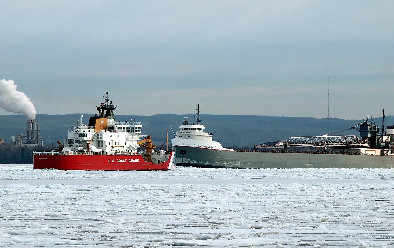
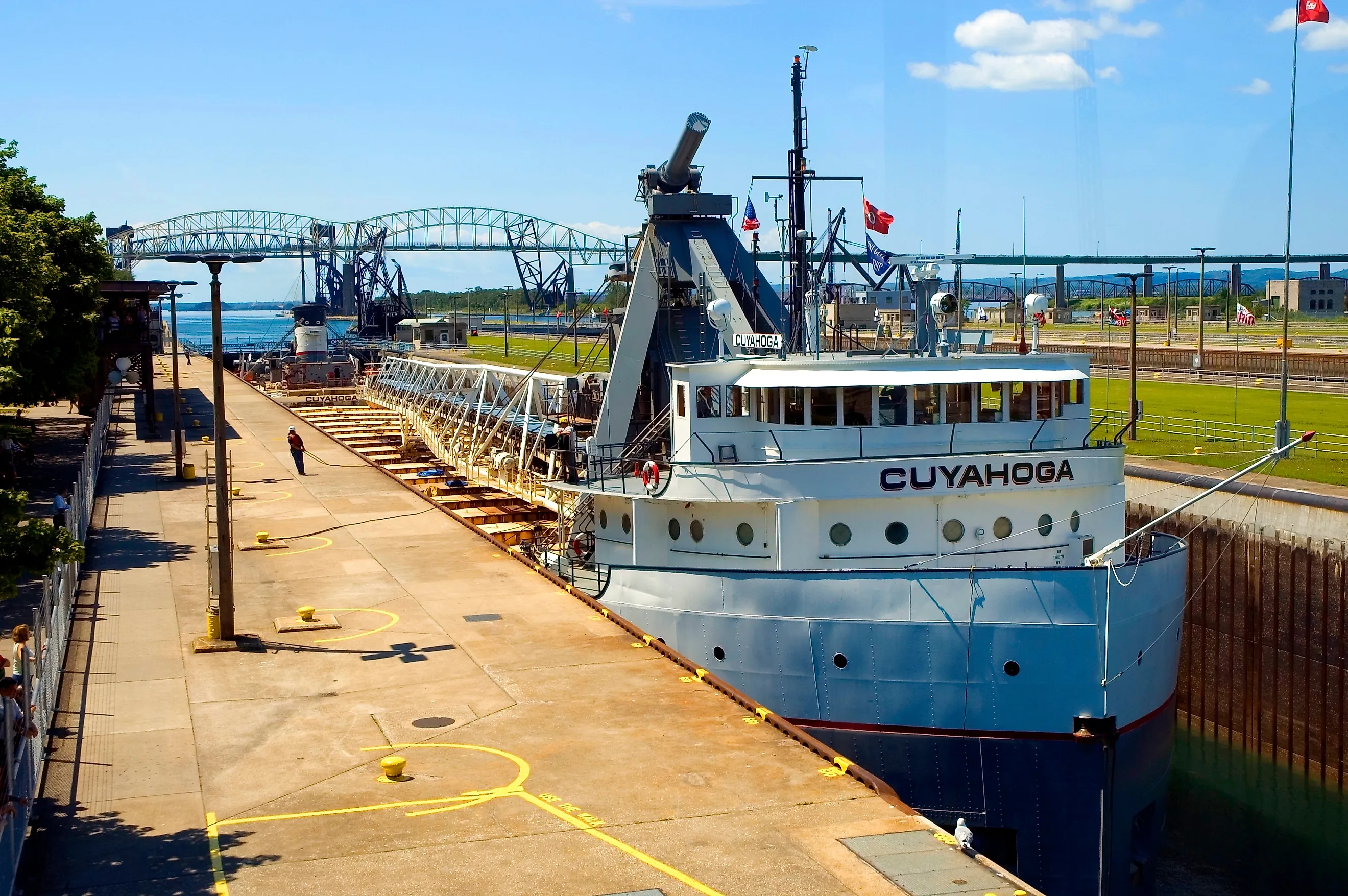
Iron ore leaving Two Harbors, Minnesota, for a steel mill on Lake Erie soon reaches the busiest measured connecting waterway on the Great Lakes. The St. Marys River links Lake Superior with Lake Huron, but rapids and a roughly 21-foot difference in water level stand in the way. Ships get past them through the Soo Locks at Sault Ste. Marie. The U.S. Army Corps of Engineers recorded an average 63.183 million tons of cargo a year on this route from 2019 through 2023, more than on any other Great Lakes connecting waterway in the same report.
In 2024 alone, 68.1 million tons passed through the locks during more than 6,000 passages. The Poe Lock carried 95.1% of that cargo because it is the only existing Soo chamber large enough for the biggest 1,000-foot lake freighters. Many arrive carrying iron ore from ports such as Duluth-Superior, Two Harbors, Silver Bay, Marquette, and Presque Isle. A vessel can spend hours crossing open Lake Superior, then find its journey south dependent on a single lock chamber in northern Michigan.
St. Clair River

Lake Huron pinches down into the St. Clair River at its southern end, where ships bound for the lower lakes enter the same corridor between Michigan and Ontario. The Army Corps measured an average 50.376 million tons of cargo a year here from 2019 through 2023, the second-highest figure among the Great Lakes connecting waterways in its report. Ore carriers coming south from Lake Superior use the river on trips toward Lake Erie and southern Lake Michigan, while northbound ships carry other cargo toward the upper lakes. The loads are heavy ones. Across U.S. Great Lakes ports in 2023, iron ore accounted for 43% of cargo by weight, according to USACE. Limestone made up another 20%, followed by coal at 9%, with salt and cement at 5% each. The St. Clair River is short compared with the lakes it joins, but an enormous amount of raw material has to pass through it.
Detroit River

South of Lake St. Clair, commercial ships enter the Detroit River for the run toward Lake Erie. This stretch averaged 46.372 million tons of cargo a year between 2019 and 2023, placing it third in the Army Corps' ranking. The channel passes directly between Detroit and Windsor, so long-distance Great Lakes traffic moves beside docks, factories, bridges, and city waterfronts.
Not every freighter continues straight through. Many serve terminals around Detroit, the Rouge River, Ecorse, Wyandotte, Riverview, and Trenton. The Detroit-Wayne County port complex handled an average of about 10.075 million tons annually during the same five-year period, and the Rouge River accounted for roughly 7.523 million tons. Iron ore moving toward steel plants forms a major part of the wider traffic, joined by limestone, salt, cement, coal, and other heavy cargo. A ship carrying ore from northern Minnesota can therefore pass apartment towers and downtown skylines without ever leaving one of North America's busiest inland freight routes.
Lake St. Clair Navigation Channels

Lake St. Clair looks spacious from the surface, but large commercial ships cannot simply wander across it. Much of the lake is too shallow for loaded freighters, so vessels traveling between the St. Clair and Detroit rivers follow maintained navigation channels. USACE recorded an average 43.676 million tons of cargo a year through those channels from 2019 through 2023, the fourth-highest total among the connecting waterways it tracks.
Some of that cargo has already appeared in the figures for neighboring rivers. A load of iron ore leaving Minnesota for Cleveland can pass the St. Marys River, St. Clair River, Lake St. Clair, and Detroit River during one trip. Treating each measurement as a new load would count the same ore several times.
Keeping the route usable also involves work that passengers on shore rarely see. The Army Corps removes boulders and other obstructions from the federal channels in Lake St. Clair and the adjoining rivers. A rock sitting a little too high on the bottom matters when a heavily loaded freighter is passing only feet above it.
Welland Canal

Niagara Falls is an unbeatable obstacle for a cargo ship, so vessels traveling between Lake Erie and Lake Ontario take the Welland Canal across Ontario's Niagara Peninsula. Eight locks raise or lower ships through the large difference in elevation between the two lakes. In 2025, the Great Lakes St. Lawrence Seaway recorded 3,230 vessel transits through the canal carrying 26.942 million metric tonnes of cargo. About 22.415 million tonnes traveled toward Lake Ontario, compared with 4.527 million tonnes heading toward Lake Erie. Grain accounted for 10.240 million tonnes, while other bulk cargo made up another 13.661 million tonnes.
The vessel count is especially striking. More ships passed through the Welland Canal in 2025 than through the Montreal-Lake Ontario section farther east, even though the eastern locks handled more cargo by weight. Each ship still has to tackle the same job: crossing the Niagara Peninsula because the natural route between the lakes ends in a 167-foot waterfall.
Montreal-Lake Ontario Section Of The St. Lawrence Seaway

After Lake Ontario, ships headed toward the Atlantic enter the lock system of the upper St. Lawrence River. The Montreal-Lake Ontario section handled 28.928 million metric tonnes of cargo during 2,607 vessel transits in 2025, according to the Great Lakes St. Lawrence Seaway. Grain alone accounted for 12.291 million tonnes, about 42.5% of the year's total, while other bulk cargo contributed 14.618 million tonnes. Traffic leaned heavily eastward: 18.804 million tonnes traveled toward Montreal, compared with 10.125 million tonnes moving inland. Five Canadian locks and two U.S. locks carry ships around rapids and changes in elevation between Lake Ontario and Montreal. These figures come from a different reporting system than the Army Corps numbers used for the four U.S. connecting waterways, so they are best treated separately. For grain and other cargo leaving the lakes for overseas markets, this is the stretch that finally opens the route toward the Atlantic.
Where Great Lakes Traffic Gets Squeezed

A 1,000-foot freighter has plenty of room while crossing Lake Superior or Lake Huron. Eventually, though, it has to reach the same lock, river, or channel as everyone else. That is where the busiest Great Lakes shipping routes appear in the data. Iron ore funnels through the Soo and the rivers below Lake Huron. Ships cross shallow Lake St. Clair in maintained channels. Grain vessels use the Welland Canal to get around Niagara Falls, then continue through the St. Lawrence locks toward the ocean. The distances across the lakes are vast, but the crucial stretches of many voyages come down to a few narrow pieces of water.
The Great Lakes shipping system works because cargo keeps moving through these narrow passages between mines, ports, factories, and the Atlantic. The Soo Locks carry the heaviest measured flow, and traffic continues through the rivers and canals farther east. Their importance is simple: when one of these chokepoints slows down, the effects can reach industries hundreds of miles away.