The 10 Saltiest Lakes in North America
The 10 saltiest lakes in North America sit in closed basins with no outlet to the sea. Some are pink, some buoy swimmers with their dense waters, and some are so saturated with minerals that little can survive. Others, however, sustain entire ecosystems, from microscopic organisms to migratory birds.
What these 10 lakes share is a simple hydrological fact. Water flows into these landlocked bodies of water and evaporation takes it out, leaving dissolved salts behind to concentrate over thousands of years. The result is a collection of some of the most chemically extreme landscapes on the continent.
While the salinity content of the ocean is about 31.5 grams per liter (g/L), or a concentration of about 3.5 percent, the majority of these lakes consistently exceed that concentration. Salinity levels fluctuate with rainfall, drought, and water diversion, but they remain the saltiest in North America, ranked from least to most salty by peak documented salinity levels.
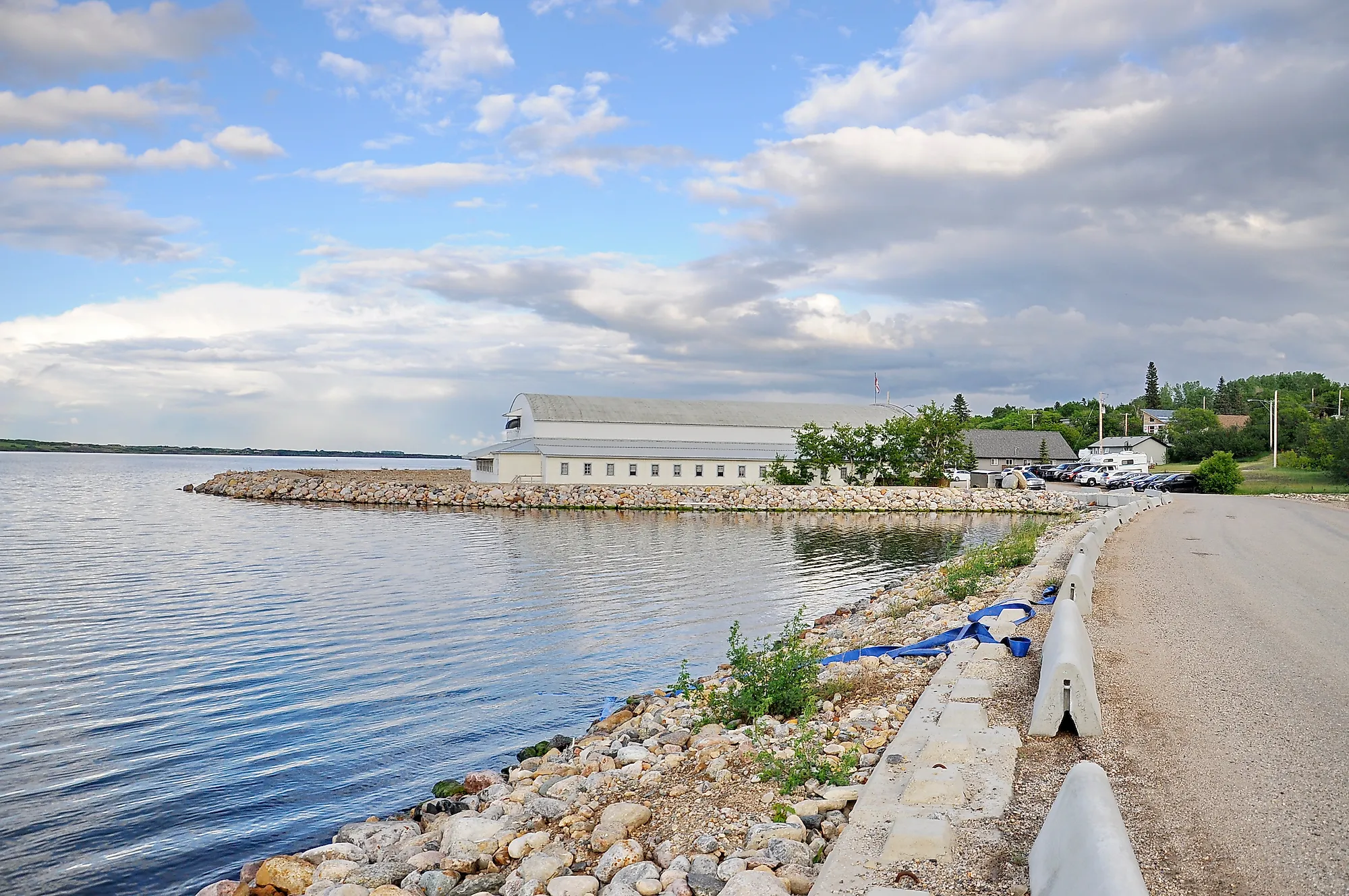
Redberry Lake

In the glaciated plains of Aspen Parkland in Saskatchewan, the hypersaline Redberry lake holds the distinction of being the core protected area of a UNESCO Biosphere Reserve. Formed as a salt lake within a closed endorheic basin, its geography prevents water from escaping except through intense evaporation. In endorheic basins, water enters but has no outlet. Salinity levels have steadily climbed over the past century. They doubled from about 12 g/L in 1926 to 24 g/L by 1988. Contemporary levels range between 21 g/L to 40 g/L, depending on seasonal precipitation. If the current trend continues, salinity levels are expected to reach around 100 g/L by 2070.
The lake's escalating hypersalinity acts as a biological filter. In the 1940s, salinity was low enough to sustain a thriving, commercially harvested population of stocked whitefish. However, by 1981, concentrations surpassed 20 g/L, and the fish could no longer survive. The fishery has been permanently closed ever since.
Despite the loss of large fish populations, the lake remains a critical federal bird sanctuary and an Important Bird Area. Over 180 species of birds use this lake as a migratory staging and feeding ground. These include birds listed under the Species at Risk Act including the whooping crane, peregrine falcon, and piping plover.
Salton Sea

The Salton Sea is California's largest lake, although it did not exist 120 years ago. A levee failure on the Colorado River in 1905 flooded the below-sea-level Sonoran Desert basin for two years. This created a lake roughly 35 miles long that has been slowly concentrating salt ever since. The lake currently sits 243 feet below sea level with no outlet.
The Colorado River Science Organization documents that since 2000, salinity has jumped by over 80 percent to approximately 75 g/L. This is more than twice the salinity of the Pacific Ocean, as sharply reduced agricultural inflows have accelerated evaporative concentration. The California State Water Resources Control Board has modeled salinity reaching approximately 196 g/L by 2045 if trends continue unchanged.
The California Department of Fish and Wildlife documents that more than 400 resident, migratory, and special status birds species have been recorded in the Salton Sea area. About 270 species use the sea on a regular basis. The US Fish and Wildlife Service's Sonny Bono Salton Sea National Wildlife Refuge reports that over 124,000 shorebirds of at least 25 species migrate through annually along the Pacific Flyway. It is identified as the third most important shorebird habitat west of the Rocky Mountains.
Mono Lake

Mono Lake sits within a volcanic basin at the eastern edge of the Sierra Nevada in California, fed entirely by snowmelt with no outlet to the sea. Since 1913, the salinity levels had ranged from 42 to 99 g/L. The current average salinity levels hover around 81 g/L. The lake's chemistry produces tufa towers, columns of calcium carbonate that rise from the water surface as levels drop.
When the city of Los Angeles began diverting the lake's tributary streams in 1941, Mono Lake lost 45 vertical feet of elevation and half of its volume. According to the Mono Lake Committee, this doubled the salinity levels. A 1994 State Water Board decision mandated lake level recovery, though the lake has not yet reached its target of averaging 6,392 feet above sea level. This elevation recovery would translate to a lake salinity level of about 68 g/L.
Big Quill Lake

Big Quill Lake lies within the glaciated plains of east-central Saskatchewan and forms part of the Quill Lakes complex, which was designated a Ramsar Wetland of International Importance in 1987. The lake's salinity is documented by the Western Hemisphere Shorebird Reserve Network as three times that of the global average ocean salinity. This places the salinity of Big Quill at about 105 g/L. The lake averages only about five feet in depth and occupies a closed endorheic basin. As evaporation exceeds inflow, dissolved sodium sulfate salts become concentrated in the lake.
Despite its hypersaline state, Big Quill supports a functioning and commercially significant ecosystem. The lake hosts a permanent population of brine shrimp and Diaptomus copepods, both harvested commercially as aquarium food. Wind actions across the shallow lake creates exposed mudflats that concentrate feeding shorebirds in numbers large enough to earn the Quill Lakes designations as a Western Hemisphere Shorebird Reserve Network site of regional importance. Tens of thousands of shorebirds use the lake during spring and fall migration, including phalaropes, sandpipers, and avocets.
Lake Abert

Lake Abert occupies a dry basin in Lake County, Oregon, and is the state's only hypersaline lake. The Chewaucan River sustains the lake, which sits in a closed endorheic basin where water can leave only through evaporation. The Oregon Natural Desert Association documents salinity levels historically between three and 12 percent, the upper limit measuring 120 g/L. Only two invertebrates are able to live within Lake Albert, the alkali fly and brine shrimp. The organisms can only survive when the salinity levels remain between three and eight percent.
Roughly 80 percent of the world population of Wilson's phalarope depends on the lake during fall migration, making its water chemistry a matter of ecological consequence. The birds feed on the alkali fly and brine shrimp, but water diversions and drought have pushed salinity to damaging extremes in recent decades. This has resulted in collapsing invertebrate populations and has reduced waterbird sightings by as much as 82 percent, according to research from the University of Montana and Audubon Society.
Little Manitou Lake

Little Manitou Lake in Saskatchewan carries a mineral salt concentration of up to 180 g/L, placing it well above ocean levels and among the saltiest lakes on the continent. The lake's waters carry a mineral salt composition of sodium, magnesium, and potassium. That mineral profile, combined with the high density of the water, gives it a specific gravity of 1.06, making the lake naturally buoyant. It has drawn visitors for therapeutic bathing for over a century.
Little Manitou Lake's salinity does not just limit what lives in the water; it defines it entirely. The Canadian Journal of Research documented that among all of Saskatchewan's saline lakes, brine shrimp of the species Artemia salina are found exclusively in Little Manitou Lake. This is because the mineral composition of the water provides the precise chemical conditions the species requires. Complex aquatic plants cannot establish themselves at this salinity and are entirely absent from the lake. This is an unusual characteristic even among hypersaline systems. What does thrive is a microbial and invertebrate community built around blue-green algae composed primarily of euryhaline species.
The surrounding wetlands and grasslands of the prairie pothole region support migratory waterfowl, shorebirds, and grasslands birds that use the lake margins for feeding and staging. The lake's salinity is also declining, according to the University of Washington research published in Springer Nature. This is a consequence of water management projects in the broader watershed rather than natural variation. That shift carries implications for the brine shrimp population, which evolved to thrive specifically in Little Manitou's mineral chemistry. This population has no comparable habitat nearby if conditions change enough to push the lake outside their tolerance range.
Great Salt Lake (South Arm)

The Great Salt Lake is the largest saltwater lake in the Western Hemisphere by surface area. A railroad causeway bisects it into two distinct basins, the southern Gilbert Bay and the northern Gunnison Bay. The South Arm receives roughly 95 percent of the freshwater inflow from the Bear, Weber, and Jordan rivers. It has averaged 142 g/L since 1996, according to research published in PLOS One. The documented historical range sits at 48 to 295 g/L depending on the water levels.
Friends of Great Salt Lake (FOGSL) notes that the functional ecosystem of the lake depends on the south arm remaining in a salinity range of approximately 120 to 160 g/L. Brine shrimp in this arm produce eggs that support a harvest industry while feeding up to 10 million migratory birds annually along the Pacific Flyway. These migratory birds include eared grebes, phalaropes, and American avocets. The lake produces 40 to 45 percent of the world's brine shrimp supply, making its ecology a matter of global significance for the aquacultural industry.
However, water diversions since the 1980s have dropped the lake levels to record lows. In 2022, FOGSL warned that the South Arm salinity exceeded 180 g/L, disrupting foundational algae and cyanobacteria populations. It also shrinked the shallow habitat that the brine shrimp and migratory bird species depend on. In 2022, brine shrimp populations were in decline and emaciated eared grebes were observed along the lake shore. Following FOGSL advocacy, a rock berm was installed to prevent the North Arm's hypersaline brine from flowing into the South Arm. In 2024, Utah's Legislature passed House Bill 453, the mineral and water rights provisions to keep the lake within optimal levels.
Searles Lake

Searles Lake sits in the Searles Valley of California's Mojave Desert as one of the most chemically concentrated lake beds in North America. It appears at first as a flat, blindingly white expanse of crystallized minerals in San Bernardino County. The subsurface brine has ranged between 25 to 346 g/L.
The lake sits in an andorheic basin that last held permanent surface water during the Pleistocene, when it formed part of a chain of lakes fed by glacial meltwater from the Sierra Nevada. NASA's Earth Observatory documents that the lake is known for an unsual abundance of rare elements and evaporite minerals. These include trona, hanksite, and halite. They are formed within its sediments over thousands of years of evaporative concentration.
Today its chemistry is complex enough to include borate concentration so high that they prevent even the sulfate-reducing bacteria that thrive at Mono Lake from colonizing its sediments. The only life the lake can consistently support are specialized halophilic, or salt-loving, microbes.
Great Salt Lake (North Arm)

The North Arm of the Great Salt Lake operates as an almost entirely different body of water from the South Arm, isolated from freshwater inflow since the Union Pacific causeway was completed in 1959. PLOS One research documents that it averages 317 g/L since 1996. It frequently approaches full salt saturation.
The Great Salt Lake Salinity Matrix has recorded a historical range of 167 to 362 g/L in Gunnison Bay. At those concentrations, even brine shrimp cannot survive. The water's vivid pink and red coloration comes from dense populations of haloarchea. These are salt-loving microorganisms that thrive when salt levels exclude all competition, as documented by the American Society for Microbiology.
The North Arm represents one of the most extreme microbial ecosystems in North America. It supports a simplified but ancient community of halophilic bacteria and archaea with few parallels on the continent. Shore-nesting birds and waterfowl use the margins and nearby wetlands of Gunnison Bay, but the open water itself supports almost no food web beyond microbes.
Spotted Lake

Northwest of Osoyoos in British Columbia's Okanagan Valley, Spotted Lake, or Kliluk, holds one of the most concentrated mineral brines anywhere on the continent. A study of the microbial diversity of Spotted Lake, published by Frontiers in Microbiology, measured a peak salinity concentration of 371 g/L. The lake's exceptionally high levels of magnesium sulfate, sodium sulfate, and other minerals cause it to separate into dozens of distinct colored pools during summer as water evaporates, leaving behind mineral-crusted circles of varying hues.
The lake is sacred to the Syix Nation and returned to indigenous stewardship in 2001 after a decades-long effort to protect it from commercial extraction. In most seasons, its hypersaline environment supports only specialized halophilic microbial organisms. Because the lake is protected and access is restricted, it can be viewed from a highway pulloff than visited directly.
North America's Saltiest Lakes
The saltiest lakes in North America reached their chemistry the same way. Water arrived to form shallow landlocked lakes, evaporation happened at a rate faster than fresh water flowed in, and dissolved minerals stayed behind. That process has been running for thousands of years, and the ecosystems that developed around it are as specific as the chemistry itself. Brine shrimp, halophilic microbes, migratory shorebirds, and specialized inverterbrates all depend on salinity ranges that most inland water bodies never reach.
The same closed basin hydrology that concentrated their minerals over thousands of years also makes them acutely sensitive to reduced inflow, upstream diversion, and drought. Once salinity climbs past the thresholds that keystone invertebrates can survive, the animals that depend on those food sources quickly lose their footing in the lake's food web. The future of these unique bodies of water depends almost entirely on how much freshwater reaches them, a variable controlled far more by policy decision than by rainfall.