The Lakes Formed by Collapsed Caves
A collapsed-cave lake is really the open ceiling of a flooded cavern, left after thousands of years of acidic water eating through limestone. That origin turns each of these ten into something far odder than an ordinary pool. At Mexico's Sacred Cenote, the Maya cast offerings of gold and jade into the water. Some of the people who carried them went in too. Croatia's Red Lake drops beneath walls taller than most skyscrapers, among the highest lake cliffs in Europe. Its neighbor, Blue Lake, sometimes empties so completely that the town of Imotski holds football matches on the bare floor. Namibia's Lake Otjikoto still guards German artillery dumped into it during World War I.
The Sacred Cenote, Mexico

The Sacred Cenote is a natural limestone sinkhole opening onto groundwater, and this one stands north of the main monuments at Chichén Itzá. An ancient raised road connects it to the ceremonial center. Measuring about 60 meters, or 197 feet, across, it is much larger than an ordinary village well. Mexico's National Institute of Anthropology and History gives its water depth as approximately 13 meters, or 43 feet. The opening formed where limestone above an underground water chamber gave way, leaving sheer walls around the exposed pool. Its importance, however, extends far beyond its geology. Maya communities used the cenote for ceremonies and offerings, and archaeological work recovered human remains and objects made from materials including gold, jade, wood, and pottery. Chichén Itzá (not the cenote by itself) was added to UNESCO's World Heritage List in 1988. Swimming is not permitted in this protected archaeological feature.
Cenote Ik Kil, Mexico
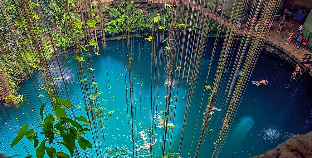
At Ik Kil, the collapse produced a nearly circular opening framed by hanging roots and plants. The cenote lies about 3 kilometers, or 1.9 miles, from Chichén Itzá and is now reached by a staircase cut down the inside wall. Its surface opening is roughly 60 meters, or 197 feet, wide. The water sits about 26 meters, or 85 feet, below ground level, and the flooded shaft continues for approximately another 48 meters, or 157 feet. Those measurements make Ik Kil much deeper than its calm surface first suggests. Unlike the Sacred Cenote, Ik Kil operates as a swimming site, with platforms and visitor facilities around the pool. Its open shape represents a late stage in a cenote's development: most of the former cave roof has disappeared, allowing sunlight, rain, falling leaves, and tree roots to enter directly.
Blue Lake, Croatia

Blue Lake, or Modro Jezero, swings so far through the year that its shoreline cannot be described with one permanent measurement. At high water, the lake may stretch roughly 800 meters long and 400 to 500 meters wide. Its water can approach 90 meters, or 295 feet, in depth, yet during dry periods the lake may vanish and expose a rocky floor. Residents of nearby Imotski have occasionally used that dry basin for football matches. Blue Lake occupies a huge collapsed depression whose sides continue to break down through erosion and rockfalls. Water levels largely follow changes in the surrounding groundwater, although rainfall, melting snow, and local drainage also contribute. This means the lake behaves less like a sealed bowl and more like a visible opening into a changing underground water system.
Red Lake, Croatia

Only about 500 meters from Blue Lake, Red Lake presents a far more imposing vertical drop. A 1998 speleological expedition measured a total height difference of about 528 meters, or 1,731 feet, from the upper rim to the deepest point. The opening covers roughly 27,000 square meters, and the water column reaches a measured depth of about 287 meters, or 942 feet. Estimates of the sinkhole's total volume run to roughly 25 to 30 million cubic meters. In 2017, French diver Frederic Swierczynski became the first person to reach the bottom, touching down near 245 meters after a four-hour descent. Divers have found submerged passages in its walls, supporting the view that it remains connected to a wider underground system. The name comes not from red water but from the iron-stained, reddish-brown cliffs surrounding it. Scientists describe Red Lake as a major collapse feature: an enormous underground chamber failed, leaving a water-filled pit with some of the tallest lake walls in Europe.
Melissani Lake, Greece

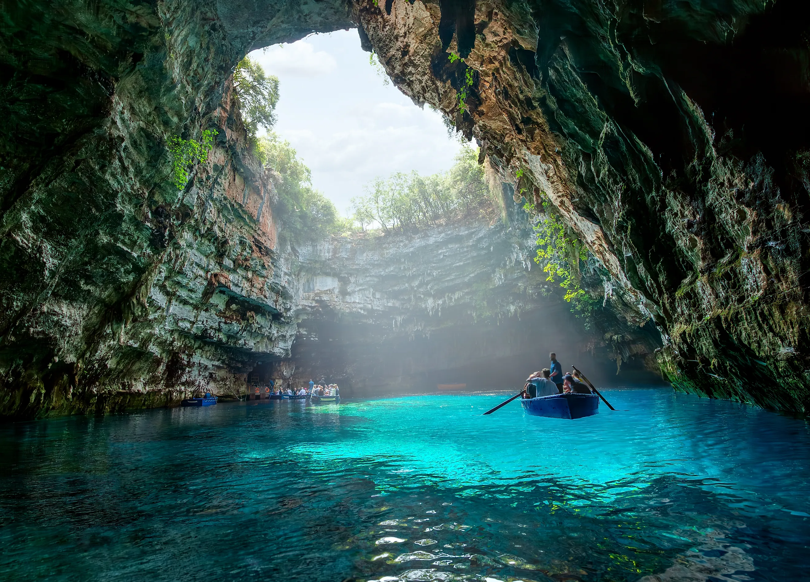
Sunlight is the feature that makes Melissani Lake instantly recognizable, but that light reaches the water only because part of the cave roof is gone. The lake lies on the Greek island of Kefalonia, about 20 meters, or 66 feet, below the surrounding ground. Its flooded passage is approximately 100 to 160 meters long, depending on where the chamber's limits are measured, and the deepest water reaches about 30 meters. The water is not purely fresh: seawater enters Kefalonia's underground channels, mixes with rainwater, and crosses the island before emerging near the coast. A major earthquake struck the Ionian Islands in 1953 and is commonly associated with further collapse of the roof, although the opening may have developed in more than one stage. Today, visitors enter through a tunnel and cross the lake in small boats beneath both intact stone and open sky.
Lake Otjikoto, Namibia

Permanent natural lakes are rare in Namibia, making Lake Otjikoto unusual before its geology is even considered. The lake occupies the remains of a collapsed limestone cavern about 20 kilometers northwest of Tsumeb. Its exposed surface is close to 102 meters, or 335 feet, across, but the chamber widens and branches below the water. Published depth figures vary because submerged side passages and sloping debris make the bottom difficult to define. Surveys and regional studies commonly report depths of roughly 58 to more than 90 meters. The lake also holds a remarkable historical record. In 1915, retreating German forces dumped weapons and military equipment into Otjikoto rather than surrendering them to South African troops. Some pieces were later recovered, while others remain underwater. The lake was declared a national monument in 1972.
Lake Guinas, Namibia

Lake Guinas lies west of Tsumeb on privately owned land, concealed within a steep-sided limestone opening. It is often paired with Otjikoto, but Guinas is deeper and has a more extensive submerged chamber. Surveys place its maximum depth near 130 meters, or 427 feet, while its exposed surface covers only about 0.66 hectares, or 1.6 acres. The water-filled space becomes wider below the rim, demonstrating how little of a collapsed cave can be visible from above. Guinas is also the original natural home of the rare Otjikoto tilapia, despite the fish's common name. The species was later introduced into Lake Otjikoto and several artificial ponds. Stories often claim that the two Namibian lakes are joined by an underwater tunnel. Their shared limestone setting makes the idea tempting, but researchers have not established a direct passable connection between them.
Lake Kashiba, Zambia

A visitor approaching Lake Kashiba through the forests of Zambia's Copperbelt Province does not see a broad beach or a gradual shoreline. The ground ends at pale rock walls, with blue water lying roughly 10 meters, or 33 feet, below the surrounding land. Zambia's National Heritage Conservation Commission describes Kashiba as a sunken lake approximately 800 meters in diameter and more than 100 meters deep, although other accounts give a much smaller surface area of about 3.5 hectares. The conflicting dimensions reflect the lake's irregular shape and the limited number of detailed surveys available publicly. Its origin is clearer: groundwater dissolved the limestone, created underground spaces, and eventually caused the weakened roof to fall. Kashiba is the best-known of several "sunken lakes" in the region and is protected as a national monument. Local Lamba traditions also connect the lake with the history of the Goat Clan.
Montezuma Well, United States

Montezuma Well appears unexpectedly in the dry landscape of central Arizona. It is not a hand-dug well but a large spring-fed lake inside a collapsed limestone basin. The opening measures roughly 112 to 143 meters, or 368 to 470 feet, across, depending on the points used for measurement. The main pool averages about 17 meters, or 55 feet, deep, while vents in the floor extend farther downward. The National Park Service reports that the limestone collapse occurred between about 12,000 and 15,000 years ago, although parts of the structure may be older. Underground springs keep the water level remarkably steady: annual variation is about 16 centimeters, and the average temperature stays near 21°C, or 70°F. Water leaves through a natural outlet and feeds an irrigation channel whose route has been used by people for many centuries.
Devils Well, United States
Devils Well in Missouri offers a direct view into a cave lake whose roof has partially collapsed. From the viewing area, the water lies about 30 meters, or 100 feet, below. The lake itself may be another 24 meters, or 80 feet, deep, and its level can rise or fall by 2.4 to 3 meters after changes in rainfall. The flooded chamber measures approximately 122 meters long and 30 meters wide, about the length of a football field. Unlike an open cenote, Devils Well still retains much of the cavern around the water, so the collapse functions as a window rather than a complete removal of the ceiling. Tracing studies have shown that its water later emerges at Cave Spring beside the Current River. The dark lake also supports cave-adapted animals, including the blind southern cavefish, which depends on clean underground water.
Lake or Opening Into the Underground?
These places do not all fit the everyday picture of a lake. Some are open pools surrounded by cliffs, some are spring-fed basins, and others remain mostly underground. What joins them is the failure of rock above a natural cavity. That failure brought buried water into view and created a direct connection between the surface and an underground drainage system. The process also explains why these lakes can be unusually deep for their surface size, why some rise and fall without visible rivers, and why pollution entering one opening may travel quickly through caves and cracks. Their clear water and dramatic walls are the visible results of a much larger structure that continues beneath the ground.