Gulf of San Jorge
Argentina is home to a collection of freshwater lakes, rivers, and waterfalls, which exist along the country’s million square miles of land. Specifically, the San Jorge Gulf is one of Argentina’s many water bodies that boast unique characteristics and relationships to the country. Also known as the Golfo San Jorge, the Gulf of San Jorge lies in Argentina’s Patagonia region.
Geography of The San Jorge Gulf

Open to the Atlantic Ocean, the Gulf of San Jorge is an ocean basin that sits in Patagonia's central region, between 45 degrees S and 47 degrees S. It's considered the largest gulf of the Argentinian Patagonian Shelf, spanning from the Dos Bahías Cape (in the north) to the Tres Puntas Cape (in the south). Its shoreline also extends from the Argentine provinces of Chubut to Santa Cruz.
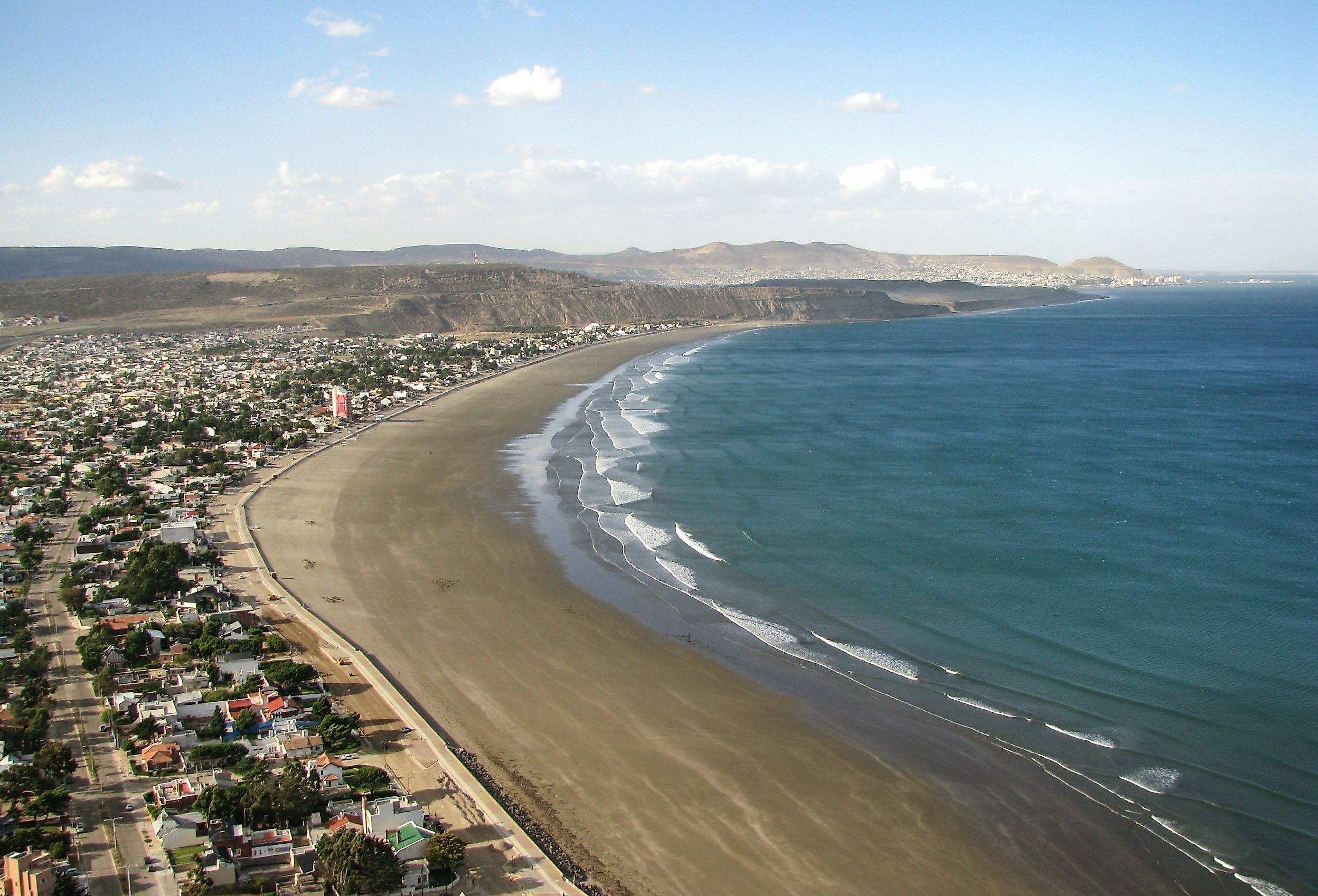
Cities And Towns Along The San Jorge Gulf
There are a handful of cities and towns that exist along the coast of the San Jorge Gulf, each with its own history and unique landmarks.
Caleta Olivia

Nicknamed “Oil City”, Caleta Olivia nears the border with Chubut and is considered the gateway to Argentina’s Santa Cruz province. The city’s specialty is oil extraction. Caleta Olivia houses the Natural Caleta, which was declared a Municipal Nature Reserve. This natural landmark sits along the coast, near the Municipal Sports Complex. The city also erected the “El Gorosito” monument, which pays homage to oil and tankers. The monument is of an oil worker looking towards northern Argentina, representing Patagonia’s abundance of minerals.
Comodoro Rivadavia

Also known as Comodoro, Comodoro Rivadavia is one of the area’s largest port cities. The city was founded in 1901 by Francisco Petrobelli, a businessman who wanted to develop an Atlantic Ocean port. The city was named after Comodoro Martín Rivadavia who served in Argentina’s navy. Comodoro sits near one of the most vital oil extraction regions in the country. Due to its lively nature, weather, beautiful coastline, and wealth, Comodoro attracts many people from Argentina, Chile, Bolivia, and Peru. However, Comodoro Rivadavia is considered one of Argentina’s most expensive cities due to its high rent.
Camarones

Camarones is a coastal town set 262 km from Comodoro Rivadavia and 1,680 km from Buenos Aires. In 1958, the town acquired its municipality status but has existed since 1890, when it was used by the Spanish for transporting goods around Camarones Bay. The town is also known as the childhood home of Argentina’s President, Juan Domingo Perón. The fishing town is popular for outdoor activities like diving, nautical excursions, rural tourism, wildlife watching, sports fishing, and the Perón Family Museum.
Rada Tilly

Also known as Villa Rada Tilly, the village of Rada Tilly lies along the center of the San Jorge Gulf. This village sits near Punta Piedras to the North and Punta del Marqués to the South. Rada Tilly was founded in 1884 by Welsh settlers who were drawn to the area’s mild climate and natural resources.
In the summer, tourists are drawn to Rada Tilly to enjoy various adventure sports by the coast. Its picturesque beaches and cliffs are also to be admired! Rada Tilly is also home to the Rada Tilly Lighthouse, which is one of the oldest Argentine lighthouses built in 1884.
Characteristics Of The San Jorge Gulf

The Gulf of San Jorge is approximately 142 miles at the mouth, covering about 15 square miles. Due to its geography, over 70% of the gulf's basin is between 230 to 328 feet deep. Meanwhile, to its south, it reaches depths of about 164 to 197 feet deep. At its north, it reaches 295 feet deep.
Its seabed comprises mud, sand, gravel, and sand with carbonate, which were formed from the remains of bivalves and cirripedes. There are no rivers that drain into the gulf. Annual rainfall in the Gulf of San Jorge is no less than 200 mm per year.
Marine Life

The San Jorge Gulf harbors one of the greatest biodiversity profiles within the Patagonian Shelf, due to its proximity to other bays, creeks, and islands. The gulf is also regarded as a breeding ground for many sea birds and marine mammals. Various whale species have been found on the gulf, which include the Southern Right Whale, Sei Whales, and Humpback Whales. Otherwise, researchers have also identified other animals in and around the gulf, including the Southern King Crab and the Magellanic Penguin. Phytoplankton is also grown within the gulf, including diatoms and dinoflagellates, which are supported by nutrient-rich waters that are received by various surrounding water bodies.
Economy & Human Interactions In And Around The Gulf

In an attempt to protect the local habitat and the gulf's natural resources, the northern zone of the SJG was recognized as protected by national law, also known as the Coastal Marine Park "Patagonia Austral," which was Argentina's first marine park. International and national researchers have also recognized the Gulf as a "hotspot" for scientific research related to physical, chemical, biological, and geological studies.
The "Blue Pampa" Project was a project to research and ensure "conservation and management" within "five different areas" in the South Atlantic; out of these five geographic areas, the San Jorge Gulf was one of them, due to its profitable fishing ventures in all the Argentine Sea.
Communities around the San Jorge Gulf rely on commercial fishing, such as fishing for crustaceans. Fishing around the Gulf was a profitable venture due to the shrimp population.
Oil extraction is another popular activity near the San Jorge Gulf. However, activities tied to the oil industry in the area have environmental concerns, including oil spills that can cause damage to the coastline and pollution.
The San Jorge Gulf is one of Argentina’s many water bodies that boasts unique characteristics and a relationship to the country.


