The Counties With The Most Farmland In America
America's largest farm sprawls across the high desert of northern Arizona. Apache County holds more than five million acres of farm and ranch ground. The federal government counts cropland and open grazing range alike as land in farms. Grazing range fills most of that total across all ten counties here. Nine of the ten leaders sit deep in the arid West. The 2022 Census of Agriculture ranks each county by total farmland acres.
Apache County, Arizona

Apache County holds 5,534,505 acres of farm and ranch land, more than any county in the United States. The same county ranks 2,548th out of 3,078 in the value of what it sells. Cropland makes up 37,526 of those acres. Pastureland makes up 4,926,716. Irrigation reaches 7,729 acres, a share the census records as less than half of 1%.
Sheep outnumber cattle by nearly two to one, 69,090 head against 37,055. No county in Arizona sells more sheep, goats, wool, and mohair. The crop table runs to a few thousand acres in total. Forage takes 3,495 of them. Corn, which the census lists as traditional or Indian corn, takes 1,187 more, followed by 172 acres of squash and 116 of watermelons.
Coconino County, Arizona

Coconino County covers 5,513,546 acres of farmland and shed 10% of that total in five years. The Grand Canyon sits within the county. Pasture accounts for nearly all the remainder, 5,359,071 acres of pastureland set against 12,466 acres of cropland, and livestock brings in 94% of sales.
Cattle number 41,999 head, so cattle outnumber sheep here, which is not the case in Apache or Navajo counties. Vegetables account for 183 acres, watermelons for 43, and squash for 38, while the forage total stays withheld to protect individual operations. Sales of $22,593,000 place the county 2,427th nationally.
Navajo County, Arizona

Navajo County gained farmland while its two neighbors lost theirs, climbing 5% to 4,637,488 acres. Farm numbers moved the other way, falling 22% to 3,269. Average farm size rose 35% to 1,419 acres. Fewer operators working more ground is the national trend of the past five years compressed into a single county.
Sheep and lambs number 39,927 against 20,363 cattle, and 79% of farms sell under $2,500 a year. Sales reached $47,996,000, the strongest of the three Arizona counties and still 1,993rd nationally. After expenses, the county lost $26,034,000 on farming in 2022. Apache, Coconino, and Navajo together lost roughly $80 million that year.
Cherry County, Nebraska

Grass covers Cherry County and its ranchers turn a profit on it. The largest county in Nebraska reported 3,795,779 farmland acres, 1.7 million fewer than Apache County, and earned $56,110,000 in net cash farm income. Sales of $270,939,000 rank it 570th, against 2,548th for Apache County.
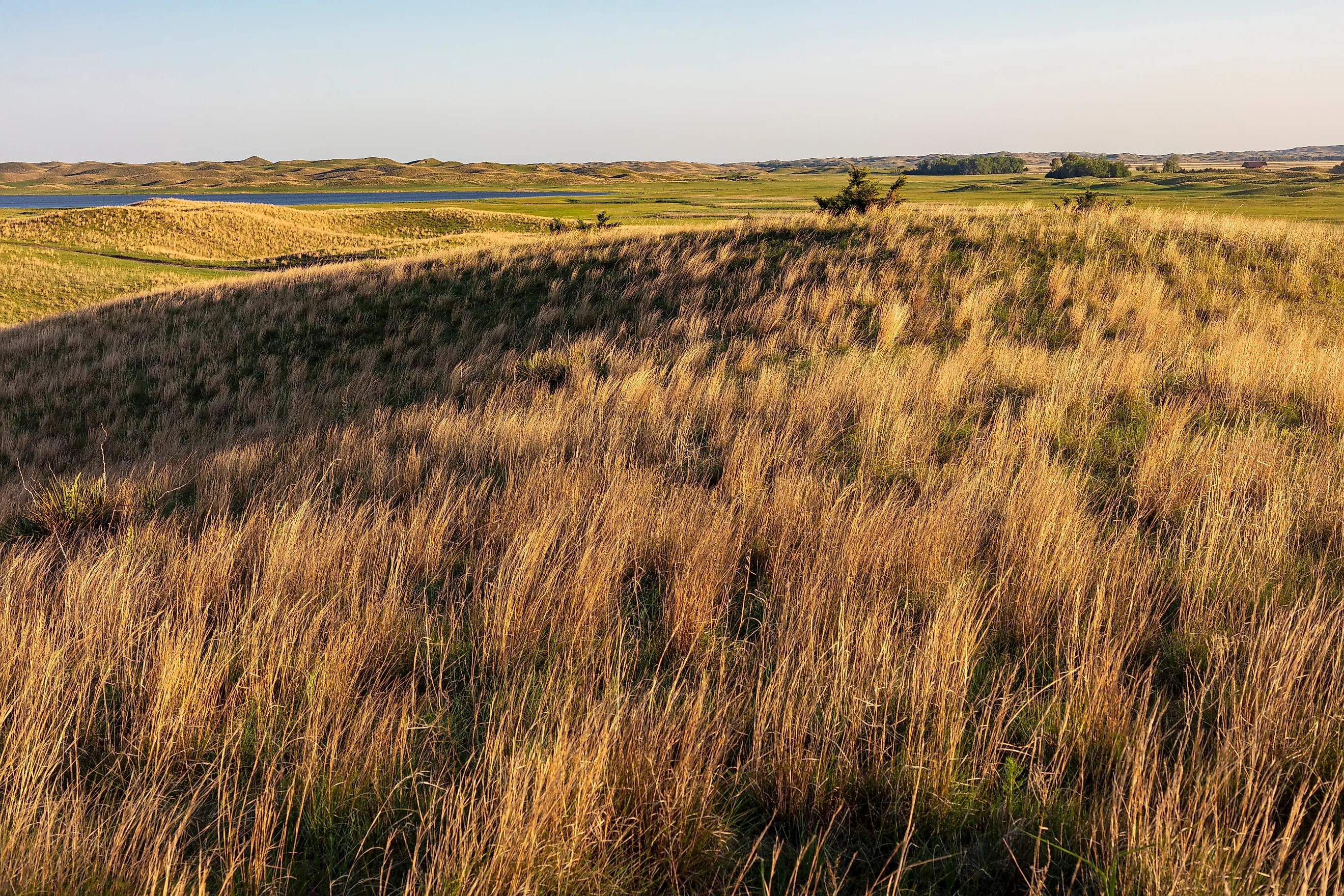
The Sandhills roll across the county. Grazing land here feeds 337,095 cattle, sheep number just 125, and cattle sales rank 68th among all counties. Nearly two thirds of farms work more than 1,000 acres. The average operation covers 6,223 acres against 1,036 in Apache County, and sales run about 16 times higher.
Big Horn County, Montana

Big Horn County counts 3,191,315 acres in farms, and its operators earn a solid living from them, which sets the county apart from the Arizona three. Sales rose 57% to $130,868,000, and $30,947,000 remained once costs were met. Much of the Crow Reservation falls inside its boundaries.
Crops and livestock split almost evenly at 46% and 54%. Wheat covers 83,342 acres and forage 73,195. Irrigation reaches 41,818 acres, including 6,804 planted to sugarbeets. Cattle number 89,583 head, worth $69,145,000 at market. Montana State University Extension puts more than 99% of the county's land area inside a farm or ranch.
Pecos County, Texas

Pecos County carries 3,013,934 farmland acres across the Trans-Pecos country of west Texas. Pastureland takes up 2,907,281 of them and cropland 86,467. Fort Stockton serves as the county seat. The average farm nearby covers 12,104 acres, up 30% while farm numbers dropped 19%.
Ranchers keep 14,902 sheep and 8,757 goats alongside 25,933 cattle. Livestock of that kind ranks 67th nationally by sales value, far above the county's overall standing of 1,976th. Sales here split 60% to crops and 40% to livestock. Cotton covers 2,980 acres, and pecans appear among the top crops with their acreage withheld.
Rosebud County, Montana

Rosebud County draws its 2,873,641 acres from the same eastern Montana grassland as Big Horn next door. Extension figures classify more than 85% of it as farmland. The county contains most of the Northern Cheyenne Reservation. Farm counts slid 13% to 360 while average size climbed 21% to 7,982 acres.
Government payments rose 204% to $11,430,000, set beside total sales of $75,844,000. Cattle number 66,397 head and sold for $49,929,000. Forage covers 55,768 acres and wheat 24,735. Beneath those figures come 3,868 acres of dry edible peas and 2,972 acres of lentils.
Carbon County, Wyoming

Carbon County irrigates 157,301 acres, or 5% of its farmland. Every Arizona county above waters well below 1%. Farms here take in 2,866,440 acres, of which 2,630,818 are pastureland, and stock raising supplies 93% of everything sold.
Cattle number 95,021 head against Cherry County's 337,095, and their sales rank 214th among all US counties. Forage covers 85,899 acres. Corn, barley, and soybeans all stay withheld from publication. Hay remains the only crop the census will name here. Its 311 farms average 9,217 acres apiece, and Wyoming has no larger farmland county.
Hudspeth County, Texas

Hudspeth County grew its farmland 16% between 2017 and 2022, reaching 2,642,028 acres. Crops bring in 81% of sales rather than livestock, a reversal of the balance struck in Carbon and Campbell counties. Total sales rose 270% to $64,412,000 across the same five years.
Farms water 36,165 acres here, and hay and other crops sold $35,997,000, second in Texas and 89th across the country. Cotton covers 7,915 acres, with 810 more in pecans. Federal payments came to $3,521,000 across 162 farms. Sierra Blanca, the county seat, sits in one of only two Texas counties that keep Mountain Time all year.
Campbell County, Wyoming

Campbell County lost 10% of its grazing and cropland over five years, closing this ranking at 2,599,124 acres. Farms fell 15% to 548, and the typical holding runs 4,743 acres. Stock accounts for 95% of sales, and cropland covers just 131,367 acres.
Gillette, the seat of county government, calls itself the Energy Capital of the World, and the county sits over the Powder River Basin coalfield. Government payments reached $19,298,000 in 2022, a rise of 519%, set against $60,923,000 in sales. Roughly one dollar of federal support arrived for every three dollars sold, and cattle numbered 67,410.
What The Acreage Measures
Farmland in the federal count means land operated, and pasture outweighs cropland many times over wherever the census publishes both figures. Price follows the same pattern. Outside Alaska, the cheapest agricultural land in the nation lies in Navajo, Apache, and Coconino counties. They run $325, $329, and $344 an acre against a national median of $4,382. Acreage and value move in opposite directions.
Acreage, sales, livestock, and land values come from the 2022 Census of Agriculture. County land areas come from the US Census Bureau.