Towns at the Very End of the Road
Towns at the very end of the road share attributes of natural beauty in outlying locations. Some are surrounded by forests and glaciers at the boundaries of Alaska's Inside Passage. Others, such as Cape Cod's Provincetown, look out over the Atlantic Ocean. Another coastal location, Tofino, British Columbia, sports a rainforest near the northern tip of a Clayoquot Sound peninsula. Along the way, the road shares stories of American history and offers opportunities for outdoor recreation. These six towns in Canada, Europe, and the US offer more than the distinction of a distant address. They weave narratives reflecting the adventurous spirit of exploration and isolated landscapes.
Provincetown, Massachusetts

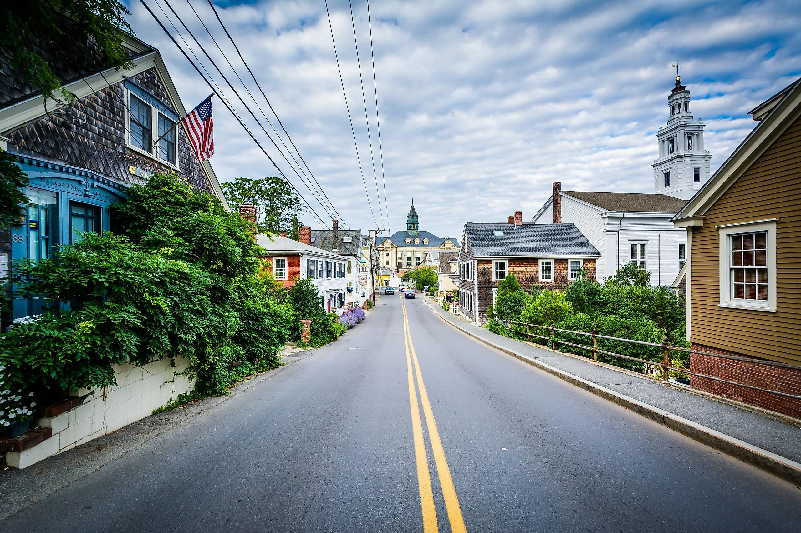
Provincetown combines its end-of-the-road status with American history against the scenic backdrop of the Cape Cod National Seashore. Located at the northern tip of Cape Cod, it is the eastern terminus of US Route 6, which extends approximately 3,205 miles to Bishop, California, on the opposite side of the country. It is one of the longest continuous highways in the US, notable for its cross-country course before passing by the fishing villages and sand dunes of the Cape.
The Pilgrims first came ashore in the remote Provincetown area in 1620 before continuing to Plymouth. Pilgrims' First Landing Park marks the approximate site with a commemorative marker and waterfront views. Nearby, the 252-foot granite Pilgrim Monument commemorates the Pilgrims' first landing and the signing of the Mayflower Compact in Provincetown Harbor. Otherwise, life in Provincetown is shaped by the tourist season. A year-round population of about 3,660 climbs toward 60,000 at the height of summer, and the town now pays property owners up to $20,000 through its Lease to Locals program to convert a seasonal unit into a year-round rental for the workers who staff that season.
Tofino, British Columbia, Canada

Extensive natural regions and scenic landscapes define the town of Tofino. Situated at the far western edge of Vancouver Island, British Columbia, Tofino lies on the northern tip of the Esowista Peninsula in Clayoquot Sound. The Pacific Rim Highway (Highway 4) crosses the island and terminates in Tofino. The Pacific Terminus sign at the end of First Street also claims to mark the western end of the Trans-Canada Highway system, though the official terminus is in Victoria.
In town, the Anchor / Third Street Park & Lookout offers views of the harbor and the surrounding coastline. The town lies within the roughly 865,000-acre Clayoquot Sound UNESCO Biosphere Region, encompassing old-growth forest, mountains, estuaries, and rocky coastal shores. Its remote, end-of-the-road location has created a tight-knit community for locals and draws tourists in the summer for camping and surfing, while winter is the high season for storm watchers keen to see the Pacific Coast at its most rugged.
Haines, Alaska

Noted for its wildlife and imposing geological formations, Haines occupies a peninsula between Chilkoot Inlet and Chilkat Inlet on the Lynn Canal, a glacial fjord more than 2,000 feet deep. It is set at the northern end of Alaska's Inside Passage, connected to Haines Junction in Canada's Yukon Territory by the 152-mile Haines Highway, which joins the Alaska Highway. Life here is organized around that single highway and the ferry dock. Reaching Anchorage means about 775 road miles out through the Yukon and back across the border, and getting to Juneau means a flight or a four-and-a-half-hour Alaska Marine Highway sailing, because the state capital, 80 miles south, has no road at all.
While the remote northern geography may offer a challenge for humans, it's a bonus for other species. The American Bald Eagle Foundation supports the conservation of bald eagles and their habitats through educational workshops and on-site nature exhibits. Nearby, the approximately 48,000-acre Chilkat Bald Eagle Preserve protects the river flats and forests that support wildlife, including one of the world's largest concentrations of bald eagles.
Mallaig, Scotland

The fishing port town of Scotland's Mallaig blends fictional scenes with access by road, rail, ferry, and seasonal steam train. The A830, known as the Road to the Isles, ends in Mallaig on the Sound of Sleat, the strait that separates the mainland from the Isle of Skye, accessible by ferry from the Mallaig Ferry Terminal. Mallaig also serves as the terminus of the West Highland Line and the seasonal Jacobite Steam Train. The Jacobite covers approximately 84 miles round-trip between Fort William and Mallaig. It is widely recognized for crossing the Glenfinnan Viaduct, which appeared as the Hogwarts Express route in the Harry Potter films.
About 700 people live in Mallaig year-round, and the harbor is still a working one. The fleet that made this the busiest herring port in Europe during the 1960s now lands prawns and shellfish, and the same pier supplies Knoydart, the roadless peninsula across Loch Nevis, where roughly a hundred residents get everything by boat. The Mallaig Heritage Center, near the train station, preserves the region's history through photographs and local exhibits. The walkable town center on Station Road has a variety of restaurants and shops, such as Mallaig Art Gallery & Crafts. Nearby, Haggard Alley, a Harry Potter-themed gift shop, reflects the town's connection to the famous railroad trip.
Grand Isle, Louisiana

Part of the Mississippi River Delta Plain, Grand Isle plays host to beaches and wildlife habitat at the southern terminus of Louisiana Highway 1. This is the only road that connects the barrier island to the mainland, accessible via a bridge. The road ends near Grand Isle State Park, which overlooks the Gulf of Mexico and offers beach access and campsites. About 1,000 people live on Grand Isle year-round, on an island where Hurricane Ida damaged every structure in 2021 and knocked out power for close to three months. Enrollment at the island's school has fallen from roughly 187 students before the storm to 68, while vacation rentals and fishing camps now drive much of the local economy.
The Grand Isle Birding Trail leads birdwatchers through a chenier forest, a unique shell or sand-covered ridge with oak trees, providing refuge for migrating birds. Local events, such as the Grand Isle Tarpon Rodeo, an annual saltwater fishing tournament, and the Grand Isle Migratory Bird Festival, honor and celebrate the region's coastal heritage while bringing this resilient community together.
St. Anthony, Newfoundland and Labrador, Canada

St. Anthony presents a vast landscape of Arctic formations and Viking history at the tip of the Great Northern Peninsula. Part of the historic Viking Trail, an approximately 300-mile-long road that winds through historic Viking sites, this port town is known for iceberg viewing and whale watching. It sits along Iceberg Alley, where icebergs drifting down from Greenland and the Arctic can be seen from land or on boat tours. The town even hosts an annual Iceberg Festival. St. Anthony is accessible via the Viking Trail/Great Northern Peninsula Highway (Route 430).
Fishing Point Municipal Park provides access to several hiking trails ranging in difficulty, including Iceberg Alley, Cartier's View, Whale Watchers, and the Santana Trail. The Fishing Point Lighthouse, also known as Fox Point Light Station, and the Great Viking Feast dinner theatre are within the park. St. Anthony counted 2,180 residents in 2021, down from 2,730 two decades earlier, and it serves as the regional center for the whole Northern Peninsula and southern Labrador. The Charles S. Curtis Memorial Hospital, descended from Wilfred Grenfell's medical mission, is the largest employer in town.
Towns at the Very End of the Road
Although these towns each occupy distinct geographic settings, they share the characteristics of natural beauty and diversity in remote and inviting communities. Framed by the terrain of peninsulas and inlets, they make their entrance and exit points a defining feature. The northern end of Newfoundland and Labrador's Great Northern Peninsula is home to St. Anthony's Arctic formations and marine wildlife. Grand Isle, Louisiana, uses its coastal terminus as a setting for saltwater fishing and the preservation of migrating bird habitats. Meanwhile, the port town of Mallaig, Scotland, is reachable by unique modes of transport, including the Jacobite Steam Train or ferry service. Together, these towns show how distinctive landscapes and the journeys required to reach them create remarkable places.