The Cheapest Beautiful Towns To Live In Arkansas
The cheapest beautiful towns in Arkansas are the ones next to land nobody can sell. The typical home is worth $228,662 as of June 2026, up 3.5% on the year, according to Zillow. All eight towns here fall below that, and Hardy, the cheapest, averages $106,189. That money buys an address within reach of a national forest, a wild and scenic river, and the oldest state park in Arkansas. Hardy alone carries 41 National Register buildings along one Main Street, in a town of 780. The scenery here is permanent because the ground under it is public.
Mulberry

Local home values in Mulberry reached $191,928 in June 2026, about 16% under the Arkansas figure. Values climbed 8.1% over the year, a faster climb than most of the eight. What that gets is a community of roughly 1,600 on the Interstate 40 corridor, so work in either direction along the valley stays reachable. The Mulberry-Pleasant View Bi-County School District works out of a building on West Fifth Street, four schools and about 400 students spread over two counties. Main Street began as the wagon road down to the river.
Crawford County acquired Mulberry from Franklin County in 1895, and the deal came with an unusual price: a bridge across the Mulberry River. More than a century later, that river is still the town's defining feature. It comes down out of the Boston Mountains through the Ozark National Forest and empties into the Arkansas River just south of the city limits. Congress protected the upper river under the National Wild and Scenic Rivers System in 1992. The water above town moves through narrow canyons and past tree-lined bluffs at Class I and II.
Ozark

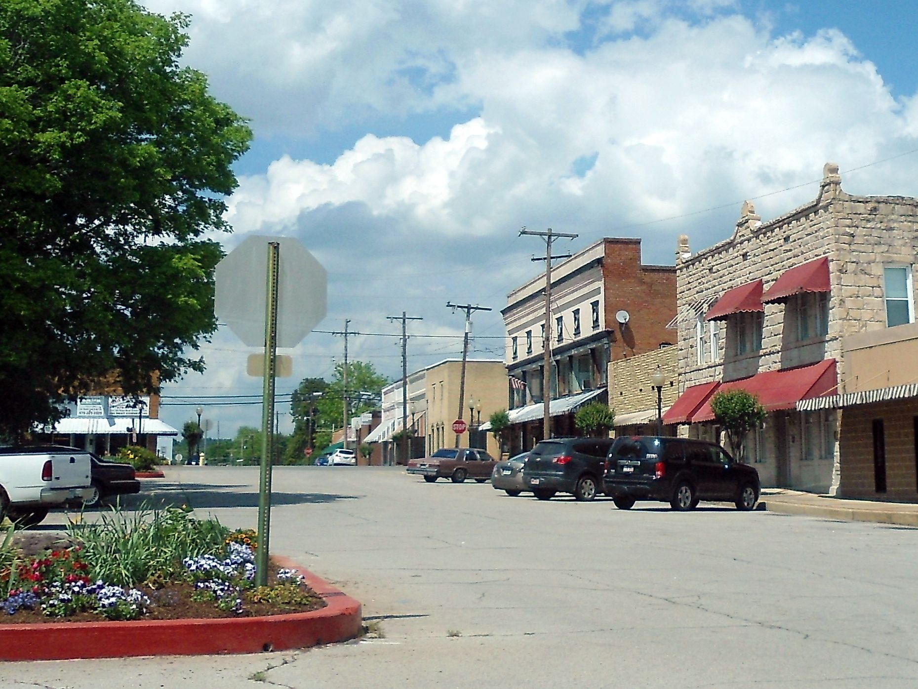
Brick and locally quarried stone make up the Ozark Courthouse Square Historic District, two blocks by two blocks. The bulk of it dates from 1890 to 1930, when the railroad arrived, and the Register added the district in 2002. The Franklin County Courthouse stands at its center. Architect Frank W. Gibb designed the 1904 building, and crews rebuilt it above the ground floor after a 1944 fire. Over at 3rd and River streets, the Franklin County Jail of 1914 keeps its native sandstone walls and crenellated parapet, though offices fill it now.
The county's odd arrangement of government comes down to the Arkansas River. An 1885 act split Franklin County in two, because crossing the river was hard enough to justify a second courthouse. Ozark seats the Northern District; Charleston seats the Southern. Housing runs $176,324 as of June 2026, roughly 23% below the state figure, and it appreciated 3.6% last year. The Ozark School District covers the town. A municipal community center west of downtown keeps a year-round calendar of its own, and the Ozark Mountains rise north of the river valley.
Waldron

Homes here cost about 35% less than the Arkansas typical, $149,242 against $228,662 in June 2026. Prices rose 7.2% over the past year and nearly 18% since 2021. The Waldron Commercial Historic District runs five blocks along South Main, protected since 2008 and largely built between 1880 and 1920. The old Art Deco courthouse of 1933 rises within those blocks. A Tyson Foods plant is the county's largest employer. The Waldron School District enrolls about 1,600 across four schools, and a hospital and a nursing home have served the town for decades.
Timber covers 82% of Scott County, and the US Forest Service owns most of it. No other fact explains Waldron's price so well. The Ouachita National Forest surrounds the town, and no one can plat, sell, or build on that ground. Waldron stands on the South Fork of the Poteau River in the Ouachita Mountains. Lake Hinkle, a 960-acre Arkansas Game and Fish Commission lake, adds another stretch of public shoreline.
Dardanelle

The road to the top has so many tight hairpin turns that park rules turn back any trailer longer than 24 feet. Highway 155 climbs to Mount Nebo State Park, established in 1928 atop a flat-topped mountain 1,350 feet above the valley floor. Lake Dardanelle and the river bends show from the rim. Cabin 1 up there was the first cabin ever rented in the Arkansas state park system. Of the park's 15 cabins, twelve still line the bluff.
A house in Dardanelle cost $184,790 in June 2026. The statewide figure that month was $228,662, so the gap is about 19%. Roughly 4,500 people live at the bottom of that road. The town shares the Yell County seat with Danville, among the Arkansas counties that still seat two courts. A courthouse, a school district, and the river landing are all in town. The state park keeps its mailing address in Dardanelle rather than anywhere closer.
Morrilton

Cedar Falls drops 95 feet into a canyon on Petit Jean Mountain. Arkansas's park service rates it among the tallest continuously flowing waterfalls in the state. Petit Jean State Park opened in 1923 as the first state park in Arkansas, the one every later park was measured against. Mather Lodge overlooks Cedar Creek Canyon, 24 rooms and a restaurant behind glass. The park's mailing address is Morrilton, and the mountain road is the town's front yard.
Down in the valley, about 7,200 people live between the Arkansas River and Interstate 40. Typical value in June 2026 was $172,921, or 24% under the state number, with 7.9% added in a single year. The Morrilton Commercial Historic District covers 130 acres of Broadway and Railroad Avenue built up between 1880 and the 1920s. The Register added it in 2003. The 1875 depot survives on Railroad Avenue between Division and Moose streets.
Mammoth Spring

Water surfaces here at nine million gallons an hour, from a pool whose bottom nobody sees. Mammoth Spring is a National Natural Landmark, and the state park service calls it one of the largest springs in the world. The water arrives at a constant 58 degrees, forms a 10-acre lake, then pours over an 1880s dam and leaves town as the Spring River. Mammoth Spring State Park contains all of that. So do the restored 1886 Frisco depot, a caboose parked outside, and the shells of the mill and the hydroelectric plant that used the same water until 1972.
The typical house cost $167,026 in June 2026, some 27% below the Arkansas number, on a 20% gain since 2021. Some 940 residents occupy the last stretch of US 63 before the Missouri line. Mammoth Spring School District teaches prekindergarten through twelfth grade in town, roughly 500 students, and Fulton County Hospital is down the highway in Salem. The park doubles as the Arkansas Welcome Center, which makes the state's front door a local ball field and picnic ground.
Hardy

Hardy's Main Street carries 41 commercial buildings with National Register listings, a remarkable count for a town of 780. Most went up before the Second World War, most hold shops now, and all of them stand near the river. The Spring River passes the end of Main at the same 58 degrees it left Mammoth Spring at, a few miles north. The result is cold-water float and trout country rather than lake country.
Nothing here is expensive. June 2026 priced the typical Hardy house at $106,189, under half the Arkansas figure and the lowest price here by a wide margin. Values still rose 6% across the year. The town dates to 1883 and the arrival of the Kansas City, Springfield and Memphis Railroad, and it carries the name of the contractor whose crews laid the track. Highland School District covers Hardy across two counties and places its middle school in town. A pair of city parks reach the river near the historic blocks.
Harrisburg

Harrisburg housing sat at $155,427 in June 2026, roughly 32% under the Arkansas typical, following a 5.2% year. The money buys into a county seat, with a courthouse on Market Street, a county library branch, and a health unit on North Main. The Harrisburg School District operates five schools, enrolling roughly 1,400. The Crowley's Ridge Parkway, a National Scenic Byway since 1998, follows the high ground past town.
Crowley's Ridge lifts as much as 250 feet from the Delta floor. The formation is windblown loess, 1 to 12 miles wide, and it extends the length of eastern Arkansas. Harrisburg occupies the top of it. Lake Poinsett State Park lies a mile east on Highway 14 and two miles south on Highway 163, where the state dammed Distress Creek in the early 1960s. The lake spent seven years drained while crews rebuilt its shoreline and water control structure. It reopened fully stocked in 2025, and the 1.1-mile Great Blue Heron Trail loops its wooded end.
What Nobody Can Sell
In each of these towns, the view belongs to land that is not for sale. A national forest surrounds Waldron. A protected river passes Mulberry. State parks sit on Mount Nebo and Petit Jean and around the spring itself, and a public lake lies below Harrisburg. No part of that acreage can be subdivided, which is why the scenery here outlasts the asking price. All eight towns fall between 16% and 54% under the Arkansas figure, and all eight are worth more than they were a year ago.