The 12 Can't-Miss Towns In The Pacific Northwest
The most beautiful towns in the Pacific Northwest have their scenery at the end of the street. At low tide in Cannon Beach, you can walk across the sand to the foot of Haystack Rock. In Port Townsend, a beach at Fort Worden runs out to Point Wilson Lighthouse. These 12 towns make a loop around the region, through the San Juan Islands, over the North Cascades, into the Idaho Panhandle and back down through Oregon to the coast. The beach towns are at their best right now, and the overlooks at Washington Pass and Dee Wright Observatory can wait for summer.
Port Townsend, Washington

On the Olympic Peninsula, Port Townsend's Water Street runs along the waterfront past galleries, bookstores and cafes, with boats in view between the buildings, and every September the Wooden Boat Festival brings about 300 more of them to town, on land and in the water. Walking north out of downtown, Chetzemoka Park comes first, a city park with a gazebo on a bluff above Admiralty Inlet. Fort Worden, a 432-acre state park, is farther on, and the Port Townsend Marine Science Center on its waterfront has exhibits on what lives in the Salish Sea. From there a sandy beach leads out to Point Wilson Lighthouse, at the spot where Admiralty Inlet meets the Strait of Juan de Fuca. Driftwood lies along the sand, and Whidbey Island is in view across the water.
Friday Harbor, Washington

Friday Harbor, on San Juan Island, is about 70 minutes from Anacortes on a direct Washington State Ferries sailing, and reservations are recommended. A block above the marina on First Street, the Whale Museum has two gray whale skeletons, one hanging from the ceiling and one laid out on the floor so it can be put together like a very large puzzle. Whale-watching boats and kayak outfitters work out of the blocks around the ferry terminal, with their fullest schedules between late spring and early fall, and May, June and September are quieter than the middle of summer.
Lime Kiln Point State Park, on the island's west side about 15 minutes away by car, is the place to watch for whales without getting on a boat. Washington State Parks calls it one of the best whale-watching spots on earth, and orcas, lately mostly Bigg's killer whales, pass close to its rocky shore. Humpback and minke whales turn up offshore too. The lighthouse has a whale listening station, and on a clear day Vancouver Island is in sight from the coast path. At English Camp, on the island's north end, the Young Hill trail climbs about 600 feet in a mile to a lookout over the water.
La Conner, Washington

Back on the mainland, La Conner's big month is April, when the Skagit Valley's tulip fields bloom around Mount Vernon and the Tulip Parade comes down First Street, the town's shopping street. Behind the First Street shops, a boardwalk follows the Swinomish Channel, and an ice cream cone is the usual thing to carry along it. La Conner Seafood & Prime Rib House sits right on the channel, and the Museum of Northwest Art, also on First Street, keeps a permanent collection of Northwest artists along with its changing shows. Pioneer Park, by the Rainbow Bridge, has picnic tables beside the water, wooded trails, and a 13-foot salmon slide for children who have been patient through lunch. From those picnic tables, boats can be watched passing under the bridge on their way along the channel.
Winthrop, Washington

East of the Skagit Valley, the North Cascades Highway, State Route 20, crosses Rainy and Washington passes on the way to Winthrop, about 130 miles from Burlington. Near the top, at Washington Pass, a paved path a quarter-mile round trip ends on a ledge facing Liberty Bell Mountain, whose east face rises a sheer 2,000 feet above the highway. In autumn, golden larches cover the slopes below it. Down in Winthrop, a wooden boardwalk connects the shops, and every one of them has a Western facade, a look the town has committed to completely.
The highway over the passes usually closes in late November or early December and reopens in April or early May, so winter visitors come up the Methow Valley from Pateros, 42 miles south. The Winthrop Rink is an outdoor ice rink in winter, with a view of Mount Gardner, and a roller rink in summer. Once the snow is down, more than 120 miles of trails are groomed across the Methow Valley, and the Methow Community Trail connects Winthrop with the neighboring community of Mazama.
Chelan, Washington

About 60 miles south of Winthrop by way of Pateros, Chelan sits at the foot of Lake Chelan, and the way to see the lake is from a boat headed for Stehekin, at its far end. The Lady of the Lake boats cover the 50-mile lake in about four hours each way on the slower boat and about two and a half on the Lady Express. No road reaches Stehekin, which can be visited only by boat, floatplane, helicopter or hiking trail, and the village sits among glaciered mountains at the north end of the lake. Rainbow Falls, 312 feet high, is up the Stehekin Valley, kokanee salmon spawn in the Stehekin River in the fall, and fly-fishing guides can be booked in the village.
On land, the view over the lake comes from Chelan Butte. The hike to the lookout is about 7.5 miles round trip with 2,500 feet of climbing, wildflowers in spring, and the lake and the North Cascades in view for the second half of the way, and a road also climbs to the top, a spot known for hang gliding and paragliding. Down at the shore, Don Morse Park has a large beach on the waterfront, and the Chelan area has about 40 wineries and tasting rooms.
Sandpoint, Idaho

Sandpoint's biggest musical event of the year, the Festival at Sandpoint, fills War Memorial Field for about a week and a half in late July and early August, with concerts alongside Lake Pend Oreille, Idaho's largest lake. People bring their own chairs and blankets and settle in on the field for an evening of music by the water.
City Beach, at the end of Bridge Street, is a short walk from downtown and has a sandy swimming area with lifeguards in summer. In the warm months, the Great Escape lift at Schweitzer carries riders to the summit for 360-degree views of mountain ranges in Montana, Washington and Canada. The Long Bridge path starts downtown behind the Old Power House and runs two flat miles over the lake, an easy bike ride with water on both sides.
Hood River, Oregon

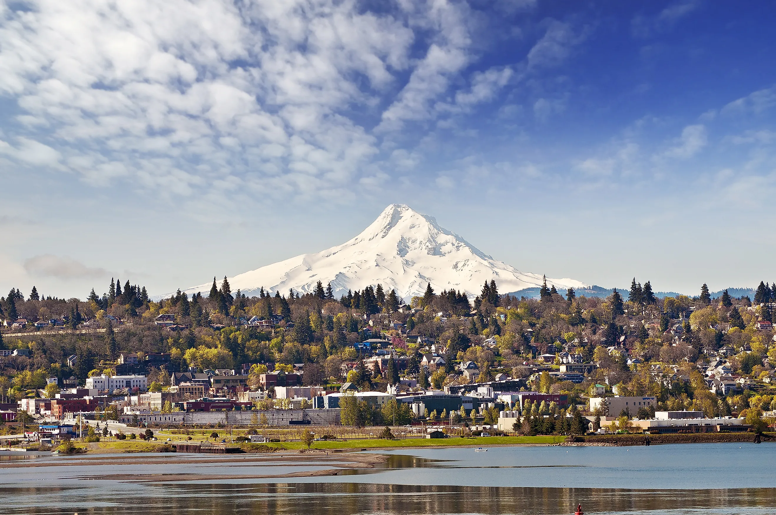
On the Oregon side of the Columbia River Gorge, windsurfers and kiteboarders launch off the waterfront at Hood River, and a paved path leads west to Waterfront Park, with its play area and a boulder for climbers. The Hook, a protected cove, is where beginners take windsurfing lessons, and from its end there is a river-level view west to Cook Hill and Dog Mountain, with Mount Adams to the north. Nichols Basin, a sheltered inlet, is a safe place to swim or try a kayak for the first time.
Mount Hood is about 30 miles south, and the Fruit Loop, 35 miles on Highways 35 and 281, runs through the valley's orchards toward it. Panorama Point is the stop for a long look at the mountain, and the lavender fields at Lavender Valley have Mount Hood behind them. On the patios at Mt. Hood Winery and Cathedral Ridge Winery, Mount Hood and Mount Adams are both in view, which makes choosing a seat harder than choosing a wine. Cherry season typically spans mid-June and July, and Kiyokawa's orchard and farm stand has fruit late August through October.
Sisters, Oregon

Breakfast at Sisters Bakery is a good start in Sisters, in Central Oregon, before the drive west on Highway 242 toward McKenzie Pass. Fifteen miles out, Dee Wright Observatory looks across 65 square miles of black lava rock to Mount Washington, Mount Jefferson and the North, Middle and South Sisters, all in one view. It is a great deal of dark rock under a great deal of mountain, and worth staying with for a while. The site is free, and the Lava River National Recreation Trail starts right beside the observatory. The highway closed for the season on November 5 and usually reopens in mid-June. Back in town on the second Saturday of July, the Sisters Outdoor Quilt Show puts more than 1,000 quilts on display, and thousands of quilters and admirers stroll the streets to see them.
Ashland, Oregon

A morning in Ashland, in Southern Oregon, starts with a walk in Lithia Park, which follows Ashland Creek up from a few central blocks of cafes and shops. Footbridges cross the creek, and the Japanese Garden, with its rocky paths and running water, is a quiet place to stop. Volunteer naturalists lead free guided walks, and on summer Thursday nights the Butler Bandshell has free concerts.
Between June and October, hikers drive up Mount Ashland, where the one-mile Summit Trail leaves the ski area parking lot for the 7,533-foot top. The view of the Cascades reaches Mount Thielsen in the north and Mount Shasta in the south, and lupine blooms in the meadows.
Evenings are for the Oregon Shakespeare Festival, which runs mid-March through late October, with plays on the outdoor Allen Elizabethan stage as well as indoors. The free Green Show is held most evenings June through September, an easy thing to catch before the curtain.
Bandon, Oregon

Down on the South Coast, Bandon's Cranberry Festival fills Old Town on the second weekend of September, with a Saturday morning parade and a cranberry-eating contest. Old Town sits along the Coquille River, with seals in the marina and the Coquille River Lighthouse in view. People fish and crab from Webber's Pier, and the boardwalk businesses that rent the gear will cook the catch, which is about as neighborly as a waterfront gets.
Face Rock State Scenic Viewpoint is about a mile from Old Town and costs nothing to visit. An ADA-accessible path goes around the point, and stairs lead down to the beach, where Face Rock and the Cat and Kittens rocks sit offshore. At low tide, walkers can reach Cathedral Rock and Wizard's Hat within the surf zone, keeping to the coast's standing rule about never turning their backs on the ocean.
Yachats, Oregon

High tide is the time to be on the rocks south of Yachats, the reverse of the low-tide walk at Bandon. Thor's Well, just over three miles south of town, is a collapsed sea cave that fills and drains with the waves, sometimes shooting water 20 feet into the air. The best visit comes close to high tide on a calm day, a little early, so you can see the well empty before the water comes in. Spouting Horn, beside it, is best at high tide or in a storm, and Devil's Churn, just north of the Cape Perpetua Visitor Center, is more than 80 feet wide where it opens to the ocean. Above them, the Cape Perpetua Overlook, at about 800 feet, is the highest viewpoint on the Oregon Coast you can drive to, and the visitor center area charges $5 per vehicle a day.
In town, the 804 Trail follows the shore 1.7 miles north from Yachats State Park, passing Smelt Sands about halfway. Smelt Sands is known for tidepooling, and it is an excellent place to watch for whales.
Cannon Beach, Oregon

Cannon Beach, on the North Coast, is worth seeing first from above, at the viewpoint in Ecola State Park, three miles north of town. A few steps from the parking lot, the view looks south over Crescent Beach and Bird Rocks toward Haystack Rock, and when the weather allows, Tillamook Rock Lighthouse is out to the west.
At low tide, you can walk right up to Haystack Rock itself. The tide pools at its base are best an hour before low tide, and minus tides are better still. Puffins are on the rock from early spring into midsummer, and above the high-tide line it is part of the Oregon Islands National Wildlife Refuge, so climbing past the barnacle line is off-limits. Interpreters with the Haystack Rock Awareness Program are out on the sand during daytime low tides between mid-February and late October, and they will help you identify whatever is living in the pool at your feet.
Early November divides the region. Highway 242 over McKenzie Pass closed for the season on November 5, so Dee Wright Observatory is out of reach until about mid-June, and Washington Pass likely has only a few weeks left before the snow closes it. The ferries to Friday Harbor keep running, and the coast has plenty on the calendar. Cannon Beach holds its Stormy Weather Arts Festival in early November, the Yachats Celtic Music Festival brings three days of music and dancing November 13 through 15, and Oregon State Parks runs Winter Whale Watch Week December 27 through 31. A tide chart and a warm coat are enough for Haystack Rock and Thor's Well in any month. When the North Cascades Highway opens again in spring, the quarter-mile path at Washington Pass will lead back out to the ledge and Liberty Bell's 2,000-foot east face.