Strait Of Juan De Fuca
Often referred to as the Juan de Fuca Strait in Canada, the Strait of Juan de Fuca is a strait running between the countries of the United States and Canada. The international border between the two countries passes through the center of the strait.
The Strait of Juan de Fuca was named in the year 1787 by English captain Charles William Barkley in the honor of a Greek mariner, Juan de Fuca, who had explored the area as a part of the Spanish expedition in 1592.
Where Is The Strait Of Juan De Fuca?
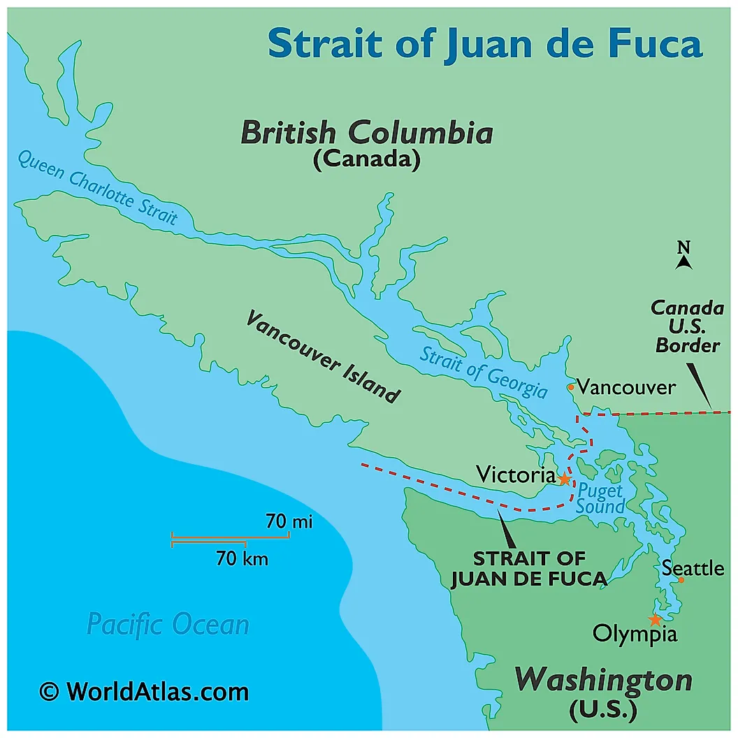
The Strait of Juan de Fuca extends eastwards from the North Pacific Ocean and is situated between the US state of Washington’s Olympic Peninsula and Vancouver Island in the Canadian province of British Columbia. The strait serves as an outlet of the Salish Sea into the Pacific Ocean.
Geography
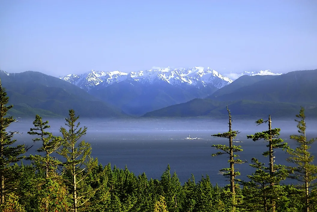
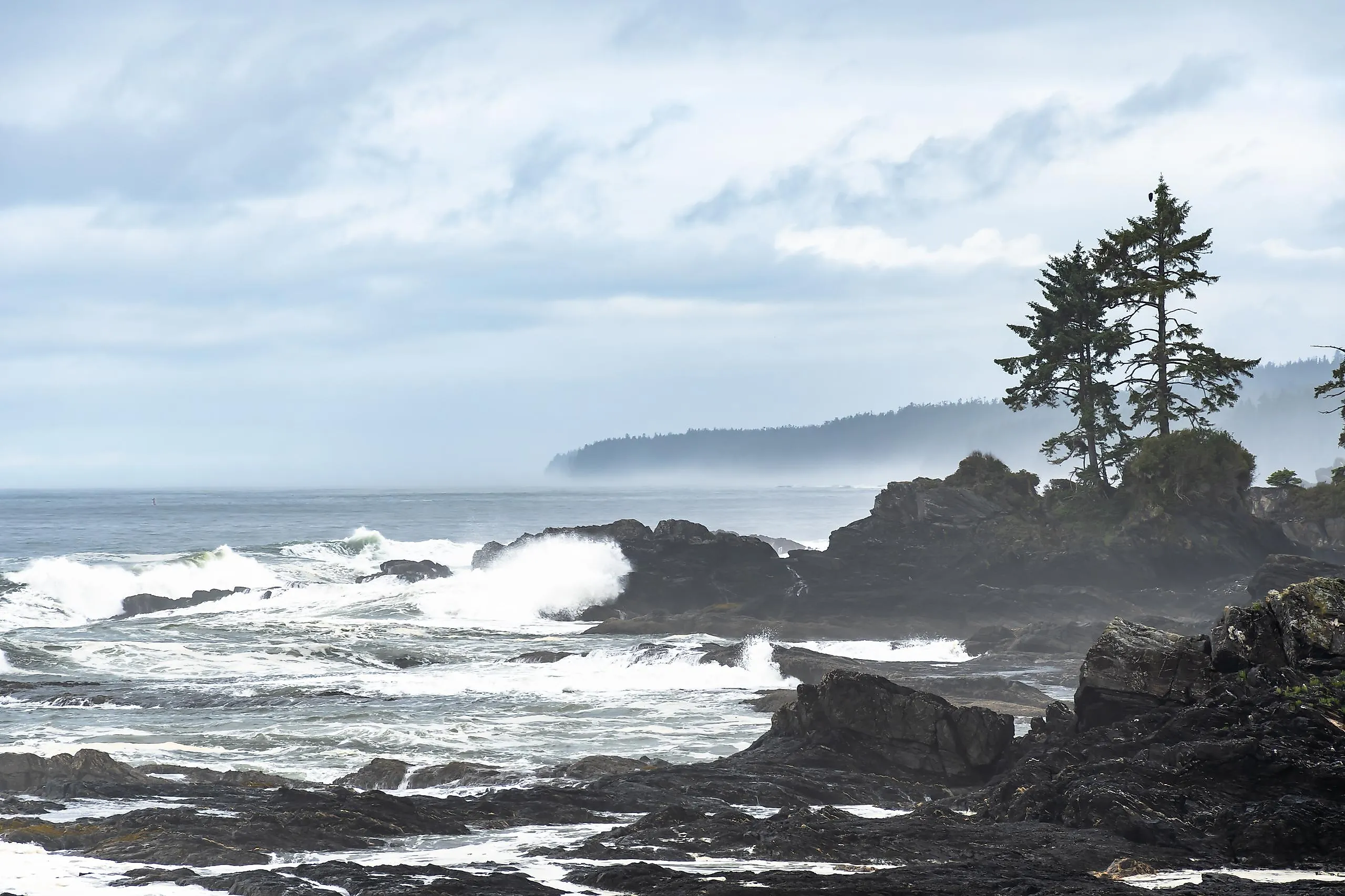
The Strait of Juan de Fuca is about 154 km in length and its width ranges from 19 to 40 km. The strait has an average depth of only 100 m. The climate of the strait is a contentious issue because, as per the Köppen classification, the strait experiences a Mediterranean climate, but most local climate experts assert that the strait has an oceanic climate. The strait’s climate is mainly oceanic, but its dry summer season is what leads it to be classified as a Mediterranean climate in the Kӧppen classification.
The eastern part of the strait receives comparatively less rainfall than the strait’s western part. While the western part receives about 250 cm of rainfall, the eastern part receives lesser than 410 mm of rainfall. The strait is exposed to the westerly winds and the Pacific waves, which covers the sea waters with a thick fog and makes it much rougher compared to the other protected inland areas, leading to frequent advisories about sailing in these waters.
Human Settlement

The significant counties that are positioned along the banks of the strait include the Clallam, Jefferson, Island, San Juan, and Skagit counties in the US state of Washington and the regional districts of Cowichan Valley and the Capital Regional District of the Canadian province of British Columbia.
Several vehicle ferries provide services and make many trips every day across the strait’s waters, traversing between Washington’s Port Angeles and Victoria, British Columbia. In addition, several passenger ferries that are a part of the Washington ferry system also operate in the strait, which also includes many privately-owned high-speed ferries as well as some seasonal ferries.
Many fish species are found in the Strait of Juan de Fuca including salmon, sea bass, lingcod, and halibut. Shellfish like clams, Dungeness crab, and oysters are also found. Seabirds like the common murre (Uria aalge) and Pacific Coast murres are also found along the shores of the strait.


