8 Off-The-Grid Colorado Towns To Visit In 2026
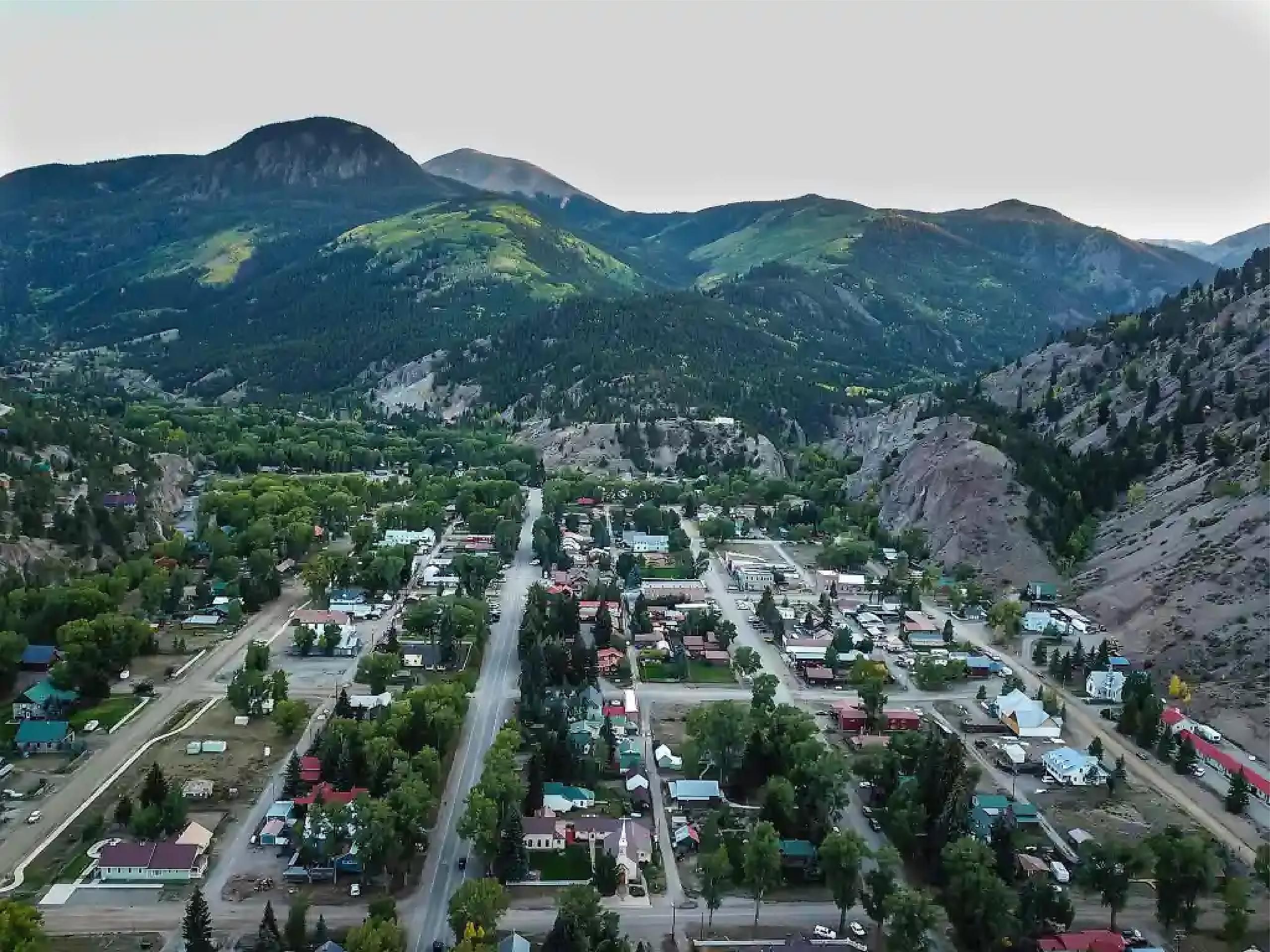
Colorado's hidden gems and off-grid towns know how to honor their roots and keep it simple. Lake City occupies a pocket of the San Juan Mountains in which Hinsdale County claims to be the least-populated county in the contiguous United States. Walden sits in North Park, a high-elevation basin above the Rockies that most travelers bypass entirely on the way to better-known destinations. In Marble, an 1893 water-powered mill in a narrow side canyon has become one of the most photographed structures in the state, yet most visitors have never even heard of the town. Across these eight places, the common thread is the specific, remote landscapes that forced each community to develop on its own terms.
Lake City

Lake City sits at 8,671 feet, deep in the San Juan Mountains. The Alpine Loop Backcountry Byway begins here. The Loop is a 64-mile network of rugged 4x4 roads connecting Lake City to Silverton and Ouray via two mountain passes. Along the way, the road passes the ghost towns of Animas Forks, Capitol City, and Henson, each holding the rusted remnants of the silver mining boom that built the San Juans in the late 19th century. American Basin, near the top of Cinnamon Pass, produces one of Colorado's most spectacular wildflower displays each July, and the Handies Peak trailhead at its edge offers a relatively accessible route to one of Colorado's 14,000-foot summits.
Back in town, North Clear Creek Falls drops 100 feet over a volcanic ledge just off Highway 149 and is reachable within minutes of the main street. Lake San Cristobal, the state's second-largest natural lake, offers fishing, boating, and paddling two miles south of town. Lake City holds International Dark Sky Park designation, making its high-altitude night sky as much of a draw as the terrain around it. The Hinsdale County Museum on Silver Street covers the town's Victorian-era origins, including the Alfred Packer incident of 1874, which remains the most notorious story in the county's recorded history.
Marble

Marble sits at the end of a dead-end road in the Elk Mountains. It remains completely isolated from nearby Crested Butte by rugged, impassable wilderness ridges. For most visitors, the historic Crystal Mill is the primary reason to find it. The 1893 water-powered compressor, which used the drop of the Crystal River to power air drills in a nearby silver mine, occupies a wooden platform above a rocky gorge and has appeared in more Colorado photography collections than almost any other structure in the state. Reaching it requires a two-mile hike or a high-clearance vehicle drive from the edge of town, which keeps the crowd manageable.
The Colorado-Yule Marble Quarry, which produced the stone used in the Lincoln Memorial and the Tomb of the Unknown Soldier in Washington, DC, sits above town and still operates intermittently. Quarry tours through the Marble Historical Society take visitors into the hillside workings where massive white marble blocks were cut by hand in the early 20th century. Beaver Lake, just outside the town limits, provides a flat and easy hiking loop through aspen groves above the Crystal River valley. Slow Groovin' Chophouse on the edge of town boasts exceptional mountain barbecue and hosts much of the town's social life. For difficult terrain, the Lead King Basin jeep road climbs above the Crystal River valley into a high basin ringed by the Maroon Bells-Snowmass Wilderness boundary.
Meeker

Meeker sits along the White River at the base of the Flat Tops. This vast volcanic plateau became one of the first areas in the nation designated as wilderness. Trappers Lake, 45 miles east of town at 9,627 feet, is often called the "Cradle of the Wilderness" because it was the place that convinced forester Aldo Leopold and landscape architect Arthur Carhart in 1919 that some land should be permanently set aside without roads. That conversation contributed directly to the Wilderness Act of 1964. The Flat Tops Wilderness surrounding the lake now covers roughly half a million acres of roadless plateau.
The White River itself, flowing through town, carries a blue-ribbon trout designation and draws fly fishers from across the Rocky Mountain region. The White River Museum, housed in a log cabin from the 1880s that served as General Ranald Mackenzie's army headquarters, covers the history of the Meeker Massacre of 1879 and the removal of the Ute people from the White River valley. Each July 4th weekend, the Range Call Rodeo brings bucking broncos and barrel racing to the Meeker fairgrounds in a celebration established in 1885, making it one of the longest-running rodeos in the state. Sleepy Cat Lodge, operating east of town along the road toward Trappers Lake, offers cabin accommodations at the edge of White River National Forest.
Monte Vista

Monte Vista lies at the center of the San Luis Valley, a broad, high-altitude basin rimmed by the San Juan and Sangre de Cristo ranges. In late February and March, the Monte Vista National Wildlife Refuge fills with more than 20,000 sandhill cranes during their northward migration, and the San Luis Valley Crane Festival each March draws birders and photographers from across the country to observe the gathering from designated viewing blinds. The Ski Hi Stampede, held each August, has run since 1919, making it one of the oldest continuously operated rodeos in Colorado. Great Sand Dunes National Park, about 40 miles east along State Highway 160, gives any Monte Vista visit a natural extension. The Brewster Street Tap House on Main Street serves local craft beers and functions as the town's primary evening gathering spot.
Antonito

Antonito is the Colorado terminus of the Cumbres and Toltec Scenic Railroad, a 64-mile narrow-gauge steam line that crosses into New Mexico over the 10,015-foot Cumbres Pass. The railroad has operated since 1880 and was officially designated a National Historic Landmark in 2012. It climbs through volcanic canyons and mountain meadows entirely without roads, making the rail journey the only way to see much of the surrounding landscape. Trains run from late May through mid-October, with full round-trips taking approximately seven hours and stopping at the halfway point in Osier, New Mexico.
The Conejos River, flowing through the valley below the railroad grade, is designated a gold medal fishing river and draws anglers to some of the most productive trout water in the southern Rockies. The Los Caminos Antiguos Scenic Byway passes through Antonito and follows routes used by Spanish colonial settlers, Ute traders, and early American explorers through the Conejos River valley. Our Lady of Guadalupe Church in nearby Conejos, the oldest parish in Colorado, has operated on its original site since 1856. Narrow-gauge buffs and railroad historians consider the Cumbres and Toltec one of the most significant surviving examples of railroad technology from the American West.
Lyons

The red quartzite walls that line the Main Street corridor give Lyons a visual identity unlike any other community on the Front Range. The stone, quarried from the surrounding canyon walls starting in the 1880s, built many of the buildings across northern Colorado and earned Lyons an early reputation as a regional quarrying center. The Planet Bluegrass concert campus, home to the Rocky Mountain Folks Festival in August and RockyGrass in July, draws tens of thousands of music fans to outdoor stages set against the canyon walls each summer. Oskar Blues Grill and Brew, the original location of the brewery that in 2002 became the first American craft brewery to can its own beer, operates on Main Street and draws visitors from the broader craft beer community.
Hall Ranch, a Boulder County open space property rising directly above town, provides 8.5 miles of multi-use trails through scrub oak and ponderosa with views across the St. Vrain valley. The Button Rock Trail follows the North Fork of the St. Vrain Creek into a canyon above the Longmont Reservoir, passing through mountain mahogany and Douglas fir. Lyons hosts a First Friday Art Walk through the downtown gallery corridor on the first Friday of each month, and the A-Lodge Lyons on the main commercial strip provides overnight accommodations with easy walking access to the music venues.
Cortez

Cortez, in Montezuma County, is situated at the convergence of the Colorado Plateau and the Great Sage Plain. Its position at the edge of the ancient Ancestral Puebloan homeland gives it a cultural depth that most Colorado towns cannot match. Mesa Verde National Park, 10 miles east of town, preserves the most concentrated collection of cliff dwellings in North America, with Cliff Palace, a 150-room structure built into a sandstone alcove, accessible by ranger-led tours. The Cortez Cultural Center on Main Street presents rotating exhibitions on Ancestral Puebloan history and hosts Native American dances during the summer visitor season.
The Crow Canyon Archaeological Center, north of Cortez along County Road K, offers day and multi-day programs that put participants alongside professional archaeologists excavating active sites in the surrounding mesa country. McElmo Canyon, running west of town toward Utah, holds dozens of documented prehistoric sites among its red sandstone walls and can be explored on a self-guided drive. The Four Corners National Monument, where Colorado, Utah, Arizona, and New Mexico meet at a single point, is 40 miles southwest. The Kelly Place Bed and Breakfast, operating on a working archaeological homestead in McElmo Canyon, gives the most committed visitors a place to sleep surrounded by the same landscape that sustained the Ancestral Puebloans for centuries.
Walden

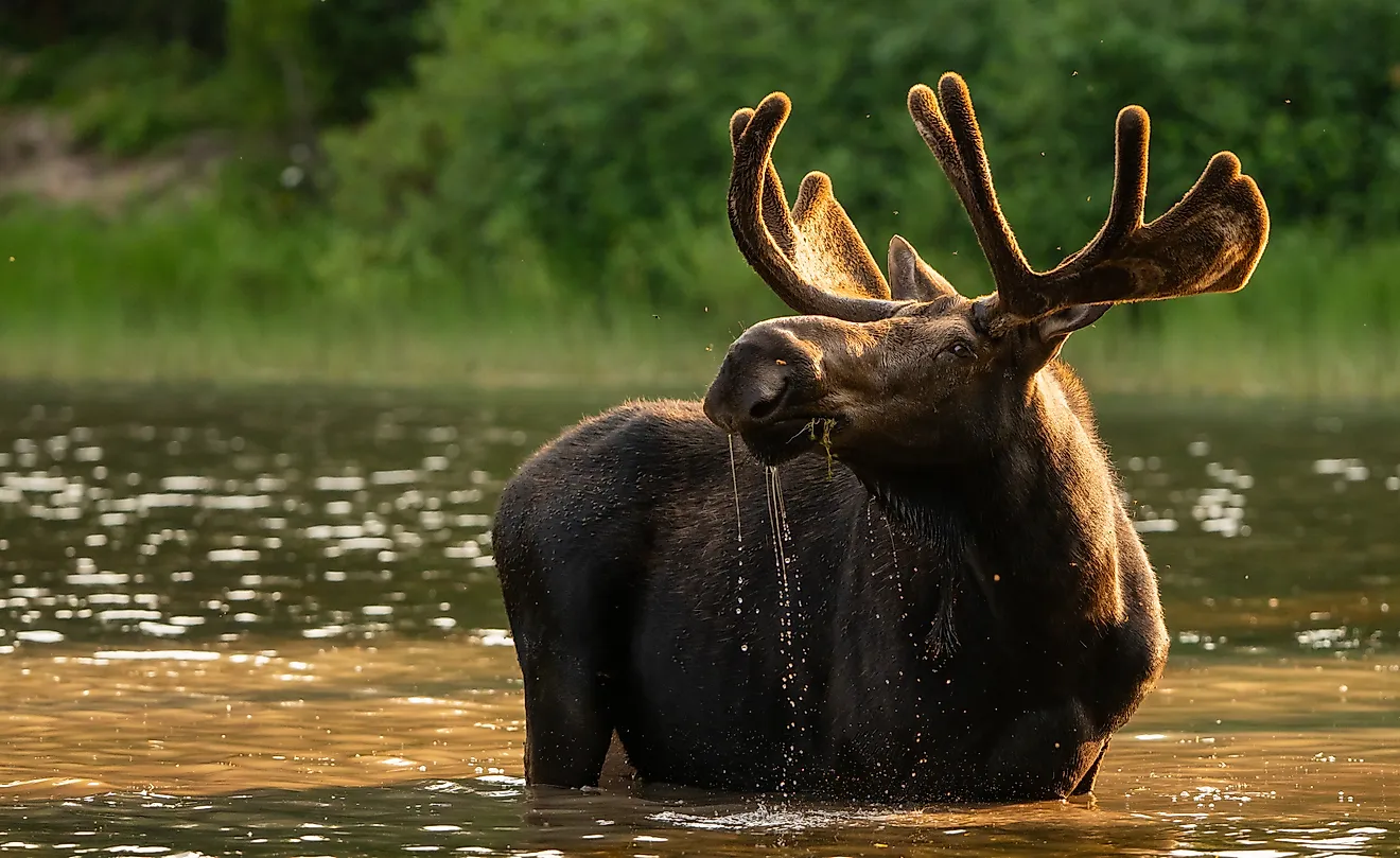
Walden sits at 8,099 feet in the center of North Park, a high-altitude sedimentary basin rimmed by the Medicine Bow and Never Summer ranges, and the surrounding public lands give this small Jackson County seat one of the most compelling wildlife rosters of any Colorado town. Colorado State Forest State Park, which covers more than 70,000 acres beginning immediately north of town, holds one of the largest moose populations in Colorado and consistently ranks among the state's best venues for moose viewing in the early morning and evening hours along its willow-fringed creek corridors.
The Nokhu Crags, a dramatic series of volcanic spires rising above American Lakes in the Never Summer range, are accessible via the American Lakes Trail beginning at Colorado State Forest. Arapaho National Wildlife Refuge, five miles south of Walden along State Highway 125, protects critical habitat for pronghorn antelope, migratory ducks, and shorebirds along the Illinois River. The Jackson County Museum in the courthouse building covers the North Park ranching and trapping history that made the basin one of Colorado's most productive hunting and fur-trading territories in the 19th century. The Cache la Poudre-North Park Scenic Byway, running north from Walden toward Fort Collins, passes through some of the most remote and least traveled canyon country in northern Colorado.
Eight Towns, Eight Different Colorados
Colorado's best-known destinations cluster along the interstate corridors and established ski resort circuits. The eight towns in this article represent the state's less obvious geography. The San Juans hold three of them in separate pockets, each shaped by a distinct era of mining, quarrying, or backcountry access. The San Luis Valley and southern Colorado anchor two more, one oriented around a century-old steam railroad and one around a wildlife refuge that fills with cranes each March. The Front Range foothills and the northern high basins add a music town built into red sandstone and a moose-watching gateway with 70,000 acres of state forest at the edge of the main street. The beauty of each is that the town required deliberate settlement and still requires deliberate travel to reach.