Political And Physical Maps
Maps are visual representations of an entire area or a portion of an area that is drawn to scale and usually represented on a flat surface. Most cartographers classify maps into two categories: thematic maps and reference maps. Reference maps represent the different attributes of the Earth, such as its physical features like rivers, mountains, geographic positions, and boundaries, and other features like roads, towns, and cities. The various types of reference maps include Political maps, Physical maps, Road maps, Topographic maps, Time Zone maps, Geological maps, and Zip code maps. The following article discusses in detail the two most popularly used reference maps - the Political and Physical Maps and the differences between them.
Physical Maps
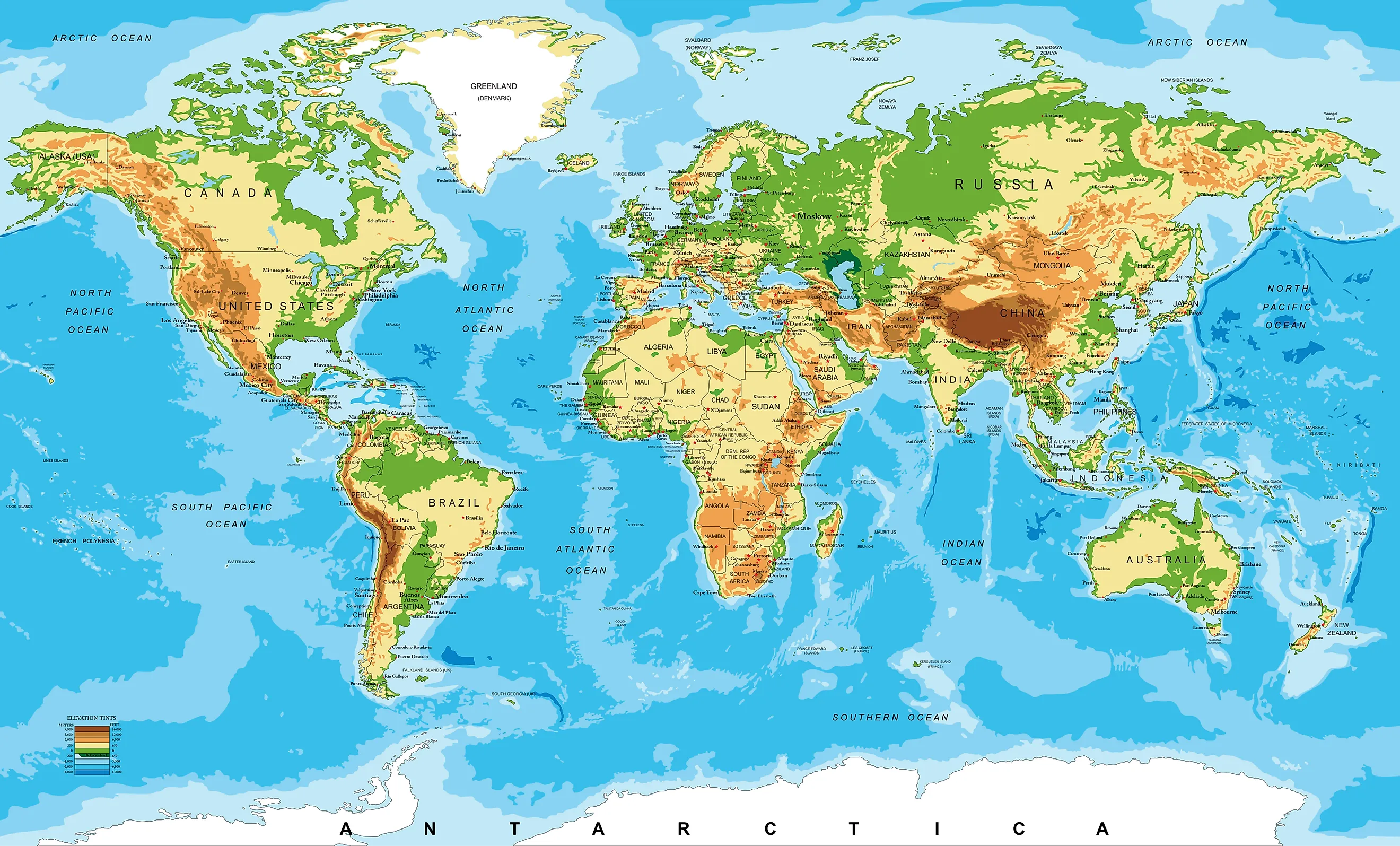
Also referred to as a relief map, a physical map represents the Earth's various natural features, such as mountains, water bodies, deserts, and other recognizable landforms. These maps also provide information about the natural features' shape, height, and depth. Like most other maps, the physical maps also have a key that provides explanations of all the symbols used on the map.
Cartographers use different colors and shades to represent the various natural features on a physical map. For example, the blue color is usually used to depict the oceans, rivers, seas, lakes, and gulfs on the map. The shallow areas are represented by light blue, which gradually darkens as the water body becomes deeper. Likewise, different shades of green, brown, and gray are used to depict elevations. Low-lying land is represented by dark green color, while lighter shades of green represent higher elevations. With further increase in elevation, the color slowly grades into tans and browns. The highest elevations are often depicted in shades of gray. White colors are also used to represent the glaciers and ice caps.
Sometimes, the most important political boundaries, such as the country and state boundaries, are also shown on the physical maps. However, this information is not the main focus of the physical maps, but it is usually included for geographic reference and for increasing the map’s utility. Therefore, any person who wishes to know more about a particular region’s geography and geology can use a physical map. These maps are also used by pilots while flying planes over long distances and for a better understanding of the various geographic features.
Political Maps

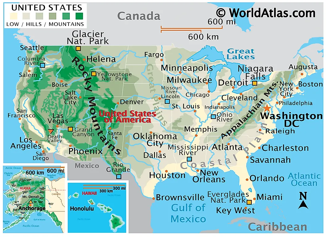
Political Maps are the most commonly used reference maps that show the geographic boundaries between different administrative subdivisions like countries, states, and provinces. Depending on their use, some political maps also show principal roads, cities, towns, and districts. In short, the political characteristics of a particular area are displayed on political maps. Although topographical features are not shown on this map, sometimes the political maps display some physical features like major oceans, rivers, lakes, and mountains for geographical reference.
Similar to physical maps, different colors for different places are used in political maps; however, there is no such specific rule for the choice of colors. Irrespective of the size of the political maps, some three or four colors, like, blue, black, and red, are sufficient for use on these maps. The blue color represents water bodies; black or red represents cities, roads, and transportation lines. The black color is also used in different types of dashes and dots to define the boundaries. For example, one can see the political map of the United States in which different colors are used to represent the 50 states and their bordering places.
Political Maps help one to know the extent of a country or a region, and the relevant data on these maps serve as a significant information source for a country’s government. These maps are also known as “reference maps,” and people refer to them from time to time. However, sometimes, these boundaries have led to territorial disputes between the neighboring nations due to the lack of clear border markings. Various international organizations rely on political maps to dissipate such territorial disputes.
Similarities Between Political And Physical Maps
The above discussion clearly points out the various differences between Physical and Political Maps. However, it is to be noted that these maps do share some common features. Both the physical and political maps use different colors to represent different elements. More bright colors are used on a political map to distinguish between the countries and the states clearly. In contrast, quite dull colors are used on a physical map to depict different elevations. Nevertheless, one can sometimes find certain political features on physical maps and geographical features on political maps. Also, some names are written on both these maps, indicating the different places they represent.


