Maps of Nevada

Nevada is a western state that borders California to its west, Utah to its east, Arizona to its south, and both Idaho and Oregon to its north. The majority of the state lies within the Pacific Time Zone, with small portions near its northeastern border following Mountain Time. Its capital is Carson City, which rests near the shores of Lake Tahoe.
Nevada officially gained statehood in 1864 after being a designated territory of the United States since 1861. Prior to that, it was a part of the larger Utah Territory. Historically, Nevada, along with several other southwestern states in the 19th century, economically thrived off of silver mining, earning it the nickname "The Silver State." This history can be explored in former mining communities like Goodsprings, just south of Las Vegas.
It is a landlocked lock state, with vast deserts featuring few bodies of water within it, too. What attracts many to Nevada, however, is its rugged landscapes, where natural wonders like Great Basin National Park, Red Rock Canyon National Conservation Area, Valley of Fire State Park, and many more exist.
Its biggest and most iconic draw, though, is the city of Las Vegas, where gambling, luxury hotels, and a plethora of other tourist attractions can be found. Las Vegas is also Nevada's most populous city, with 641,903 residents.
Size
Nevada, the 7th-largest state in the United States by landmass, spans an impressive 110,572 square miles. It is very similar in size to the country of Ecuador, which covers a total of 109,484 square miles.
Known for its arid deserts and expansive mountain ranges, much of Nevada is sparsely populated, with over 80% of the land managed by federal or state agencies, the highest of any state in the country.
The state is divided into 17 counties, with Clark County—home to Las Vegas—housing most of the population.
Bodies of Water
Although Nevada is the driest state in the U.S., it still contains some significant bodies of water, including lakes, reservoirs, and rivers.
Lake Tahoe, which is split between Nevada and California, is a major natural freshwater lake renowned for its clarity and mountainous scenery. It is a key recreational and ecological site in the Sierra Nevada Mountains. The Truckee River flows from Lake Tahoe through Reno and into Pyramid Lake. Pyramid Lake is one of Nevada’s few remaining remnants of ancient Lake Lahontan, a massive prehistoric body of water that once covered much of the state.
Lake Mead, formed by the Hoover Dam on the Colorado River, is the nation’s largest reservoir by volume when full. It provides water to millions in Nevada, Arizona, and California, as well as recreational opportunities like boating and fishing. Nearby, Lake Mohave, downstream from Lake Mead, also supports the region's water supply and recreation. The Humboldt River, Nevada's longest, winds through the northern parts of the state.
Smaller bodies of water, such as Walker Lake and Ruby Lake National Wildlife Refuge, also provide small yet significant oases in Nevada's desertlands.
Climate
Nevada's climate is predominantly arid to semi-arid, with significant regional variations due to its mountainous terrain. The state falls into three primary climate regions: the Great Basin Desert in the north, the Mojave Desert in the south, and alpine climates in the higher mountain ranges.
Winters in Nevada can be quite cold, particularly in the northern areas. Average January temperatures across the state sit at around 50°F, although it varies greatly depending on where you are. Summers are hot, especially in the southern Mojave Desert, where average July temperatures hover over 75°F, occasionally exceeding 110°F in some parts.
Annual precipitation is fairly low, averaging about 10.3 inches statewide. Some areas, like the Mojave Desert, receive less than 6 inches annually, while higher mountain ranges can accumulate up to 30 inches, primarily as snow.
Nevada is largely shielded from extreme weather events like tornados due to its inland location. Thunderstorms can be more common during the summer monsoon season, particularly in southern Nevada, sometimes producing flash floods.
Topography
Nevada's topography is characterized by a series of parallel mountain ranges and wide, flat valleys, a geographic feature known as "basin-and-range" terrain. The state contains 314 distinct named mountain ranges. Its valleys, often arid and covered with sagebrush deserts, separate these numerous peaks.
Notable ranges include the Sierra Nevada, Ruby Mountains, and Spring Mountains, the latter home to Mount Charleston near Las Vegas, a popular area for skiing. Nevada also features impressive canyons, such as Red Rock Canyon near Las Vegas, which displays deeply red and orange sandstone formations shaped by erosion.
The highest point in Nevada is Boundary Peak, reaching 13,147 feet in the White Mountains near the California border. The lowest point, at 481 feet, lies along the Colorado River at the southern tip of the state (also along the California border).
Geology
Nevada’s unique geology is defined by its diverse rock formations, rich mineral resources, and tectonic activity. The state is part of the Basin and Range Province. Covering several western states and a portion of northern Mexico, this is where the Earth’s crust has been stretched, creating parallel mountain ranges and valleys.
Nevada’s rock formations show off billions of years of geological history, from ancient Precambrian to more recent volcanic deposits. Sedimentary rocks, including limestone and shale, are common, while the state's mountain ranges often expose igneous and metamorphic rocks.
The state is renowned for its mineral wealth, including gold, silver, copper, and lithium. Nevada is the leading producer of gold in the U.S. and a key player in lithium extraction for batteries.
Nevada is also seismically active, with frequent small earthquakes and occasional larger ones, as it lies within the Walker Lane fault system, a tectonic zone near the Sierra Nevada.
Natural Environment
Nevada may seem desolate, but it actually supports a highly diverse variety of plants and animals adapted to desert and mountain ecosystems.
The state’s vegetation ranges from lowland desert plants to alpine species in higher elevations. Sagebrush, Nevada’s state flower, dominates much of the landscape, thriving in its numerous desert valleys. Joshua trees, found in the southern Mojave Desert, are iconic symbols of the region’s desert-dwelling biodiversity as well. In higher elevations, bristlecone pines, some over 4,000 years old, are among the oldest living organisms on Earth.
The fauna of Nevada includes species that are equally adapted to its harsh environments. Desert bighorn sheep, Nevada’s state animal, navigate the mountainous terrain and steep valleys. The mountain lion, an apex predator in the state, inhabits the same remote mountain ranges. The Lahontan cutthroat trout, Nevada’s state fish, thrives in high-altitude streams and lakes, particularly in the Great Basin.
Nevada also supports a healthy variety of birdlife, including golden eagles and sage grouse. Reptiles like desert tortoises are common in the Mojave Desert, while amphibians are more restricted to the few wetter areas such as Ruby Lake National Wildlife Refuge.
Tourist Attractions
Nevada has a thriving tourism industry, drawing millions of visitors from around the world each year to its natural and manmade attractions. Here are some of the most popular spots in Nevada you can visit today.
Las Vegas Strip
The Las Vegas Strip is one of the most iconic tourist destinations in the world and among the most visited places in the United States. This 4.2-mile stretch in southern Nevada is home to opulent casinos, luxury hotels, world-class restaurants, and a massive variety of entertainment entertainment options, from museums to live shows.
Visitors can explore landmarks like the Bellagio fountains, the High Roller Observation Wheel, and the replica Eiffel Tower at Paris Las Vegas, just to name a few. Renowned for its nightlife, the Strip also hosts concerts, magic shows, and Cirque du Soleil performances, often at venues within the many hotels.
Beyond gambling, its luxury boutiques and rooftop lounges make it a hub for anyone seeking a taste of luxurious relaxation.
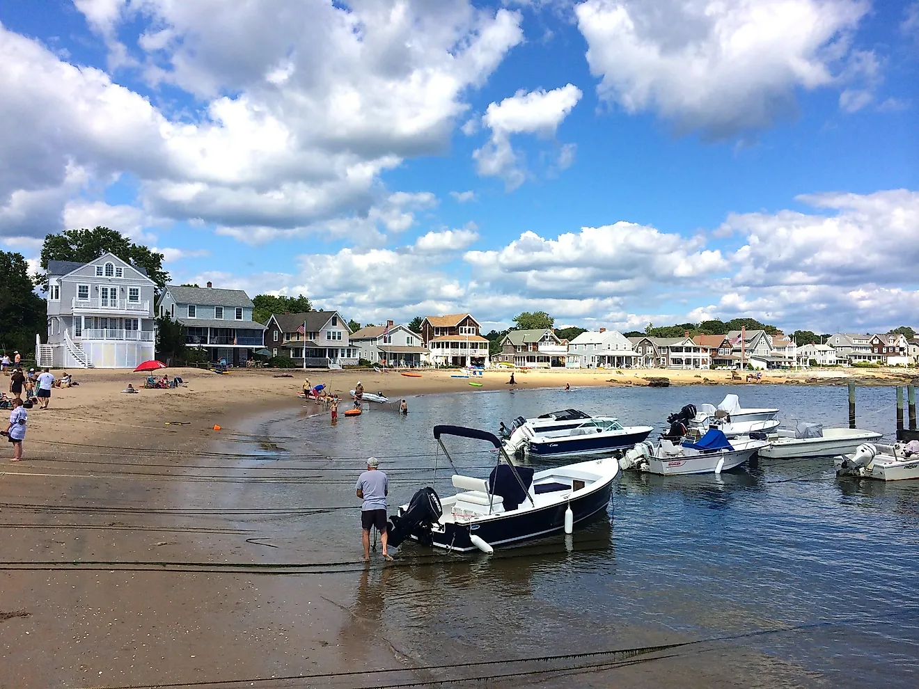
Lake Tahoe
Straddling the Nevada-California border, Lake Tahoe is a year-round destination known for its crystal-clear waters and eye-opening alpine scenery. On the Nevada side, popular attractions include Sand Harbor and the scenic East Shore Trail.
Here, you can enjoy swimming and boating in summer (with historic boat tours available to book), while winter brings skiing and snowboarding at resorts like Heavenly and Diamond Peak. The area’s hiking trails, including those in the Tahoe Rim Trail network, offer unbeatable views over the blue waters of the lake.
Lake Tahoe is also a huge draw for wildlife viewing and landscape photography.
Red Rock Canyon National Conservation Area
Located a short drive from Las Vegas, Red Rock Canyon National Conservation Area is a striking contrast to the city’s urban vibe. The park’s sandstone formations, shaped by millions of years of erosion from both wind and water, display amazingly vibrant red and orange hues.
You can explore its 13-mile scenic driving loop and hiking trails like Calico Tanks and Ice Box Canyon and embark on opportunities for rock climbing. Red Rock Canyon is a must-visit for nature lovers and outdoor adventurers staying in the Las Vegas area.
Hoover Dam
Situated in the Colorado River on the Nevada-Arizona border, Hoover Dam is an engineering wonder and a hugely popular tourist attraction. Completed in 1936, the dam created Lake Mead, the largest reservoir in the U.S.
Visitors can take guided tours to explore the dam’s history and construction, as well as walk along its towering crest for great views of the Black Canyon.
The nearby Hoover Dam Visitor Center contains exhibits and a museum that will teach you more about the dam’s significance in power generation and water supply to the southwest.
Geographical Regions
Nevada is split up into multiple distinct geographical regions, from desert plains to mountainous plateaus.
Great Basin
The Great Basin covers most of northern and central Nevada and is the largest desert area in the U.S. It features a cold desert climate, with hot summers and cold winters.
As far as plant life goes, sagebrush dominates this landscape, and it is interspersed with salt flats, playas, and mountain ranges. This region is home to animals such as pronghorn antelope and sage-grouse, as well as archaeological sites belonging to the Indigenous cultures who originally inhabited the area.
Mojave Desert
Located in southern Nevada, the Mojave Desert is known for its hot, arid climate and the highly picturesque Joshua trees. The region includes areas like the Valley of Fire State Park and Red Rock Canyon. The city of Las Vegas lies within this desert, serving as an urban oasis, the largest of which in the state.
The Mojave also supports diverse animals, including notable species like desert tortoises, roadrunners, and scorpions, all of which thrive in its extreme conditions.
Sierra Nevada
The Sierra Nevada region touches the far west of Nevada and is characterized by high-altitude terrain, alpine forests, and the majestic Lake Tahoe.
Known for its heavy snowfall, the region is a popular destination for winter sports, including skiing and snowboarding. In summer, hiking trails offer access to mountain vistas, with wildlife like black bears and bald eagles available to spot throughout.
Counties Map

Nevada is divided into 17 counties. In alphabetical order, the counties are: Carson City, Churchill, Clark, Douglas, Elko, Esmeralda, Eureka, Humboldt, Lander, Lincoln, Lyon, Mineral, Nye, Pershing, Storey, Washoe, White Pine.
With an area of 286,382 sq. km, Nevada is the 7th largest and the 19th least populous state in the USA. Located in the western part of the state is the Consolidated Municipality of Carson City – the capital city of Nevada. The capital city acts as the regional and commercial retail hub for northwestern Nevada, which is known for its irrigated farms, mining (silver and other minerals), and livestock farming. Situated in the southeastern part of the state is Las Vegas – the largest and the most populous city in Nevada. Nicknamed as “The Entertainment Capital of the World”, Las Vegas is an internationally renowned resort city. It also serves as the state’s cultural and commercial hub being synonymous with gambling, nightlife, and shopping. It is the 28th most populous city of the United States and also one of the world’s most visited cities.
Where is Nevada?

The State of Nevada is located in the western region of the United States. Nevada is bordered by California in the west; by Arizona in the southeast; by Utah in the east; by Oregon in the northwest and by Idaho in the northeast.
Regional Maps: Map of North America
Outline Map of Nevada

The above blank map represents the State of Nevada, located in the western region of the United States. The above map can be downloaded, printed and used for geography education purposes like map-pointing and coloring activities.

The above outline map represents the State of Nevada, located in the western region of the United States.
Key Facts
| Legal Name | State of Nevada |
|---|---|
| ISO 3166 Code | US-NV |
| Capital City | Carson City |
| Major Cities |
|
This page was last updated on February 12, 2025