Maps of Nebraska
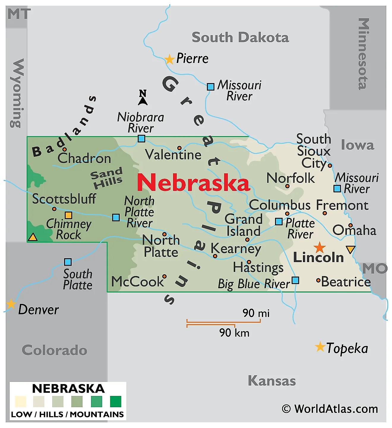
Nebraska is located in the Midwestern United States, sharing borders with South Dakota to the north, Iowa and Missouri to the east, Kansas to the south, and Colorado and Wyoming to the west. It covers an area of 77,358 square miles (200,356 square kilometers), ranking as the 16th largest state.

Nebraska looks flat on a map and is anything but uniform on the ground. The land climbs steadily from 840 feet along the Missouri River in the southeast to 5,429 feet in the far southwestern corner, a rise of roughly 4,600 feet across about 430 miles. Rainfall drops by more than half over the same distance. Along the way the state passes from glaciated farm country through the largest field of sand dunes in the Western Hemisphere to semi-arid high plains and a small patch of genuine badlands.
Where Is Nebraska?

Nebraska measures about 430 miles east to west and 210 miles north to south, with the Panhandle extending west between South Dakota and Colorado. It is landlocked between six states, and so far from the sea that reaching salt water means crossing at least three more states in any direction.
The Missouri River forms the entire eastern boundary, and the rest of the borders are survey lines. With roughly 2 million residents, Nebraska is the 37th most populous state, and it is divided into 93 counties.
The Dissected Till Plains

Eastern Nebraska belongs to the Dissected Till Plains, a section of the Central Lowland province. This is an important distinction, because the region is often mislabelled as Great Plains: the Great Plains proper begin further west, and the eastern fifth of the state is a different landscape with a different origin.
Ice Age glaciers reached this far and no further, leaving behind a thick sheet of till. Windblown loess later settled on top, and streams have since cut the surface into gently rolling hills, with bluffs and broad bottomlands along the Missouri. The combination of till and loess produced deep, fertile soil, which is why this fifth of Nebraska holds most of its cropland and most of its people, including Omaha and Lincoln.
The Great Plains and High Plains

West of roughly the 98th meridian, Nebraska becomes Great Plains country, and this covers most of the state. The land is a broad, semi-arid tableland built of sediment washed east off the Rocky Mountains over millions of years, now dissected by river valleys. Elevations climb to about 4,000 feet at the Colorado and Wyoming lines.
Within this province sit several distinct subregions. The Loess Hills and Loess Plains of the south-central counties carry deep windblown silt. The Rainwater Basin, a flat expanse of about 7,000 square miles in the southeast of this belt, is pocked with shallow wetlands that draw enormous numbers of migrating waterfowl each spring.

In the Panhandle, erosion has left isolated bluffs and escarpments standing above the plain. Scotts Bluff rises about 800 feet above the North Platte valley, and Chimney Rock, a slender spire of clay and volcanic ash, was the most recorded landmark on the Oregon Trail. The Wildcat Hills and the pine-covered Pine Ridge escarpment run along the northern Panhandle.
Panorama Point, the highest place in Nebraska at 5,429 feet (1,655 meters), is here in the High Plains, in the extreme southwestern corner of Kimball County near the Colorado and Wyoming borders. It is not in the Sand Hills, as is sometimes stated. Despite the name it is not a peak at all, but a low rise on a working bison ranch, with a prominence of only about 40 feet. Some sources give its elevation as 5,424 feet, reflecting an older survey datum.
The Sand Hills

The Sand Hills occupy north-central Nebraska, mainly north of the Platte River, not the western part of the state. Covering roughly 19,600 square miles, they form the largest sand dune field in the Western Hemisphere and one of the largest anywhere outside a true desert.
The dunes were built during dry periods after the last Ice Age, when wind reworked sand carried east from the Rockies. Most stand 25 to 50 feet high, though some tiered ridges reach 300 feet. What makes them unusual is that they are stabilised: a thin but tough cover of sand bluestem, prairie sandreed, and needle-and-thread grass holds them in place, and the dunes move only where that cover is broken.

Because the sand will not hold a plough, roughly 85% of the Sand Hills remains unbroken native grassland, the highest proportion anywhere in the Great Plains and among the largest intact grasslands left in the world. The region is cattle country rather than crop country.
Its hydrology matters far beyond Nebraska. Rain soaks straight through the porous sand rather than running off, making the Sand Hills the principal recharge zone for the Ogallala Aquifer, which supplies irrigation across eight states. The water table sits so close to the surface that thousands of shallow lakes and wet meadows fill the valleys between dunes. At Halsey, within this region, the Nebraska National Forest is the largest hand-planted forest in the United States, established in 1902 on ground that never grew trees naturally.
The Badlands

Nebraska's northwestern corner holds a small area of badlands, continuous with the much larger White River Badlands of South Dakota. Here, soft Oligocene claystone, siltstone, and volcanic ash have been stripped by wind and water into pinnacles, gullies, and mushroom-shaped pedestals where a hard caprock protects softer rock beneath.

Toadstool Geologic Park, within the Oglala National Grassland, is the best known section. These same beds are among the richest fossil deposits of their age in North America, preserving the mammals of about 30 million years ago, and nearby Agate Fossil Beds National Monument protects a comparable record.
Rivers

All of Nebraska drains east to the Missouri, and the state has an unusually dense river network for so dry a place, largely because groundwater from the Sand Hills feeds streams year round.
The Platte is the dominant river, formed near the city of North Platte where the North and South Platte join after flowing in from Wyoming and Colorado. It is famously wide and shallow, a braided channel of sandbars once described as a mile wide and an inch deep. Each spring roughly a million sandhill cranes gather along an 80-mile stretch of it near Kearney and Grand Island, one of the largest bird concentrations on earth.

The Niobrara runs along the northern edge of the Sand Hills and is protected as a National Scenic River. Spring-fed waterfalls drop into it from the canyon walls, and the valley marks a biological crossroads where eastern deciduous forest, northern boreal forest, and western pine forest overlap with two kinds of prairie. Other major rivers include the Loup system, the Elkhorn, the Republican, and the Big and Little Blue.
Lakes and Reservoirs

Nebraska has thousands of small natural lakes, nearly all of them in the Sand Hills, where the water table intersects the valley floors between dunes. Some are alkaline, concentrated by evaporation in basins with no outlet.
The state's large lakes, however, are all artificial. Lake McConaughy, impounded behind Kingsley Dam on the North Platte near Ogallala, is the largest at roughly 30,000 acres, with white sand beaches that draw visitors from across the region.

Lake McConaughy near Ogallala Nebraska.
Harlan County Lake on the Republican, Lewis and Clark Lake on the Missouri, and the Calamus, Sherman, and Merritt reservoirs round out the list, most of them built for irrigation and flood control between the 1930s and the 1960s.
Climate

Nebraska has a humid continental climate in the east and a semi-arid steppe climate in the west, with the transition running roughly down the middle of the state. Sitting at the centre of the continent with no barriers in any direction, it is exposed to Arctic outbreaks in winter and hot, dry southwesterly winds in summer.
Precipitation falls off steeply from east to west, from about 34 inches a year in the southeast corner to under 16 inches in the Panhandle. That single gradient explains the shift from corn and soybeans in the east to wheat, rangeland, and irrigated circles in the west.
Temperature swings are extreme. Summer highs regularly exceed 100 degrees Fahrenheit, winter lows fall well below zero, and blizzards can arrive from the southwest with little warning. Nebraska averages around 55 tornadoes a year and lies within the corridor where they are most frequent.
Nebraska Geography at a Glance
| Feature | Detail |
|---|---|
| Total area | 77,358 sq mi (200,356 sq km), 16th largest state |
| Dimensions | Approx. 430 mi east to west; 210 mi north to south |
| Highest point | Panorama Point, 5,429 ft (1,655 m), Kimball County, High Plains |
| Lowest point | Missouri River in the southeast, 840 ft |
| Bordering states | Six: South Dakota, Iowa, Missouri, Kansas, Colorado, Wyoming |
| Major land regions | Dissected Till Plains in the east; Great Plains across the west |
| Sand Hills | Approx. 19,600 sq mi in north-central Nebraska, largest dune field in the Western Hemisphere |
| Eastern boundary | Missouri River |
| Principal river | Platte, formed by the North and South Platte |
| Largest reservoir | Lake McConaughy, approx. 30,000 acres |
| Counties | 93 |
Counties Map
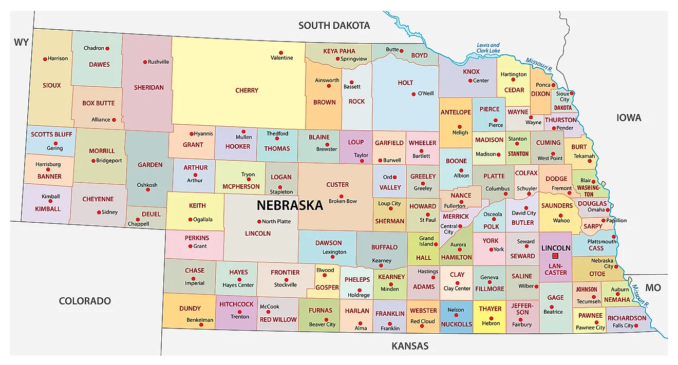
The State of Nebraska is divided into 93 counties. In alphabetical order, these counties are: Adams, Antelope, Arthur, Banner, Blaine, Boone, Box Butte, Boyd, Brown, Buffalo, Burt, Butler, Cass, Cedar, Chase, Cherry, Cheyenne, Clay, Colfax, Cuming, Custer, Dakota, Dawes, Dawson, Deuel, Dixon, Dodge, Douglas, Dundy, Fillmore, Franklin, Frontier, Furnas, Gage, Garden, Garfield, Gosper, Grant, Greeley, Hall, Hamilton, Harlan, Hayes, Hitchcock, Holt, Hooker, Howard, Jefferson, Johnson, Kearney, Keith, Keya Paha, Kimball, Knox, Lancaster, Lincoln, Logan, Loup, Madison, McPherson, Merrick, Morrill, Nance, Nemaha, Nuckolls, Otoe, Pawnee, Perkins, Phelps, Pierce, Platte, Polk, Red Willow, Richardson, Rock, Saline, Sarpy, Saunders, Scotts Bluff, Seward, Sheridan, Sherman, Sioux, Stanton, Thayer, Thomas, Thurston, Valley, Washington, Wayne, Webster, Wheeler, and York.
With an area of 200,356 sq. km, Nebraska is the 16th largest, the 37th most populous, and the only triply landlocked state in the USA. Located in the southeastern part of the state is Lincoln – the capital city of Nebraska. It serves as an administrative, cultural, commercial, financial, education, and health-care center of the state. It also hosts the country's 2nd tallest capitol building, a 400-foot tower surpassed only by Louisiana's. Located in the eastern part of the state, on the west bank of the Missouri River, is Omaha – the most populated city in Nebraska. It houses the headquarters of four Fortune 500 companies, namely Berkshire Hathaway, Union Pacific, Kiewit, and Mutual of Omaha, along with three more in the wider Fortune 1000. That gives Omaha more Fortune 500 headquarters than considerably larger cities such as Austin, Detroit, and San Diego. The city is also home to major firms including the Gallup Organization, DLR Group, and HDR Inc.
Where is Nebraska?
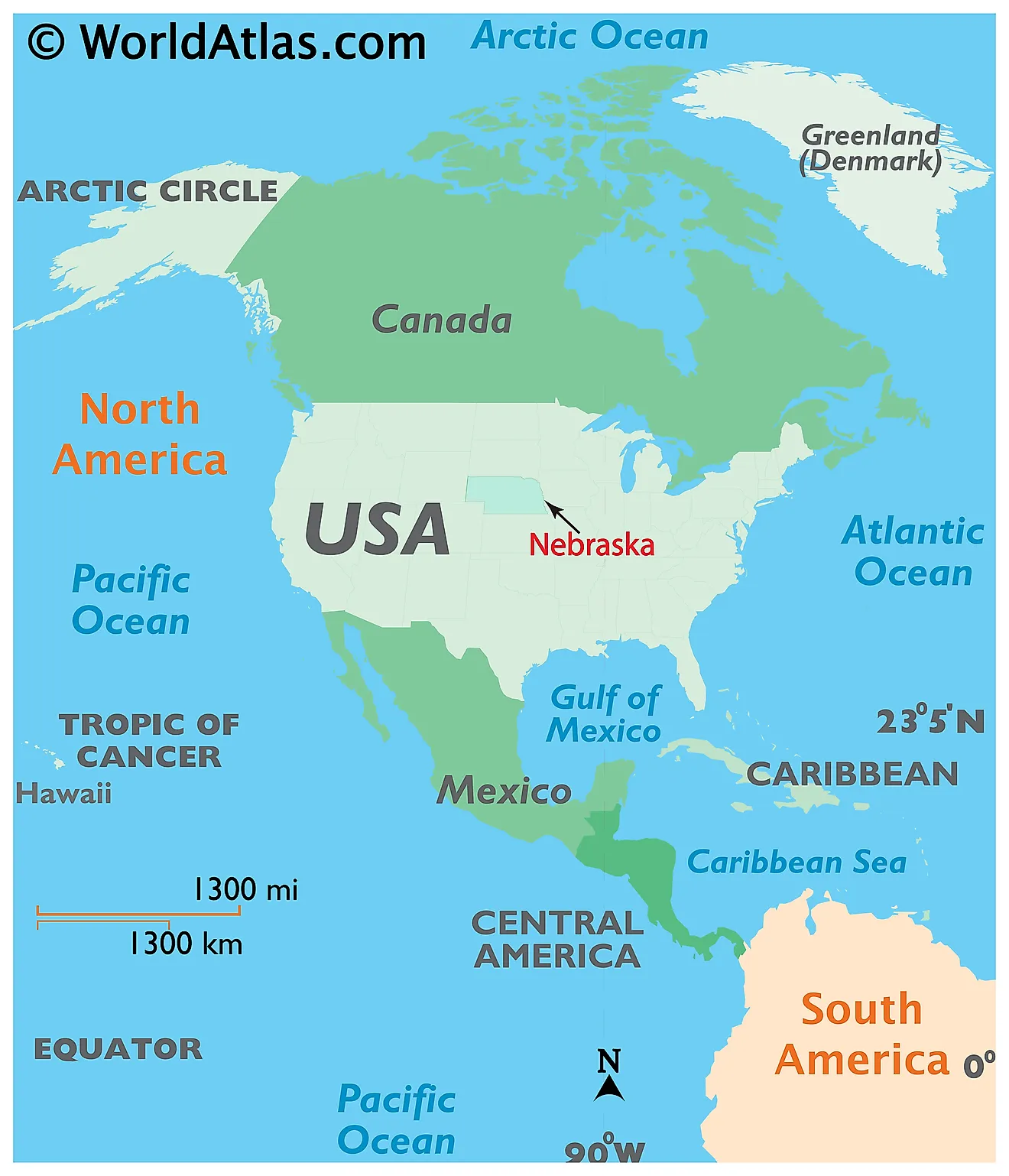
The State of Nebraska is located in the central (Midwest) region of the United States. The triply-landlocked state of Nebraska is bordered by the states of Colorado in the southwest; by Wyoming in the west; by South Dakota in the north, by Iowa in the east, by Missouri in the southeast, and by Kansas in the south. The Missouri River flows along the state’s entire eastern border.
Regional Maps: Map of North America
Outline Map of Nebraska
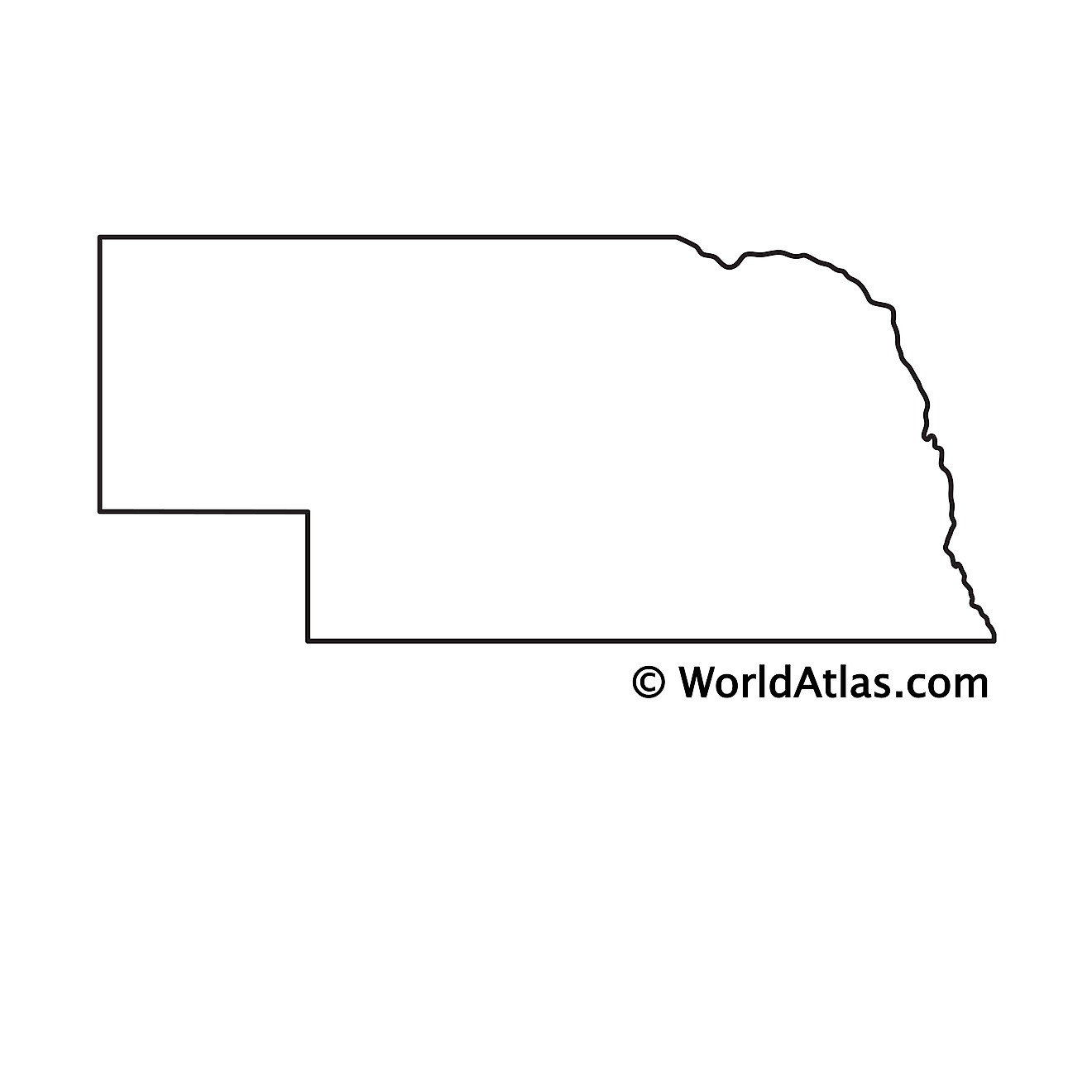
The above blank map represents the State of Nebraska, located in the central (Midwest) region of the United States. The above map can be downloaded, printed and used for geography education purposes like map-pointing and coloring activities.
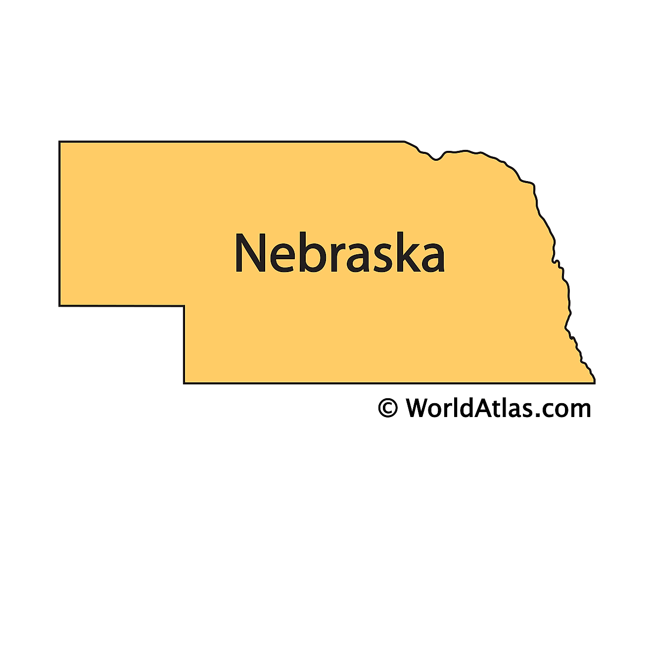
The above outline map represents the State of Nebraska, located in the central (Midwest) region of the United States. It is the only triply landlocked state in the USA.
Key Facts
| Legal Name | State of Nebraska |
|---|---|
| ISO 3166 Code | US-NE |
| Capital City | Lincoln |
| Largest City |
Omaha (859,770) |
This page was last updated on September 20, 2026