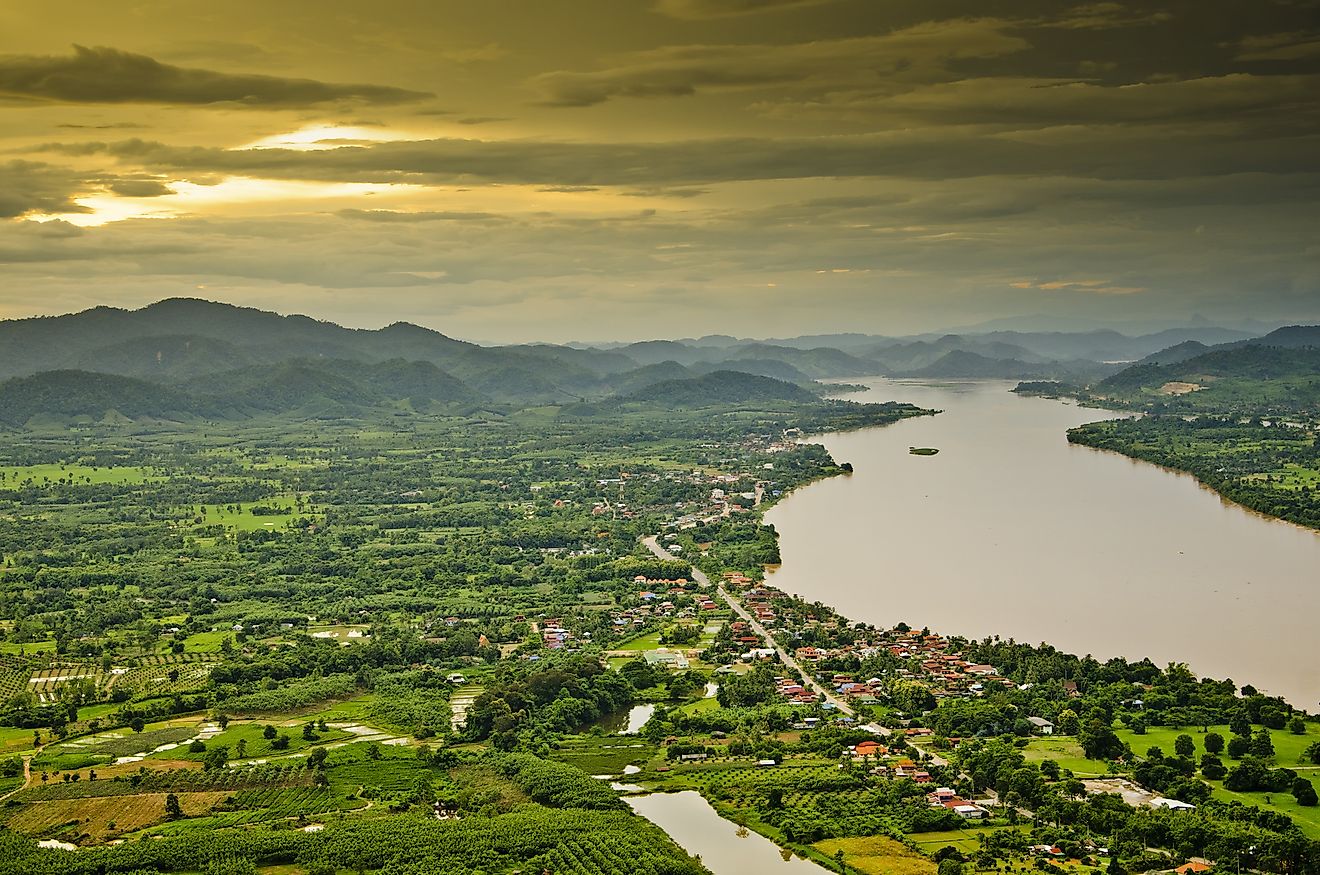
Niobrara River
The Niobrara River rises near the town of Lusk in Niobrara County in the eastern part of the US State of Wyoming. The name of the river is of Omaha and Ponca Indian origin and means “The wide-spreading water.” Niobrara flows east across the High Plains, the eastern plains of Nebraska, the northern edge of the Sand Hills, and joins the Missouri River near the village of Niobrara at the South Dakota state line. The river has a more uniform flow than most plains and streams due to regular contributions from groundwater and tributaries in the Sand Hills. However, it is wide and shallow in its lower course. The Niobrara River is approximately 914 km long and drains an area of 30,000 square km.
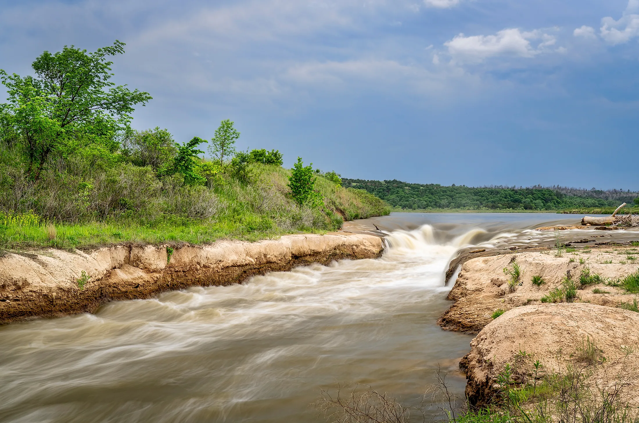
Course Of The Niobrara River

Niobrara River rises in the High Plains, Wyoming, in the southern part of Niobrara County. The river flows in the eastern direction as an intermittent stream past the town of Lusk and southeastwards in northwestern Nebraska. The Niobrara River travels in the southeast direction across the Pine Ridge country of Sioux County. It then flows eastwards through Agate Fossil Beds National Monument, past Marsland, and through Box Butte Reservoir. The river runs east across northern Nebraska, near the northern edge of the Sandhills and past Valentine. The Snake River joins it about 21 km southwest of Valentine. Niobrara is also joined by the Kenya Paha River, approximately 10 km west of Butte in north-central Nebraska. The river joins the Missouri River near the village of Niobrara in northern Knox County, just upstream of Lewis and Clark Lake.
Threats To The Niobrara River

Deposition of sediments is one of the major threats to the Lower Niobrara River. The sediment is backing up in the upper reaches of Lewis and Clark Lake behind the Missouri River’s Gavins Point Dam. Dams and other flood control infrastructure have caused sediment to accumulate in the reservoir system. As sediment builds up on the riverbed, it raises the river levels, creating flooding issues for tributaries like the Niobrara River. The sediment build-up is so extreme at the confluence of the Niobrara and Missouri River that it has led to an increase in the level of the local water table. This has led to flooded cropland and basements, significantly impacting boating and other recreation. One of the consequences of the sediment build-up was relocating the Village of Niobrara in 1973. The Lower Niobrara slowly loses the seeps, springs, and canyons that characterize this Wild and Scenic River as the sediment builds within the system. Only a few of the great cottonwood trees in the confluence area have survived the recently sustained high waters. One of the measures taken to tackle this issue is the effort taken by the USACE that purchased thousands of acres of riverside land to limit future liability, but it is not the long-term answer.
Recreational Activities Along
Due to the unusual nature of the valley, and the river’s relatively rapid flow, thousands of visitors come annually for an experience unique on the Great Plains. Tubes and canoes are the chosen means of enjoying the river. The Fort Niobrara National Wildlife Refuge stretch provides a quitter float and permits hiking into a federal wilderness area.
Wildlife

The middle Niobrara River Valley has been called the “biological crossroads of the Great Plains.” Six divergent ecological communities occur in the river valley. Western pine forest occurs on the dry south-facing canyon slopes. On the other hand, the north-facing slopes are often shaded and are fed by an ample supply of groundwater which maintains eastern deciduous forest species. The area is home to diverse wildlife with this abundant and diverse assemblage of plants and habitats. Here, eastern and western forest bird species co-mingle and sometimes hybridize. Indigo buntings and Lazuli, eastern and western pewees, Bullock’s and Baltimore orioles —even butterflies co-mingle and hybridize. An isolated subspecies of the eastern woodrat finds refuge here, hundreds of miles from the remainder of its kind.