West Indies
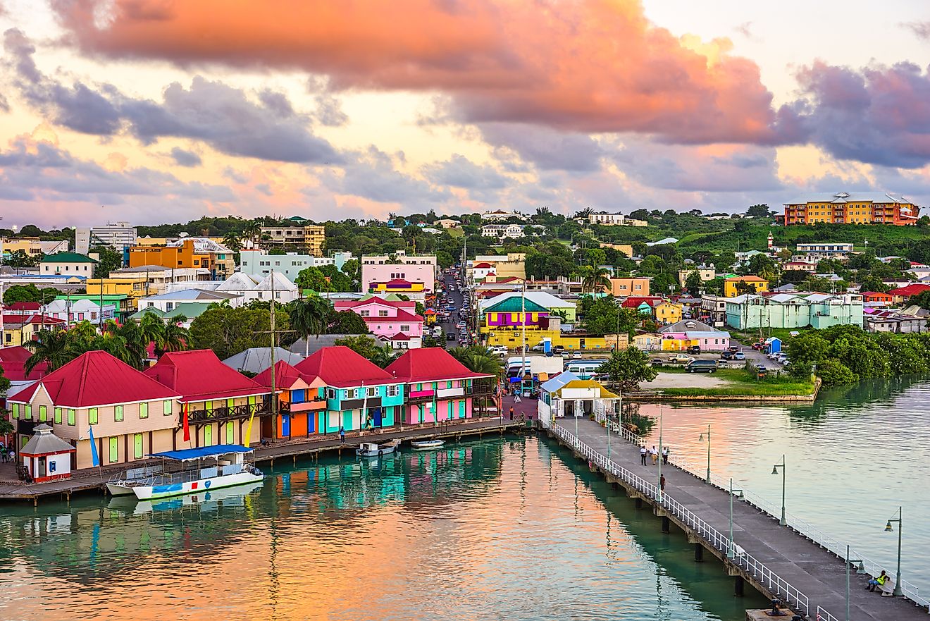
- The West Indies are a chain of islands in the Caribbean Sea and Atlantic Ocean.
- Some of the West Indies are coral islands, while others are volcanic in origin.
- The West Indies are divided into three groups: The Bahamas, the Greater Antilles, and the Lesser Antilles.
- The West Indies stretch from the Bahamas in the north, all the way south to the northern shores of South America.
- Nearly 44 million people live in the West Indies.
The West Indies are a chain of islands located in the Caribbean Sea and the Atlantic Ocean. This chain of islands runs from the north, close to the US State of Florida, all the way south to the northern shores of South America. They were named the Indies by Christopher Columbus, the first European on record to reach the islands. He believed that he had reached India, and thus, called the newly-discovered islands the Indies. Later, when it was discovered that what Columbus discovered was not India, the islands were renamed the West Indies, to distinguish them from the Spice Islands in the Pacific Ocean, otherwise known as the East Indies, which now comprise the territory of Indonesia.
Geography Of The West Indies

The West Indies consists of three distinct island groups: the Bahamas, the Greater Antilles, and the Lesser Antilles.
The Bahamas

The most northerly group of islands in the West Indies are the islands of the Bahamas, which consist of approximately 3,000 islands and reefs. The islands of the Bahamas are coral islands, which were formed when coral reefs became dry land following a reduction in sea levels. They are made entirely of calcium carbonate, which is the material produced by the organisms that live in coral reefs. This feature has resulted in the Bahamas having the clearest waters in the world, in which it is possible to see up to 61 meters deep. The islands contain 5% of all the coral in the world. The Bahamas is also the name of a country that controls much of this island group. Although politically, The Bahamas is usually considered part of the Caribbean, it is technically not located in the Caribbean Sea, but in the Atlantic Ocean. The Bahamian island of San Salvador was the first island that Columbus set foot on when he reached the West Indies.
The Greater Antilles

The Greater Antilles are the large islands in the west and center of the Caribbean Sea. The most westerly island is Cuba, which is also the largest island in the West Indies. Cuba is an island composed mostly of limestone. In fact, about 65% of the island contains limestone. Compared to other islands in the Caribbean, Cuba is relatively flat. Two-thirds of the island is composed of plains, and the median elevation is just 90 m above sea level. There are more than 500 rivers in Cuba, the longest of which is the Cauto River, which flows for 370 km. Most of these rivers, however, are too shallow to be navigated by boat.
To Cuba’s south is the island of Jamaica. Like the other islands of the Antilles, Jamaica was formed by a series of volcanoes that rose from the sea billions of years ago. The island has three geographic regions: the eastern mountains, the central valleys and plateaus, and the coastal plains. The highest point in Jamaica is Blue Mountain Peak, which reaches a height of 2,256 m. The island’s terrain varies to the extent that it produces two types of climates, an upland tropical climate and a semiarid climate. The former dominates on the windward side of the mountains, while the latter is more prevalent on the leeward side.
The large island east of Cuba and Jamaica is known as Hispaniola. It is the second biggest island in the West Indies. Hispaniola is divided between the two countries of Haiti and the Dominican Republic. It has five mountain ranges. These mountains are sparsely populated, but a significant amount of agricultural activity, most notably the growth of coffee, is done in the mountain ranges. In contrast, the northern plains of Hispaniola are heavily populated.
The most easterly island of the Greater Antilles is the island of Puerto Rico. The island’s geography has three main features: mountains, coastal plains, and valleys. Three-fourths of the island consists of the mountains and hills of the Central Cordillera. This area is surrounded by coastal plains. The rivers of Puerto Rico are narrow and unnavigable by boat, but they have proven to be a good source of hydroelectric power.
The Lesser Antilles

Beyond Puerto Rico, to the east, lie the Lesser Antilles. The Lesser Antilles stretch south, all the way to the northern shores of South America. There are actually two groups of islands in the Lesser Antilles. The northern group is called the Leeward Islands, which stretch from the island of Anguilla in the north to the island of Montserrat in the south. These islands are in the shape of an arc and were formed by the meeting of the North American and Caribbean tectonic plates.
The southern group of the Lesser Antilles is known as the Windward Islands, which are located at the foot of the Caribbean Sea. These islands are generally mountainous and volcanic in origin. Some of the Windward Islands, such as Martinique, still have active volcanoes. The island of St. Lucia even has a volcano that you can drive through. The island of Trinidad is the largest and southernmost island of the Windward Islands and the Lesser Antilles in general. At its nearest point, it is just 11 km from the coast of the South American country of Venezuela.
A Brief History Of The West Indies

Archeological evidence suggests that the West Indies were settled, at least partially, as long ago as 3100 BCE, with Cuba, Hispaniola and Trinidad bearing signs of having been inhabited as long ago as 5000 BCE. Upon contact with Europeans, the main Indigenous groups in the West Indies were the Taíno, who lived in the Greater Antilles, the Bahamas, and the Leeward Islands; the Island Caribs and Galibi, who lived in the Windward Islands, and the Ciboney in what is now western Cuba. On his first voyage to the West Indies, Christopher Columbus made contact with the Lucayans in the Bahamas and the Taíno in Cuba and Hispaniola.
After the Spanish, who sponsored Columbus’ voyage, discovered that there was gold to be found on the territory of the Indigenous peoples in the West Indies, they sought to conquer the islands for themselves. While doing so, they enslaved much of the Indigenous population. Eventually, the Indigenous people of the West Indies were driven to the brink of extinction, not just by slavery and other acts of genocide perpetrated by the Spaniards, but also by diseases brought to the islands from Europe for which they had no immunity. To supplement indigenous slave labor, the Spaniards imported slaves from Africa, whose descendants would later comprise much of the population of the West Indies.
By the end of the 16th century, other European powers began exploring and settling the West Indies. Several wars were also fought in the region and resulted in ownership of territory changing hands on several occasions. During the colonial period, piracy became widespread throughout the West Indies, especially in the period between 1640 and 1680. This era of piracy is sometimes memorialized in today’s popular culture, including the Pirates of the Caribbean movies.

The decolonization of the West Indies began in the early 19th century. Haiti was the first country in the West Indies to become independent in 1804 with the Haitian Revolution, followed by the Dominican Republic in 1844. Other European colonies in the region gained their independence in the 19th and 20th centuries, though even today, several islands in the West Indies are still European possessions. The islands of Martinique and Guadeloupe, for example, are still controlled by France. The Virgin Islands remain under British and US rule, while the islands of Sint Eustatius, Saba, and Bonaire are still Dutch territory. The US also has territory in the West Indies, which includes Puerto Rico.
Demographics Of The West Indies

Today, nearly 44 million people call the West Indies home. Haiti has the region’s biggest population, with 11.5 million people living on the island. Not too far behind is Cuba, which has a population of approximately 11.4 million. The Dominican Republic, which shares the island of Hispaniola with Haiti, is the third most populous, with a total of more than 10.9 million people. Jamaica, Puerto Rico, and the country of Trinidad and Tobago have populations of approximately 2.9 million, 2.8 million, and 1.4 million, respectively. The rest of the West Indies’ countries and territories all have populations of less than a million. The region’s smallest population is situated on the British-controlled island of Montserrat, which is home to less than 5,000 people.
The people of the West Indies are multiracial, multicultural, and multilingual. Generally, the predominant language of each country or territory in the region is the one spoken by the current or former colonial power. For example, English is spoken in the former British colony of the Bahamas and the current British colony of Montserrat, while French or French Creole is spoken in formerly French-controlled Haiti and the currently French-controlled islands of Guadeloupe and Martinique. Dutch is the primary language on the islands of Aruba and Curaçao, which are still controlled by the Netherlands, while Spanish is the dominant language in the former Spanish colonies of Cuba, the Dominican Republic, and Puerto Rico.

The origins of the people of the West Indies lie in different parts of the world, including Europe, Africa, and the Indian Subcontinent. Most of the people in Haiti, Jamaica, and the Bahamas, for example, are of African descent. In other countries, such as the Dominican Republic, the population is more racially mixed. Trinidad and Tobago contains a large population of people who are descended from the Indian Subcontinent, while most of Cuba’s population is of European descent. There are still remnants of the West Indies’ pre-Columbian Indigenous population, most notably on the islands of Dominica, St. Vincent and the Grenadines, and Cuba.


