Maps of The Gambia

As observed on the physical map of the country, The Gambia is a very small and narrow country whose borders seem to follow the path of the meandering Gambia River, and at less than 30 miles wide at its widest point, nearly 10% of the country's land area is covered by water.
The Gambia River itself is one of Africa's major rivers. It stretches 1,130 km (700 miles) from northwestern Guinea to the Atlantic Ocean at the city of Banjul. It is navigable for about half of that length.
The remainder of Gambia's terrain is a grassy flood plain with Guinean mangroves covering the landscape as you move closer to the coastline; the Sudanian Savanna lies further inland.
The highest point of the country (marked with an upright yellow triangle on the map) is an unnamed hill at 53 m at the easternmost region, and the lowest point is the Atlantic Ocean (0 m).
Regions of The Gambia Map

The Gambia is divided into five regions. These are Central River, Lower River, North Bank, Upper River, and West Coast. The country also has one City or Banjul which is the capital of the country. With an area of 2,894.25 sq. km, Central River is the largest region by area while the West Coast is the most populous one.
Where is The Gambia?

The Gambia is a country in West Africa in the Northern and Western Hemisphere regions of the Earth. It is mainland Africa's smallest country and is almost surrounded by Senegal except for a short coastline on the Atlantic Ocean to the west.
Gambia Bordering Countries: Senegal.
Regional Maps: Map of Africa
Outline Map of The Gambia

The blank outline map represents the West African country of The Gambia. The map can be downloard, printed, and used for educational purposes.

The above map represents the outline of the West African country of The Gambia. To the left, the country has a coastline on the Atlantic and extends as a narrow horizontal band from there to the east. It is surrounded on all the other three sides by Senegal.
Key Facts
| Legal Name | Republic of The Gambia |
|---|---|
| Flag |
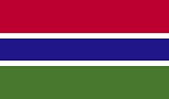
|
| Capital City | Banjul |
| 13 27 N, 16 34 W | |
| Total Area | 11,300.00 km2 |
| Land Area | 10,120.00 km2 |
| Water Area | 1,180.00 km2 |
| Population | 2,347,706 |
| Largest City |
Banjul (481,472) |
| Currency | Dalasis (GMD) |
| GDP | $1.76 Billion |
| GDP Per Capita | $751.29 |
This page was last updated on February 24, 2021