What Happens If The Mississippi Jumps Into The Atchafalaya
In the remote, rugged backcountry of central Louisiana, a massive structure of concrete and steel plays a crucial yet often underappreciated role: it keeps the Mississippi River confined to its course. The reality is that the Mississippi River has been attempting to escape its boundaries for decades, and if it ever manages to succeed, the consequences will be severe. Such a reroute wouldn't be gentle; it would drain vital resources from New Orleans and Baton Rouge, disrupt a significant portion of the U.S. economy, and reshape the Gulf Coast's landscape all at once. This isn't a science fiction scenario but rooted in basic physics. Engineers have been battling this natural force for over sixty years, with only limited success. Here is what is truly at risk.
The River Wants to Leave

To grasp the threat, it's essential to recognize that a large river isn't static. It's a dynamic, ever-changing entity. The Mississippi River, which drains around 41 percent of the continental US, carries an enormous amount of sediment southward. This sediment accumulates at the river's mouth, gradually creating new land in the Gulf of Mexico. As a result, the river's course becomes longer and more meandering over time. Eventually, the path becomes so sluggish that the river seeks a quicker route downward. Over thousands of years along Louisiana's delta plain, it has repeatedly shifted its course, often swinging like a hose and abandoning old channels approximately every thousand years. The current route past New Orleans has been used since around 1000 A.D. In essence, the Mississippi isn't just capable of flooding or changing; according to its geological timeline, it is overdue for a significant shift.
The Shortcut

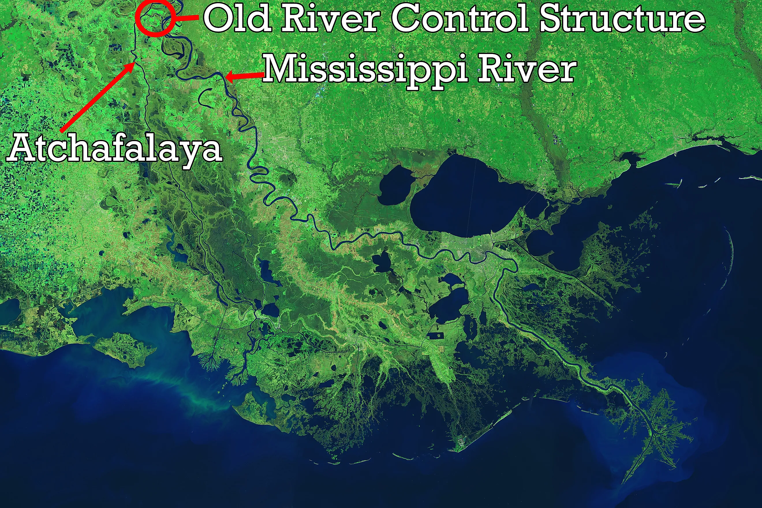
The river's natural escape route is already present and highly attractive. The Atchafalaya River splits from the Mississippi about 45 miles upstream of Baton Rouge and flows directly to the Gulf at Morgan City. This path is roughly 150 miles shorter than the route through New Orleans and is more than twice as steep. For a river seeking the fastest, steepest descent, this is an irresistible option. Over the past century, the Mississippi has gradually allowed more water to flow into the Atchafalaya. Around 1900, only about 5% of the combined flow went that way, but by the 1950s, it had grown to nearly 30% and was increasing quickly. Engineers studied the risks and found them concerning: if no measures were taken, the Atchafalaya could become the Mississippi’s main channel, possibly as early as the 1970s. The river was nearing this change rapidly, not over many decades, but within just a few years.
The Concrete Cork

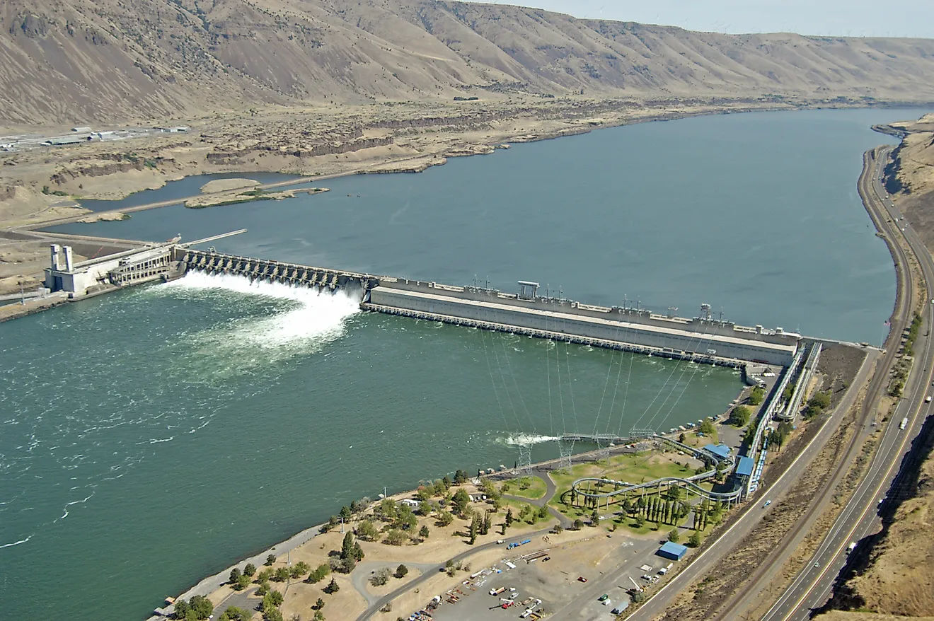
The solution was to build a dam at the river's escape route. Completed in 1963, the Old River Control Structure is a complex of large gated barriers where the Mississippi, Atchafalaya, and Red River converge. Its main purpose is to maintain the flow split at the 1950 ratio, which Congress codified into law: 70 percent of the water must flow past Baton Rouge and New Orleans down the Mississippi, while no more than 30 percent can go down the Atchafalaya. Daily, operators adjust the gates to redirect billions of gallons back onto the Mississippi, the river's preferred path. It's a remarkable feat of engineering, sometimes called America's Achilles' heel, and essentially a constant tug-of-war against gravity. The river pushes, and the structure holds—most of the time.
The Night It Almost Lost

In 1973, the structure almost failed entirely when a severe flood struck the control complex. The torrent eroded the riverbed beneath the main Low Sill structure, removing a 67-foot concrete wing wall and creating a crater the size of a football field underneath the foundation. For several days, the structure was on the verge of collapse, and if it had failed, the Mississippi River would have broken through the gap, redirecting the Atchafalaya River. John McPhee famously highlighted this narrow escape in his essay "Atchafalaya," emphasizing how close disaster was. The Army Corps of Engineers responded by strengthening the site and later installing a larger auxiliary structure to distribute the load, increasing the system's resilience. However, the core lesson remained: the river nearly succeeded and would likely try again.
What Happens If It Jumps

Imagine a future where the structure finally fails during a superflood, causing the Mississippi to overflow into the Atchafalaya. The effects would be enormous and quickly become apparent. As the main flow bypasses the old channel, the last 200-plus miles past Baton Rouge and New Orleans would slow significantly. Without the continuous freshwater, this channel would transform into a saltwater estuary, as seawater from the Gulf of Mexico would push upstream, possibly reaching as far as Baton Rouge, 230 miles inland.
That one change alone would be devastating. About 1.5 million people in the New Orleans area depend on the Mississippi for drinking water, which would be poisoned by saltwater. The well-known industrial corridor between the two cities, housing at least ten oil refineries and hundreds of billions of dollars in petrochemical facilities, relies entirely on river freshwater. This would come to a halt. Additionally, shipping would be impacted: four of the fifteen largest U.S. ports are located here, handling over 60% of the nation's grain exports. As the old channel silted up, large ships could no longer access these ports, and the new Atchafalaya channel is too unstable and unfinished to use. An official estimates that closing the lower Mississippi to shipping could cost the economy around $295 million daily. A barge can carry as much cargo as a thousand trucks, and the country lacks the trucks and trains to replace that capacity.
The damage affects multiple sides. Barges carry petrochemicals, fertilizers, and raw materials upriver to farms and factories throughout the middle of the country, so a shutdown here would cause widespread disruptions beyond Louisiana. The new channel would also cut through a dense network of energy infrastructure, including major natural gas and oil pipelines that cross the Atchafalaya en route to the Midwest and East Coast. A river carving a new path to the Gulf could sever these pipelines. Since about three-quarters of Louisiana's electricity comes from natural gas, the same disaster that disrupts water could also blackout power across the industrial region vital for much of the nation's supply.
When, Not If

The area surrounding the new channel would face severe destruction. Morgan City and much of the Atchafalaya Basin could experience catastrophic flooding as an enlarged river carved a new, powerful bed, damaging pipelines, bridges, roads, and railways. A new delta would start forming into the Gulf south of Morgan City, similar to what is already occurring at Wax Lake nearby. Meanwhile, the historic bird's-foot delta south of New Orleans, deprived of sediment, would erode away. This process would effectively redraw the coastline.
Most geologists agree that this issue is not about if, but when it will happen. The century-long clock is running out, and with each flood, the river gains more leverage. As the climate warms, the Mississippi faces more frequent and larger high-water events, each pushing harder against the gates. The Old River Control Structure has managed to hold for over sixty years, and it might continue to do so for many more. However, it is not defeating the river—only delaying the inevitable. The Mississippi is vast, persistent, and patient, and it has all the time it needs to wait for that one flood that the concrete cannot withstand.