The Longest Rivers In Japan
The Shinano, also known as the Chikuma in its upper reaches, is the longest river in Japan at 367 kilometers (228 miles). The Tone is the only other river in the country that reaches 200 miles in length. Japan's mountainous terrain creates steep-gradient rivers that run quickly from highland origins down to coastal plains and farmland before draining into the sea. River levels shift with the seasons, rising with snowmelt in spring and heavy rains in summer, then dropping during drier stretches of the year. Other important rivers include the Abukuma, Kitakami, and Mogami in the Tohoku region, and the Shimanto on the island of Shikoku, often called the last clear stream in Japan.
Shinano

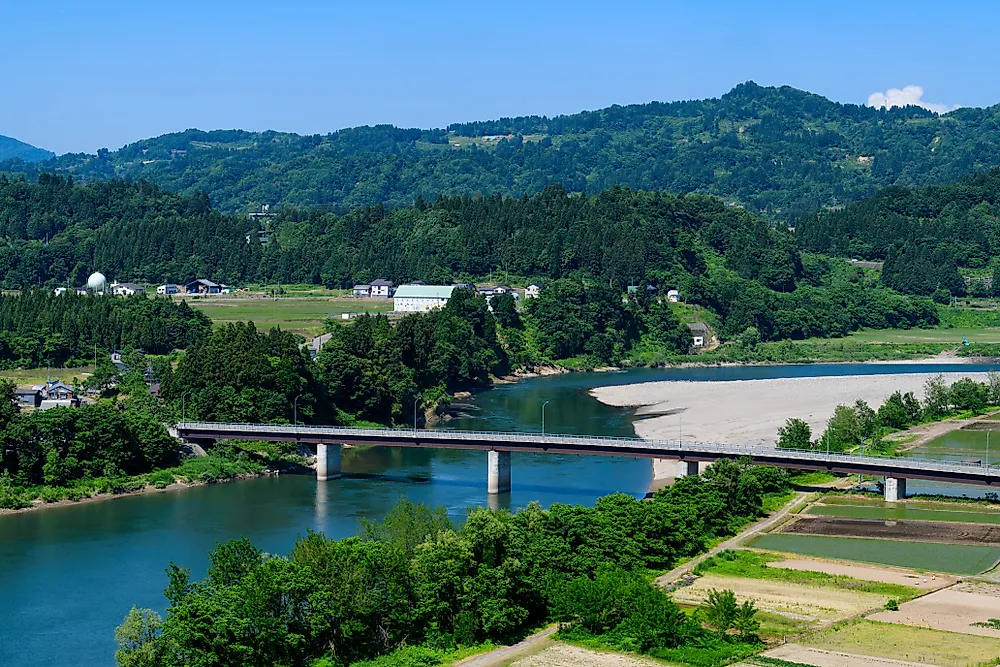
The Shinano River, at 367 kilometers (228 miles), is the longest river in Japan. It rises from Mount Kobushi in the Japanese Alps of Nagano Prefecture and flows northeast through Nagano and Niigata Prefectures before emptying into the Sea of Japan. In its upper reaches, the river is known as the Chikuma, which accounts for roughly 60% of the total basin. The junction of the Chikuma and Sai rivers is the historical site of the Kawanakajima Battles, a series of 16th-century clashes between the Takeda and Uesugi clans. The river's drainage basin covers 11,900 square kilometers (4,600 square miles) and provides water for the extensive rice fields of the Niigata plains. The Okozu Divertory Channel, completed in 1922, protects the Niigata lowlands from flooding by diverting excess water into the sea. The Bandai Bridge, built in 1929 and designated a nationally important cultural property, stretches 307 meters across the river and offers views of the Niigata cityscape.
Tone

The Tone River is 322 kilometers (200 miles) long and has the largest watershed of any river in Japan, covering 16,840 square kilometers (6,500 square miles). It rises from Mount Ominakami in the Echigo Mountains on the border of Gunma and Niigata Prefectures and flows across the Kanto Plain on Honshu before emptying into the Pacific Ocean at Choshi in Chiba Prefecture. The river supplies water for more than 30 million people in the greater Tokyo metropolitan area, making it one of the most critical water resources in the country.
Ishikari

The Ishikari River is 268 kilometers (167 miles) long, making it the third longest river in Japan and the longest in Hokkaido. It originates from Mount Ishikari in the Daisetsuzan Volcanic Group and flows through the cities of Asahikawa and Sapporo before reaching the Sea of Japan. Its drainage basin covers 14,330 square kilometers (5,530 square miles), the second largest in the country after the Tone.
Teshio

The Teshio River is 256 kilometers (159 miles) long and also located in Hokkaido. It originates from Mount Teshio in the Kitami Mountains and flows to its mouth at the Sea of Japan in the town of Teshio. Its basin covers 5,590 square kilometers (2,160 square miles). Forests surround the upper portions of the river, and as it flows into the lowlands, meanders increase, giving it a winding appearance. The lower 158 kilometers of the Teshio are unbroken by dams or weirs, a rarity among Japanese rivers. This uninterrupted stretch makes it popular for canoeing, with an annual canoe race held along the river.
Kitakami

The Kitakami River is 249 kilometers (155 miles) long with a drainage basin of 10,150 square kilometers (3,920 square miles). It starts from Mount Nanashigure in northern Iwate Prefecture and flows south between the Ou Mountains and Kitakami Mountains through mostly rural areas of Iwate and Miyagi Prefectures. The river is unusual in that it splits into two mouths near the coast, one draining into Ishinomaki Bay and the other directly into the Pacific Ocean. The Kitakami was an important transportation route during the Edo period and before the railways of the early Meiji period.
Abukuma

The Abukuma River is 239 kilometers (149 miles) long and flows through Fukushima and Miyagi Prefectures before emptying into the Pacific Ocean at Iwanuma. It originates from Mount Asahi in the Nasu Mountains at an elevation of 1,835 meters. The river's drainage basin covers approximately 5,400 square kilometers and supports around 1.36 million people. Between Nihonmatsu and Fukushima, the river passes through a deep ravine called Horai-kyo. The Abukuma is the second longest river in the Tohoku region and is classified as a Class A river under Japanese law.
Mogami
The Mogami River is 229 kilometers (142 miles) long and flows entirely within Yamagata Prefecture, making it one of the few major Japanese rivers contained within a single prefecture. It originates from Mount Azuma and flows north through the Yamagata Basin before turning west at Shinjo and emptying into the Sea of Japan at Sakata. The Mogami is considered one of Japan's three most rapid rivers, alongside the Fuji and Kuma. Its cultural significance runs deep. The 17th-century poet Matsuo Basho wrote about the Mogami in his travel memoir Oku no Hosomichi, and the river has been a celebrated subject in Japanese poetry for centuries. Historically, it served as a major transportation route for goods like safflowers and rice heading to the Kansai region.
Tenryu

The Tenryu River is 213 kilometers (132 miles) long and flows from Lake Suwa in Nagano Prefecture through the mountains of central Japan before reaching the Pacific Ocean near Hamamatsu in Shizuoka Prefecture. The river passes through Nagano, Aichi, and Shizuoka Prefectures, cutting between the Central Alps and Southern Alps through deep V-shaped valleys. Historically nicknamed the "Violent Tenryu" for its fast, turbulent flow and tendency to flood, the river now hosts multiple hydroelectric dams, including the Sakuma Dam completed in 1956. Its basin covers 5,050 square kilometers (1,950 square miles) and drains a coastal plain known for fruit and rice production.
Agano

The Agano River is 210 kilometers (130 miles) long and flows through Fukushima, Gunma, and Niigata Prefectures. It originates from Mount Arakai on the border of Fukushima and Tochigi and flows through the Aizu Basin, where it is joined by water from Lake Inawashiro and the Tadami River, before turning west and emptying into the Sea of Japan in Niigata Prefecture. Its drainage basin covers 7,710 square kilometers (2,980 square miles) and supports roughly 560,000 people. The river is historically significant as the site of Japan's first high-voltage, long-range power transmission line, built at the Inawashiro Power Plant between 1899 and 1940.
Shimanto

The Shimanto River is 196 kilometers (122 miles) long and flows through western Kochi Prefecture on the island of Shikoku. It is sometimes called the last clear stream in Japan because it has no dams along its length, a distinction it shares with only two other rivers in the country (the Nagara and Kakita). The Shimanto's watershed covers 2,270 square kilometers (880 square miles). One of its most distinctive features is its 47 chinkabashi, or sinking bridges, which are low-water crossings built without railings so they can be submerged during floods without being swept away. Kochi Prefecture has moved to preserve these bridges as cultural heritage. Fishing and nori (seaweed) production remain important industries along the river.
The Longest Rivers in Japan
| Rank | River | Length (km) | Length (miles) |
|---|---|---|---|
| 1 | Shinano (Chikuma) | 367 | 228 |
| 2 | Tone | 322 | 200 |
| 3 | Ishikari | 268 | 167 |
| 4 | Teshio | 256 | 159 |
| 5 | Kitakami | 249 | 155 |
| 6 | Abukuma | 239 | 149 |
| 7 | Mogami | 229 | 142 |
| 8 | Tenryu | 213 | 132 |
| 9 | Agano | 210 | 130 |
| 10 | Shimanto | 196 | 122 |