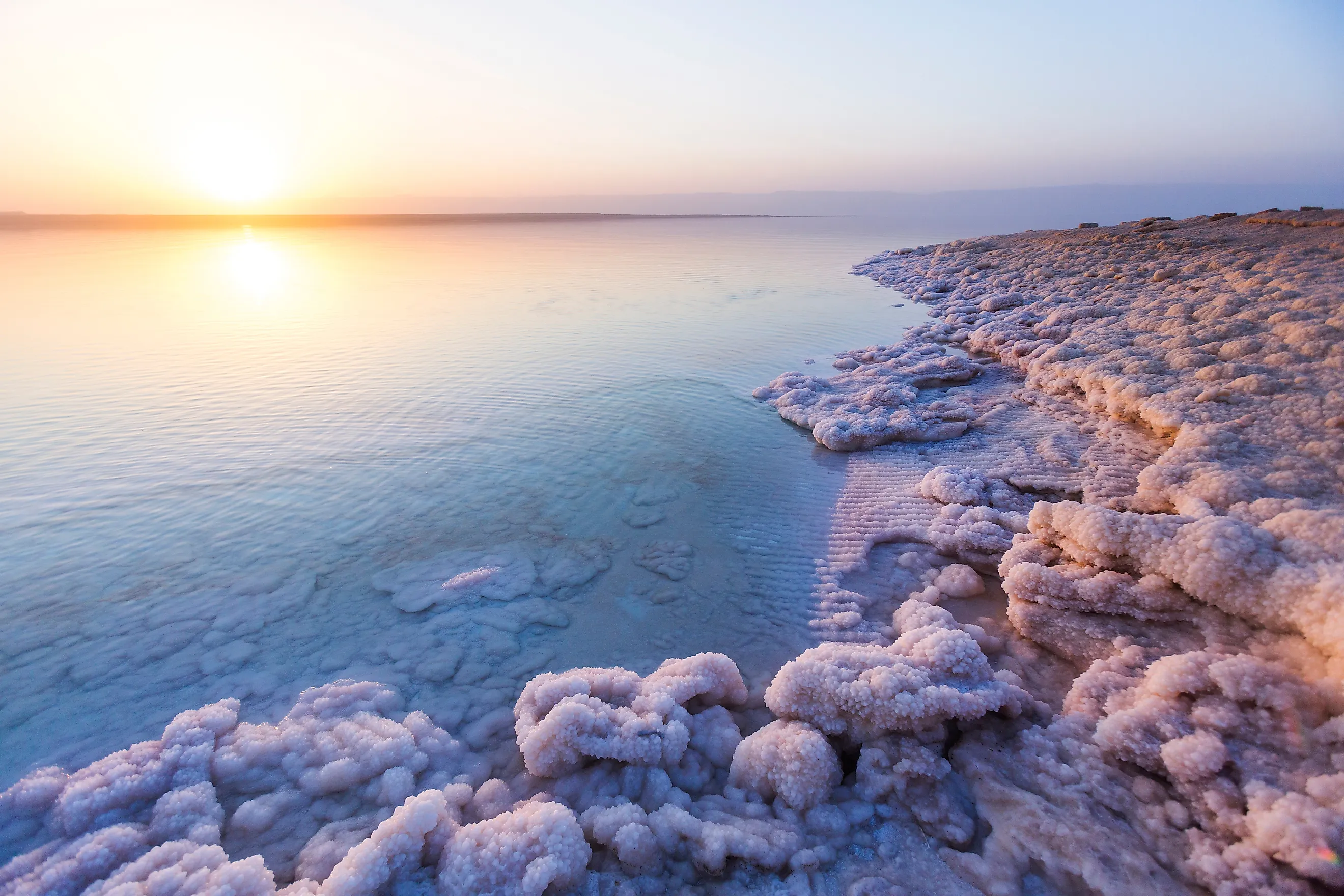
The World's Saltiest Bodies of Water
The saltiest body of water on Earth is not the Dead Sea. It is not the Great Salt Lake. It is a 60-metre-wide pool in the Danakil Depression of northern Ethiopia called Gaet'ale Pond, holding about 433 grams of dissolved salts per litre, almost thirteen times the salinity of the open ocean. Antarctica's Don Juan Pond holds second place at around 400 g/L, and Lake Retba in Senegal ties with it. From those extremes, salinity grades down through dozens of hypersaline lakes, brackish seas, and the average open ocean (35 g/L) all the way to nearly fresh inland waters. The twenty bodies below cover that full spectrum, with verified peak salinity values, ranked from the saltiest pond on Earth to the brackish edge of the Baltic Sea.
How Salinity Is Measured
Salinity is the total mass of dissolved salts (chiefly sodium chloride, but also calcium chloride, magnesium chloride, magnesium sulphate, and various carbonates) per unit mass or volume of water. Oceanographers and limnologists typically report salinity in three more or less interchangeable units: grams per litre (g/L), parts per thousand (ppt or ‰), or percentage by weight. Open-ocean salinity averages 35 g/L, equivalent to 35 ppt or about 3.5 per cent. A body of water is described as "hypersaline" when it carries more dissolved salts than the open ocean, and the term "brine" is usually reserved for waters above about 50 g/L. Bodies below ocean salinity but above freshwater (between roughly 0.5 g/L and 30 g/L) are called brackish; this category includes the Caspian Sea, the Baltic Sea, and most coastal estuaries.
The chemistry of dissolved salts varies sharply between hypersaline waters. Most ocean salt is sodium chloride (table salt). The Dead Sea is unusual for being dominated by magnesium and calcium chlorides rather than sodium. Don Juan Pond is almost pure calcium chloride brine (90 to 95 per cent of the dissolved load), which lowers the freezing point of the water far below that of ordinary seawater and explains why the pond stays liquid at -50°C while every other water body in the McMurdo Dry Valleys freezes solid. Lake Natron in Tanzania, by contrast, owes its salinity to dissolved sodium carbonate and sodium bicarbonate rather than chloride, which pushes its pH up to about 10.5 and gives the lake its caustic alkalinity rather than ordinary saltiness.
Gaet'ale Pond, Ethiopia - 433 g/L

Gaet'ale Pond, in Ethiopia's Afar Region near the Dallol volcanic crater, is the saltiest natural body of water on Earth as confirmed by Guinness World Records. Researchers measured a salinity of 433 g/L (43.3 per cent salt by weight) in 2017 work led by Erika Pérez and Yonas Chebude of Addis Ababa University, more than twelve times the salinity of seawater and noticeably saltier than the Dead Sea, which sits at 337 g/L. The pond is roughly 60 metres long and 40 metres wide, and its water temperature runs between 50 and 55°C because the pond is fed by a tectonic hot spring reactivated by a 2005 Afar earthquake.
The brine is loaded with calcium and magnesium chlorides and stained yellow by trace iron compounds, with continuous bubbling of carbon dioxide from the volcanic substrate below. The site is potentially lethal to small animals: bird and insect carcasses around the pond's edge are common, killed by inhalation of volcanic CO2 that pools near ground level. Despite the conditions, Gaet'ale is now a regular feature on Danakil tourist itineraries operated out of Mekele, the regional capital. The pond has no inlet or outlet and depends entirely on geothermal recharge for its water balance.
Don Juan Pond, Antarctica - ~400 g/L

Don Juan Pond, in the floor of Upper Wright Valley in Antarctica's McMurdo Dry Valleys, held the title of saltiest body of water on Earth from its 1961 discovery until Gaet'ale Pond's 2017 confirmation displaced it. Its calcium-chloride brine has been measured at salinities ranging from 200 g/L during wet periods to as much as 474 g/L during evaporative draws, with an average around 400 g/L. The pond is ankle-deep, covers approximately 0.03 square kilometres in current conditions (down from about 0.25 square kilometres on USGS maps from 1977), and is the only major Antarctic lake that does not freeze. Winter air temperatures in the valley regularly reach -50°C; the calcium chloride dissolved in the water lowers its freezing point sufficiently for the pond to stay liquid.
The source of Don Juan's salt has been the subject of competing theories for fifty years. A long-standing view attributed it to upwelling groundwater carrying dissolved minerals from rocks beneath the valley floor. A 2013 paper by Brown University geologists James Dickson and James Head proposed instead that the salt comes from near-surface brines forming via deliquescence (calcium chloride salts on valley walls absorbing trace atmospheric moisture, then flowing downslope) and that this same mechanism may help explain the briny streaks observed on Mars by orbital cameras. Don Juan Pond hosts a sparse microbial community of cold-tolerant halophilic bacteria and archaea, the only known organisms able to function at these salt concentrations.
Lake Retba, Senegal - ~400 g/L

Lake Retba, called Lac Rose locally, is a 3-square-kilometre hypersaline lake on Senegal's Cap Vert Peninsula about 35 kilometres northeast of Dakar. Salt concentrations reach around 40 per cent (400 g/L), high enough to support effortless flotation and a continuous artisanal salt-harvesting industry. The lake's distinctive pink colour comes from Dunaliella salina, a halophilic green algae that produces red and orange carotenoid pigments as a sunscreen response to the harsh light and high salinity. The colour is most intense during the dry season (January through April) and fades after heavy rains.
About 3,000 salt workers (mostly women in cooperatives) wade into the lake daily to break up salt crystals and rake the brine onto barges; the harvest then goes to drying pyramids on the lakeshore. The workers coat their skin in shea butter as a barrier against the corrosive effects of prolonged brine exposure. Severe flooding in August 2022 stripped Retba of its pink colour temporarily by diluting the salinity and washing away salt mounds; the salinity and the algae had largely recovered by 2025. The lake is on UNESCO's Tentative List as a candidate World Heritage Site.
Lake Vanda, Antarctica - ~350 g/L

Lake Vanda lies further down the same Wright Valley as Don Juan Pond, fed by the 32-kilometre Onyx River (Antarctica's longest river) and capped permanently by 3 to 4 metres of clear lake ice. The lake is meromictic, meaning its water column never mixes vertically. Three distinct layers stratify by salinity: a relatively fresh surface layer just below the ice, a mid-depth layer at roughly seawater salinity, and a deep brine layer at the bottom that reaches about 350 g/L. The bottom water is more than ten times saltier than the ocean and even saltier than the Dead Sea, but the temperature there sits around 23°C despite Antarctica's surface conditions, because the dark lake bed absorbs sunlight transmitted through the clear ice cover and the dense bottom brine prevents convective heat loss.
Vanda has been a long-running natural laboratory for polar and astrobiology research. The lake's microbial communities (concentrated mainly in distinct biomass layers within the water column) are among the simplest aquatic ecosystems studied, and the lake's response to climate forcing is closely tracked through the McMurdo Long-Term Ecological Research site. Vanda Station, a small New Zealand research base on the lakeshore, operated seasonally from 1968 until 1995, when it was dismantled and removed to comply with Antarctic environmental protocols as the lake level rose toward the station's foundations.
Garabogazköl, Turkmenistan - ~350 g/L

Garabogazköl (also written Kara-Bogaz-Gol) is a shallow but vast hypersaline lagoon on the eastern shore of the Caspian Sea in Turkmenistan, covering about 18,000 square kilometres in normal conditions. It connects to the Caspian by a single narrow strait less than 200 metres wide; Caspian water flows in continuously, then evaporates so rapidly under the arid climate that salts concentrate to about 350 g/L, roughly ten times the salinity of the open ocean. The lagoon is the world's most active natural salt-precipitation environment, depositing roughly 100 million tonnes of mineral salts per year.
The strait was dammed in 1980 by Soviet authorities to halt the perceived "loss" of Caspian water to the Garabogazköl evaporation pan. The result was catastrophic: the lagoon dried completely within four years, exposing approximately 18,000 square kilometres of salt-encrusted lakebed to the wind, and the resulting salt-dust storms damaged agricultural soils across western Turkmenistan and northern Iran. The dam was demolished in 1992 after Turkmen independence, and the lagoon refilled within five years. Industrial extraction of sodium sulphate (Glauber's salt) from the lagoon now produces several hundred thousand tonnes per year, and the Soviet-era industrial city of Bekdash on the western shore remains the centre of the operation.
Lake Assal, Djibouti - 348 g/L

Lake Assal is a crater lake in central Djibouti, sitting in the Afar Triangle (the same tectonic region as Gaet'ale Pond, roughly 350 kilometres to the southwest) at 155 metres below sea level, the lowest point on the African continent. Its salinity averages 348 g/L, about ten times the open-ocean value, with the dissolved load dominated by sodium chloride. The lake is fed mainly by subsurface seepage from the Gulf of Tadjoura, an arm of the Indian Ocean, with no surface outlet; evaporation in the arid Afar climate concentrates the salts and deposits a vast white salt crust around the shoreline.
Salt has been harvested at Lake Assal for at least a thousand years. Afar caravan traders called the harvested rock salt "white gold" and traded it north into the Ethiopian highlands along the Berbera-to-Shewa caravan route, with payment historically made in livestock or grain. Industrial extraction began in the 1990s, and a Salt Investment SA concession now produces around 4 million tonnes per year. The Djibouti government has nominated the lake as a UNESCO World Heritage Site to balance the salt industry's expansion against conservation of the area's geological values.
Dead Sea, Israel/Jordan/West Bank - 337 g/L

The Dead Sea is the most famous hypersaline lake in the world, though its 337 g/L salinity ranks it only seventh among the bodies covered here. It is the deepest hypersaline lake on Earth at 304 metres maximum depth, and its surface (which sits about 437 metres below mean sea level as of 2024 measurements, and falling roughly a metre per year) is the lowest exposed land elevation anywhere on the planet. The lake is shared between Israel, Jordan, and the Israeli-occupied West Bank, with no surface outlet and a single major inflow from the Jordan River, much of which is now diverted upstream for irrigation and municipal use.
The Dead Sea's mineral chemistry is unusual for being dominated by magnesium chloride and calcium chloride rather than sodium chloride, which gives the water its slightly oily texture and unusually bitter taste compared with the more familiar ocean salinity. The high density (about 1.24 g/cm³, compared with 1.025 g/cm³ for seawater) allows people to float at the surface without effort, the lake's longest-standing tourism draw. Industrial extraction of potash, bromine, and magnesium has been a major contributor to the Dead Sea's shrinkage (industrial evaporation pans on the southern Israeli and Jordanian shores remove water alongside the upstream Jordan River diversions), and the lake has lost about a third of its surface area since 1970. The Red Sea-Dead Sea Conveyance project, intended to replenish the lake using desalinated Red Sea water, has been under discussion since the 2000s but remains unbuilt as of 2026.
The Great Salt Lake and Other North American Salt Lakes

The Great Salt Lake in northwestern Utah is the largest salt lake in the Western Hemisphere and a shrunken remnant of Pleistocene Lake Bonneville, which covered most of the eastern Great Basin until about 14,500 years ago. The lake is split into two distinct arms by the Lucin Cutoff railway causeway, which the Southern Pacific Railroad built across the lake in 1959. The North Arm (Gunnison Bay) is isolated from inflow and concentrates to about 317 g/L, while the South Arm (Gilbert Bay) receives inflow from the Bear, Weber, and Jordan rivers and runs around 142 g/L. The two arms also differ in colour: the North Arm appears pink to red from halobacteria and Dunaliella algae blooms, while the South Arm is greener.
The lake has been shrinking since the early 2000s under combined effects of upstream water diversion for agriculture and municipal supply, prolonged drought, and warming climate. By 2022 it reached its lowest level on record (about 4,188 feet above sea level, with surface area down to roughly 950 square miles, less than half its 1980s extent), exposing approximately 800 square miles of lakebed to wind erosion. The exposed playa releases arsenic-laced dust that has become a major Wasatch Front public health concern. Smaller hypersaline lakes in western North America include Mono Lake in California (88 g/L, famously photographed for its calcium carbonate tufa towers), Lake Abert in southern Oregon (around 120 g/L, an important migratory bird stop on the Pacific Flyway), and Little Manitou Lake in Saskatchewan (about 180 g/L, locally called "Canada's Dead Sea" for its similar buoyancy).
The Salton Sea, California - ~75 g/L

The Salton Sea in California's Imperial Valley is a younger hypersaline lake of a different origin. It formed accidentally in 1905 when the Colorado River breached an irrigation canal headworks at the Mexican border and ran for nearly two years into the dry Salton Sink before engineers managed to close the breach. The resulting inland sea covered about 970 square kilometres at its peak. The lake has no natural outlet, and a century of agricultural runoff has steadily concentrated the salts: it now sits at about 75 g/L (around 7.5 per cent salinity, just over twice seawater), up from 35 g/L (roughly ocean salinity) in the 1970s and 1980s.
The Salton Sea has shed roughly 40 per cent of its surface area since 2003, when reductions in agricultural inflows under California's Quantification Settlement Agreement began. The newly exposed lakebed is contaminated with decades of pesticide and fertiliser residue, and dust generated from the playa has been linked to elevated asthma rates in nearby communities. The California Salton Sea Management Program has spent over half a billion dollars since 2018 on habitat restoration ponds and dust-suppression revegetation, with marginal results so far.
Saline Seas and the Open Ocean

Among large connected seas, the Red Sea is the saltiest at approximately 40 g/L. The high value reflects intense evaporation in the arid Arabian climate combined with the sea's restricted exchange with the Indian Ocean through the narrow Bab-el-Mandeb strait at its southern end. The Mediterranean Sea averages around 38 g/L for similar reasons, though deep currents through the Strait of Gibraltar moderate this somewhat. The Atlantic, Pacific, and Indian Oceans all run around 35 g/L on average, the standard reference value for "seawater," with regional variations from 32 g/L in higher-rainfall tropical areas to over 37 g/L in the dry subtropical gyres.
Inland brackish seas at the lower end of the spectrum include the Black Sea at 17 to 22 g/L (about half ocean salinity, the result of heavy river input from the Danube, Dnieper, Don, and Volga via the Sea of Azov), the Caspian Sea at about 12 g/L on average (lower than the open ocean, reflecting the Volga's massive freshwater input), and the Baltic Sea at 7 to 10 g/L on the open Baltic Proper and as low as 2 g/L in the Bothnian Bay. The Baltic is sometimes called the world's largest brackish water body. Estuaries (the Hudson, the Thames, the Chesapeake) typically grade from near-freshwater inflows down to ocean-salinity ranges depending on tidal state.
Why Some Bodies of Water Are Saltier Than Others
Three conditions almost always combine to produce a hypersaline body of water. First, the basin must be endorheic (have no outflow to the ocean) so that dissolved salts accumulate rather than flush away. Second, evaporation must exceed inflow, which concentrates the salts left behind as water vapor leaves the basin. Third, an ongoing supply of dissolved minerals must reach the basin through river inputs, groundwater, or volcanic activity. The classic example is the Dead Sea, where the Jordan River brings in roughly 1.3 g/L of dissolved minerals each year, the basin has no outflow, and Levantine summer evaporation removes about 1.5 metres of water per year from the surface.
Hot springs and geothermal recharge produce the most extreme cases. Gaet'ale Pond receives essentially pure brine from below at temperatures of 50°C or higher, with no surface inflow at all to dilute it. Don Juan Pond's calcium chloride is delivered by either groundwater seepage or atmospheric deliquescence, both depending on calcium-rich source rocks in the surrounding ranges. Volcanic activity contributes both the heat for accelerated evaporation and the chemistry of the dissolved load: Lake Natron's alkalinity comes from Ol Doinyo Lengai, a nearby active volcano emitting unusual sodium-carbonate-rich lavas. By contrast, the open oceans receive a steady salt input from rivers but have no enclosing basin, so global ocean salinity has stayed near 35 g/L over geologic timescales because salt is continuously removed by precipitation onto the seafloor and subduction at plate margins.
Life in Hypersaline Waters
Hypersaline waters support a narrower but still diverse range of organisms than freshwater or marine ecosystems, all classified broadly as halophiles (salt-lovers). The dominant life forms are typically microbial: salt-tolerant bacteria and archaea, especially the family Halobacteriaceae, which can include red carotenoid pigments responsible for the pink colours seen in the North Arm of the Great Salt Lake and Lake Retba. Halophilic green algae of the genus Dunaliella also contribute the pink and red tones in some lakes and are commercially harvested for beta-carotene production. The Dead Sea's microbial communities include species in the genus Haloferax, capable of metabolizing organic matter at 30 per cent salinity.
Among multicellular life, the most successful hypersaline-water organism is the brine shrimp (Artemia), a small crustacean a few millimetres long that thrives at salinities the Great Salt Lake and Lake Urmia regularly reach. Brine shrimp populations in the Great Salt Lake's South Arm sustain a commercial cyst-harvesting fishery (sold globally as fish-food and aquaculture feedstock) that exceeds 8,000 tonnes per year. Migratory water birds (American avocets, eared grebes, Wilson's phalaropes, and several flamingo species) feed heavily on brine shrimp and brine flies at salt lakes and provide the primary ecological link between hypersaline basins and the surrounding terrestrial food webs. Lake Natron supports Africa's only major breeding colony of Lesser Flamingos, with around two million birds raising chicks on the lake's caustic but predator-free shoreline each year.
Fish, by contrast, almost never survive at salinities above about 80 g/L (roughly twice seawater). The Salton Sea's tilapia population collapsed when salinity passed 60 g/L in the 2010s; the Dead Sea and the Great Salt Lake have never supported a fish community in recorded history. Specialised pupfish (Cyprinodontidae) in the southwestern United States and certain killifish in the Australian outback can tolerate brackish to mildly hypersaline conditions up to about 70 g/L, but the harshest hypersaline environments belong almost entirely to single-celled organisms.
The Twenty Saltiest Bodies of Water
| Rank | Body of Water | Peak Salinity | Type | Location |
|---|---|---|---|---|
| 1 | Gaet'ale Pond | 433 g/L (43.3%) | Hypersaline pond | Ethiopia |
| 2 | Don Juan Pond | ~400 g/L (40%) | Hypersaline pond | Antarctica |
| 3 | Lake Retba (Lac Rose) | ~400 g/L (40%) | Hypersaline lake | Senegal |
| 4 | Lake Vanda (bottom layer) | ~350 g/L (35%) | Hypersaline lake | Antarctica |
| 5 | Garabogazköl | ~350 g/L (35%) | Hypersaline lagoon | Turkmenistan |
| 6 | Lake Assal | 348 g/L (34.8%) | Hypersaline crater lake | Djibouti |
| 7 | Dead Sea | 337 g/L (33.7%) | Hypersaline lake | Israel, Jordan, West Bank |
| 8 | Great Salt Lake (North Arm) | 317 g/L (31.7%) | Hypersaline lake | United States (Utah) |
| 9 | Lake Baskunchak | ~300 g/L (30%) | Hypersaline lake | Russia (Astrakhan) |
| 10 | Lake Urmia | 120-380 g/L (variable) | Hypersaline lake | Iran |
| 11 | Little Manitou Lake | ~180 g/L (18%) | Hypersaline lake | Canada (Saskatchewan) |
| 12 | Great Salt Lake (South Arm) | ~142 g/L (14.2%) | Hypersaline lake | United States (Utah) |
| 13 | Lake Abert | ~120 g/L (12%) | Alkaline saline lake | United States (Oregon) |
| 14 | Mono Lake | ~88 g/L (8.8%) | Alkaline saline lake | United States (California) |
| 15 | Salton Sea | ~75 g/L (7.5%) | Hypersaline lake | United States (California) |
| 16 | Hamelin Pool | ~66 g/L (6.6%) | Hypersaline embayment | Australia (Shark Bay) |
| 17 | Red Sea | ~40 g/L (4.0%) | Sea | Middle East / Africa |
| 18 | Mediterranean Sea | ~38 g/L (3.8%) | Sea | Southern Europe / N. Africa |
| 19 | Atlantic, Pacific, Indian Oceans | ~35 g/L (3.5%) | Ocean | Global |
| 20 | Black Sea | 17-22 g/L (1.7-2.2%) | Brackish sea | Eastern Europe / Asia Minor |