Douglas Bay
Located in British Columbia, Canada, Douglas Bay is situated across from Anvil Island, surrounded by waters of the triangular Howe Sound.
Douglas Bay's source of water is from the Slaish Sea, crossing along the wildlife-rich land of Vancouver Island and the Olympic National Park. A challenging destination to reach, the bay is part of the Sunshine Coast Regional District of BC, separating Gambier Island from Anvil Island.
Location

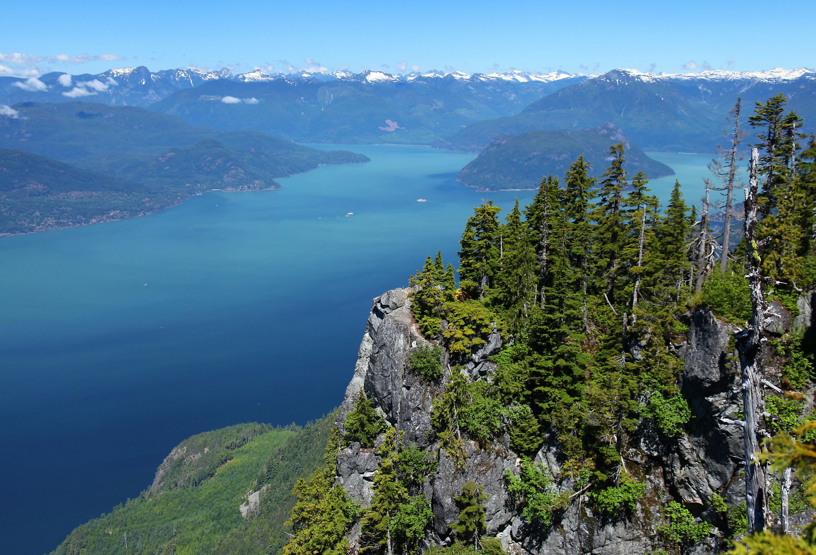
Situated roughly 0.95 miles northeast of Centre Creek, and 0.75 miles northwest of the Ramillies Channel, Douglas Bay is located in the northeast corner of Gambier Island. The Bay area comprises waterfront and non-waterfront acreages of privately owned lands and off-grid communities. The mouth of the bay opens on the Howe Sound that spans over 45 km long, along west Vancouver,and Sunshine Coast, home to Douglas Bay. The 500 ft deep sound was created by glaciers dating back to the Ice Age and surrounded multiple islands such as Bowen, Gambier, Anvil, and Keats Islands.
Climate

Douglas Bay enjoys a primarily warm climate with significant rainfall even during the driest months, with an average of 1089 m of rain annually. Max temperatures on the island are during the month of August, reaching an all-time high of 35 F. The mean annual temperature ranges from 9.2 to 10.5°C, and the absolute minimum temperature ranges from -21.1 to -11.7°C.
Ecology

Douglas Bay is part of the Coastal Douglas-fir Biogeoclimatic Zone, a strip of ecosystems on the narrow strip of southeast Vancouver.
The water depths and Mediterranean-like climates make it highly diverse in its species, home to numerous endangered wildlife in British Columbia. The many elements of a perfect environment are suitable for developing some of the richest flora and fauna ecosystems, including Garry oak ecosystems, wetlands, and shorelines.
History

Douglas Bay is one of the distant protected bays that Squamish people referred to as part of the Cha7élkwnech Island, whereas it was named Gambier by settlers in honor of James Gambier, a Newfoundland governor. Douglas Bay and surrounding areas were to become copper mines if not for the Island Trust Act in 1979, which aims to protect and preserve lands of unique amenities for environmental benefits.
Conclusion
Ultimately Douglas Bay is not an everyday destination to visit but would however be a memorable experience to explore. However, since Douglas Bay consists of mainly privately owned properties, the best way to see and explore is through its extensive trails across Gambier Island, featuring lakes such as Gambier and Damsoon Lake on their way.


