Cache la Poudre River, Colorado
The Cache La Poudre River is a 203 km long river that flows in the US State of Colorado. It is the state's only nationally designated "Wild & Scenic" River. The Cache La Poudre River watershed provides water supply for over 330,000 residents of the northern Colorado Front Range and helps to maintain approximately 185,000 acres of irrigated and dry agricultural lands. The Cache la Poudre River is vital to many communities in northern Colorado and has a significant economic impact on the area, supporting whitewater rafting, recreational fishing, and brewing industries. The federally designated Cache la Poudre River Corridor National Heritage Area extends 72 km along the river's flood plain. It helps to promote the area's cultural and heritage character and preserve the surrounding natural environment.
Course Of The Cache la Poudre River

The Cache la Poudre River originates from the Poudre Lake in the northern portion of the Rocky Mountain National Park and flows eastwards from the Continental Divide in Colorado's Front Range. From here, the river flows through the Poudre Canyon's Roosevelt National Forest. The Poudre River then emerges from the foothills at the northern portion of the city of Fort Collins. The river flows in the eastern direction across the Great Plains past the northern part of Greeley. The Poudre River finally drains into the South Platte River about 8 km east of Greeley. From its headwaters to its meeting with the South Platte River, the Poudre River lowers 7,000 feet.
Exploration And Naming Of The Cache la Poudre River
The Cache la Poudre River's original name was reported as "Pateros Creek," given by a perplexed Frenchman who discovered it after trekking for 20 days without food. According to a different tale told by C.A. Duncan, a son of an early settler, the river was given the name "Piteux Creek" by a pioneer who spent the winter of 1839–1840 close to its banks and nearly perished from cold. A Sioux tribe gave the river still another name, "Minni Luzaha," which translates to "Swift Current."
The final name given was Cache la Poudre. The rare French street name Cache la Poudre means "cache of powder" or, less officially, "hide the powder." A big group of French trappers traveled from St. Louis to Wyoming in 1836, and they camped in Colorado close to what would ultimately become the Cache la Poudre River, according to a possibly fictitious 1883 description provided by Abner Loomis to the Fort Collins Courier. The team tried to move on, but a strong snowstorm stopped them. Orders to lessen the loads on wagons were issued after the storm passed. Extra supplies were placed in a sizable pit that had been dug, which had been covered and disguised. Months later, the group returned and collected their cache. The term "Cache La Poudre," which would subsequently be given to the surrounding river, referred to the major part of the cache that was composed of gunpowder.
Brief History Of The Cache la Poudre River

Initially, the water from the Cache la Poudre River was used to fill the reservoir at the new water works plant, erected in 1882, although it couldn't be relied upon totally. The city of Fort Collins was forced to buy water rights from the owner of a neighboring ditch in 1889 since the river flow was so low. Fort Collins started the Colorado-Big Thompson project, which included building Horsetooth Reservoir in response to the city's 20th-century growth. Every Front Range city's water supply was severely stressed because of the region's post-World War II exponential growth. Sudden catastrophic floods frequently affected the adjacent settlements along the river. In 1864, a flood devastated Camp Collins, a military outpost in La Porte that was close to the river. The camp was moved and given the new name of Fort Collins by the military. The existing city of Fort Collins was founded even though no fort was ever erected, and it is still often flooded by the Cache La Poudre River.
Ecology Of The Cache La Poudre River

The 13-mile-long research region of the Poudre River is positioned between the downstream, warm-water, low-gradient reach in the Colorado high plains and the upstream, cold-water, steep-gradient system in the Front Range of the Southern Rocky Mountains. From its headwaters downstream through the city of Fort Collins, the Cache la Poudre River supports a variety of populations of wild trout. Brown trout, rainbow trout, cutthroat trout, and cut bow trout, are found in the river waters. Mule deer, elk, black bears, foxes, mountain lions, bobcats, moose, squirrels, and rabbits are some of the animals frequently seen near the river.
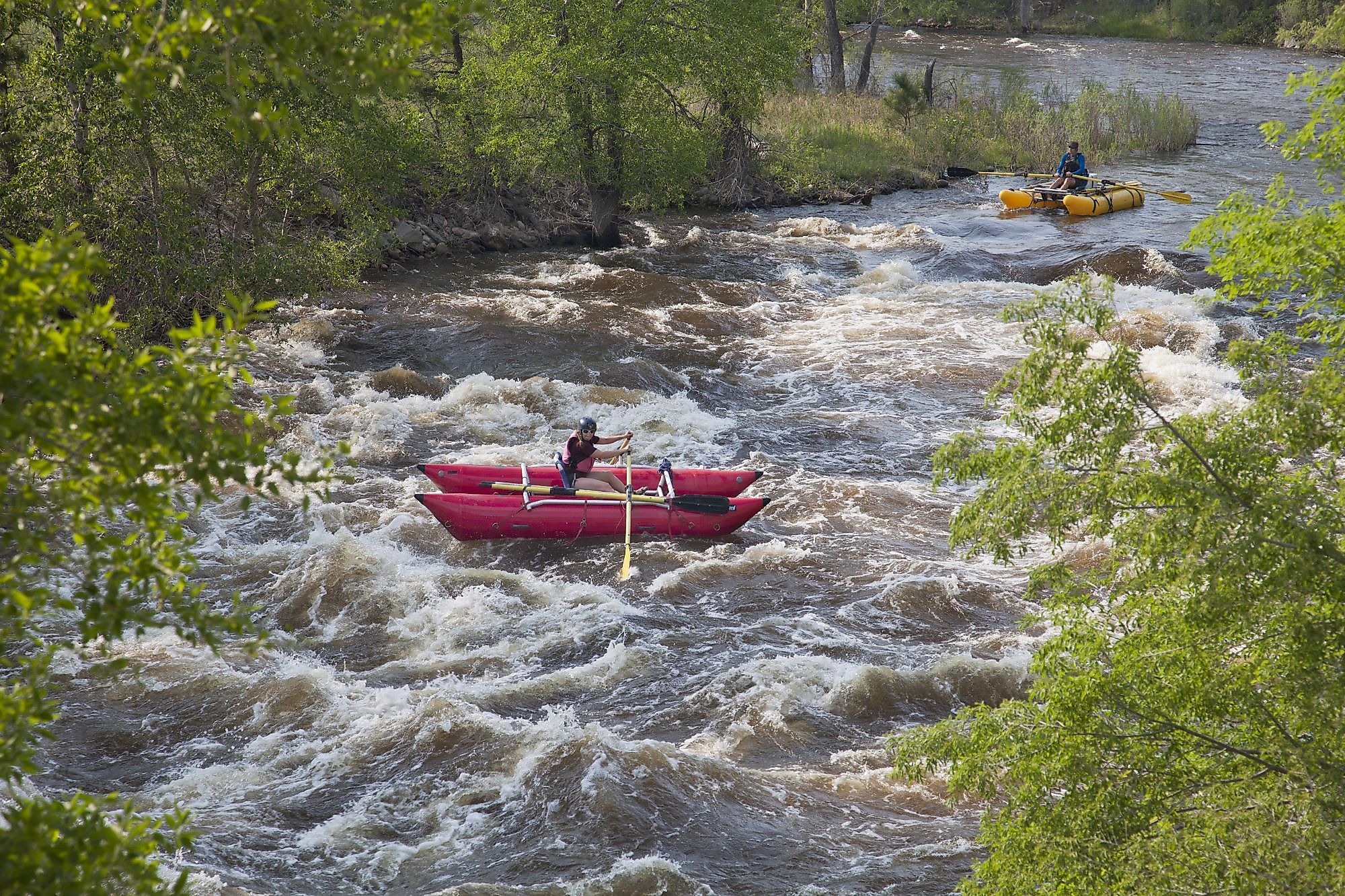
Recreation Along The Cache La Poudre River

The Cache la Poudre River offers several recreational activities, including camping, kayaking, fly fishing, and river rafting experiences. Along the river, RV and tent sites are available, and the majority are first come, first served. The Narrows, Ansel Watrous, Stove Prairie, and Mountain Park campgrounds along the river accept bookings for travelers. Poudre Canyon and areas leading to Poudre Lake are some of the best places for fly fishing. In addition, there are numerous paths for biking and hiking in the summer and cross-country skiing, snowshoeing, and snowmobiling in the winter. Between Windsor and Greeley, the Poudre River Trail follows the Cache la Poudre River for 21 miles over a beautiful route. Hikers, runners, cyclists, and inline skaters use this paved track.


