8 Great Road Trips to Take on the Atlantic Coast
Stretching 2,069 miles, the Atlantic Coast of the US possesses both historically significant cities and quirky cultural enclaves. Pass through New England's states, like New Hampshire and Massachusetts, all the way down to the tropical climate of the Florida Keys. You can take advantage of these trips by following the Florida Keys Scenic Highway all the way down to Key West, or indulging in American history on the New Hampshire Seacoast Ride. This is a part of the US where old American roots and beautiful scenery intertwine.
A1A Scenic & Historic Coastal Byway

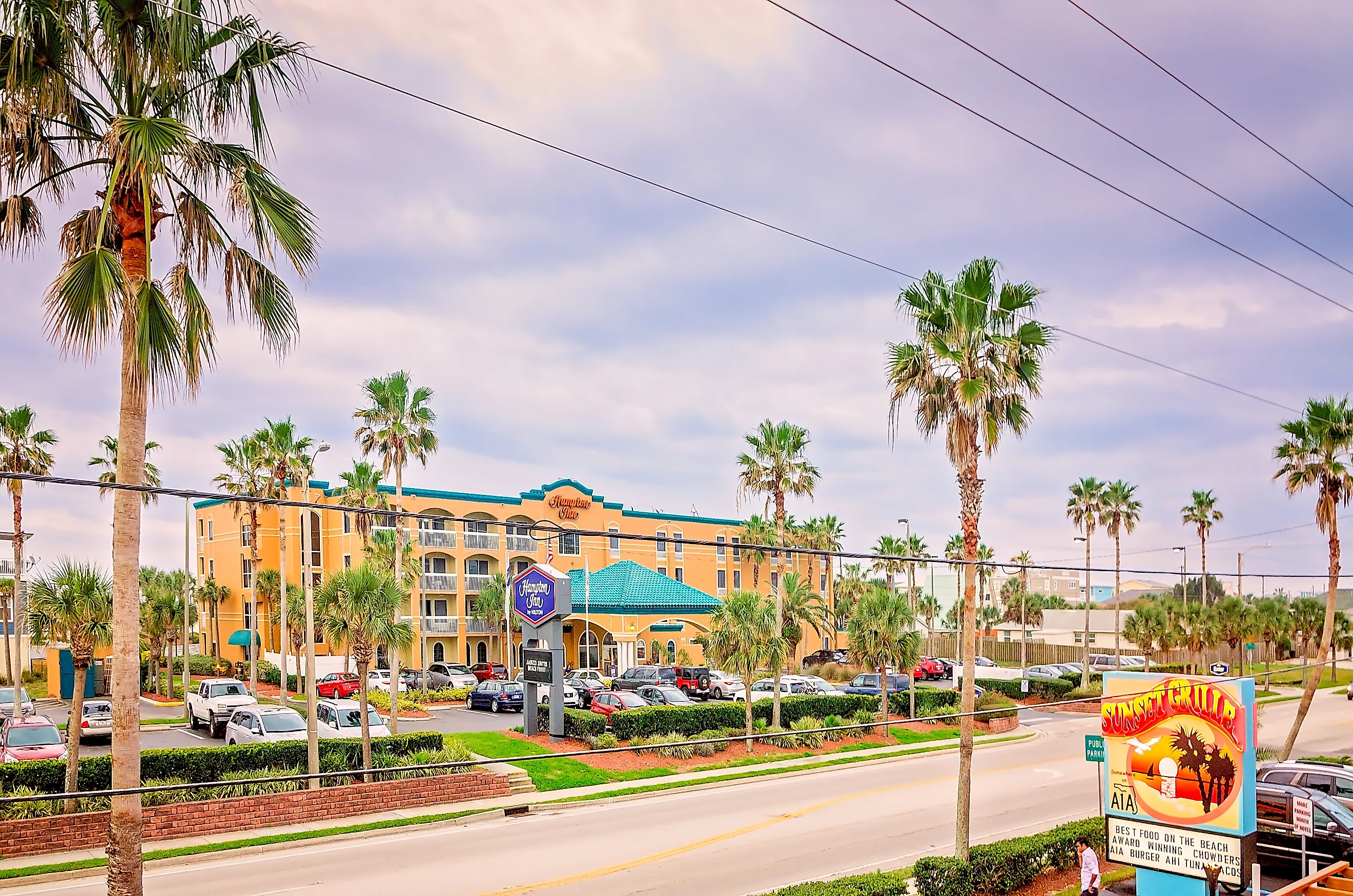
Florida's A1A Scenic & Historic Coastal Byway covers 72 miles along the northeast coast, beginning at the northern edge of St. Johns County near Ponte Vedra Beach and ending at Gamble Rogers Memorial State Recreation Area near Flagler Beach. The road follows State Road A1A through St. Augustine, Butler Beach, Crescent Beach, and Marineland.
The northern portion runs beside the Guana River and the wetlands of the Guana Tolomato Matanzas National Estuarine Research Reserve before reaching St. Augustine. Castillo de San Marcos and the St. Augustine Lighthouse make logical stops without requiring a major break in the route. South of the city, A1A returns to the barrier island and passes beaches, dunes, and the Matanzas River before reaching Fort Matanzas National Monument.
The road becomes increasingly exposed near Marineland and Flagler Beach, where the Atlantic sits immediately beside sections of A1A. That makes the final portion one of the parts where driving is the attraction rather than merely the way to the next stop. The entire route can be driven in roughly 90 minutes without stopping, according to Florida Scenic Highways, but half a day is more realistic if St. Augustine, Fort Matanzas, or the beaches are included.
Florida Keys Scenic Highway

US 1 becomes a very different highway once it reaches the Florida Keys. The Florida Keys Scenic Highway covers 110 miles and crosses 43 keys on its way south to Key West. Bridges and causeways repeatedly replace solid ground, making the roadway itself the defining feature of the trip. Key Largo is the first major stop, with John Pennekamp Coral Reef State Park just off US 1. Islamorada follows farther south, where short side roads lead toward the Gulf and Atlantic sides of the islands. Grassy Key and Marathon mark the transition into the Middle Keys.
The biggest change comes south of Marathon. Seven Mile Bridge carries US 1 across a broad stretch of open water toward the Lower Keys, with the old railroad bridge and Pigeon Key visible alongside part of the crossing. Bahia Honda State Park sits shortly beyond the bridge. Big Pine Key provides a worthwhile detour to the freshwater Blue Hole and Key deer habitat before the highway continues across more low islands toward Key West.
Outer Banks Scenic Byway

North Carolina's Outer Banks Scenic Byway requires both a car and two ferry crossings. The federally designated route includes about 138 driving miles plus another 25 miles aboard ferries, beginning at Whalebone Junction south of Nags Head and continuing across Hatteras Island, Ocracoke Island, Cedar Island, and the Down East mainland.
NC 12 carries the first leg south through Cape Hatteras National Seashore. Bodie Island Lighthouse appears early in the drive, followed by the undeveloped marshes and dunes of Pea Island National Wildlife Refuge. Rodanthe and the Chicamacomico Life-Saving Station come next, followed later by Cape Hatteras Lighthouse near Buxton.
At Hatteras, the road temporarily ends. The free Hatteras-Ocracoke vehicle ferry operates first come, first served, and NC 12 resumes on Ocracoke Island. After passing through Ocracoke Village, a second ferry crosses Pamlico Sound to Cedar Island. Reservations are available and recommended for the longer Ocracoke-Cedar Island crossing, particularly during busy periods. The mainland portion passes Cedar Island National Wildlife Refuge and low marshland before reaching the communities east of Beaufort.
Old King's Highway, Massachusetts

Route 6A takes the slower side of Massachusetts' Cape Cod. The complete highway covers about 62 miles, beginning near Bourne and eventually reaching Provincetown, although Route 6A merges into US 6 across part of the Outer Cape. The best-known Old King's Highway section passes through Sandwich, Barnstable, Yarmouth, Dennis, Brewster, and Orleans along the Cape Cod Bay side of the peninsula.
Sandwich provides an appropriate first stop, with the Dexter Grist Mill and Sandwich Glass Museum close to the route. Beyond town, Route 6A alternates between wooded sections, old residential areas, tidal creeks, cranberry country, and views across broad salt marshes. A side road toward Sandy Neck provides access to dunes and Cape Cod Bay.
Barnstable and Yarmouth Port keep the road close to the Cape's older village centers. Farther east, the drive through Dennis and Brewster includes tree-covered stretches broken by marshes leading toward the bay. The Cape Cod Museum of Natural History in Brewster sits beside one of those marsh systems. Drivers can continue through Orleans and use US 6 across Eastham and Wellfleet before Route 6A appears again in Truro. Its final section follows the bay side toward Provincetown.
New Hampshire Seacoast Ride

New Hampshire has only a short Atlantic shoreline, which makes it possible to drive most of it in a single afternoon. The state's Coastal Byway follows Routes 1B and 1A through Portsmouth, New Castle, Rye, North Hampton, Hampton, and Seabrook. Visit New Hampshire lists the designated drive at 18.5 miles, though the broader Route 1A/1B coastal corridor is often described as roughly 22 miles.
Begin in Portsmouth and cross onto New Castle using Route 1B. The road wraps around the island with views across the Piscataqua River and Portsmouth Harbor. Fort Constitution and Portsmouth Harbor Lighthouse sit near the northern end of New Castle before the route turns south toward Rye.
Route 1A then becomes a true shoreline road. Odiorne Point State Park provides access to rocky coast and tide pools, while Rye Harbor and Jenness State Beach break up the middle portion. Unlike longer Atlantic routes dominated by barrier islands, this drive shifts quickly between exposed rock, small coves, sandy beaches, and settled neighborhoods. Hampton Beach marks another change, with a denser beachfront strip before the road approaches the Hampton-Seabrook salt marshes. Without stops, the drive takes about an hour.
Chesapeake Country Scenic Byway

Maryland's Chesapeake Country Scenic Byway is the largest trip on this list. The current route covers 419 miles across the Eastern Shore, beginning in Chesapeake City and ultimately reaching Crisfield. Maryland recommends 12 to 17 hours of actual driving and five to seven days for the full trip.
This is a network of interconnected roads rather than one continuous highway, which suits the geography. MD 213 carries the trip through the upper Eastern Shore near Chesapeake City and Chestertown. Side routes lead toward Rock Hall and Eastern Neck National Wildlife Refuge before the drive continues toward Kent Island and the central Eastern Shore.
Around Easton, MD 33 leads toward St. Michaels and Tilghman Island. Another branch reaches Oxford, where the seasonal Oxford-Bellevue Ferry offers an alternative to driving around the Tred Avon River. The landscape becomes flatter and wetter around Cambridge and Blackwater National Wildlife Refuge. Roads such as MD 16 and MD 335 cross fields, creeks, and tidal marshes with relatively little elevation change. Farther south, MD 413 leads toward Crisfield and the edge of Tangier Sound.
Delaware Bayshore Byway

Delaware's Bayshore Byway follows the Delaware River and Delaware Bay coastline through some of the least developed sections of the state. The route begins in New Castle and works south toward Lewes using a network of two-lane roads. DelDOT describes roughly 100 miles of coastline, while the complete byway network totals about 157 route miles when branches and connections are included.
State Route 9 forms the backbone of the northern section. Leaving New Castle, the road passes Delaware City, the Chesapeake & Delaware Canal, Port Penn, and broad areas of tidal marsh. Bombay Hook National Wildlife Refuge is one of the strongest stops because its wildlife drive fits naturally into the road trip rather than requiring a long detour. South of Dover, the byway becomes less dependent on one numbered highway. Local roads reach Kitts Hummock, Slaughter Beach, Prime Hook National Wildlife Refuge, and other small Delaware Bay communities before the route approaches Lewes.
This drive is less about continuous ocean views than open coastal geography. Much of the road runs behind marshes and farm fields, with short roads leading east toward the bay. Spring shorebird migration can bring heavy activity around Delaware Bay, particularly near refuge areas, while coastal storms can affect low-lying roads. Allow at least two days if the wildlife refuges and waterfront side roads are part of the plan.
Bold Coast Scenic Byway, Maine

Maine's Bold Coast Scenic Byway provides a better northern bookend for an Atlantic Coast road-trip list than a generic East Coast highway. The Federal Highway Administration currently lists the National Scenic Byway at 147 miles, although some Maine tourism material continues to describe an earlier 125-mile version. The route begins around Milbridge and heads northeast through Washington County toward the Canadian border.
US 1 handles part of the trip, but the byway repeatedly leaves the highway for roads closer to the coast. State Route 187 loops through Jonesport before rejoining US 1 near Jonesboro. At East Machias, Route 191 heads toward Cutler and the Cutler Coast Public Lands, where a hiking stop gives access to cliffs and spruce-fir forest above the Gulf of Maine.
Route 189 then reaches Lubec. A short side road leads to West Quoddy Head State Park at the eastern edge of the United States. Continuing inland reconnects with US 1 near Whiting, after which the road skirts Cobscook Bay before Route 190 crosses causeways toward Eastport. This is a slower road than the mileage suggests. The route moves between US 1, smaller state highways, fishing communities, blueberry barrens, forest, tidal bays, and peninsulas.
Choosing Which Route to Take
The amount of time available narrows the choices quickly. New Hampshire's Coastal Byway fits into an afternoon, while Florida's A1A and Cape Cod's Route 6A work well as day trips. The Florida Keys need at least a full day even though the highway covers only 110 miles because bridges, parks, and limited alternate roads slow the pace.
The Outer Banks adds ferry schedules to the equation, and Chesapeake Country is substantial enough to treat as a multi-day trip. Delaware's Bayshore and Maine's Bold Coast occupy the middle ground, with enough side roads and natural areas to reward an overnight stop. What connects all eight is that the road follows the geography instead of bypassing it. Causeways cross the Florida Keys, ferries fill gaps in North Carolina's NC 12, Route 1A stays beside New Hampshire's shore, and roads around Chesapeake Bay repeatedly bend around rivers and tidal marshes.