Maps of Prince Edward Island
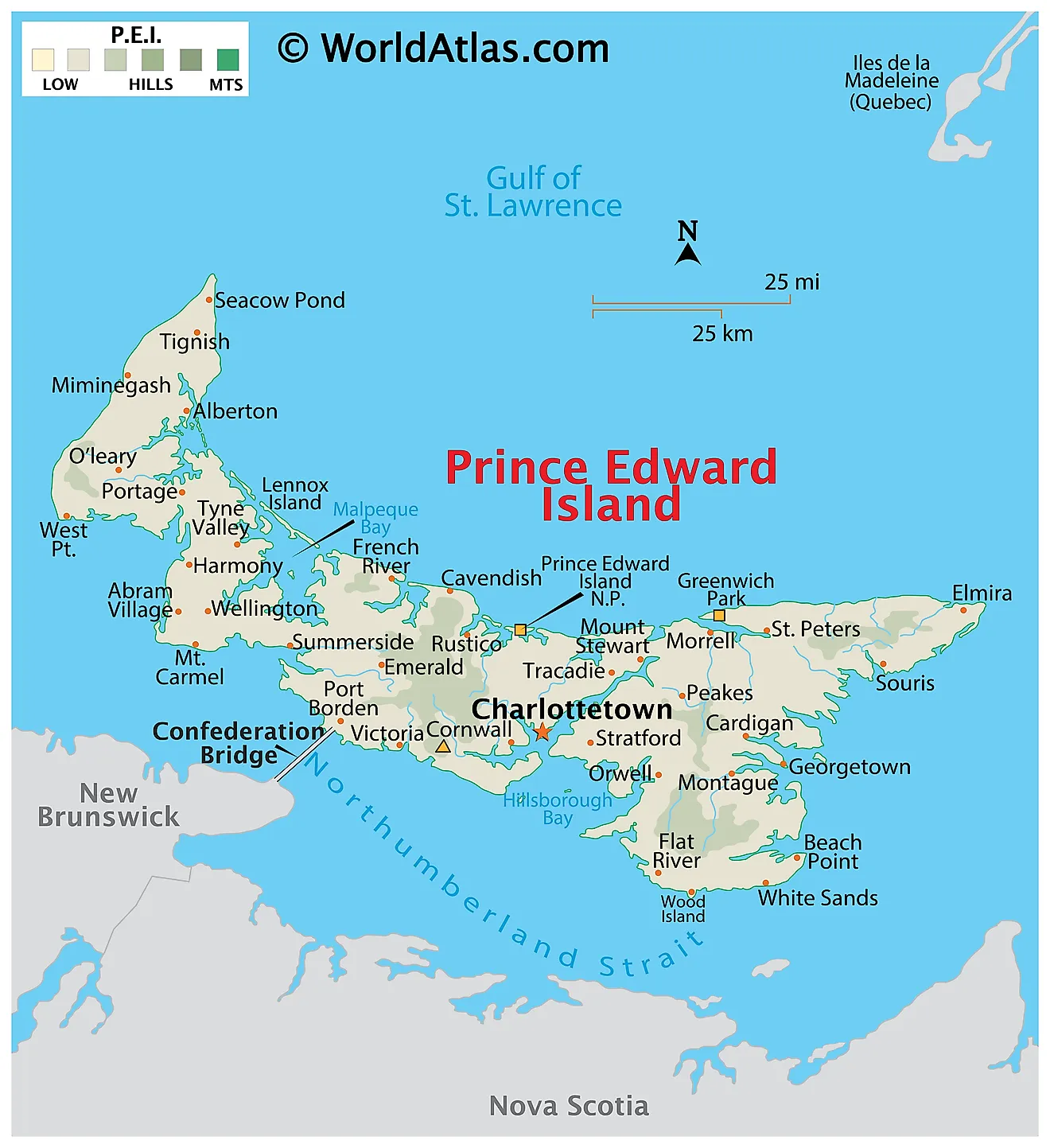
Prince Edward Island, located in the Gulf of St. Lawrence, is one of Canada's ten provinces. It sits in the Atlantic region, bordered by New Brunswick to the west, Nova Scotia to the south, and Newfoundland and Labrador to the east. The Northumberland Strait separates the island from the mainland. Prince Edward Island has a total area of 2,185 square miles, making it the smallest province in Canada. Numerous small streams and rivers are found here. However, there are no major lakes on Prince Edward Island.
The geography of Prince Edward Island can be divided into three distinct regions: the Eastern Coastal, Central Lowland, and Western Coastal regions.
The Eastern Coastal region features white sandy beaches, towering red sandstone cliffs, and picturesque fishing villages. The region is known for its coastal dunes and barrier islands, which form a significant part of the island's shoreline. Greenwich Dunes, part of the PEI National Park, is a prime example of the area's unique coastal geography. The Hillsborough River is the largest river in this region, winding through the landscape and providing a habitat for various wildlife species.
The Central Lowland region is characterized by gently rolling hills, fertile soil, and mixed forests. The agricultural heartland of Prince Edward Island, this region is famous for its potato production, which contributes significantly to the island's economy. The largest body of water in this region is the Hillsborough Bay, with several rivers draining into it, such as the West River and the Wilmot River. This area also includes the capital city of Charlottetown, situated on the southern shore of the bay.
The Western Coastal region is distinguished by its rugged coastline, with red sandstone cliffs and expansive sand dunes. It is home to the North Cape, the northernmost point of Prince Edward Island, which is known for its wind energy production. This region is also home to several bays, such as Malpeque Bay, which supports the island's renowned oyster industry. In this area, one can find the Mill River and Trout River, both of which contribute to the rich aquatic ecosystem.
Provinces Map
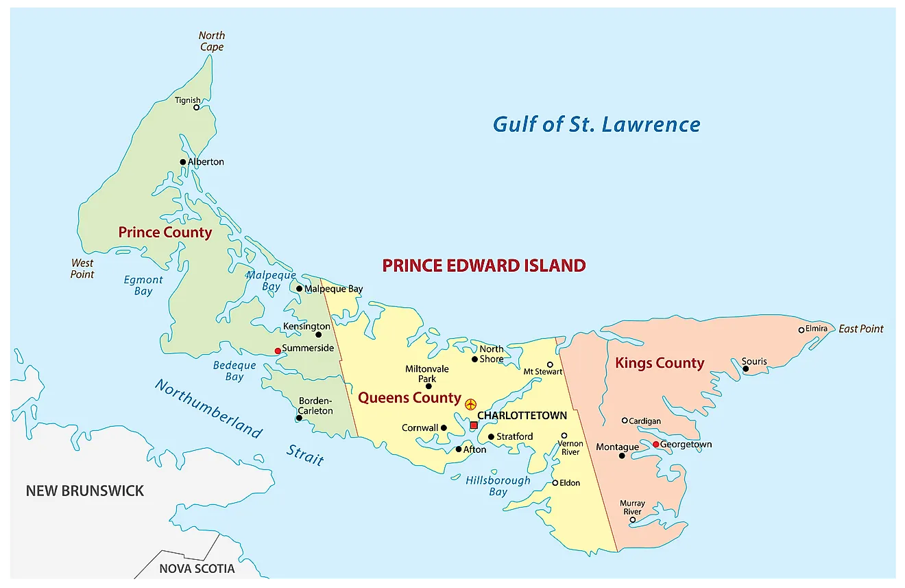
The Canadian Province of Prince Edward Island is divided into 3 counties. In alphabetical order, these counties are Kings, Prince and Queens. The Province is further divided into a total of 63 municipalities. Of these 63 municipalities, there are 2 cities, 10 towns, 50 rural municipalities, and 1 resort municipality.
With an area of 5,686 sq. km, Prince Edward Island is the smallest and the least populous Canadian province. Located in the southern shore of the Island on the Charlottetown Harbor is Charlottetown – the capital and the largest city of Prince Edward Island. The famous “Charlottetown Conference” which resulted in the creation of the Canadian Confederation was held here in 1864. The city is thus also referred to as the “Birthplace of Confederation”.
Where is Prince Edward Island?
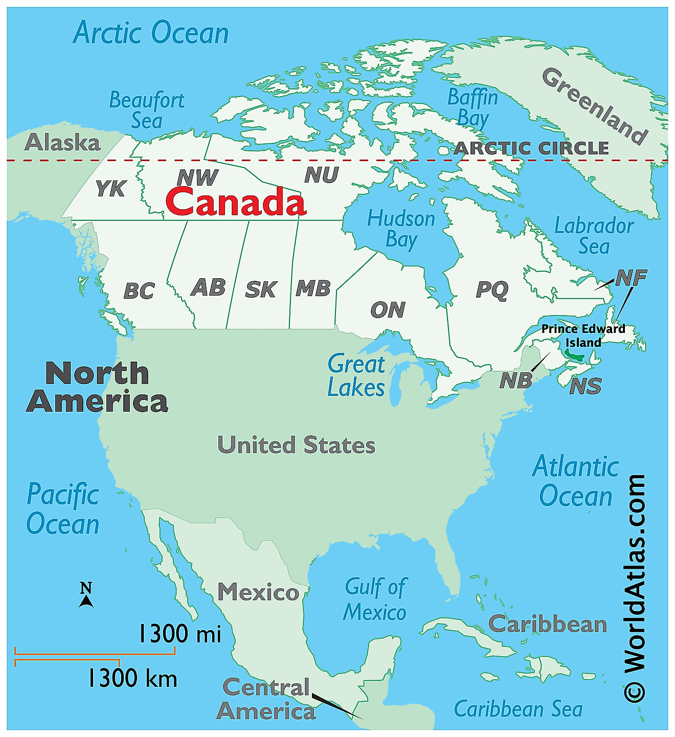
The Province of Prince Edward Island is located in the Canadian Maritimes region, in the eastern part of Canada, in the continent of North America. It is geographically positioned in the Northern and Western hemispheres of the Earth. The island is situated in the Gulf of St. Lawrence and is bounded by the Northumberland Strait in the south and west. The Prince Edward Island is placed to the east of the Canadian province of New Brunswick; to the north of the Nova Scotia peninsula and the west of Cape Breton Island.
Regional Maps: Map of North America
Outline Map of Prince Edward Island
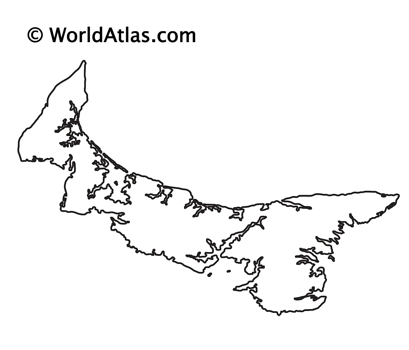
The above blank map represents the Province of Prince Edward Island, located in the Canadian Maritimes region, in the eastern part of Canada. The above map can be downloaded, printed, and used for geography education purposes like map-pointing and coloring activities.
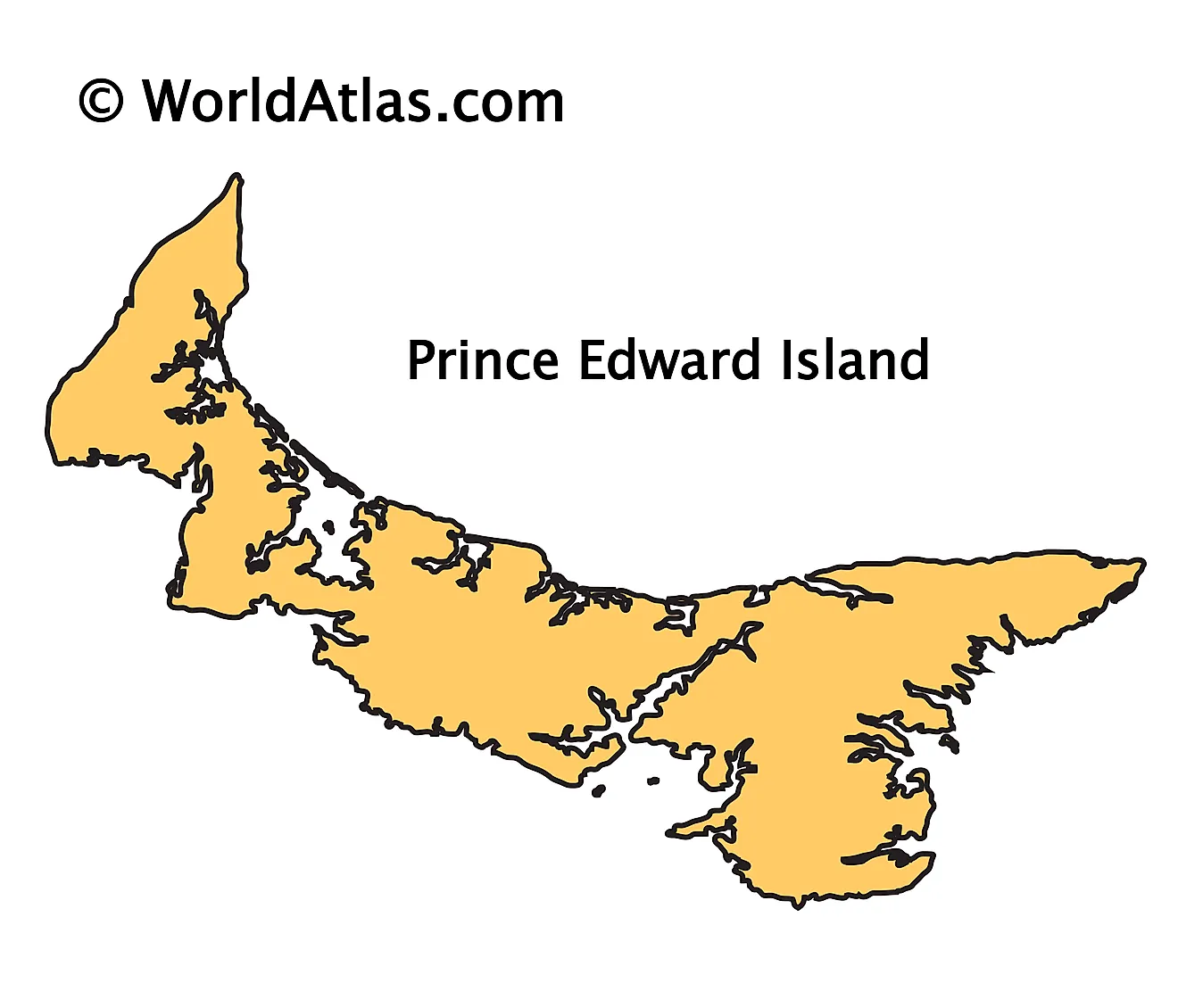
The above outline map represents the Province of Prince Edward Island, located in the Canadian Maritimes region, in the eastern part of Canada.
Key Facts
| Legal Name | Province of Prince Edward Island |
|---|---|
| ISO 3166 Code | CA-peiz |
| Capital City | Charlottetown |
This page was last updated on March 30, 2023


