10 Great Road Trips to Take on the Pacific Coast
Along the Pacific Coast, a tank of gas can carry you past ocean bluffs, volcanic peaks, and old-growth redwoods, with many of the best views sitting right beside the road. The drives here run through California, Oregon, and Washington, some hugging the shoreline and others crossing high mountain passes. In Oregon, US 101 follows roughly 340 miles of coast between Astoria and Brookings, passing the Oregon Dunes and, near the end, the Arch Rock and Natural Bridges pull-offs. Washington's North Cascades Highway climbs to 5,477 feet at the Washington Pass Overlook, with views of Liberty Bell Mountain. California's Redwood Highway leads onto the 31-mile Avenue of the Giants through Humboldt Redwoods State Park on its way to Crescent City. These ten great road trips showcase the Pacific Coast at its most varied, with lots of reasons to stop or pull over.
US 101, Astoria to Brookings (Oregon)

By taking US 101, you can follow the Oregon coast for nearly its entirety, roughly 340 miles from Astoria to Brookings. The road winds along the ocean, inland past bays, farmland, and forest, and even past the central dunes and then the cliffs of the southern part of the coast. The trip starts at the Astoria-Megler Bridge and heads south to Cannon Beach, up the shoulder of Neahkahnie Mountain in the Oswald West State Park and on to Tillamook. From there, you can take the Three Capes Scenic Route detour, which loops along the shore and eventually rejoins the highway. Past Newport and Yaquina Bay Bridge, a side road takes you up the cliffs of Cape Perpetua, the highest viewpoint you can drive to on the Oregon coast.
You'll pass Heceta Head with its iconic lighthouse and continue on to Florence, then Coos Bay. The Oregon Dunes National Recreation Area is about 40 miles long, and it's best to pull off here to witness it properly rather than hidden behind the trees along the highway. The trip starts to come to an end as you hit Bandon, Port Orford, and Gold Beach, with the finale being the Samuel H. Boardman State Scenic Corridor. Here you'll be able to access the Arch Rock, Natural Bridges, and Cape Ferrelo pull-offs. All in all, it's an easy route to take at your own speed, with towns and rest stops coming often enough that you can stop to stretch your legs and not have to worry about hitting empty.
Historic Columbia River Highway, Troutdale to The Dalles (Oregon)

This old road winds through the Gorge for about 70 miles. Built between 1913 and 1922, it takes you from wet forest to dry grassland. To start, leave I-84 at exit 17 in Troutdale and follow US 30, the Historic Highway, east. From Troutdale, the road climbs above the Sandy River to the Portland Women's Forum State Scenic Viewpoint and Vista House, then drops into the waterfall corridor. The route takes you past falls like Latourell, Bridal Veil, Multnomah, and Horsetail. The century-old viaducts on either side of Multnomah Falls reopened in May 2026 after repairs, though they're limited to vehicles under 35 feet.
From late May to early September, you'll need a timed-use permit to park at the I-84 Multnomah Falls lot. The old road rejoins I-84 near Ainsworth State Park, and you stay on the interstate past Hood River, because the original highway between Hood River and Mosier is now the car-free Twin Tunnels trail. Take exit 69 in Mosier to rejoin US 30. From there, it runs past Memaloose Overlook, up to Rowena Crest Viewpoint, and down the Rowena Loops to The Dalles. It's fantastic for wildflowers in April and May.
Rogue-Umpqua Scenic Byway, Roseburg to Gold Hill (Oregon)

This route runs alongside one river into the High Cascades, then brings you back down another, over about 172 miles. It combines OR 138, OR 230, OR 62, and OR 234 between Roseburg and Gold Hill, and becomes a loop if you take I-5 back to the starting point. It's generally considered an eight-hour journey, though you can add time by taking the Crater Lake detour. Heading east from Roseburg on OR 138, you'll reach Glide, where the North Umpqua and Little River meet at the Colliding Rivers Viewpoint. The road follows the North Umpqua into the Umpqua National Forest, where short trails lead to waterfalls like Susan Creek, Fall Creek, and Clearwater Falls. Past Lemolo Lake is Diamond Lake, which sits between Mount Thielsen and Mount Bailey.
Near the southern tip of the lake, you'll switch to OR 230 and follow the Rogue River, joining OR 62 north of Union Creek. The Rogue Gorge features a collapsed lava tube, and a few miles south at Natural Bridge, the river runs underground through another. Downstream, a dam backs the river up into Lost Creek Lake, and OR 62 and OR 234 then cross valley country to Gold Hill. The Crater Lake detour starts at the park's North Entrance near Diamond Lake, where the 33-mile Rim Drive circles the lake. It's typically fully open from mid-July to November 1st, though an early snowstorm can close it sooner. The North Entrance Road closes at the same time but usually opens between mid-May and late June. For part of this past summer, construction on East Rim Drive blocked the full loop.
North Cascades Highway (SR 20), Burlington to Winthrop (Washington)

SR 20 is the northernmost road across the Washington Cascades. The road takes you from the Skagit River farmland to the Methow Valley. You'll start from I-5 in Burlington and follow the road east to Winthrop for about 130 miles. The main stretch, from Rockport to Winthrop, is around 95 miles. The Skagit River will lead you through Sedro-Woolley, Concrete, and Rockport straight to Marblemount. This is the last place to stop for gas for the next 75 miles. In Newhalem, you can stop to rest at the North Cascades Visitor Center, or continue to the Diablo Lake Overlook.
Just past the overlook, a trailhead at milepost 134 leads down to Ross Dam. The road then ascends to Rainy Pass, where the Pacific Crest Trail and Rainy Lake offer options to get out for a hike. The highest point of the journey will be the Washington Pass Overlook, at 5,477 feet, with views of Liberty Bell Mountain. You'll then drop down along Early Winters Creek and on to Mazama and Winthrop. This road trip is absolutely stunning in the fall when the larches change, and it's one of your last chances to take the drive before a portion of it closes for the winter.
Olympic Peninsula Loop (US 101) (Washington)

The Olympic Peninsula Loop circles the Olympic Mountains, taking in saltwater lowlands, a subalpine ridge, rain forest valleys, and the Pacific coast. You'll start at Discovery Bay, at the junction of US 101 and SR 104, then head west through Port Angeles before the highway turns south through Forks and on to Aberdeen. To complete the loop, take US 12 east to Elma, then SR 8 east to rejoin US 101 west of Olympia. From there, the road heads north through Shelton and along Hood Canal. The loop is about 330 miles before side trips.
Along the way, you'll pass the lavender farms around Sequim and the shore of Lake Crescent. Two of the best stops are dead-end spur roads off the highway. Hurricane Ridge Road climbs 17 miles from Port Angeles into the mountains, and the Upper Hoh Road runs about 18 miles into the Hoh Rain Forest and its trails. Back on 101, you'll reach the coast at Ruby Beach and follow the bluffs past Kalaloch before turning inland to Lake Quinault. Be aware that from about late November through March, Hurricane Ridge Road is generally open only Friday through Sunday and on holiday Mondays, weather permitting.
Whidbey Island to Chuckanut Drive, Mukilteo to Bellingham (Washington)

This is one of the most distinctive trips on the list, with a ferry, an island, and a cliffside road above Samish Bay. You'll start in Mukilteo and end in Bellingham's Fairhaven district, about 95 miles plus the ferry ride. It links two scenic byways, starting with the Whidbey Scenic Isle Way between Clinton and Deception Pass and finishing on Chuckanut Drive, which runs about 21 miles from the north edge of Burlington to Fairhaven. The Washington State Ferries crossing from Mukilteo to Clinton takes about 20 minutes and is busiest in the summer, so arrive early. From Clinton, SR 525 runs up the island's spine through Freeland and Greenbank, past fields, forests, and peekaboo views of the water, to SR 20 just south of Coupeville. A side road there leads to Ebey's Landing National Historical Reserve and its bluffs above Admiralty Inlet.
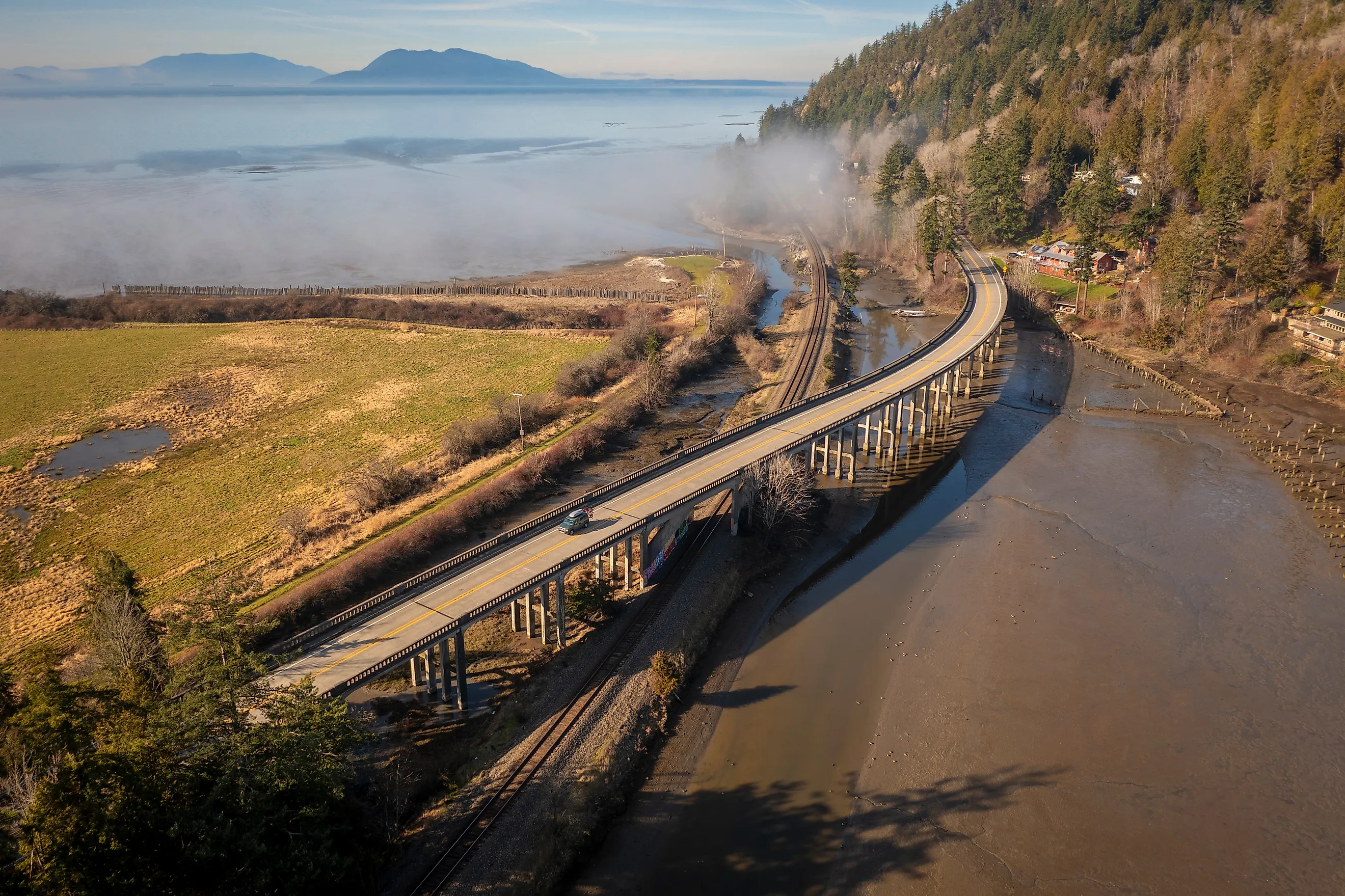
Back on SR 20, you'll continue north to Oak Harbor and on to Deception Pass State Park, where you can park and walk the bridge over the tidal channel. The highway then crosses Fidalgo Island and the Skagit flats to Burlington. Head one exit north on I-5 and take exit 231 onto Chuckanut Drive. The next nine miles or so are farmland, with detours like the village of Edison for those who want to explore some more. You'll then climb into the Chuckanut Mountains, hugging the cliffs above Samish Bay with stunning views of the San Juan Islands before passing Larrabee State Park and ending in Fairhaven.
Chinook Scenic Byway (SR 410), Enumclaw to Naches (Washington)

This road takes you through Mount Rainier National Park with magnificent views of the Cascades, topping out at 5,430 feet at Chinook Pass. The drive starts in Enumclaw, climbs to Chinook Pass, then drops into the Naches Valley. It's about 90 miles from start to finish, with plenty of stops in between for sightseeing. Once in Naches, you can loop back west over White Pass. East of Enumclaw, the road follows the White River and winds past Federation Forest State Park to Greenwater, your last real supply stop. Past Crystal Mountain Boulevard, the highway enters the national park. At the White River Entrance, you can detour about 15 miles up Sunrise Road to Sunrise, the highest point you can drive to in the park.
Back on SR 410, you'll reach Cayuse Pass at the SR 123 junction, then take the switchbacks up to Tipsoo Lake and Chinook Pass, where the Pacific Crest Trail crosses. Tipsoo Lake is a perfect place to stretch your legs and take it all in on its short shoreline trail. Continuing east, the road drops along the American River and then the Naches River through pine forest, past the Boulder Cave area. For the finale, you'll drive past the orchards around Naches. The full route is open only from late spring through fall because the stretch over Chinook Pass closes every winter, usually in November. Sunrise Road has a shorter season, typically from early July to late September or early October.
Redwood Highway (US 101), Leggett to Crescent City (California)

A stretch of US 101, this road links the two biggest concentrations of old-growth coastal redwood and offers three side roads that take you into the depths of it all. It runs about 175 miles between Leggett and Crescent City if you take it straight, though the side roads are highly recommended for the scenic route. Start by taking the Phillipsville exit north of Garberville onto the Avenue of the Giants, a 31-mile road through Humboldt Redwoods State Park that parallels US 101 to Pepperwood. Stop at Founders Grove and head west on Mattole Road into Rockefeller Forest along Bull Creek before rejoining 101 through Eureka and Arcata. Past Trinidad and the lagoons south of Orick, turn up Bald Hills Road just north of town to Lady Bird Johnson Grove.
The Newton B. Drury Scenic Parkway then runs ten miles through Prairie Creek Redwoods State Park before you rejoin 101 and cross the Klamath River. Once you reach Crescent City, Howland Hill Road continues ten miles through Jedediah Smith Redwoods State Park to the Smith River, though about half of it is gravel and its gate is locked each evening. The highway alternates between redwood flats, open coastline, and river crossings, and each side road is a short detour. Bald Hills and Howland Hill roads are both narrow and not suited to trailers or large RVs, and Bald Hills Road can close during storms. In summer, expect fog along the coast and in the northern groves, while the inland Avenue of the Giants is usually clear and warmer.
Volcanic Legacy Scenic Byway (SR 89), Lassen to Mount Shasta (California)

This drive links Lassen Park, home to the southernmost active volcano in the Cascades, to Mount Shasta, the largest volcano in California. It's roughly 130 miles from Lassen Volcanic National Park's southwest entrance to just south of the town of Mount Shasta. The 30-mile park highway starts at the Kohm Yah-mah-nee Visitor Center and passes a roadside hydrothermal area called Sulfur Works. You'll then climb past the Bumpass Hell trailhead and Lake Helen, reaching a high point of 8,512 feet near the Lassen Peak trailhead. The road then descends past Summit Lake and the Devastated Area caused by the 1914-1917 eruptions, and down to Manzanita Lake.
You'll leave the park on a road that heads north to Old Station, which features Subway Cave, a walkable lava tube. Continue on to the Hat Creek valley and pass through lava plateaus, pine forests, and streams before passing McArthur-Burney Falls Memorial State Park. Here you can experience the 129-foot falls. You'll complete the drive by heading through the town of McCloud, with a magnificent view of Mount Shasta. This drive is only one stretch of the roughly 500-mile wonder that is the Volcanic Legacy Scenic Byway, but it's perfect for a weekend road trip. The park highway does close after the first heavy snow and usually doesn't reopen until early summer, and the Bumpass Hell Trail is often snow-covered into July.
Trinity Scenic Byway (SR 299), Redding to Arcata (California)

SR 299 is the major route from the northern Sacramento Valley to the north coast. It's incredibly varied, starting in valley oak country, crossing summits, following river canyons, and ending in the redwoods along the coast. It's roughly 150 miles, and services between towns are thin, so gassing up in Weaverville or Willow Creek is highly recommended. West of Redding, the road passes Shasta State Historic Park before following the north shore of Whiskeytown Lake, with the option to take Crystal Creek Road up to the trailhead for Whiskeytown Falls. The highway climbs over Buckhorn Summit and drops toward the Trinity River.
While in Weaverville, you can stop at the Joss House, an 1874 Taoist temple and the oldest continuously used Chinese temple in California. Past Junction City, SR 299 follows the Trinity River for close to 50 miles through the small communities of Big Bar, Del Loma, Burnt Ranch, Hawkins Bar and Salyer, a steep, dry canyon with river-access pull-offs along the way. Once you hit Willow Creek, you can take SR 96 toward the Klamath River, or continue on SR 299 through Douglas firs and redwoods before descending along the Mad River past Blue Lake to US 101 at Arcata, where the road connects directly to the Redwood Highway.
Picking the Right Season for a Pacific Coast Road Trip
Timing is the deciding factor for most of these trips, since winter brings road closures, especially in the mountains. These include the North Cascades stretch of SR 20, Chinook Pass, Crater Lake's Rim Drive and North Entrance Road, and the Lassen Volcanic National Park Highway. Most reopen between late spring and early summer, making them ideal for a summer trip. If you're hoping to hit the road soon, Crater Lake National Park stays open all winter, with Highway 62 and the road to Rim Village plowed year-round. Coastal routes, such as the Whidbey Island trip, are also open year-round.