Why Some Mountains Are Flat On Top
Grand Mesa in western Colorado has a summit plateau of roughly 500 square miles, a tabletop broad enough to hold more than 300 lakes. Around the mesa, softer rock beneath its basalt cap has steadily eroded while the resistant summit has endured. Similar geological processes can leave mountains flat on top, whether the protective cap is sandstone or volcanic rock cooled beneath a glacier. Four mountains on four continents reveal how these striking landforms developed.
Grand Mesa
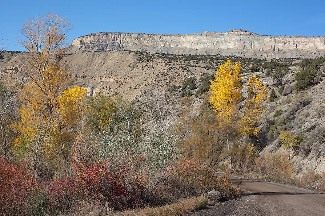
Grand Mesa rises about 6,000 feet above the Colorado River and Gunnison River valleys that flank it, reaching roughly 11,000 feet at its highest point east of Grand Junction. It did not start out as a mountain. The basalt now forming its cap once poured across a valley floor as lava, burying the low ground in rock far harder than anything around it. Then the Colorado River cut down through the surrounding sedimentary layers, and the basalt-capped valley floor stayed put while everything beside it wore away. The valley eventually became the high ground, hence the reason for the flat top.

Geologists call this process topographic inversion, and Grand Mesa is considered one of the largest flat-topped mountains in the world by surface area. The plateau today falls inside Grand Mesa National Forest, where more than 300 alpine lakes, many now used as reservoirs, sit atop the basalt. Winter snowfall on the mesa regularly tops 300 inches. Summer hikers reach the rim on marked Forest Service trails from the Lands End and Crag Crest trailheads, the latter a nearly 11-mile loop along the plateau's spine with modest elevation gain once the rim is reached.
Table Mountain

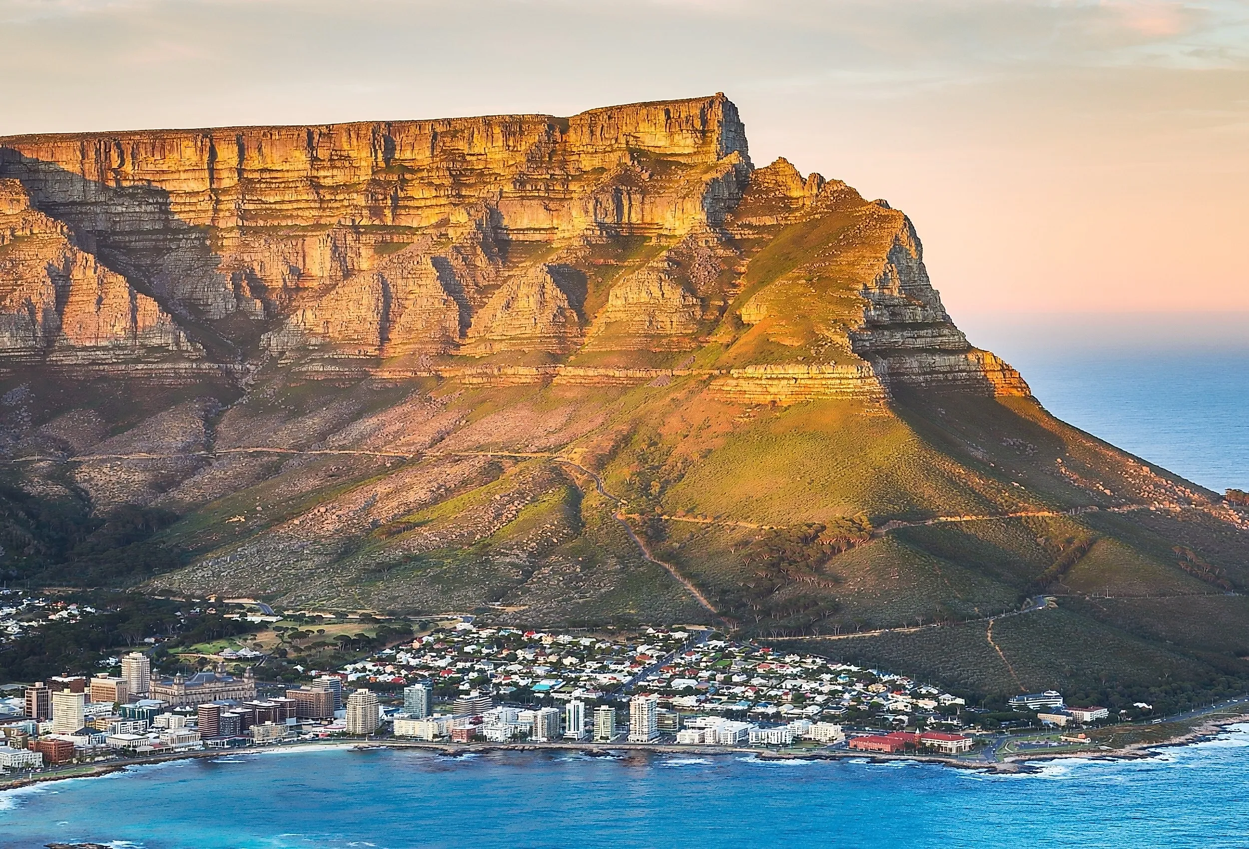
Table Mountain, overlooking Cape Town, South Africa, reaches 3,558 feet above the city. The mountain has a summit plateau long enough that a full cable car ride covers the main viewing points in under ten minutes. Its flat top is made of Table Mountain Sandstone, a hard, quartz-rich rock. The mountain formed as a syncline, meaning its plateau was originally the floor of a shallow basin, not a peak. Layers of softer shale and other sedimentary rock once sat above that sandstone floor and around it. Over millennia, that softer material eroded away on every side, leaving the resistant sandstone standing as the flat summit seen today, framed by Devil's Peak and Lion's Head roughly 3 miles apart.
Portuguese navigator António de Saldanha made the first recorded ascent in 1503. Today, most visitors reach the plateau by the cable car that has operated since 1929, while hikers take routes like Platteklip Gorge, a direct, roughly 2.2-mile trail with about 2,300 feet of elevation gain, steep and exposed enough that guides recommend an early start and caution in wind or fog. Table Mountain National Park draws about 4.2 million visitors a year to the mountain and the wider Cape Peninsula.
Mount Roraima And The Ancient Tepuis
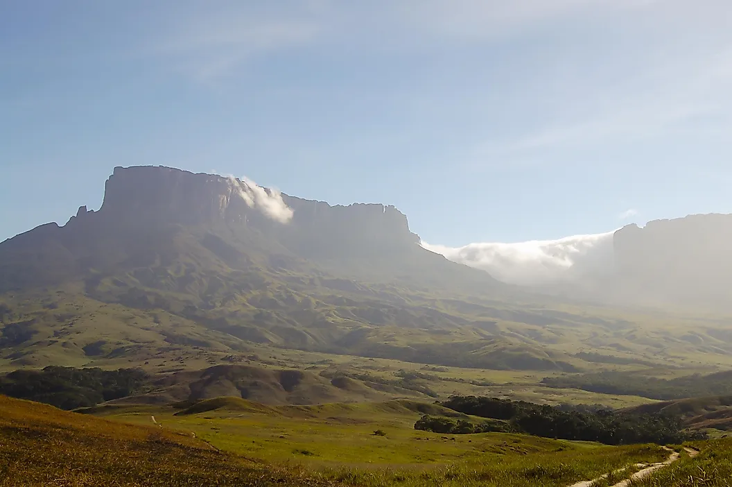
Mount Roraima, on the shared border of Venezuela, Guyana, and Brazil, tops out at 9,220 feet. It carries a summit plateau more than 6 miles long, edged by cliffs that drop nearly 1,300 feet on several sides. It belongs to a class of flat-topped mountains called tepuis, a Pemon word meaning "house of the gods," built from sandstone that is among the oldest exposed rock formations on Earth.
Unlike Grand Mesa or Table Mountain, Roraima's summit is nearly pure silica sandstone with almost no soluble minerals left in it, stripped out over geologic time by relentless equatorial rainfall. That chemical weathering, rather than a river cutting a valley, is what left the plateau standing while the surrounding lowland sandstone dissolved and washed away. The result is a summit with sinkholes, quartzite spires, and a cave network exceeding 15 km. It has been isolated long enough that Roraima's summit hosts endemic species found practically nowhere else, including the Roraima toad. British colonial officer Everard im Thurn and Harry Perkins led the first recorded ascent in 1884, using a natural ramp. For more on how tepuis differ from other tabletop formations, see what defines a tepui.
Herðubreið: A Volcano Shaped By Ice
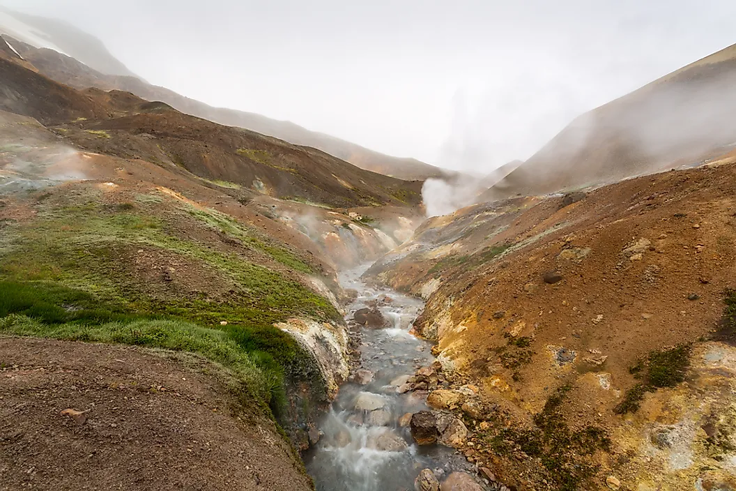
Herðubreið, in Iceland's eastern highlands, reaches 5,518 feet and owes its flat top to a mechanism unrelated to erosion entirely. It is a tuya, a volcano that erupted underneath a glacier roughly 800 meters thick during the last ice age. Magma rising into that ice first cooled and shattered into hyaloclastite, a jumbled volcanic rock, then built up in pillow-shaped layers as it kept erupting into meltwater trapped beneath the ice sheet. Once the growing volcanic pile finally broke through the surface of the ice, the eruption behaved like an ordinary lava flow, spreading sideways rather than up and capping the pile with a flat sheet of basalt. That sequence: confined eruption below, open eruption above, is why tuyas end up flat-topped and steep-sided rather than cone-shaped.

Icelandic geologists used the term after studying formations like this one, though the type locality is Tuya Butte in British Columbia, Canada, first analyzed by geologist Bill Mathews in 1947. Icelanders voted Herðubreið the country's national mountain in 2002, and it is often called the Queen of Icelandic Mountains. Hans Reck and Sigurður Sumarliðason made the first confirmed ascent in 1908; the mountain's loose, crumbling rock still makes the summit push technical and dangerous, and it sees far fewer ascents than the highland hiking trails around its base at Herðubreiðarlindir.
What A Flat Summit Actually Records
A flat-topped mountain is not a coincidence of shape. It is a record of whatever proved harder to erode than everything around it, whether that is a lava flow that filled an old valley, an ancient sandstone basin turned inside out, silica-rich rock too pure for rainfall to dissolve, or magma that had nowhere to go but sideways under a glacier. Each of the four processes here, topographic inversion, synclinal exposure, chemical weathering of pure sandstone, and subglacial volcanism, produces a mountain with a table for a summit, but for reasons that have almost nothing to do with each other.