The World's Largest Endorheic Lakes Explained
Lakes might appear static, but the vast majority are anything but. Many act as temporary holding basins for water on its journey to the ocean, linked by rivers that flow into and out of them. But this isn’t always the case: some lakes are drainage basins—one-way systems where rivers flow in, but there’s no outflow. These are called endorheic lakes, and their isolation from the global ocean defines them. Although few of us use that term in everyday conversation, some of the world’s best-known lakes exhibit this drainage pattern.
What Are Endorheic Lakes?
At its most basic, an endorheic lake is a lake with no natural outflow. In other words, water collects and remains in the basin until it evaporates. Although rivers often feed these lakes, they are far more affected by evaporation than most lakes.
Also called endorheic basins, these lakes have several unusual features. Most notably, they tend to be extremely saline compared to typical freshwater lakes. This is partly due to their geography: endorheic lakes are usually found in landlocked, arid regions where there isn't enough rainfall to dilute the salts that accumulate as water evaporates. As a result, several of the largest endorheic lakes are known for their salinity.
Endorheic lakes are also delicate ecosystems that are highly sensitive to environmental change. One famous example is the Aral Sea in Central Asia, which was once one of the world’s largest endorheic lakes but has now shrunk to a fraction of its original size. In the late 20th century, efforts to expand agriculture in the region led to most of the lake’s source rivers being diverted for irrigation. In an arid region with little precipitation, this spelled disaster for the Aral Sea, which is now nearly dried up. Isolated and landlocked, endorheic lakes are especially vulnerable to such disturbances.
But if endorheic lakes are so sensitive, how do some attain such impressive size? And where in the world can you find the largest endorheic lake systems? If you’re curious, these five lakes drain the largest volumes of water without ever reaching the ocean.
The Top Five Largest Endorheic Lakes
Caspian Sea

The world’s largest remaining endorheic lake has a deceptive name: it may be called a sea, but it has nothing whatsoever to do with the ocean. Bordering Turkmenistan, Kazakhstan, Russia, Azerbaijan, and Iran, this landlocked sea is considered the world’s largest lake and, to some, a proper marine ecosystem. But, like all endorheic lakes, it’s completely isolated from the world’s oceans. Spanning 750 miles from north to south, the Caspian Sea is undeniably ocean-like in scale: at its deepest, it’s over 3,300 feet deep.
Although scientists believe that the Caspian Sea was once connected to the ocean, it’s been millions of years since that was the case. Still, it retains many features of a true ocean: saline waters, thriving maritime industries, and even beach resorts. This is largely due to its multiple river inputs. Where some endorheic lakes are fed by a single river, the Caspian Sea is fed by three major rivers—most notably the Volga, which contributes over 80% of the inflow—as well as dozens of smaller ones. As the primary drainage basin of the Volga, Ural, and Terek rivers, it’s no wonder the Caspian Sea maintains its impressive size.
Accordingly, it’s home to over 850 animal species, including its only marine mammal, the endemic Caspian seal, and about 500 species of plants. It’s a critical wintering ground for arctic-dwelling bird species as well. And notably, six species of sturgeon are found here, providing a large share of the world’s caviar. Although illegal fishing and pollution have not been kind to the Caspian Sea’s animal populations, a hopeful recent development saw Azerbaijan establish a national park along its portion of the Caspian’s shore to protect vital wetlands and wildlife.
That’s not to say that the Caspian Sea is invulnerable, though. Damming projects on its source rivers, as well as increased evaporation due to climate change, threaten the health of the Caspian Sea ecosystem and all the industries that rely on it. Combined with industrial pollution and illegal fishing in the region, these pressures present conservation challenges that are only beginning to be understood.
Lake Balkash

Not quite as well-known as the world’s largest endorheic lake, Lake Balkhash in eastern Kazakhstan is nevertheless an impressive runner-up. Spanning about 605 km (376 miles) from west to east, its surface area can expand to around 7,300 square miles during years of abundant rainfall. Its main input is the Ili River, which is especially vital in this arid region where precipitation is scarce.
Although Lake Balkhash isn’t as deep or biodiverse as the Caspian Sea, it has several noteworthy features. Firstly, it’s almost evenly split between freshwater and saline water due to its geography. The Saryesik Peninsula bisects Lake Balkhash, creating a mostly freshwater western half and a deeper, saltier eastern half. Lake Balkhash is also frozen from November through early April, owing to its inland location and continental climate.
However, Lake Balkhash is now severely impacted by environmental changes. While fishing and shipping have long been key industries, the construction of the Kapshagay hydroelectric dam on the Ili River in the late 20th century reduced the river’s inflow by roughly two-thirds. This caused the lake’s level to drop about 7 feet between 1970 and 1987, increasing salinity and contributing to pollution from copper mining and industrial runoff along its shores. Unfortunately, unlike measures taken for other lakes, very few actions have been implemented to reverse these effects.
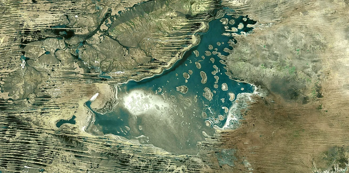
Lake Chad

Africa is home to some of the world’s largest and most biodiverse lakes, including the third-largest endorheic lake on Earth. Lake Chad forms a natural border for Cameroon, Niger, Nigeria, and Chad, and at its peak, its surface area was about 6,000 square miles (15,500 square kilometers). It is a crucial source of freshwater in an extremely water-scarce region and has played an important role in West African trade routes throughout history. Some of the earliest evidence of human habitation in Africa has been found near Lake Chad, and it was once a rich habitat for many of the continent’s best-known animal species.
That said, Lake Chad is also one of the fastest-shrinking endorheic lakes. Much of the region’s population relies on Lake Chad for livelihoods such as agriculture, herding, and fishing. This dependence, combined with unsustainable water use and reduced rainfall, has significantly shrunk the lake in recent decades. Habitat degradation has also disrupted migration patterns of many animals that once frequented the area, and much of the former lakebed is being overtaken by sand dunes.
To help the lake meet the needs of local people and wildlife, researchers and organizations are working with communities to develop more sustainable and efficient water-use practices while restoring habitats—especially wetlands and forests—that have been harmed by the lake’s decline. So, although Lake Chad’s rapid shrinking is alarming, it is also the focus of some of the most vigorous and hopeful conservation efforts among endorheic lakes.
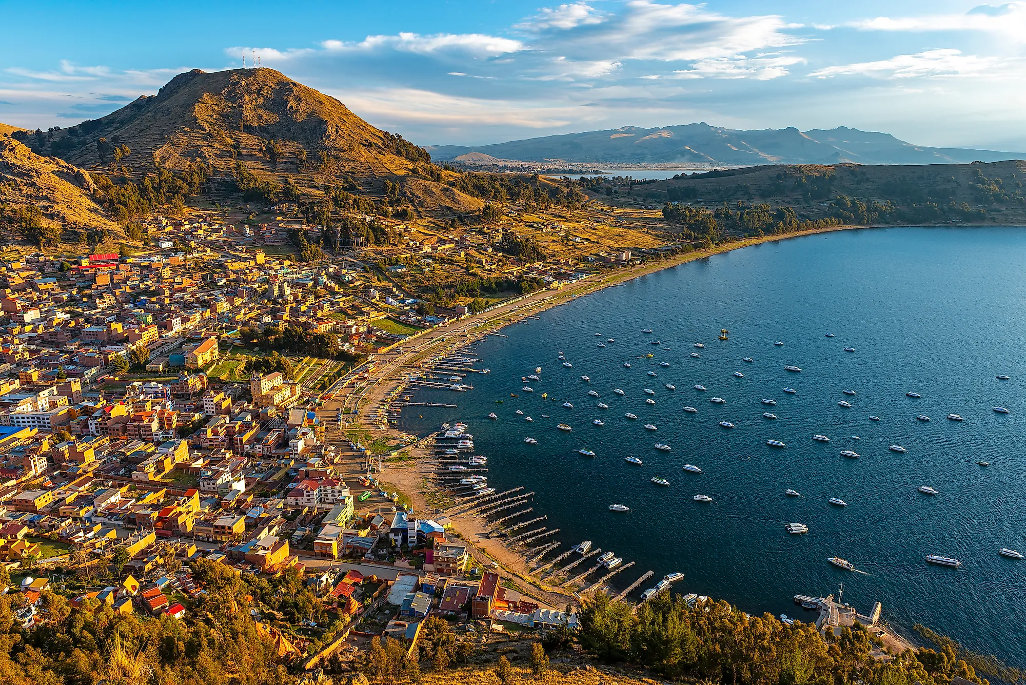
Lake Titicaca
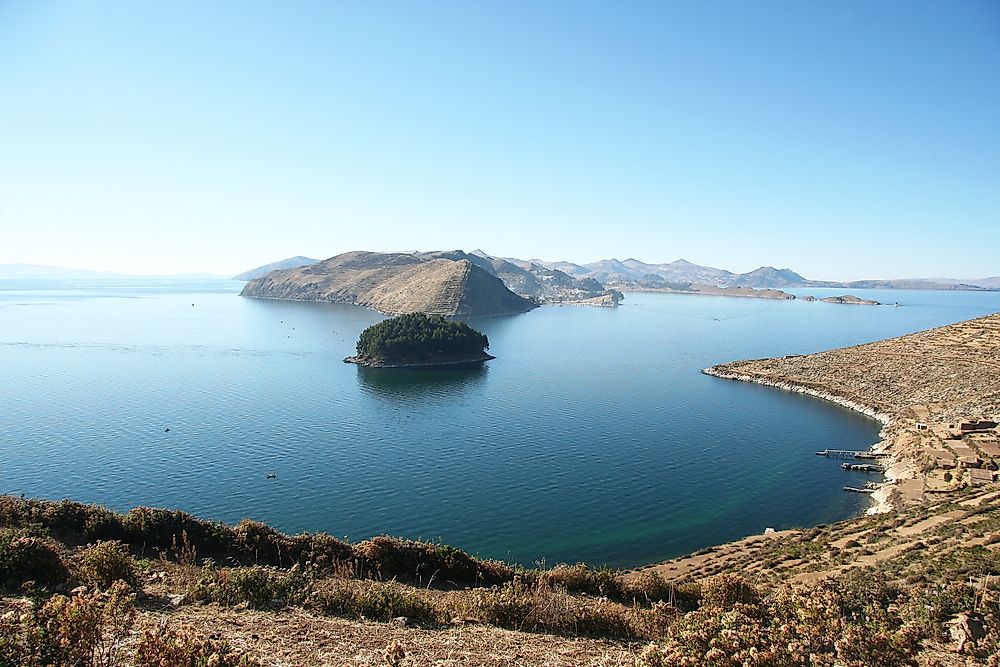
If you’ve heard of any of these top five largest endorheic lakes, it’s probably this one. Set high in the Andes on the border between Bolivia and Peru, Lake Titicaca is world-famous for its altitude (it’s said to be the world’s highest navigable lake) and — let’s face it, we were all thinking it — definitely the most fun-to-say name on this list. And the superlatives keep coming. Besides having the highest average altitude of any navigable lake on Earth, at about 12,500 feet (3,810 meters), Lake Titicaca is one of fewer than twenty “ancient lakes” in the world. It formed when water began to collect in a tectonic basin created by seismic activity and is now fed by over 25 small rivers.
At its widest point, Lake Titicaca is about 120 miles (194 kilometers) across. It covers roughly 3,200 square miles (8,300 square kilometers) in a basin between two ranges of the Andes Mountains, and it can be as deep as 920 feet (280 meters). Although one small river drains roughly 5% of the lake’s water, it is essentially endorheic.
As an extremely rare source of abundant freshwater high in the cold, arid peaks of the Andes, Lake Titicaca has been continuously inhabited by successive cultures for thousands of years. The lake was even the legendary birthplace of the first Inca emperor, who believed their creator deity emerged fully formed from its depths to create the rest of the world. Today, thanks to its isolation and reliance on tourism, Lake Titicaca is an important center for the preservation of Indigenous cultures and traditions in the region.
Although Lake Titicaca doesn’t experience the same water stress as some of the other lakes on this list, the need for greater regulation of resource use has arisen as local communities compete for tourist revenue. The creation of the Titicaca National Reserve further aims to protect this remarkable lake from future climate stressors and human conflicts.
Great Salt Lake

Most Americans don’t quite associate Salt Lake City with vast natural landscapes. As a thoroughly mid-sized American city better known as a hub of Mormonism and a gateway to some of the country’s best skiing, it’s easy to forget that one of the world’s largest endorheic lakes is only a few miles away. Even being located so close to a major city, the Great Salt Lake lives up to its name.
At first glance, the Great Salt Lake is exactly what it claims to be: a vast, shallow, salty lake stretching all the way to the horizon that smells relentlessly of sulfur. It’s saltier than the ocean, with an average salinity of about 12% — so salty that no fish can survive — so you’ll need to look to terrestrial creatures to find anything bigger than a sand fly in this area. The lake’s Antelope Island supports bison, elk, and antelope, though.
But what’s perhaps most fascinating about the Great Salt Lake is how much larger it once was. It’s a remnant of Lake Bonneville, a vast saline lake that covered over 20,000 square miles of Utah as recently as 10,000 years ago. It’s about 75 miles long these days, but that still makes it the largest endorheic lake in North America. Fed by four rivers, the Great Salt Lake is not currently shrinking significantly, but the area’s lack of precipitation means there’s no hope of it ever becoming any less salty, either.
Unlike most of the other lakes on this list, the Great Salt Lake supports very few industries beyond tourism and a handful of small operations that extract salt from the lake for human use. Instead of a hub for fishing or shipping industries, it’s a state park set aside for recreation. Swimming, boating, and hiking are the main activities around the Great Salt Lake.
Why Endorheic Lakes Deserve Our Attention
Not many people will see a lake and ask, “How did it get there?” But if you ever do, you may find that the answer is wrapped up in complex hydrological and geographical questions that are as fascinating as they are fraught. And as human impacts on the natural environment accelerate, we may have to start. Endorheic lakes are some of our most fragile natural systems, and with water stress a constant question in many of the arid regions where they tend to be located, it’ll take thoughtful conservation efforts to keep these fascinating ecosystems in balance.