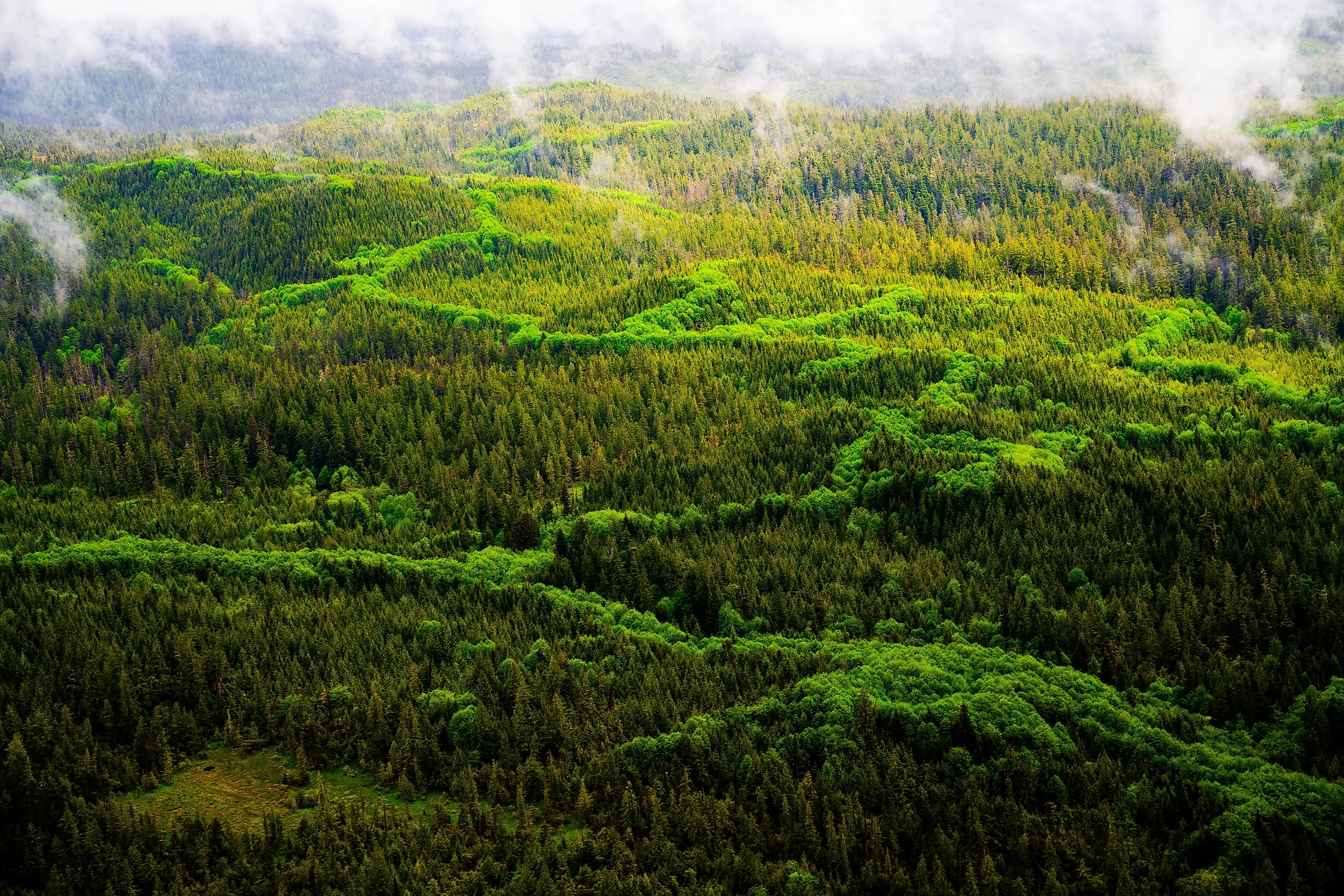
The Largest National Forest In The United States
At about 17 million acres, the Tongass National Forest in Southeast Alaska is larger than the state of West Virginia, and it holds two records at once. It is the largest national forest in the US National Forest System and the largest intact temperate rainforest left on Earth.
Covering nearly the entirety of Southeast Alaska's Alexander Archipelago and coastal mainland, this vast, island-studded wilderness is defined by towering old-growth conifers, wetlands, and tidewater glaciers.
Because its dense canopy traps immense amounts of carbon and its roadless islands shelter dense populations of brown bears, eagles, and spawning salmon, the Tongass functions as both a critical North American carbon sink and a thriving refuge for wild ecological processes.
Scale and Geography

The Tongass spans nearly 500 miles of Alaska's southeastern panhandle, covering about 80 percent of the region between Ketchikan and Yakutat. Rather than a single unbroken tract of trees, the forest is an archipelago. Deep, steep-sided fjords carve through the mountainous mainland and island shorelines, creating intricate marine corridors throughout the region.
The Alexander Archipelago alone contains an estimated 1,100 islands, backed by an inland mainland studded with icefields and glaciers. The Tongass dwarfs the second-largest national forest, Alaska's own Chugach, by more than 11.5 million acres.
This dramatic terrain was carved primarily by massive glacial action during the last ice age, leaving behind thousands of miles of shoreline along sheltered bays, deep marine channels, and steep coastal peaks that rise abruptly from sea level. The sheer complexity of this national forest's coast and islands creates over 11,000 miles of total shoreline, more than the entire coastline of the contiguous United States.
The Tongass's Ecosystem

Annual precipitation across the Tongass ranges from 38 inches in its driest corners to more than 220 inches in its wettest, according to the Alaska Wilderness League. These conditions sustain a coastal temperate rainforest containing more organic matter per acre than a tropical jungle. Old-growth stands of Sitka spruce, western hemlock, and Alaska yellow-cedar dominate the canopy. Some individual trees exceed 800 years old.
That density of standing and rotting biomass gives the Tongass an outsized role in carbon storage. The National Audubon Society estimates the forest holds about 20 percent of all carbon stored in the entire US National Forest System, a single forest accounting for a fifth of the system's total.
Not all of the Tongass looks like dense forest. Large sections consist of muskeg, a waterlogged wetland dominated by sphagnum moss, sedges, and stunted, centuries-old shore pine trees that barely reach taller than six feet despite their age. Limestone bedrock beneath Prince of Wales Island and several neighboring islands has dissolved into an extensive karst landscape after thousands of years of heavy rainfall, producing cave systems, including El Capitan Cave. Researchers continue to map new passages and sinkholes across the region.
Tidewater glaciers descend directly into saltwater in several parts of the forest, a feature uncommon outside polar and subpolar coastlines. 17,000 miles of lakes, creeks, and rivers run through the forest. The Forest Service also runs an active fish-passage program on the Tongass, having modified 64 barriers to open about 574 additional stream miles and 5,531 acres of lake habitat to salmon that would otherwise be blocked.
The Tongass's Wildlife

Five species of Pacific salmon spawn in the forest's rivers each year, a run that anchors the Tongass food web and its commercial fisheries alike. A stable-isotope study of Alexander Archipelago wolves found that salmon make up an average of 18.3% of their diet in southeast Alaska, more than double the share found in wolves from Alaska's interior.
Bears and scavengers drag fish carcasses out of the streams, allowing ocean-derived nutrients from salmon washing ashore and decaying along the forest floor to directly fertilize the soil and feed the surrounding trees. Brown bears reach some of their highest densities anywhere in North America on Tongass's Admiralty Island, an island the Tlingit people call Kootznoowoo, meaning fortress of the bears. NASA's Earth Observatory estimates about 1,500 bears live on this landmass about the size of Delaware, close to one bear per square mile. Neighboring Kuiu Island supports one of the densest black bear populations in North America as well, at three to five bears per square mile, according to the Alaska Wilderness League.
Bald eagles gather in flocks of up to 2,000 birds in parts of the forest during salmon runs, according to the Alaska Wilderness League. The forest also contains the highest density of nesting bald eagles in the world at 7,000 individuals. Sitka black-tailed deer depend on the forest's understory of shrubs and lichens for winter forage, and decades of Forest Service research have linked deer survival directly to the amount of old-growth canopy available to intercept snow, since deep snowpack in logged, open areas can cut deer off from food for weeks at a time.
Offshore waters add another layer of wildlife to the forest's boundaries. Humpback whales return to the channels and bays around the Tongass each summer to feed, in some cases using a cooperative technique called bubble-net feeding, in which a group of whales encircles schooling fish with a curtain of bubbles before lunging through the trapped school together. The Forest Service's species assessments list the western population of Steller sea lions, along with fin and sperm whales, among the federally protected marine species that rely on Tongass waters.
Trails, Wilderness Access, and Backcountry Cabins

There are over 140 public recreation cabins scattered across the Tongass, and about 40 of them can be reached only by seaplane, according to the Aircraft Owners and Pilots Association.
Misty Fjords National Monument itself covers 2.3 million acres and can be reached only by boat or floatplane from Ketchikan, its granite walls rising as much as 3,000 feet straight out of the tidewater of Behm Canal. Within the monument, the Forest Service maintains 13 public cabins, five three-sided shelters, and 10 trails totaling 20 miles of hiking. In its entirety, Tongass contains over 700 miles of hiking trails.
Farther south, on Prince of Wales Island, the Forest Service runs guided tours of El Capitan Cave from late May through early September. The Tongass contains 19 designated wilderness areas in total, and Forest Service data shows that 93% of its approximately 900 watersheds remain in near-natural condition.
Communities Within the Forest

The Tongass is the traditional homelands of the Tlingit, Haida, and Tsimshian peoples, and several small communities sit entirely inside the Tongass National Forest boundaries, embedded in the same islands as the forest's wilderness areas.
Angoon, the only permanent settlement on Admiralty Island, sits along the edge of the Kootznoowoo Wilderness and serves as the departure point for the 32-mile Cross Admiralty Canoe Route into the island's interior. Tenakee Springs, on nearby Chichagof Island, has no roads at all. Residents get around town by bicycle or all-terrain vehicle, and the community's natural hot spring is open to the public year-round.
Elfin Cove and Pelican, also on Chichagof Island, remain fishing communities reachable only by boat or floatplane, and Pelican serves as the access point for the White Sulfur Springs cabin, a Forest Service rental reached by a short boat trip along the coast. According to the Alaska Department of Fish and Game, access to communities like these throughout the Tongass depends entirely on scheduled flights, personal boats, or ferry service, since no road connects them to the rest of the forest or to each other.
Tongass - The Titan of the National Forests
Ultimately, the Tongass National Forest stands as a landscape of unmatched scale within the US National Forest system, spanning hundreds of miles of intricate fjords, ancient old-growth rainforest, and isolated island chains. It is an ecosystem where land and sea function together to support a complex network of wildlife.
The nutrients brought ashore by millions of spawning salmon fuel everything from giant brown bear populations to high-canopy trees, while its vast, undisturbed soils and centuries-old cedars anchor a globally significant carbon reserve. Protecting this forest preserves one-fifth of the national forest system's total carbon storage, protects nearly 900 near-natural watersheds, and secures critical habitat for the region's wildlife.