12 Nicest Small Towns In The Great Lakes
You have already been to the one near you. Everybody on this shoreline has a town an hour or two out that they have been going to since childhood, and most of us never get much past it, because the far side of the lakes counts as a whole separate trip rather than a weekend.
That is the gap here. Twelve towns across five basins and two countries, and the odds are you know one or two of them well and have never set foot in the rest. Two are in Ontario, which anyone in Michigan or Ohio can reach faster than half their own state. One is in Indiana and is better than people from Chicago expect.
They run by lake, west to east, because the basins do not produce the same kind of town. Superior gives you cold water and distance, Huron gives you wrecks, Michigan gives you the summer crowds, Erie is shallow and warm enough to swim in properly, and Ontario finishes on a battlefield.
Grand Marais, Minnesota

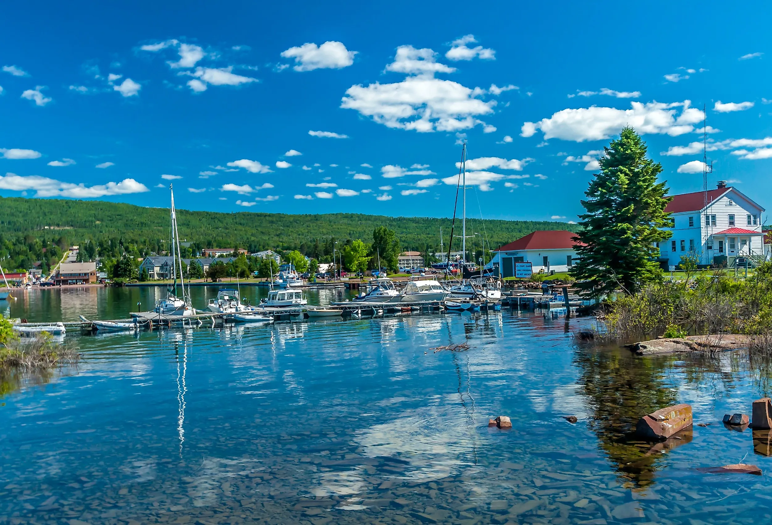
Grand Marais wraps a natural harbour on the north shore of Lake Superior, at the point where the Gunflint Trail turns inland toward the Boundary Waters. The name is French for big marsh, which does the place no favours at all.
Judge C.R. Magney State Park is twenty minutes northeast and holds Devil's Kettle, where half the Brule disappears into a pothole. It is a steep walk down and back up, and worth every step.

In town, the Grand Marais Art Colony opened in 1947 and is the oldest in Minnesota, which set the tone for the galleries along Broadway. Artists' Point is a short walk from the harbour onto a rocky spit with Superior on three sides. The Chik-Wauk Museum, at the end of the Gunflint Trail, covers the history of that nearly 60-mile road into the wilderness.
Bayfield, Wisconsin

In a cold enough winter the sea caves freeze. The Apostle Islands mainland caves south of Bayfield grow curtains and columns of ice, and when the lake ice is thick enough the National Park Service opens the walk out to them. It does not happen every year, and when it does the town fills overnight.
Bayfield is Wisconsin's smallest city by population, under 600 people, and its northernmost. There is no commercial harbour here, only ferries, sailboats, and kayaks, and the day runs on the Madeline Island schedule rather than on traffic lights.
The Apostle Islands National Lakeshore covers 21 islands with sandstone sea caves and old-growth forest. Orchards and berry farms ring the town, a legacy of glacial soil and cool lake air, and the Brownstone Trail follows an old rail grade out of the centre.
Ashland, Wisconsin

There are more than twenty large murals on the buildings in downtown Ashland, painted since the 1990s, and together they tell the town's history on its own walls. Ashland calls itself the historic mural capital of Wisconsin and has the inventory to back it.

The town sits at the bottom of Chequamegon Bay, which feeds Superior, and the Soo Line 950 locomotive stands downtown, built in 1900, retired in 1954, and handed to Ashland two years later.
Maslowski Beach has over 1,400 feet of sand and a view across the bay. Two miles out, the Northern Great Lakes Visitor Center has a five-storey observation tower over the wetlands and exhibits on the lake's human and natural history.
Munising, Michigan

The cliffs here are striped. Groundwater carrying iron, copper, manganese, and limonite seeps through the sandstone at Pictured Rocks and stains the face in red, orange, green, and black, which is how a fifteen-mile wall of rock ended up looking painted.
Munising sits at the bottom of South Bay on Michigan's Upper Peninsula, and Pictured Rocks National Lakeshore starts minutes east of downtown. Miners Castle is the only major formation you can drive to. Everything else is boat, kayak, or boots.

Waterfalls are the other local currency, with Munising Falls, Miners Falls, and Wagner Falls all a short drive out. Grand Island sits just offshore, reachable by ferry, with no development and a lot of shoreline. In winter the ice climbers arrive for the frozen falls.
Alpena, Michigan

They call the water off Alpena Shipwreck Alley, and close to 100 wrecks lie in Thunder Bay National Marine Sanctuary. Cold fresh water preserves wood in a way salt water never does, so some of these vessels still have their masts standing, and you can see several from a glass-bottomed boat without getting wet.

The town sits on Lake Huron with the sanctuary's Great Lakes Maritime Heritage Center downtown, free to enter and built around a full-size schooner replica.
Rockport State Recreation Area, twenty minutes north, has an abandoned limestone quarry where visitors collect 400-million-year-old fossils and keep what they find, plus a sinkhole loop and the remains of the ghost village of Bell.
Tobermory, Ontario

You can stand on the dock at Tobermory and look straight down at a shipwreck. The water in Big Tub Harbour is clear enough that the Sweepstakes, a schooner that went down in 1885, is visible from the surface in about 20 feet of water, and glass-bottomed boats run over it all season.
This village of under a thousand people sits at the tip of the Bruce Peninsula in Ontario, where Huron meets Georgian Bay. Fathom Five National Marine Park protects more than twenty wrecks and is Canada's first national marine park.
Bruce Peninsula National Park has the Grotto, a limestone sea cave on turquoise water that now runs on timed parking reservations because of the crowds. Flowerpot Island, a short boat ride out, has the sea stacks that give it the name.
Goderich, Ontario

Goderich is built around an octagon. The town centre is a literal eight-sided square with the courthouse in the middle and eight streets radiating off it, laid out in the 1820s by the Canada Company, and it is the reason Queen Elizabeth II is said to have called this the prettiest town in Canada.
Under all of it is salt. The Sifto mine beneath Goderich and Lake Huron is the largest underground salt mine in the world, running more than 500 metres down and for miles out under the lakebed.
The lighthouse on the bluff is the oldest Canadian light station on Lake Huron. The Menesetung Bridge crosses the Maitland River on an old rail deck, and the boardwalk runs the length of the waterfront to a beach that faces due west, which makes the sunsets the local event.
Charlevoix, Michigan

A self-taught designer named Earl Young spent fifty years building houses out of glacial boulders here, with wavy rooflines and chimneys that look melted, and locals call them the mushroom houses. There are around thirty of them, most clustered in Boulder Park, and people walk the streets specifically to look at them.

Charlevoix sits on a narrow strip between Lake Michigan and Lake Charlevoix, with Round Lake in the middle, so boats pass through the middle of downtown under a drawbridge.
Castle Farms, built in 1918 by a Sears-Roebuck vice president as a model dairy, is now a stone complex with gardens open for tours. Fisherman's Island State Park is four miles west with five miles of undeveloped shoreline and Petoskey stones on the beach.
Sturgeon Bay, Wisconsin

Sturgeon Bay is the working end of Door County. Shipyards here have been building and repairing lake freighters since the 1800s and still are, which is why this town has a commercial waterfront while the villages up the peninsula have boutiques.

Cave Point County Park is the scenic draw, where Lake Michigan has undercut the limestone into caves that boom when the waves hit. Kayakers paddle into them and cliff jumpers use the ledges above, though the water stays cold into July.
The Door County Maritime Museum sits on the water and runs tours up a ten-storey lighthouse-style tower. The Farm has livestock for children, and the Garden Door has twenty themed sections including a kaleidoscope you can stand inside.
Chesterton, Indiana

Indiana gets 45 miles of Great Lakes shoreline and has made the most of it. Indiana Dunes National Park holds 15,000 acres of dune, marsh, prairie, and oak savanna, and ranks among the most biodiverse units in the entire national park system, with more plant species than almost any park its size.

Chesterton sits at its gate. Indiana Dunes State Park, inside the national park, has three miles of shoreline and the Three Dune Challenge, a 1.5-mile scramble over the park's highest dunes that is far harder than the distance suggests.
Downtown runs to antique shops and the European Market on summer Saturdays. The Coambs-Morrow House, built in 1950, was the last Lustron home ever produced, an all-steel prefab from a company that went bankrupt the same year.
Vermilion, Ohio

Vermilion's old harbour district is called Harbour Town 1837, and the New England look is not a theme: the town was settled by people from Connecticut, and the sea captains who ran Great Lakes schooners built widow's walks onto their houses here just as they would have on the Atlantic.
The town sits where the Vermilion River meets Lake Erie, about forty minutes west of Cleveland, with a lagoon system threading residential streets so that a good number of houses have a boat at the back door.
Main Street Beach is a short walk from the shops, and the replica lighthouse at the river mouth is the town's photograph. The Woollybear Festival each autumn is the largest single-day festival in Ohio, built entirely around a caterpillar said to forecast the winter.
Sackets Harbor, New York

Two battles were fought here in the War of 1812, and for a period this village was the busiest naval shipyard in North America, with thousands of men building warships on Lake Ontario faster than the British could match.

Sackets Harbor Battlefield State Historic Site preserves the ground, the Navy Yard, and the Commandant's House, with reenactments through the summer. The whole village is a National Historic Landmark district.
Today it is about 1,400 people with a marina, a walkable Main Street, and charter boats running out for salmon and trout. Lake Ontario is the smallest of the five by surface area and the easternmost, which makes this the end of the line.
Picking A Lake
Each basin has its own character and the towns follow. Superior is the cold one, deepest and clearest of the five, and Grand Marais, Bayfield, Ashland, and Munising all trade on rock, ice, and distance. Huron has the shipwrecks, with Alpena's Shipwreck Alley on one shore and Tobermory's Fathom Five on the other, plus Goderich and its octagon.
Michigan is the summer lake, where Charlevoix, Sturgeon Bay, and Chesterton do beaches, boats, and dunes. Erie is the warmest and shallowest, which is why Vermilion's lagoons work. And Ontario, the smallest, closes it out with Sackets Harbor and a naval war most Americans have forgotten. Pick the basin first and the town second, because the drive between Grand Marais and Sackets Harbor runs well over 1,200 miles.