What Is The Driest County In The United States
Inyo County, California, contains the world-renowned Death Valley, where the valley floor receives a scarce 2-3 inches (51-76 mm) of rain annually, the least for any specific location in the entire U.S. Its exceptionally low levels of moisture help explain the county's title as, by a good margin, America's driest region. However, Death Valley does not represent the entirety of Inyo, which also includes several other vast chunks of relatively empty desert terrain and parts of the Sierra Nevada range. With that, the remarkable climate of this SoCal destination is best understood through the often sharp contrasts between its mountains and desert basins, which we will explain below.
The Geography of Inyo County

Stretching across eastern California to the Nevada border (the latter being the driest state in the country), Inyo County covers an enormous 10,200 square miles (26,428 square km). The Sierra Nevada forms its western edge, where Mount Whitney reaches 14,505 feet (4,421 meters), the highest elevation in the contiguous United States. Eastward, Badwater Basin drops to 282 feet (86 meters) below sea level, making it North America's lowest point.
Between these extremes lie Owens Valley, the White Mountains, the Inyo Mountains, and the Panamint Range. Much of this terrain consists of parallel ranges separated by basins created through faulting and crustal stretching. Sparse vegetation also changes quite a bit here with elevation, from desert shrubs and grasslands to pine forests, bristlecone pines, and alpine terrain above the treeline.
The Owens River, one of the area's only real waterways, runs through Owens Valley toward Owens Lake, while Death Valley contains a desolate yet scenic array of salt flats, alluvial fans, dunes, and rocky canyons.
In terms of human presence, there are a meager 18,000 to 19,000 permanent residents currently dwelling within Inyo County. The towns of Bishop, Independence, and Lone Pine occupy the county's western valley, linked by U.S. Highway 395.
Why is this Place so Dry?

With only about 5-6 inches (127-152 mm) of rain/snow and 25 days of measurable precipitation per year across the entire county on average, Inyo's record-breaking dryness begins with the mountain barriers between its desert basins and the Pacific Ocean. Moist air moving inland is forced upward over California's mountain ranges further west, cooling as it climbs. Water vapor then condenses, depositing rain and snow on the higher elevation, windward slopes. After crossing the crest, the air finally descends, warms, and becomes less humid, leaving the eastern slopes and valleys in which Inyo County lies in what is aptly called a "rain shadow," a space that rain and snow seemingly skip over whenever possible.
Knowing this, it's no wonder why the towering Sierra Nevada influences Owens Valley so strongly, while additional ranges east and west of them further reduce the moisture reaching Death Valley. The area's higher-than-average heat intensifies the resulting aridity by accelerating evaporation from exposed soil and surface water. To top it off, the low amount of plant life of any kind here provides little shade.
Nevertheless, precipitation varies substantially with elevation, and mountain snowmelt supplies streams that cross otherwise dry ground. Occasional Pacific storms and summer thunderstorms can bring heavy rainfall, too, producing flash floods when runoff pours from steep canyons onto the usually dry valley floor. These events are still quite rare, leading to Inyo County's widespread reputation as the driest portion of the country.
The Early Peoples and Settlement of Inyo

Long before Inyo County was established, Owens Valley Paiute, Timbisha Shoshone, and other Indigenous peoples inhabited its valleys and mountains. Paiute communities often got by irrigating native food plants using streams fed by Sierra Nevada snowmelt.
American settlers arriving during the nineteenth century introduced livestock and competed for land and water, leading to sometimes violent conflict and forced displacement. After gaining statehood in 1850, California then created Inyo County on March 22, 1866, with Independence becoming its county seat. Silver mining at Cerro Gordo helped drive an economic boom of sorts, while later operations extracted borax, gold, and other minerals.
Water (or lack thereof) reshaped the county's history when the Los Angeles Aqueduct began operating in 1913, diverting Owens Valley's water supply south and provoking bitter disputes with local farmers.
To add to the area's unusually tragic past, during World War II, the federal government incarcerated more than 11,000 people of Japanese ancestry at Manzanar between 1942 and 1945. Today, Manzanar National Historic Site preserves their experiences alongside the area's earlier Indigenous, agricultural, and water development history.
Must-See Locales within the County

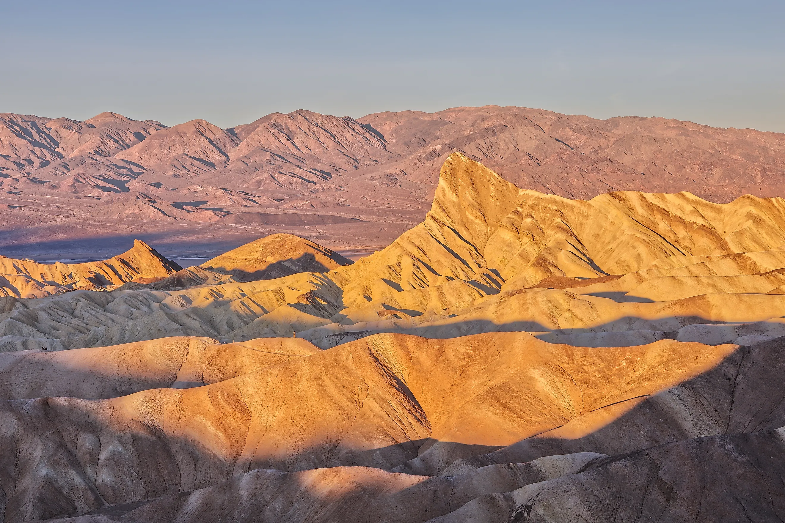
Woman admiring sunset at Zabriske Point, Death Valley National Park, California.
Death Valley National Park provides the clearest view of Inyo County's desert extremes. Here, at Badwater Basin, you can walk onto salt flats below sea level, while Zabriskie Point overlooks folded, golden badlands. Near Stovepipe Wells, Mesquite Flat Sand Dunes reveal wind-shaped ridges best photographed when low sunlight emphasizes their naturally formed contours. Dante's View offers a bird's-eye lookout point over the valley and is another excellent place to catch a sunset.
There's also lots to see outside of the national park if you know where to go. West of Lone Pine, the Alabama Hills offer a different geological setting, with their fields of rounded granite boulders right beneath the jagged Sierra Nevada. These hills have been the site of hundreds of famous film and TV shoots, too. You might recognize them in The Lone Ranger, Django Unchained, Tremors, Gladiator, and countless other classics.
Furthermore, a short trail to Mobius Arch rewards hikers with a natural stone frame around Mount Whitney. For even more alpine scenery, drive to Whitney Portal, where wooded slopes replace the valley's desert scrub. And across Owens Valley, the Ancient Bristlecone Pine Forest, a part of the broader Inyo National Forest, protects exceptionally old trees (some thousands of years old) in the White Mountains, with walking routes beginning at Schulman Grove.
Last but not least, Manzanar National Historic Site adds a historical stop, using exhibits, reconstructed barracks, and surviving camp features to explain the wartime incarceration of Japanese Americans and the experiences of families confined there.