The Most Densely Populated County In The United States
Population density in the United States spans an enormous range. While most counties are largely rural and only moderately populated, a few carry more residents than entire states on a small fraction of land. As of the 2020 census, New York County, coextensive with the borough of Manhattan, is the most densely populated county in the United States, with over 1.69 million people on only 22.7 square miles of land, or 74,781 people per square mile. Four of the most densely populated counties in the country sit within New York City, and New York County leads them all. Vertical development, a dominant economy, and centuries of urban growth explain how one county came to hold more people than eleven US states.
What Does 74,781 People Per Square Mile Look Like?

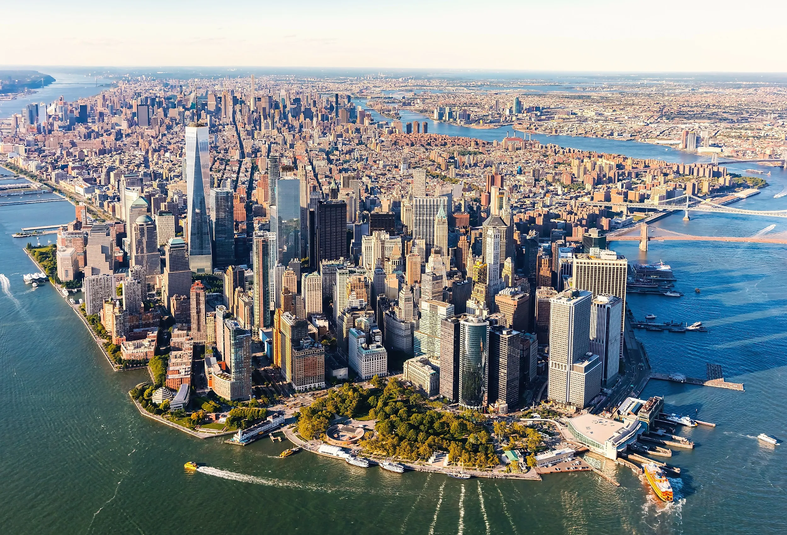
Even though a single square mile, on average, contains 74,781 people, it also contains streets, parks, offices, schools, businesses, and other infrastructure that is not used for housing. New York County comprises Manhattan Island, as well as several smaller islands, including Randall's, Wards, Roosevelt, Governors, and Liberty Islands. Not all of these smaller islands are populated, however. Governors and Liberty Islands have no permanent populations.
Due to limited space in Manhattan, New York County developed vertically rather than horizontally. New York City has more than 320 skyscrapers (buildings over 492 feet tall), the overwhelming majority of them in New York County, and some are the tallest buildings in the United States. Central Park Tower is the tallest residential building in the world, rising 1,550 feet above Midtown Manhattan, and approximately 80 percent of Lower Manhattan residents live in high-rise buildings.
How New York County Stacks Up Against Entire States

The 2020 census data show that New York County is more populous than Wyoming, Vermont, Alaska, North Dakota, South Dakota, Delaware, Rhode Island, Montana, Maine, New Hampshire, and Hawaii. Wyoming had the lowest population, with just 576,851 people, despite covering 97,093 square miles. New York County, by comparison, contains over 1.69 million people in just 22.7 square miles. Vermont came second from the bottom at 643,077 residents, fewer than half the county's total. Alaska had a population of 733,391 across roughly 570,000 square miles of land, about 25,000 times the size of New York County. Rhode Island, the smallest state, recorded 1,097,379 residents on a land area 45 times its size. If the county were a state, its 1,694,251 residents would make it the twelfth-least populous state, between Hawaii and West Virginia.
Why Is New York County So Populous?

Aside from its vertical development, New York County has remained populous because Manhattan has become one of the nation's most important economic centers. The Erie Canal opened on October 26, 1825, connecting the Hudson River to Lake Erie. It created a navigable waterway from the Atlantic Ocean to the Great Lakes and the American Midwest. It was primarily used for trade and immigration. Consequently, New York City's population quadrupled between 1820 and 1850 as its commercial importance grew.
Manhattan remains the economic center of the United States. Wall Street, in Lower Manhattan, is a global center of finance and home to the New York Stock Exchange. New York County employs over 2.3 million workers, accounting for about 60 percent of the city's private-sector jobs. On business days, so many commuters travel to New York County that its total weekday population exceeds 3.9 million.
The Densest Neighborhood

Yorkville, on the Upper East Side, is the densest neighborhood in New York County. As of the 2020 census, Yorkville has a population of just over 84,000 people and a population density of approximately 171,000 people per square mile. Yorkville's lack of historic district designation has made it vulnerable to redevelopment. According to FRIENDS of the Upper East Side, affordable low-rise tenements have been replaced by high-rise apartment buildings. Manhattan Community District 8, which includes Yorkville, lost 26 percent of its affordable housing units between 2007 and 2014, more than four times the citywide rate. Across the entire Upper East Side, 14,438 rent-stabilized units were lost between 2007 and 2020.
How Does New York County Compare With Other Counties?

Since all five of New York City's boroughs are coextensive with their respective counties, four of the most densely populated counties in the United States are located within the city. After New York County, the next most densely populated counties are Kings County (Brooklyn), Bronx County (The Bronx), and Queens County (Queens).
Outside of New York City, the most densely populated county is San Francisco County, which is also coextensive with San Francisco. The 2020 census recorded a population density of over 17,000 people per square mile in San Francisco County, which equates to less than one-quarter of New York County's population density. However, San Francisco County has 46.7 square miles of land, making it more than twice the size of New York County.
A County Like No Other
New York County is an extreme example of how a large population can be concentrated within a small area. The county is home to over 1.69 million people across just 22.7 square miles, giving it a population density of 74,781 people per square mile. Its population is larger than that of 11 entire states, while its land is smaller than many individual US cities. Skyscrapers, a strong economy, and centuries of urban growth have continued to grow New York County's population.