The Counties Named After US Presidents
California has 58 counties, and not one of them carries a president's surname. Nine other states are in the same position, among them Massachusetts, New Jersey, and South Carolina. Everywhere else the practice ran hard, and more than 200 county-level units across the United States now carry a president's name. Carrying that name is not always the same as being named for that president. County naming was a political act, and the map still records who seemed worth honoring when a legislature drew the lines.
The Washington Counties

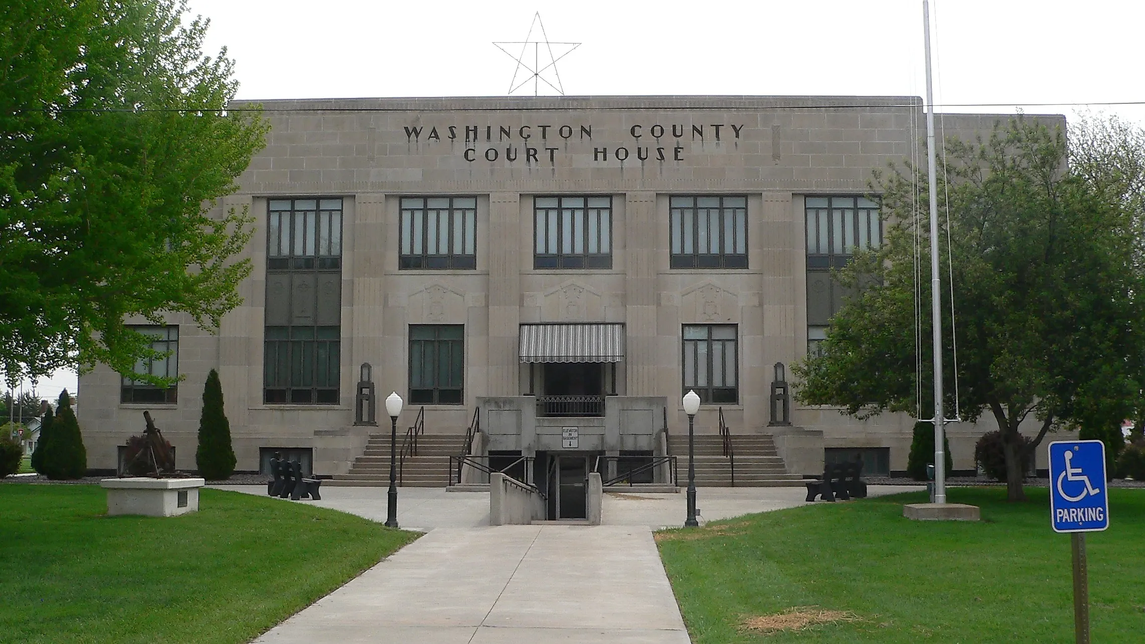
Thirty counties and one Louisiana parish carry Washington's name, more than any other surname on the American map. Maryland got there first. Its Constitutional Convention created Washington County out of Frederick County on September 6, 1776, two months after the Declaration of Independence and 13 years before Washington took office. He was still commanding the Continental Army, and the war had no settled outcome.
The Louisiana entry matters beyond the count. Louisiana divides into parishes rather than counties, which makes Washington Parish a county equivalent in Census terms and not a county at all. The difference is not trivial. Any tally of American counties moves depending on whether parishes, Alaska boroughs, and independent cities are folded into it.
The Jefferson Counties

Jefferson's name reaches 26 counties and county equivalents, second only to Washington, and three of them honor him at one remove. Montana's Jefferson County takes its name from the Jefferson River. Meriwether Lewis and William Clark named that river in late July 1805, at the three forks of the Missouri, along with the Madison and the Gallatin. Lewis recorded the reasoning in his journal, writing that the captains agreed on naming the forks for the president and for the Secretaries of the Treasury and State.
Oregon went a step further. Its Jefferson County dates to December 12, 1914, and takes its name from Mount Jefferson. That peak rises 10,497 feet on the county's western skyline and is the second-highest in Oregon. Colorado's case is stranger again. That county carries the name of the Territory of Jefferson, a government the settlers of the Pike's Peak gold rush ran for 15 months without any authority from Congress.
The Monroe Counties

Seventeen counties bear Monroe's name, and Ohio's shows how early the honor could arrive. The legislature created Monroe County in January 1813 from parts of Belmont, Guernsey, and Washington counties. James Monroe was Secretary of State that winter, and four more years would pass before he took the office himself. The county was not fully organized until 1815, still ahead of his first term.
The naming pattern is common in the early republic. A legislature honored a man for the post he held that year, and the presidency arrived later as a coincidence. Ohio put the seat at Woodsfield, on hilly ground inland from the Ohio River, which forms the county's eastern boundary. Monroe County remains among the least populated counties in Ohio.
The Jackson Counties

Michigan settled the Jackson question in a single sitting. On October 29, 1829, the territorial legislature created 12 counties at once and named eight of them for members of Andrew Jackson's newly seated cabinet. Cass County followed days later, named for the territorial governor who would join that cabinet, and Livingston County came in 1833 for Edward Livingston, another Jackson appointee. Ten counties in all make up what Michigan still calls its cabinet counties.
The accepted explanation is flattery with a purpose. Michigan was fighting Ohio over the Toledo Strip and wanted the administration on its side. Eaton and Ingham counties carry the names of the men who ran the War Department and the Treasury. Barry and Berrien took the names of the Postmaster General and the Attorney General. Jackson signed the bill admitting Michigan to statehood in 1837, among his last acts in office. The state that named ten counties for one administration never named a single one for Washington.
The Harrison Counties

Eight counties share the Harrison name, and one of the oldest honors a man who never reached the presidency. Virginia created Harrison County in 1784, in territory that is now West Virginia, for Benjamin Harrison V. He had just finished a term as governor and had put his name to the Declaration eight years earlier. His son and his great-grandson both became president. He did not. Over the following decades, eight more West Virginia counties and parts of ten others came out of that original ground.
Indiana's came in 1808, and the state historical marker there is blunt about the reason. The county honors William Henry Harrison, who owned land inside it and governed the territory that created it. He would not win the presidency for another 33 years. Three generations of one Virginia family lie behind a single county name, and the man honored first never held the office at all.
The Polk Counties

Twelve Polk counties sit on the map, and 10 belong to James K. Polk. The other two belong to his relatives. Missouri named its Polk County for Colonel Ezekiel Polk, a Revolutionary War veteran who happened to be the president's grandfather. North Carolina went further off the branch. Its Polk County, created in 1855, honors Colonel William Polk, another Revolutionary veteran and the president's first cousin once removed.
North Carolina supplies the sharper example. James K. Polk was born in North Carolina, and he had left office only six years before the county appeared. The state passed over its own native son for a soldier who fought at Brandywine, Germantown, and Eutaw Springs, and took a wound in each.
The Lincoln Counties

Lincoln's 24 counties split three ways, and only 16 of them trace to the president. Five honor Major General Benjamin Lincoln, the Revolutionary War commander who accepted the British sword of surrender at Yorktown. Kentucky and Tennessee account for two of those. Kentucky's case is the clearest. Lincoln County took shape on November 1, 1780, when Virginia divided its Kentucky County into three, alongside Jefferson and Fayette. Benjamin Lincoln was a prisoner of war that autumn and a hero at home.
Tennessee created its Lincoln County in 1809, more than 50 years before Abraham Lincoln reached the White House. Maine's is older still and belongs to neither man. The Massachusetts General Court named it in 1760 for Lincoln, England. South Dakota later named its own county after the one in Maine, which puts an English city at the root of two American counties.
The Garfield Counties

Garfield served less than seven months as president and has six counties. An assassin shot him on July 2, 1881, and he died on September 19. Washington Territory created Garfield County ten weeks later, on November 29, out of Columbia County. Colorado followed in 1883, and Nebraska organized its own in 1884. The naming was grief moving at the speed of a territorial legislature.
Garfield County in Washington holds an oddity of its own. Congress fixed the county seat by act, and no other county in Washington can say the same. Pomeroy took that designation in 1882, after several nearby towns competed for it. The county reaches north to the Snake River, where the canyon drops well over 1,000 feet below the surrounding farmland of the Palouse.
The Roosevelt Counties

Two counties honor Theodore Roosevelt, and the pair bracket his life. New Mexico Territory created Roosevelt County on February 28, 1903, out of Chaves and Guadalupe counties, while Roosevelt was still in office. Portales became the seat, a railroad town out on the eastern plains.
Montana created the second in 1919, carving it from Sheridan County during the year Roosevelt died. Wolf Point became its seat. By then the supply of new counties was thinning badly, and the practice that had put Washington's name on 31 of them was nearly finished. Two counties is a modest return for a president who reshaped the federal map, and neither of them honors the Roosevelt who came later.
Harding County, New Mexico

Harding County occupies the northeast corner of New Mexico, and its creation date is the whole point. The legislature carved it from Union and Mora counties on March 4, 1921, the day Warren G. Harding took the oath of office. The timing was deliberate, and it was also contested. The bill cleared the state House 39 to 6 two days earlier, and one senator moved to rename the county McDonald, a motion the chamber tabled.
Warren G. Harding is generally reckoned the most recent president to have a county named for him anywhere in the country. Nothing about the man made that inevitable, and county creation simply ran out of room. Mosquero serves as the seat of a county holding fewer than 700 people, the smallest population in New Mexico.
Where The Roll Call Stopped
The roll call did not end because Americans stopped admiring presidents. It ended because the country stopped making counties. Arizona and New Mexico became states in 1912, legislatures had carved up the last western territories, and blank space for new counties ran short. Later presidents took their honors from airports, highways, and schools instead. The county map had closed, and Harding was the last name it recorded.