The Appalachian Counties Time Forgot
The Appalachian Mountains and the people who live along their ancient peaks and valleys have long been isolated, often by choice. Ulster Scots pioneers arrived first, followed by Palatine Germans who settled alongside Native Americans and African Americans in Central Appalachia. The culture that took hold in the steep terrain of the mountains rested on a distrust of centralized government and a disdain for the wealthy English coastal lowlanders, and it drew families fleeing persecution.
As society changed, some communities remained untouched by progress, and the reliance on coal mining and its eventual decline created an image of places lost in the past. The inaccessibility from the outside sometimes made these communities feel bypassed, and the common economic reality was that this region could be a difficult place to live. Today, Appalachia remains steeped in its traditions and its folklore, and above all in its music. In recent decades, much of Appalachia has begun to emerge from economic isolation. However, there are still some counties that appear to be forgotten by time, and it is the individualistic determination of the local population that keeps people tied to their roots and history, no matter how much the outside world may change.
McDowell County, West Virginia

This West Virginia county is considered one of the most isolated in the eastern United States. With no four-lane highways, traveling throughout the valley-bottom county means winding mountain two-lane roads. Sharp curves and steep inclines make for difficult driving. The county seat, Welch, sits about an hour from the closest interstate highway. Reaching larger cities and their airports, such as Charlotte, North Carolina, means several hours more behind the wheel.

At one point, the county was the leading coal-producing county in the nation, holding that position until neighboring Logan County passed it in 1955. The collapse of coal employment that followed mine mechanization in the 1950s left economic scars still felt today. The poverty rate exceeds 34%, and a small community hospital in Welch provides only basic care, with more specialized healthcare and trauma centers a considerable distance away over mountain roads. The population has fallen by more than 82% since its 1950 peak of nearly 99,000. With aging infrastructure and some areas of the county resembling ghost towns, it can feel like the county exists in a different time. That isolation is what, for some residents, makes life in the county memorable. The county carries a rich Appalachian heritage and an important place in the American labor movement and the labor wars. For some residents, the mountains and valleys, together with the Indian Ridge and Warrior ATV trail systems that form part of the Hatfield-McCoy Trails, make the isolation worthwhile.
Leslie County, Kentucky

This county is found deep in the Eastern Kentucky Coalfield. The rugged, heavily forested landscape is mostly rural, with sparse populations throughout. It has some of the most impenetrable mountain terrain in the central Appalachian region, and these geographical barriers kept the county isolated. However, Leslie County has a heritage steeped in Appalachian traditions and offers outdoor activities that are a deep part of the natural beauty of the rugged countryside. The musical heritage is particularly strong. Bobby and Sonny Osborne, the bluegrass duo behind Rocky Top, grew up in the county, and the Kentucky School of Bluegrass and Traditional Music still operates in Hyden.

Located in the Cumberland Plateau, the county consists of steep ridges and narrow valleys. Possibly its best-known place name is Hell for Certain, a creek and the settlement along it, which appears on most maps as Dryhill. The name traces to early travelers who found the terrain nearly impassable, though versions of the story vary. There is no direct connection to any interstate highway. The only major road is the Hal Rogers Parkway, a mostly two-lane highway cutting through the mountains. The secondary and rural roads are winding and narrow, and quite often are not paved. With flash flooding and rockslides, the county can be frequently cut off from the outside.
The population is under 10,000, spread over 404 square miles of dense forest. Hyden, the county seat and its only incorporated city, holds barely 300 residents, and the remaining communities are small unincorporated hamlets set back in the mountain hollows. This helps give the county a feel of being removed from the 21st century, a snapshot of earlier times still being maintained. That view, like the view of all these isolated counties, is misleading.
Buchanan County, Virginia

This county is hemmed in by the massive ridges of the Cumberland Plateau. Regional hubs are connected by slow and winding mountain passes, with no direct interstate access. Buchanan County is notable for being one of the most geographically isolated counties in Virginia, and it is the only county in the state to share borders with both West Virginia and Kentucky, placing it in the heart of Central Appalachia. The towns in the county are built into the narrow, steep river valleys of the Appalachian Mountains, the county seat of Grundy among them. These communities are particularly vulnerable to natural bottlenecks, such as severe flash flooding that will completely block all transportation routes.

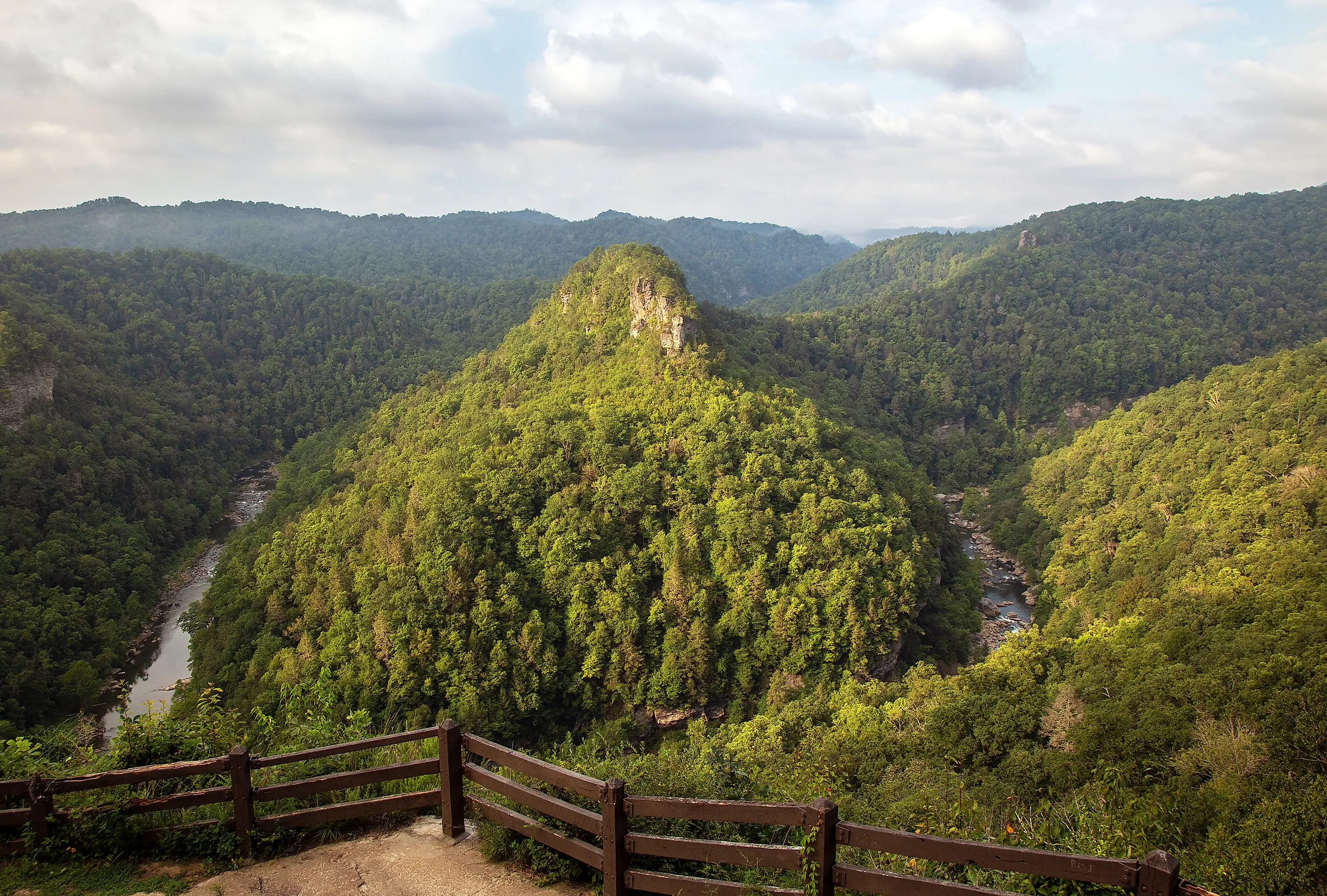
With those barriers in mind, it is easy to forget that the county's dramatic Appalachian landscapes are well-suited to outdoor recreation. Just beyond the county line, Breaks Interstate Park spans 4,500 acres along the Virginia and Kentucky border. Known as the Grand Canyon of the South, its five-mile gorge drops as much as 1,600 feet to the Russell Fork River, making it one of the deepest gorges east of the Mississippi River. There are also extensive ATV trails, and the county features rich wildlife viewing opportunities, including reintroduced elk now thriving in the area. The county economy was built on metallurgical coal, and its collapse created deep challenges. Median household income sits far below the state figure, and the poverty rate of about 25% runs roughly double the Virginia rate. With its isolation, Buchanan County continues to feel frozen in time, with amenity and infrastructure renewal being slow.
Pocahontas County, West Virginia

Pocahontas County is the third-largest in West Virginia by landmass, at about 940 square miles, and more than 60% of it is state or federal land. That includes roughly a third of the Monongahela National Forest, along with state parks and state forests. The population of about 7,600 works out to a density of 8 people per square mile, one of the most sparsely populated regions in the whole eastern United States.
Pocahontas County sits inside the United States National Radio Quiet Zone (NRQZ), where radio transmissions are restricted to protect ground-based radio telescopes. Established by the Federal Communications Commission in 1958, the 13,000-square-mile zone shields the Green Bank Observatory and the former Navy receiving site at Sugar Grove from human-made electronic noise. The strictest limits apply within ten miles of the observatory, where residents long depended on landlines and hardwired connections. That eased in August 2025, when the observatory began permitting Wi-Fi routers set to 2.4 GHz inside the ten-mile zone, beginning with the elementary and middle school next door. Even so, thin wireless coverage makes the county seem isolated not only geographically, but in time as well.

Known as the Birthplace of Rivers, the county has the highest average elevation of any county east of the Mississippi River, with eight major rivers originating in its peaks. Traveling in the county requires the use of steep, high-altitude passes that are frequently closed by heavy winter snows. This results in the scattered small communities being even more isolated, given the limited access to the digital outside world. The county seat, Marlinton, has fewer than 1,000 residents. Services in town are limited, with restaurants closing after lunch and basic shopping requiring long drives on difficult roads.
Marketed as Nature's Mountain Playground, the county has built a growing industry around outdoor recreation and adventure tourism, anchored by mountain biking at the Snowshoe Highlands Ride Center, which the International Mountain Bicycling Association rates at its silver level. The Cass Scenic Railroad State Park offers rides on historic steam trains, and as the headwaters of eight major rivers, Pocahontas County has a future in tourism focused on its dramatic natural setting.
Webster County, West Virginia

Deep in the steep and rugged center of the state, Webster County is surrounded by dense forests with few connecting roads. With its location in the central highlands of the state, the county is defined by its deep geographic seclusion. There are no four-lane highways and no interstate access, which leaves winding mountain roads as the only way in or out. Webster Springs, the county seat, sits deep in a mountain valley. Access to medical and shopping amenities requires slow travel through the mountain gaps. Large parts of the county's 556 square miles fall inside the Monongahela National Forest and Holly River State Park. Those federal and state holdings limit development and road projects across much of the county.

With a population under 7,800, the county is one of the least populated in the state. The culture of this isolation is deeply ingrained in Webster County. The county was created in January 1860, months before the American Civil War, and its government was never organized. Cut off from secessionist Virginia and from the Union alike, residents declared the so-called Independent State of Webster and named George Sawyer their governor. West Virginia became a state in 1863, and Webster County was formally organized in 1865 at the close of the war, yet that independent spirit and culture remain. This translates into a community with a strong local heritage and a close-knit community atmosphere. Outdoor recreation and adventure tourism point to an economic way forward within the dramatic mountain highlands.
Rebranding Appalachia
Although the physical and geographic barriers remain, these Appalachian counties are not stuck in the past. Outside a handful of restricted or hard-to-reach pockets, internet and cell phone service have spread through much of the region, though coverage remains uneven. The lack of amenities and infrastructural improvements comes down to small populations and to economies that once relied exclusively on coal. Like other economically challenged regions in the United States, these counties are adapting, finding new industries such as adventure tourism and building on the musical heritage and the wider culture unique to the area.