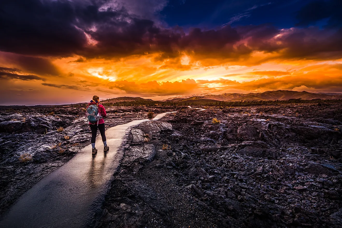
Cities Built In The Shadow Of An Active Volcano
The city of Orting sits on dried mud left by a giant lahar that swept through 500 years ago. Scientists rank Mount Rainier as the American volcano most likely to send another one down on its 9,000 residents. Across the ocean in Italy, three million people in Naples live within reach of Mount Vesuvius. That is the same volcano that buried Pompeii in 79 CE. Each city on this list trades that danger for fertile soil and a working harbor. The residents stay put and prepare.
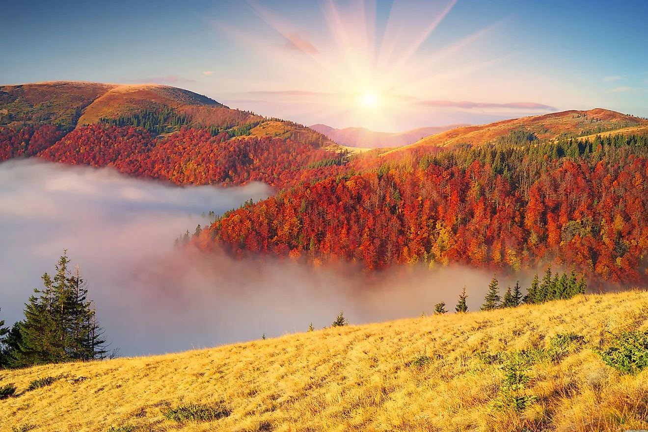
Orting, Washington

Orting has been identified as the place most at risk of lahar damage from Mount Rainier. A lahar refers to a mudflow or debris flow that results from an erupting volcano. These flows can destroy nearly anything in their path, because their strength is similar to that of moving concrete. While a lava flow would likely not extend more than a few miles beyond the Mount Rainier National Park boundary, scientists estimate that a large lahar could reach Orting in roughly 40 minutes to an hour, with some scenarios putting the warning window even shorter.

Geologists have also found evidence that at least 9 lahars from Mount Rainier have extended beyond the park into the surrounding area over the last 6,000 years. In fact, Orting is built on top of the dried dirt that was left over from the Electron Mudflow, a massive lahar that ravaged the valley 500 years ago. As such, the city is doing all it can to protect its citizens. This means Orting is also the most prepared out of any American city when it comes to volcanic eruptions.

In the 1990s, the local fire chief, Scott Fielding, considered Orting ground zero and worked hard for several years to ensure that everyone living in the city was aware of how dangerous Mount Rainier could become. Some of the warning measures in place are still used today, including monthly siren tests. Orting boasts flat land and rich soil, which makes it an ideal place for farming. People put down roots here because of it, long before scientists fully understood the dangers of lahars. Today, Orting is a fully established city of around 9,000 permanent inhabitants. If Rainier triggers another mudflow, residents may have less than an hour to escape. In the meantime, students have lahar drills in addition to fire drills, and people are practicing their speed-walking skills to reach higher ground if necessary.
Toutle, Washington

Up the highway from the local high school in Toutle, Washington, sits a 1,800-foot-wide dam managed by the Army Corps of Engineers. The dam does not hold drinking water and is not used for hydroelectric power. Instead, the sediment dam was built to catch volcanic mud before it can bury the community. The dam also catches millions of tons of sediment that flows from Mount St. Helens every year into the Toutle, Columbia, and Cowlitz rivers. There are plans to raise the dam in 2026 to further protect the communities in the line of fire, most of all Toutle.

Toutle is located in a river valley, about 25 miles directly downstream of the most active volcano in the contiguous United States. After the volcano erupted in 1980, debris totaling 1 million Olympic-size swimming pools' worth was sent into the upper Toutle Valley. That event made it clear just how necessary a sediment dam is.

The eruption also sent a destructive lahar down the Toutle River, destroying hundreds of homes and ripping out steel bridges. In 2026, the Sediment Retention Structure has kept hundreds of millions of cubic yards of volcanic debris away from Toutle and its neighboring communities since the 1980s. This helps protect Toutle, in particular, since it is built on the landscape where old-growth forest once stood and was leveled by St. Helens' eruption.
Mammoth Lakes, California

In 1990, forest rangers in Mammoth Lakes noticed that more than 100 acres of lodgepole pine trees had died on Mammoth Mountain near Horseshoe Lake. The trees were not destroyed because of drought or pest infestation. Instead, they suffocated because of the unrelenting amounts of carbon dioxide leaking from the magma chamber beneath the soil. In 2026, there are still more than 100 acres of dead and dying trees on the mountain.

Mammoth Lakes sits on the edge of the Long Valley Caldera, with Mammoth Mountain located on the caldera's southwestern rim. The caldera is an extensive volcanic system that continuously threatens the surrounding area. A catastrophic eruption around 760,000 years ago expelled about 150 cubic miles of magma, covering the western United States with ash. The eruption also formed the Bishop Tuff. After the magma chamber was spent, the ground above it collapsed. This created the depression or caldera, which is 20 miles long and 10 miles wide. The caldera is still active today, which is why it is constantly monitored by the USGS. The biggest threat right now is carbon dioxide seeping from the ground and accumulating in snowbanks and depressions where people ski and enjoy outdoor activities. It is also known as the magma system that keeps killing trees and activates the hot springs that draw tourists year-round.
The threat may be invisible, but it persists, requiring the residents of Mammoth Lakes to remain alert at all times. Low-lying areas and municipal sites must have active CO2 monitors in basements to ensure that the gas does not pool to lethal levels undetected. And since the active caldera sits atop a massive supervolcano and volcanic activity has increased in recent decades, the USGS continues to monitor the caldera for earthquake swarms and seismic shifts. While there is no reason at the moment to believe the region is on the verge of a supervolcanic eruption, the current ongoing cooling observed may be enough to release gases and liquids that could trigger smaller eruptions and earthquakes. All the while, the people of Mammoth Lakes continue to build their lives on the edge of an unpredictable mountain.
Pahoa, Hawaii

On May 3, 2018, Kilauea, an active shield volcano, erupted in the Leilani Estates subdivision. The eruption followed the collapse of the Pu'u O'o crater floor, allowing magma to intrude down Hawaii's Lower East Rift Zone. The event resulted in over 60,000 earthquakes, 24 known fissures, and the destruction of several neighborhoods, including Kapoho Beach Lots, Lanipuna Gardens, and Kapoho Vacationland. The lava spewed through the fissures; magma flowed down the mountain, destroying 32 miles of road, 13.7 square miles of land, and 700 homes. Pahoa's business district was spared, but the town, which lies in the Puna district, suffered massive destruction.

Pahoa sits right on top of the Lower East Rift Zone, which has proven to be more like an underground pressurized pipe than a traditional volcano. Fountains of 2,000-degree lava shot out of the pavements and in backyards, instead of solely flowing down the mountain. In 2026, Pahoa and the surrounding landscape are marked by jagged black rock. The lava walls are 30 feet high in some places, creating unwanted barriers. Still, many residents refused to move, while some left temporarily and then returned.

The danger remains at Kilauea, one of the world's most active volcanoes, which once again spewed lava on June 27, 2026. The volcano's 50th episode lasted seven hours. The area surrounding Kilauea, including Pahoa, is still ranked as Zone 2, which is just behind the highest possible risk level for lava flows. Leilani Estates, Kapoho, and Lanipuna Gardens fall into Zone 1. Residents are warned to check the U.S. Geological Survey's hazard maps before buying a house here.
Kagoshima, Japan

Kagoshima City experienced yet another eruption from Sakurajima, Japan's most active volcano, on June 7, 2026. One of the ash plumes reached 4,300 feet above the crater, sending ash over the city. The eruption is almost 'old-hat' for residents, considering the volcano erupts on a small scale nearly every day. Before massive eruptions happen, there are several warning signs, including tremors. While there have not been any tremors yet, there were powerful eruptions on April 11 and May 8 before the ash clouds that erupted in June. The last time the volcano caused major disruptions was in 1914 when so much lava was produced during an eruption that the cooling flow connected the island of Sakurajima to the mainland. The eruption also caused the deaths of 58 people in an earthquake triggered by the volcanic activity.

The main issue with the volcano, apart from the next potentially major eruption, is that its daily activity leaves a constant layer of gray dust coating everything. There is also the risk of falling rocks, which means elementary school kids have to wear hard hats to class. The local weather report includes ash forecasts so residents will have an idea of which way the dust blows every day. The government also distributes special yellow bags to help residents dispose of ash every day. The ash often damages crops and electricity lines, so residents cannot neglect cleaning it up. When the ash becomes very thick, it also affects road and air travel. At the same time, no one is really considering leaving, since Kagoshima is a thriving deep-water port and the volcanic soil helps grow agricultural products such as the famous Sakurajima radishes, rice, and tea. The area also attracts thousands of tourists, a key driver of the city's economy.
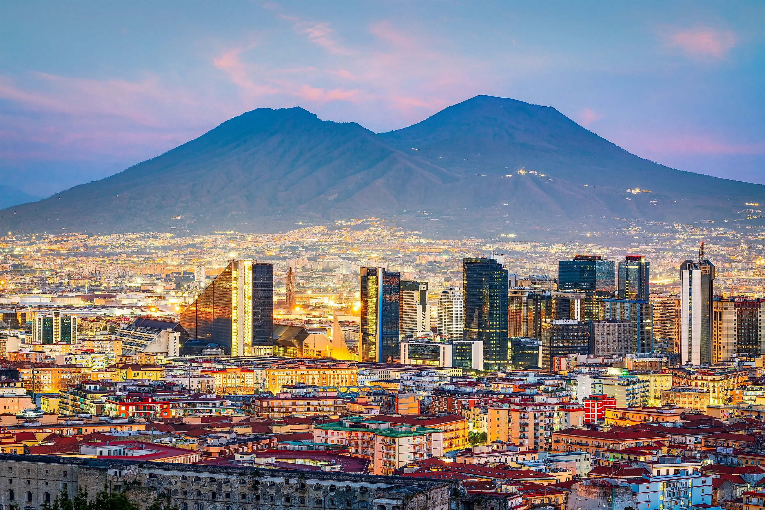
Naples, Italy

Naples and its suburbs sit in the blast radius of Mount Vesuvius, the volcano that completely buried Pompeii and Herculaneum in 79 CE. The last time Naples experienced major volcanic activity was in March 1944 during WWII, when a buildup of gas and magma caused an eruption that killed more than 20 people. Since then, nothing has really pointed towards a next catastrophe, but that does not mean it will not happen. It is only from a distance that one can really appreciate the scale of Vesuvius. It towers above the cities and towns in the line of fire and is the most famous image of the modern city of Naples. The danger the city faces also extends westward, with the Campi Flegrei caldera another highly active volcanic site.

Despite its location between what could very likely be geological time bombs, the metropolitan area is home to more than three million people. The biggest draw is the volcanic soil, which is some of the most fertile in Europe. The soil sustains vineyards and San Marzano tomato crops. Communities build their lives around agriculture and the deep-water bay, choosing economic benefits over what scientists believe is an inevitable eruption.

Life on the Bay of Naples therefore must operate according to emergency protocol. There is a Red Zone around Vesuvius. This boundary contains around 600,000 residents in the path of a pyroclastic flow consisting of extremely hot gas and rock. If scientists at the local volcano observatory detect ground swelling, the government has 72 hours to evacuate everyone by train, bus, and boat. There is a separate Red Zone for Campi Flegrei, which covers around 500,000 people in the western suburbs. Scientists are also keeping a watchful eye on the Island of Ischia, 30 kilometers southwest of Naples. Ischia is the volcano that could also erupt on a large scale in the area. Surrounded by three active volcanic systems, Naples ranks among the most volcanically vulnerable cities on Earth.
The Geography Of Volcanic Risk
Cities built in the shadows of active volcanoes have to balance their need for resources and their safety. For most residents, the payoff is worth the risk. Decades often go by between major eruptions, and in between, communities enjoy rich soil, deep-water port activities, and timber valleys. Humans seem to be built for defying environmental hazards if it means immediate benefits. At the same time, the people living in danger zones are not ignoring the magma flowing beneath their feet. They are taking every possible precaution, and they have several evacuation measures ready and waiting.
_%E2%80%94_Backwoods_Cafe_%E2%80%94_02.jpg)